The best road cycling routes in Baja California
4.3
(104)
895
riders
19
rides
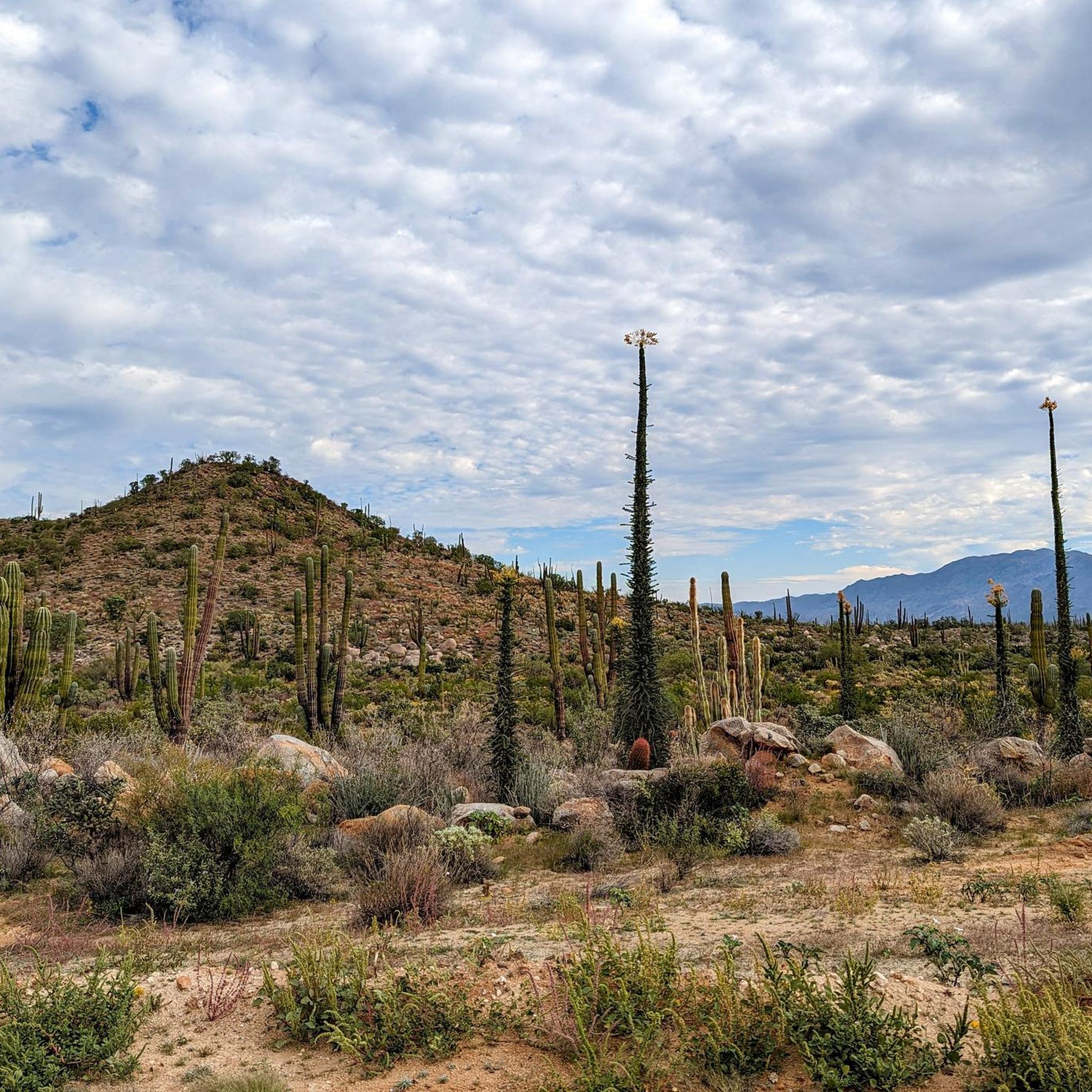
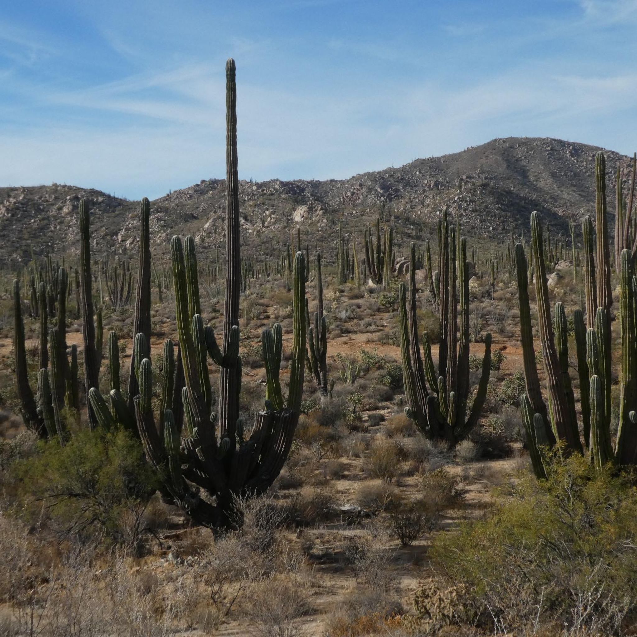
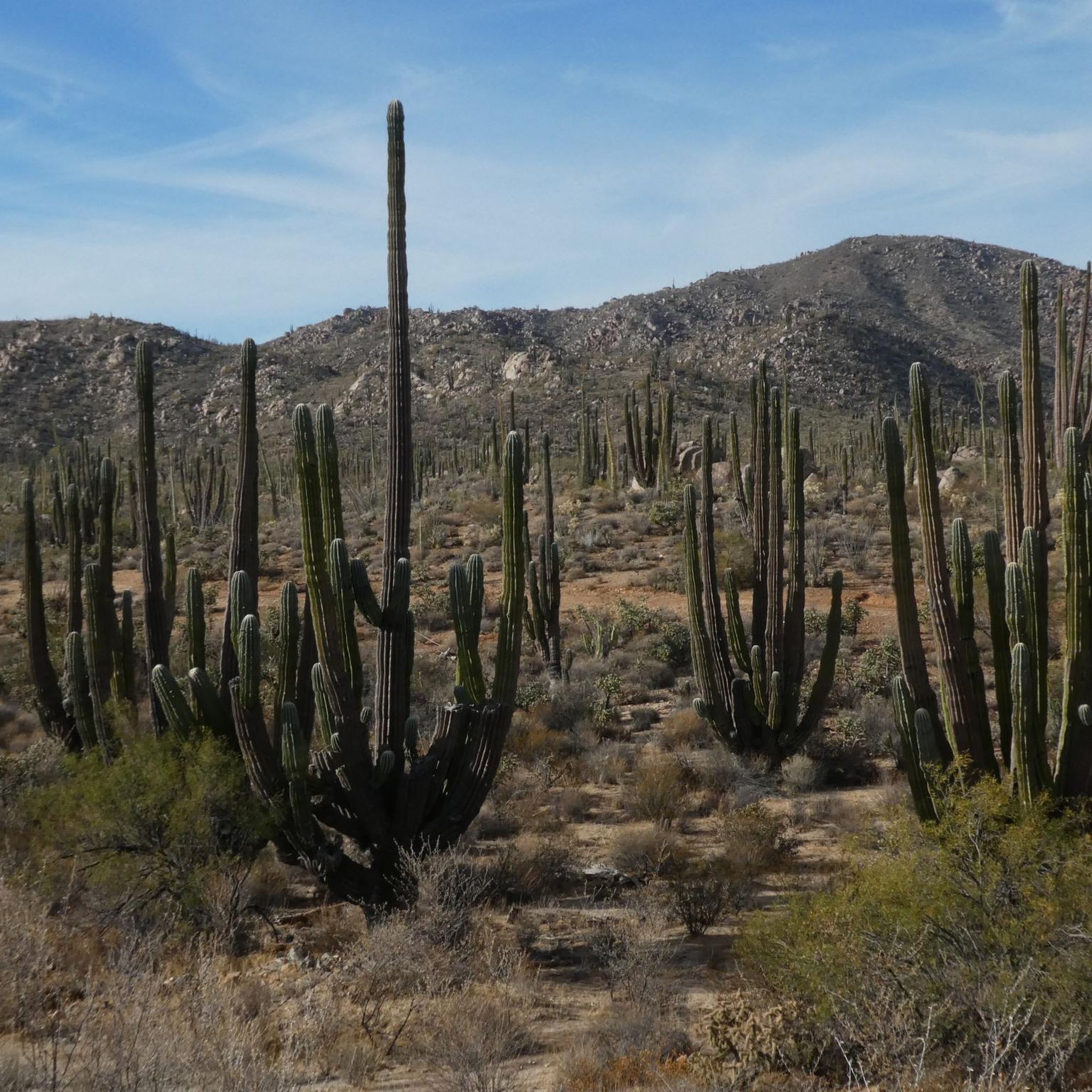
Road cycling in Baja California offers diverse terrain, characterized by rugged Pacific coastlines, the tranquil Sea of Cortez, and vast desert expanses. The region features unique flora and significant mountain ranges, including the Sierra de la Laguna and Sierra de la Giganta, which provide varied elevation changes. Cyclists can find routes ranging from paved coastal roads to challenging mountain passes, connecting urban centers with natural landscapes. The peninsula's geography supports a range of road cycling experiences across different skill levels.
…Last updated: June 29, 2026
5.0
(2)
87
riders
33.9km
01:22
70m
70m
Easy road ride. Great for any fitness level. Mostly well-paved surfaces and easy to ride.
4.0
(1)
46
riders
Moderate road ride. Good fitness required. Some segments of this route may be unpaved and difficult to ride.

Sign up for free
4.0
(2)
128
riders
Easy road ride. Great for any fitness level. Mostly well-paved surfaces and easy to ride.
19
riders
50.3km
02:38
800m
790m
Moderate road ride. Good fitness required. Some segments of this route may be unpaved and difficult to ride.
4.0
(2)
8
riders
14.7km
00:35
40m
40m
Easy road ride. Great for any fitness level. Mostly well-paved surfaces and easy to ride.
3
riders
26.2km
01:12
300m
300m
Easy road ride. Great for any fitness level. Mostly well-paved surfaces and easy to ride.
6
riders
131km
06:13
1,760m
1,760m
Hard road ride. Very good fitness required. Mostly well-paved surfaces and easy to ride.
7
riders
33.6km
01:41
220m
220m
Easy road ride. Great for any fitness level. Mostly well-paved surfaces and easy to ride.
5.0
(2)
5
riders
19.4km
00:56
60m
60m
Easy road ride. Great for any fitness level. Mostly well-paved surfaces and easy to ride.
Get access to more routes and recommendations from other explorers.
Sign up for free
Already have an account?
Our route recommendations are based on thousands of hikes, rides, and runs completed by other people on komoot.
Start today with a free account
Your next adventure awaits.
Login or Signup
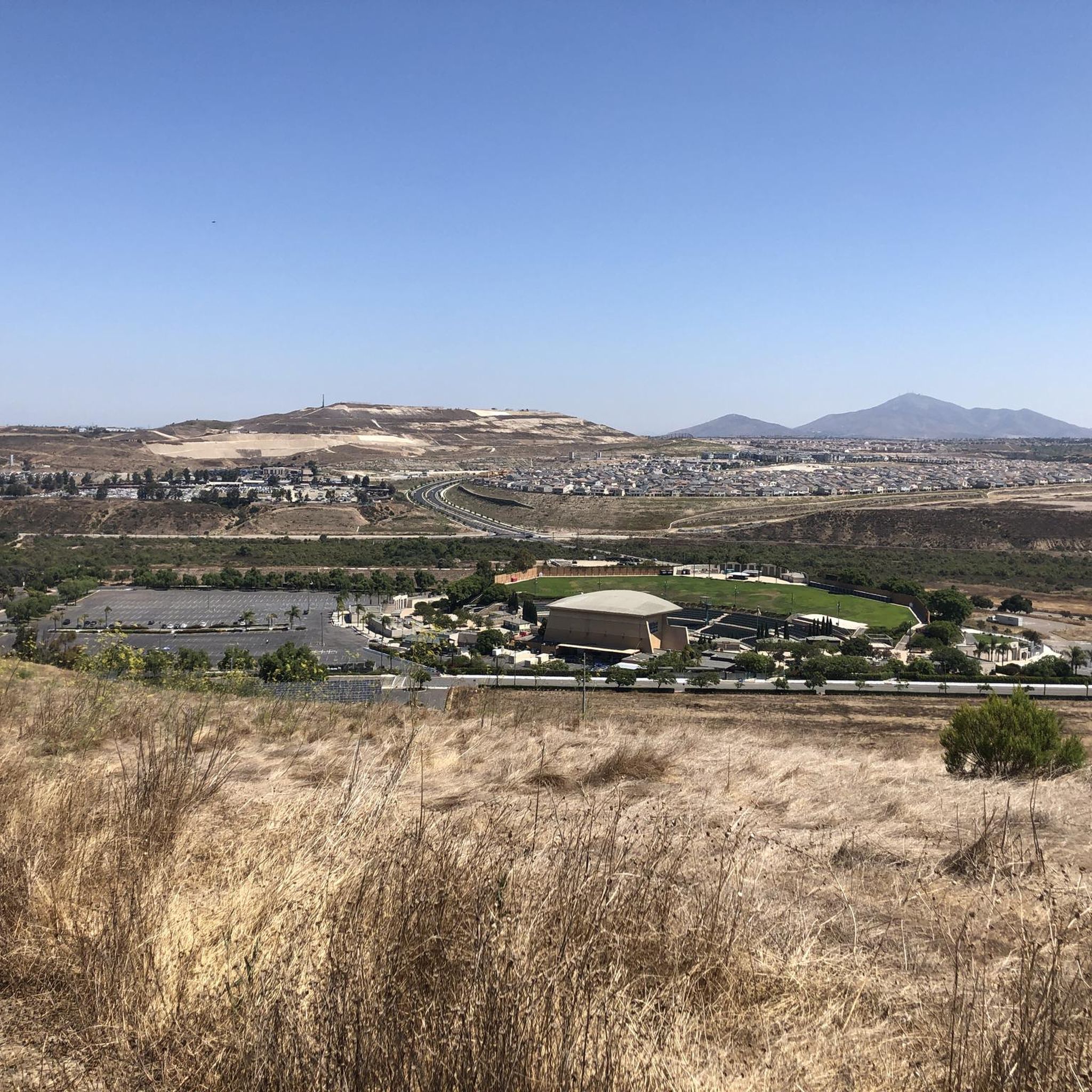




Tips from the Community

It is a large and open leisure area, with well-maintained pedestrian zones and green spaces where you can stroll calmly or go out to play sports.
0
1


The Sweetwater River is a small year-round stream that flows 55 miles from the Cuyamaca Mountains to the San Diego Bay.
1
0

The view from this section of the bikeway is stunning. The vibrant green and blue colors of the water and skyline are breathtaking and worthy of a stop to take some incredible photos.
1
0

The Colorado River State Historic Park, located in Yuma, Arizona, preserves the area's rich history tied to the Colorado River. Formerly known as the Quartermaster Depot Historic Park, it encompasses the historic Yuma Crossing, a vital river crossing point historically used by Native American tribes, Spanish explorers, and pioneers traveling westward. The park features restored adobe buildings, including the iconic Yuma Quartermaster Depot, which served as a supply base for frontier military posts. Exhibits and guided tours offer insights into the region's role in transportation, communication, and military operations during the late 19th and early 20th centuries.
1
0
The Yuma Crossing Bike Path, also known as the Colorado River Levee Multi-Use Path runs along the Colorado River just north of downtown Yuma and passes through several parks and historic sites. Key points of interest include West Wetlands Park, a 110-acre area with fishing ponds, hiking trails, picnic spots, and the highly inclusive Stewart Vincent Wolfe Creative Playground. The path also passes by the Yuma Territorial Prison State Historic Park, which provides a fascinating look into the Old West with exhibits on the lives of prisoners and guards from the late 19th and early 20th centuries. Gateway Park, near the historic Ocean-to-Ocean Bridge, offers beach access, picnic areas, and picturesque river views, making it a popular spot for relaxation and community events. Additionally, the East Wetlands area showcases restored wetland habitats ideal for nature walks and bird watching. The path also traverses the Yuma Crossing National Heritage Area, which features interpretive exhibits and scenic views that highlight the historical importance of Yuma as a crossing point on the Colorado River.
0
0

Hollenbeck Canyon Wildlife Area provides a 6,100-acre wildlife corridor between Otay Mountain and the Jamul Mountains. This mainly includes coastal sage scrub, chaparral, oak woodlands, riparian forests, freshwater marshes, and grasslands. The height range hovers between a low of 750' to 2,100'.
0
0

The incredible views are absolutely worth the climb. On a good day you can see all the way to the ocean. At the very top there is an amphitheatre and a large stone cross. If you are visiting the area, a ride up to the top of Mount Helix is a definite must do.
0
0
Frequently Asked Questions
What kind of terrain and difficulty can I expect on road cycling routes in Baja California?
Baja California offers a diverse range of terrain for road cyclists. You'll find everything from rugged Pacific coastlines to the tranquil Sea of Cortez, vast deserts with unique flora like Boojum Trees, and challenging mountain ranges such as the Sierra de la Laguna and Sierra de la Giganta. Routes vary from easy, paved bikeway loops to difficult multi-day adventures with significant elevation changes. The region has 5 easy, 6 moderate, and 4 difficult routes, catering to all skill levels.
Are there many circular road cycling routes available in Baja California?
Yes, many road cycling routes in Baja California are designed as loops, offering convenient starting and ending points. Examples include the popular Coronado Ferry – Bayshore Bikeway loop from Imperial Beach, the Otay Reservoir Dam – Lower Otay Reservoir loop from Otay Ranch Town Center, and the Sweetwater River loop from Palomar Street.
What natural features or landmarks can I expect to see while road cycling in Baja California?
Road cycling in Baja California provides opportunities to witness stunning natural beauty. You can ride along dramatic Pacific coastlines, enjoy views of the Sea of Cortez, and traverse unique desert landscapes dotted with iconic Boojum Trees and various cacti. Mountain ranges like the Sierra de la Laguna offer breathtaking vistas. Notable attractions include La Banquita, a scenic viewpoint, and the historic San Borja Mission.
What is the best time of year for road cycling in Baja California?
Baja California offers good cycling conditions for much of the year, but the best time often depends on the specific area and your tolerance for heat. The desert stretches can experience extreme heat, so cooler months are generally preferred for longer rides. Coastal areas tend to be more temperate. Always be prepared for varied weather conditions and carry sufficient water, especially in arid regions.
Are there any road cycling routes that feature waterfalls in Baja California?
Yes, some routes incorporate natural features like waterfalls. For instance, the challenging Otay Reservoir Dam – "Secret" Waterfall loop from Otay Ranch Town Center is a difficult route that includes a waterfall, offering a unique scenic element to your ride.
Are there family-friendly road cycling options in Baja California?
While the guide doesn't specifically categorize routes as 'family-friendly,' many easy and moderate paved loops are suitable for families. Routes with less elevation gain and away from heavy traffic, such as the Pivot Point Park – Riverside Park loop from Colonia Francisco Santana Peralta, could be good options for a family outing.
What do other road cyclists enjoy most about road cycling in Baja California?
The road cycling experience in Baja California is highly rated by the komoot community, with an average score of 4.5 stars from over 10 reviews. Cyclists often praise the diverse landscapes, from coastal views to desert scenery, and the variety of routes that cater to different ability levels. The opportunity to explore both urban centers and natural wonders is a significant draw.
Are there road cycling routes that offer views of reservoirs or bodies of water?
Absolutely. Several routes provide scenic views of reservoirs and other water bodies. The Otay Reservoir Dam – Lower Otay Reservoir loop from Otay Ranch Town Center and the Otay Reservoir Dam – Lower Otay Reservoir loop from Palomar Street are excellent choices for those who enjoy cycling alongside water, offering picturesque views of the reservoir.
Can I find easy road cycling routes for beginners in Baja California?
Yes, Baja California offers several easy road cycling routes suitable for beginners or those looking for a more relaxed ride. For example, the Sweetwater River loop from Palomar Street is a shorter, easy route, and the Roadbike loop from East Palomar also provides an accessible option with less elevation.
Are there any routes that explore the Sweetwater River area?
Yes, the Sweetwater River area is featured in some road cycling routes. You can explore this region on the Sweetwater River loop from Palomar Street, which is an easy route, or opt for the more extensive Sweetwater Bikeway – Sweetwater River loop from Palomar Street for a moderate challenge.
What should I know about road conditions and traffic in Baja California?
While many main roads in Baja California are paved and in good condition, traffic can be heavier near urban centers like Tijuana and Ensenada. Cyclists should be prepared for varied elevation changes, from gentle descents to significant mountain climbs. Always be mindful of your surroundings and consider routes with wider shoulders for a safer experience.
Are there options for advanced road cyclists seeking a challenge?
Absolutely. For experienced road cyclists looking for a challenge, Baja California offers several difficult routes. The Alto Climb loop from Otay Ranch Town Center is a demanding route with significant elevation gain, and the Otay Reservoir Dam – "Secret" Waterfall loop from Otay Ranch Town Center also presents a difficult, longer ride.
Most popular attractions in Baja California

Get inspired with the komoot mobile app


Didn’t find what you were looking for?
Check out more Road cycling routes throughout Baja California below and find the perfect route in your destination.
Explore more
Browse the best Road cycling routes in other regions.
