The best running trails in San Sebastián Tutla
4.5
(22)
290
runners
18
runs
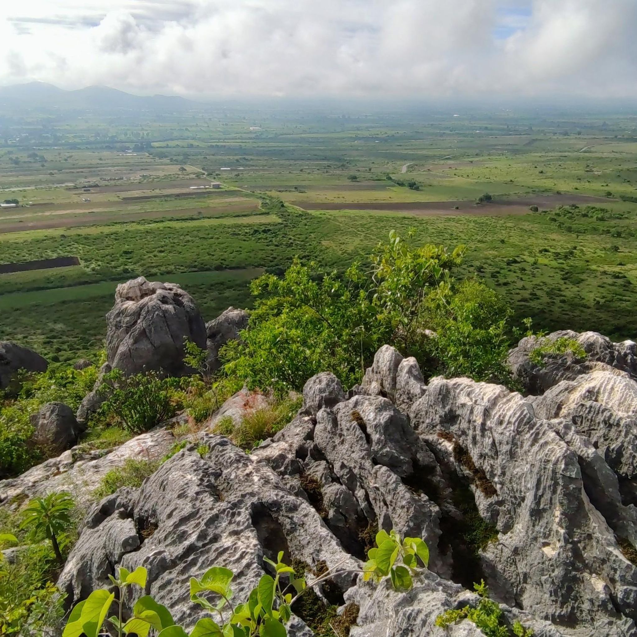
Jogging routes in San Sebastián Tutla offer a diverse landscape for runners, characterized by its hilly topography interspersed with small flat areas. The region's altitude ranges from 1,500 to 2,100 meters above sea level, providing varied elevation challenges. Runners can experience lush landscapes and semi-desert vegetation, including mezquite and guaje, along the trails. This blend of features makes it an appealing destination for outdoor activities, easily accessible from Oaxaca City.
Best jogging routes in San Sebastián Tutla
- The most popular…
Last updated: July 5, 2026
4.0
(2)
25
runners
Moderate run. Good fitness required. Mostly paved surfaces. Suitable for all skill levels.
5.0
(1)
12
runners
5.30km
00:38
140m
140m
Hard run. Good fitness required. Sure-footedness, sturdy shoes and alpine experience required.

Sign up for free
5.0
(2)
14
runners
Moderate run. Good fitness required. Mostly paved surfaces. Suitable for all skill levels.
8
runners
9.24km
00:59
130m
130m
Moderate run. Good fitness required. Mostly paved surfaces. Suitable for all skill levels.
4.0
(1)
7
runners
6.50km
00:42
50m
50m
Moderate run. Good fitness required. Mostly paved surfaces. Suitable for all skill levels.
3
runners
9.40km
01:05
140m
140m
Moderate run. Good fitness required. Mostly paved surfaces. Suitable for all skill levels.
Get access to more routes and recommendations from other explorers.
Sign up for free
Already have an account?
Our route recommendations are based on thousands of hikes, rides, and runs completed by other people on komoot.
Start today with a free account
Your next adventure awaits.
Login or Signup
Popular around San Sebastián Tutla


Tips from the Community

The steps take you to Oaxaca's local mountain, Cerro del Fortín, just outside the center. From the top you are rewarded with a magnificent view of Oaxaca. However, you should not go up in the dark.
0
0
Frequently Asked Questions
What kind of terrain can I expect on the running trails in San Sebastián Tutla?
San Sebastián Tutla offers a varied landscape for runners, characterized by its hilly topography interspersed with small flat areas. You'll find routes with significant elevation changes, as well as more balanced terrains with gentle ascents, suitable for different fitness levels. The altitude ranges from 1,500 to 2,100 meters above sea level, providing diverse challenges.
Are there running routes suitable for beginners in San Sebastián Tutla?
Yes, while many routes feature inclines, there are options suitable for beginners. For instance, the region offers moderate paths with balanced terrain. You can find 1 easy route and 12 moderate routes among the 18 available, providing good starting points for those new to running in the area.
How many running routes are available in San Sebastián Tutla?
There are over 15 dedicated running routes in San Sebastián Tutla listed on komoot, offering a wide range of options for different preferences and fitness levels. In total, there are 18 routes to explore.
What is the average length of running routes in San Sebastián Tutla?
The running routes in San Sebastián Tutla vary in length. For example, you can find shorter routes like the Fuente Jardín Carbajal loop from Oaxaca City, which is about 5.3 km, or longer options such as the Fuente de exalumnos – Fuente suroeste del Zócalo loop from Oaxaca City, which covers approximately 9.8 km.
Are there any circular running routes in San Sebastián Tutla?
Yes, many of the running paths in San Sebastián Tutla are designed as loops, allowing you to start and finish in the same location. An example is the Fuente de las Ocho Regiones – Fuente de exalumnos loop from Oaxaca City, which is a moderate 5.8 km circular route.
What natural features or landscapes can I expect to see while running in San Sebastián Tutla?
While running in San Sebastián Tutla, you'll experience lush landscapes and semi-desert vegetation, including mezquite, guaje, and cazaguate. The varied topography offers scenic views, often including mountain vistas and open fields, providing a refreshing natural environment away from urban traffic.
What do other runners say about the trails in San Sebastián Tutla?
The running routes in San Sebastián Tutla are highly rated by the komoot community, with an average score of 4.6 stars from more than 20 reviews. Runners often praise the varied terrain and the opportunity to experience the region's natural beauty.
Is San Sebastián Tutla easily accessible for runners coming from Oaxaca City?
Yes, San Sebastián Tutla is conveniently located just a short distance, approximately 5 km, from Oaxaca City. This makes it easily accessible for those looking for a tranquil escape into nature for their runs.
Are there any running routes that connect to nearby significant landmarks?
While not directly within San Sebastián Tutla, some routes in the broader area connect to significant natural landmarks. For instance, the Running loop from Santa María del Tule offers a moderate 9.4 km path that brings you close to the famous Tule Tree, traversing open fields and providing mountain views.
What is the best time of year for running in San Sebastián Tutla?
Given its semi-desert vegetation and varied altitude, San Sebastián Tutla generally offers pleasant conditions for running. However, it's always advisable to check local weather forecasts, especially during warmer months, and consider running in the mornings or late afternoons for more comfortable temperatures.
Are there any routes with minimal elevation gain for a flatter running experience?
While the region is known for its hilly topography, some routes feature more gentle ascents and descents. For example, the Fuente de las Ocho Regiones – Fuente de exalumnos loop from Oaxaca City has a relatively low elevation gain of about 40 meters, offering a less strenuous option.
Can I find routes that are considered challenging for experienced runners?
Absolutely. San Sebastián Tutla's 'accidentado' (hilly) topography provides excellent challenges for experienced runners. There are 5 difficult routes available, such as the Fuente Jardín Carbajal loop from Oaxaca City, which features significant elevation changes over its 5.3 km distance.
Most popular routes in San Sebastián Tutla

Get inspired with the komoot mobile app


Explore more
Browse the best Running Trails & Routes in other regions.
