The 9 Most Amazing Peaks around Llangynog
Best mountain peaks around Llangynog are found in north Powys, Wales, nestled at the foot of the Berwyn Range. This area is a destination for outdoor enthusiasts, surrounded by several notable mountain peaks. The region offers expansive views and a sense of solitude for hikers, featuring prominent crags, screes, and boulder-strewn slopes, alongside historical sites.
Best mountain peaks around Llangynog
- The most popular mountain peaks is Cadair Berwyn Summit, a viewpoint that is the highest point in the Berwyn…
Last updated: October 7, 2026
Cadair Berwyn Summit
Highlight • Viewpoint
Tip by

Cadair Bronwen Summit Cairn
Highlight • Natural Monument
Tip by

Sign up now to discover places like this
Get recommendations on the best single tracks, peaks, & plenty of other exciting outdoor places.
Moel Sych Summit Cairn
Highlight • Viewpoint
Tip by

Wind shelter on the summit of the Berwyn Mountains
Highlight • Viewpoint
Tip by

Foel y Geifr Summit (626 m)
Highlight • Natural Monument
Tip by
Sign up for free to discover even more peaks around Llangynog.
Already have an account?
Start today with a free account
Your next adventure awaits.
Other adventures around Llangynog

Tips from the Community


The loop from Llandrillo going anticlockwise is very steady and pleasant. But be prepared for substantial bog trotting in the central part of the valley passing the area marked as Gwern Wynodl. Even with newish goretex boots, we came away with wet feet. Good boots and gaiters, or wellies for that section highly recommended. Return section (first section if doing it clockwise) is also pretty boggy in parts. It also seemed like a bit more of a slog doing it clockwise.
0
0

About 5ft deep and 8ft in diameter, enough to sit and shelter from the wind. Good place to stop for coffee for 5/6 people.
0
0


Boel y Geifr 626.2m P111 (2054ft) TP3221 - Bald Goats S8545
0
0

Beautiful spot to sit and have a sandwich, looking at the views and down at the Llyn below
2
0

Once thought to be the highest summit in the Berwyn Range, Moel Sych is actually the third highest behind nearby Cadair Berwyn's main and north summits. Still, at 2,712 feet (827 m) in height, it affords terrific views across this quiet part of upland Wales. Interestingly, the summit is the meeting point of the historic counties of Montgomeryshire, Merionethshire and Denbighshire.
2
0
Frequently Asked Questions
What are some of the most notable mountain peaks to explore near Llangynog?
The Llangynog area, nestled in the Berwyn Range, offers several significant peaks. Among them are Cadair Berwyn Summit, the highest point in the Berwyn Hills, and Moel Sych Summit Cairn, known for its terrific views and historical significance as a tri-county meeting point. Another prominent peak is Cadair Bronwen Summit Cairn, a UK-listed Nuttall.
What kind of terrain and hiking conditions can I expect on the mountain peaks around Llangynog?
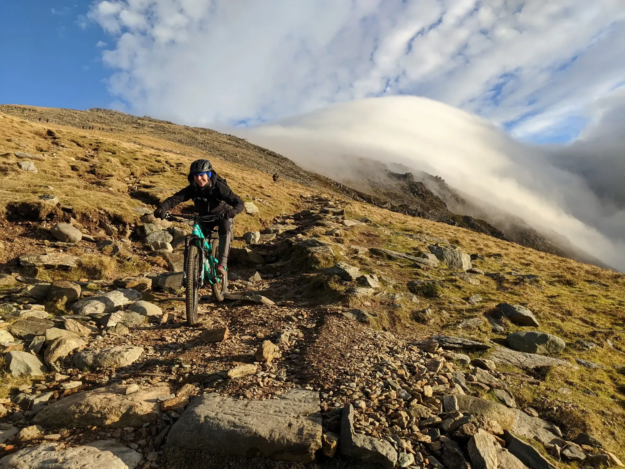
The mountain peaks around Llangynog, particularly in the Berwyn Range, feature varied terrain. You can expect challenging routes with precipitous crags, screes, and boulder-strewn slopes, especially on peaks like Craig Rhiwarth. Some areas, particularly in valleys or lower sections, can be boggy, especially after rain, so good boots and gaiters are recommended.
Are there any historical sites or unique geological features on the mountains near Llangynog?
Yes, the mountains offer both historical and geological interest. Craig Rhiwarth, for instance, features a large prehistoric hillfort, one of the highest in Wales, and evidence of early opencast copper mining. Moel Sych's summit is historically significant as the meeting point of three ancient counties. Geologically, you'll find prominent crags, screes, and rocky outcrops throughout the range.
What outdoor activities can I do near the mountain peaks of Llangynog besides hiking?
Beyond hiking, the Llangynog area is excellent for other outdoor pursuits. You can find challenging MTB trails, including routes like 'A loop around the Berwyns' or 'Slate Descent Path – Craig Rhiwarth Descent loop'. Road cycling is also popular, with routes such as 'Lake Vyrnwy – Lake Vyrnwy Straining Tower loop' available. For more relaxed walks, there are also easy hikes around the area.
What is the highest point in the Berwyn Hills near Llangynog?
The highest point in the Berwyn Hills is Cadair Berwyn Summit, standing at 2,730 feet (827 meters). It offers expansive views and is known for providing a sense of solitude for hikers.
Are there any family-friendly or easy mountain walks around Llangynog?
While many peaks in the Berwyn Range offer challenging routes, there are also easier options available in the wider Llangynog area. For family-friendly walks, consider exploring the easy hikes around Llangynog, which include routes like 'Pistyll Rhaeadr – The Cafe loop' or 'Forest Trail Descent – Deep Cave loop'.
What makes the views from Moel Sych unique?
From Moel Sych Summit Cairn, you can enjoy terrific views across the quiet Welsh uplands. What makes it particularly unique is its historical significance: the summit marks the meeting point of the historic counties of Montgomeryshire, Merionethshire, and Denbighshire.
What should I know about Cadair Bronwen for hiking?
Cadair Bronwen Summit Cairn is a significant peak within the Berwyn Range and a UK-listed Nuttall. It's often included as part of longer treks incorporating other summits. Hikers should be prepared for potentially boggy sections, especially in the central part of the valley, and consider good boots and gaiters.
Is there a wind shelter available on the Berwyn Mountains?
Yes, there is a wind shelter on the summit of the Berwyn Mountains. It's approximately 5 feet deep and 8 feet in diameter, providing a good place for 5-6 people to sit and shelter from the wind, making it a convenient spot for a coffee break.
What is the best time to visit the mountain peaks around Llangynog?
The Berwyn Mountains offer rewarding experiences throughout the year, but the best time for hiking is generally during the warmer, drier months from late spring to early autumn (May to October). During this period, the trails are less likely to be boggy, and you'll have better chances for clear panoramic views. Winter hiking is possible but requires appropriate gear and experience due to potentially harsh conditions.
Where can I find parking for hiking the peaks near Llangynog?
Llangynog village itself serves as an excellent base for accessing the peaks, and parking options are typically available within or near the village. Specific starting points for various routes may have designated parking areas, but it's advisable to check route details for precise parking information before your trip.
Most popular attractions around Llangynog

Get inspired with the komoot mobile app


Explore more
See even more amazing summits around Llangynog with these guides:
