The best road cycling routes around Argoed
4.5
(75)
3,730
riders
18
rides
Road cycling around Argoed features routes that traverse river valleys, coastal paths, and rural countryside. The landscape includes gentle gradients along the River Dee and more undulating terrain through the surrounding hills. Cyclists can expect a mix of open views and sections passing through agricultural areas, offering diverse road biking conditions.
Best road cycling routes around Argoed
- The most popular road cycling route is Dee Coastal Path – Garden City Blue Bridge loop from Buckley, a 24.5 miles (39.5…
Last updated: May 24, 2026
5.0
(1)
42
riders
39.5km
01:41
250m
250m
Easy road ride. Great for any fitness level. Mostly well-paved surfaces and easy to ride.
27
riders
45.1km
02:31
610m
610m
Moderate road ride. Good fitness required. Some segments of this route may be unpaved and difficult to ride.

Sign up for free
22
riders
47.2km
02:06
300m
300m
Moderate road ride. Good fitness required. Mostly well-paved surfaces and easy to ride.
13
riders
66.7km
02:49
390m
390m
Moderate road ride. Good fitness required. Mostly well-paved surfaces and easy to ride.
8
riders
Moderate road ride. Good fitness required. Mostly well-paved surfaces and easy to ride.
Get access to more routes and recommendations from other explorers.
Sign up for free
Already have an account?
Our route recommendations are based on thousands of hikes, rides, and runs completed by other people on komoot.
Start today with a free account
Your next adventure awaits.
Login or Signup

Tips from the Community

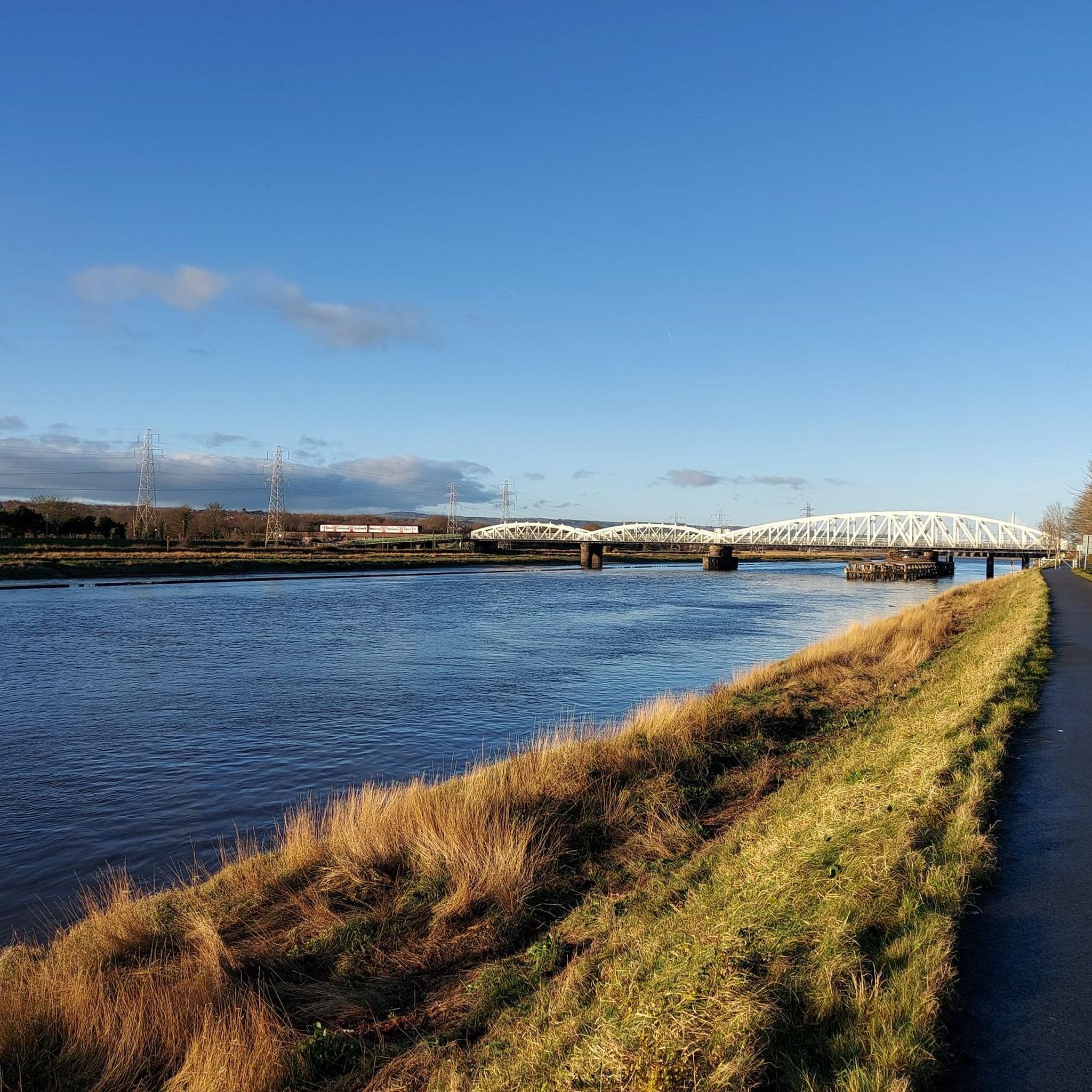
Uhmm - photo of Garden City's Welsh Road 'blue bridge' is NOT Saltney Ferry footbridge!! The Ferry is four miles upstream, towards Chester!
1
0


Wow! What a find. Wide cycle path along the wider River Dee. Some dog walkers and other users but no issues. Stunning at sunset
0
0
Hadn’t realised this would be so beautiful. Not just the bridge but then to cycle way into Chester. Would recommend.
0
0


The River Dee round is a surfaced, traffic-free loop of 15 miles (24 km). It follows the National Cycle Network Route 5 to the west of the city as far as Hawarden Bridge, returning via the riverside cycle path along the River Dee.
0
0

Dee Banks is a beautiful section of path that's brilliant for cyclists it's a 10km path that runs from garden city to Chester and beyond 😀
2
0
Frequently Asked Questions
How many road cycling routes are available around Argoed?
There are over 20 road cycling routes around Argoed, offering a variety of experiences. These include 4 easy routes and 16 moderate routes, catering to different skill levels.
What kind of terrain can I expect when road cycling in Argoed?
Road cycling around Argoed offers diverse terrain. You'll find routes traversing river valleys and coastal paths, such as the Dee Coastal Path – Garden City Blue Bridge loop from Buckley, which offers gentle gradients. Other routes lead through rural countryside with more undulating terrain and significant elevation gains, particularly in areas closer to the Bannau Brycheiniog National Park (Brecon Beacons).
Are there challenging road cycling routes with significant climbs in the Argoed area?
Yes, for cyclists seeking more challenging terrain, the area around Argoed, especially towards the Bannau Brycheiniog National Park, is known for its demanding climbs. While the immediate guide routes are moderate, the broader region features ascents like The Tumble and Gospel Pass, the highest paved road in Wales, offering substantial elevation gains and stunning views. One moderate route, Rhosesmor Limekiln – View of the Countryside loop from Soughton, already features over 1,970 feet (600 meters) of elevation gain.
Can I find easy or family-friendly road cycling routes around Argoed?
Yes, Argoed offers several easy and family-friendly options. The village of Argoed in Caerphilly County Borough is integrated into established cycling networks, including traffic-free paths like National Cycle Network Route 467, which follows a former railway line through the Sirhowy Valley. The Dee Coastal Path – Garden City Blue Bridge loop from Buckley is an easy route following the estuary, suitable for less strenuous rides.
Are there any circular road cycling routes in Argoed?
Many of the road cycling routes around Argoed are designed as loops, allowing you to start and finish in the same location. Examples include the Dee Coastal Path – Garden City Blue Bridge loop from Buckley and the River Dee Riverside Trail – Dee Banks Path loop from Soughton, both offering scenic circular rides.
What natural features or landmarks can I see along road cycling routes near Argoed?
Road cycling routes near Argoed offer views of diverse natural features and landmarks. You can explore the picturesque Sirhowy Valley, wooded hillsides, and the impressive Hengoed Viaduct. Further afield, towards the Bannau Brycheiniog National Park, you'll encounter dramatic mountain scenery, including views of Pen y Fan. Notable highlights in the broader area include the Jubilee Tower on Moel Famau and the Moel Gyw Summit, offering panoramic viewpoints.
Where can I find parking for road cycling routes in Argoed?
While specific parking locations for each route aren't detailed, Argoed and surrounding towns often provide public parking facilities. For routes utilizing national cycle networks or former railway lines, designated parking areas are typically available near trailheads or in nearby villages. It's advisable to check local council websites or specific route descriptions for the most accurate parking information.
Is public transport available to access road cycling routes in Argoed?
Yes, Argoed is accessible by public transport, which can help you reach various cycling routes. The village of Argoed in Caerphilly County Borough has bus services, and its integration into the National Cycle Network means some routes are reachable from public transport hubs. For routes further into the Bannau Brycheiniog National Park, services might be less frequent, so planning ahead is recommended.
What is the best time of year for road cycling in Argoed?
The best time for road cycling in Argoed is generally from spring through autumn (April to October). During these months, the weather is typically milder and drier, making for more pleasant riding conditions. Summer offers longer daylight hours, while spring and autumn provide beautiful scenery with fewer crowds. Always check the local weather forecast before heading out.
Are there cafes or pubs along the road cycling routes in Argoed?
Yes, many road cycling routes in and around Argoed pass through or near villages and towns where you can find cafes, pubs, and other amenities. These establishments offer opportunities for refreshments and breaks during your ride. The Monmouthshire and Brecon Canal towpath, for instance, passes through charming towns with such facilities.
What do other cyclists say about road cycling in Argoed?
The road cycling routes around Argoed are highly rated by the komoot community, with an average score of 4.0 stars from 3 reviews. Cyclists often praise the diverse landscapes, from tranquil river valleys to challenging rural climbs, and the mix of traffic-free paths and scenic country roads.
Are there any long-distance road cycling options from Argoed?
Yes, Argoed serves as a gateway to several long-distance cycling options. The region connects to the Valleys Cycle Network, and routes like the Taff Trail and Lôn Las Cymru pass through the broader Brecon Beacons area. These routes offer extensive mileage, showcasing diverse terrain from open moorland to reservoirs and waterfalls, ideal for multi-day tours or extended rides.
Are dogs allowed on road cycling routes around Argoed?
While many public paths and cycle routes in the UK are dog-friendly, specific rules can vary. On designated cycle paths, dogs are generally permitted if kept on a lead. However, on roads, it's typically not advisable to cycle with dogs due to safety concerns. Always check local signage and respect any restrictions, especially in nature reserves or agricultural areas.
Most popular attractions around Argoed

Get inspired with the komoot mobile app


Explore more
Browse the best Road cycling routes in other regions.
