The best running trails around Eglwysbach
4.8
(30)
6,744
runners
223
runs
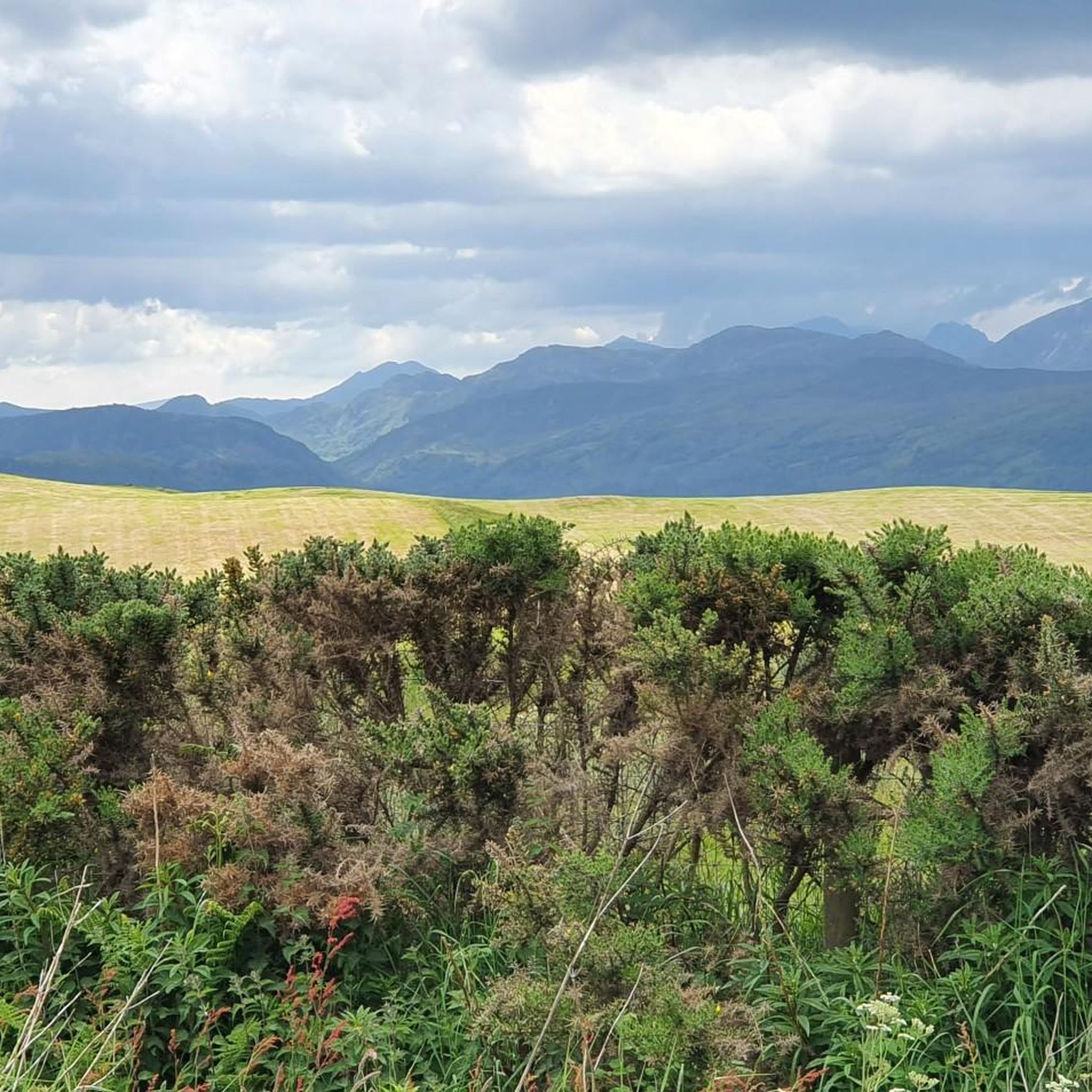
Jogging around Eglwysbach offers diverse landscapes within the Conwy Valley, characterized by its blend of river valleys, rolling hills, and views towards the Carneddau mountains. The region provides a variety of running surfaces, from field paths and B-roads to more challenging trails with elevation changes. Its proximity to Gwydyr Forest and the eastern fringes of Snowdonia National Park ensures access to extensive natural terrain suitable for various running experiences.
Best jogging routes around Eglwysbach
- The most popular jogging route is…
Last updated: May 11, 2026
43
runners
22.5km
02:41
530m
530m
Hard run. Very good fitness required. Mostly paved surfaces. Suitable for all skill levels.
40
runners
Hard run. Very good fitness required. Mostly paved surfaces. Suitable for all skill levels.

Sign up for free
5.0
(1)
7
runners
9.63km
01:04
220m
220m
Moderate run. Good fitness required. Mostly paved surfaces. Suitable for all skill levels.
5.0
(1)
7
runners
9.91km
01:07
230m
230m
Moderate run. Good fitness required. Mostly paved surfaces. Suitable for all skill levels.
6
runners
7.22km
00:47
110m
110m
Moderate run. Good fitness required. Mostly paved surfaces. Suitable for all skill levels.
Get access to more routes and recommendations from other explorers.
Sign up for free
Already have an account?
Our route recommendations are based on thousands of hikes, rides, and runs completed by other people on komoot.
Start today with a free account
Your next adventure awaits.
Login or Signup

Tips from the Community

The pipes are directly linked to the legacy of the tragic Dolgarrog Dam Disaster. In November 1925, the failure of the Eigiau Dam, followed by the overtopping and failure of the Coedty Dam, caused a devastating flood that swamped the village, killing 16 people. This disaster led to the passing of the Reservoirs (Safety Provisions) Act in 1930, which introduced crucial laws on reservoir safety. While the pipes themselves weren't the cause, they are an integral part of the hydro-electric system that was at the heart of the disaster.
0
0
The Dolgarrog pipes are a prominent and historically significant feature in the landscape around the village of Dolgarrog in the Conwy Valley, North Wales. They are part of a hydro-electric power scheme that has been in operation for over a century. These large pipes carry water from the Carneddau mountains to the Dolgarrog hydro-electric power station, which was originally built to provide cheap electricity for an aluminium smelting plant established in 1906. While the aluminium factory has since closed, the power station continues to feed electricity into the National Grid.
0
0
The sobering part was reading how they thought it was safe after hearing the church bells. They weren't, it was the church getting swept away!!!!
0
0
Just a little slice of paradise. Was the only person there, I hadn't actually seen a person all day. So..... a bit of free swimming was required
0
0

a very interesting route ebike needed
0
0

Remains of the Dolgarrog Dam Disaster Dolgarrog, Wales The worst flood disaster in Welsh history might have been a lot worse if it had not happened on movie night. LLYN EIGIAU, A LAKE AT the edge of the Carneddau mountains in Snowdonia, Wales, was the origin of the worst dam disaster in Welsh history. The devastating flood of 1925 is commemorated by a plaque placed on the massive boulders that came to rest after destroying much of the village of Dolgarrog. In 1911, a dam three-quarters of a mile long and 35 feet high was built across part of the eastern side of the lake to supply water for the hydroelectric power station in the village and power the aluminum works next to the station. A new tramway was constructed to bring materials for the dam from Dolgarrog. It is reported that the original contractor withdrew from the project, unhappy that corners were being cut in the construction of the dam. And indeed, his misgivings were realized. In November, 1925, after 26 inches of rain fell in just five days, the Eigiau dam failed. The water flowed down to Coedty Reservoir, which rapidly caused its earth bank dam to burst as well and release billions of gallons of water. The torrent of water, estimated at over 70 billion gallons, flowed down into the village of Dolgarrog, creating massive damage and leading to the loss of 16 lives. The death toll could have been worse, but it was fortunate that the breach occurred on the night when the local community hall was used as a cinema. The hall was on slightly higher ground, and many of the town residents were safe inside. The force of water carried some massive boulders (some as heavy as 200 tonnes) down to into the village, which was destroyed by the flood. Gwilym Wyn Roberts, whose mother survived the flood, told the BBC that “Cows were seen hanging from the trees and the aluminum works were submerged under 5 feet of mud.” These boulders are now marked with a memorial plaque, and the village has been rebuilt away from the devastated area. The remains of the dam are easily accessible on foot from a parking lot about half a mile away from the breached dam wall. A close look at the remains of the Eigiau dam today reveals that the foundations were insufficient, and close observation reveals large lumps of unmixed concrete. The dam material that can be seen through existing holes tends to break away easily and is clearly badly graded. After the disaster, an additional breach was created in the dam to ensure that water could not build up to dangerous levels. A Parliamentary investigation led to more stringent rules on British dam construction, as part of the Reservoirs (Safety Provisions) Act in 1930. Today the lake covers an area of about 120 acres (about half the impounded area when the dam was in use) and is only about 32 foot deep. This memorial commemorates the victims of the dam disaster in Dolgarrog on the dark and stormy night of 2 November 1925.
0
0

Flat gravel road from the car park to the track junction. Nice to bike in from pen y gaer hill fort to the NE.
0
0
Frequently Asked Questions
How many running routes are available around Eglwysbach?
Eglwysbach offers a wide selection of over 200 running routes, catering to various fitness levels and preferences. From gentle paths to more challenging trails, there's a diverse network to explore.
Are there any easy running trails suitable for beginners or families in Eglwysbach?
Yes, Eglwysbach has around 20 easy running routes. A notable option is the Hiraethlyn Walk, an accessible 3.5-mile circular route around the village that traverses field paths and B-roads, offering picturesque views. You can find more details about this specific walk on visitconwy.org.uk.
What kind of terrain can I expect on jogging routes near Eglwysbach?
The jogging routes around Eglwysbach offer a diverse range of terrain. You'll encounter everything from field paths and B-roads to more challenging trails with significant elevation changes. The area's proximity to Gwydyr Forest and the eastern fringes of Snowdonia National Park ensures access to extensive natural terrain, including forest trails and paths with views of the Carneddau mountains.
Can I find routes with scenic views of the mountains or valleys?
Absolutely. Many running routes in Eglwysbach provide stunning scenic views. You can expect inspiring vistas of the Conwy Valley and the majestic Carneddau mountains, offering a dramatic backdrop to your run. The Hiraethlyn Walk, for instance, is known for its picturesque views of the surrounding valley and mountains.
Are there any circular running routes in the Eglwysbach area?
Yes, there are several circular running routes available. For example, the Hiraethlyn Walk is a well-known circular route around the village. Many of the routes on komoot are designed as loops, allowing you to start and finish in the same location.
What do other runners enjoy most about jogging in Eglwysbach?
The running experience in Eglwysbach is highly rated by the komoot community, with an average score of 4.75 stars from over 20 reviews. Runners often praise the diverse landscapes, the inspiring views of the Conwy Valley and Carneddau mountains, and the variety of terrain that caters to different fitness levels.
Are there any challenging running trails for experienced runners?
Yes, Eglwysbach offers around 70 difficult running routes for those seeking a challenge. A prime example is the Eigiau Dam Ruins – Eigiau Valley Gravel Road loop from Dolgarrog, a 13.8-mile trail with significant elevation gain that explores the Eigiau Valley.
Are there any attractions or points of interest along the running routes?
While Eglwysbach itself is a village, its surrounding area boasts several points of interest. You might encounter views towards the Foel Fras summit or Tal y Fan summit. The nearby Bodnant Garden also offers natural scenery that could be incorporated into longer runs, though it's not directly on the routes listed here.
Can I find running routes that pass by water features like rivers or waterfalls?
Yes, some routes offer views of water features. The Running loop from River Conwy provides views of the River Conwy. While not directly on the listed running routes, the famous Swallow Falls is a notable natural attraction in the broader region.
Are there running routes that go through forests or woodlands?
Absolutely. Eglwysbach's proximity to the gorgeous Gwydyr Forest, particularly near Betws-y-Coed, means you'll find a variety of trails weaving through woodlands. These forest trails offer shaded paths and a different running experience compared to open valley routes.
What is a moderately challenging running route in the area?
For a moderately challenging run, consider the Steep Tarmac Road loop from River Conwy. This 6.0-mile trail leads through the scenic Conwy Valley and typically takes about 1 hour 5 minutes to complete, offering a good balance of distance and elevation.
Are there any running routes that start near Bodnant Garden?
Yes, there is a moderate route that starts near Bodnant Garden. The Steep Tarmac Road loop from Bodnant Garden is a 6.2-mile (9.9 km) route that offers a good running experience in the vicinity of this renowned attraction.
Most popular attractions around Eglwysbach

Get inspired with the komoot mobile app


Explore more
Browse the best Running Trails & Routes in other regions.
