The best walks and hikes around Clifton Campville
4.4
(482)
4,928
hikers
344
hikes
Hikes around Clifton Campville explore the gently rolling agricultural landscape of the Staffordshire countryside. The area is characterized by open fields, mature woodlands, and paths along the River Mease. The terrain is generally flat with slight elevations, making it accessible for a wide range of walking abilities.
Best hiking trails around Clifton Campville
- The most popular hiking route is Hiking loop from Shuttington CP, a 3.1 mile (5.0 km) trail that takes about 1 hour 18 minutes to complete. This is an easy route with minimal elevation change.
- Another top favourite among local hiking enthusiasts is Colorful Wheel Sculpture loop from Amington, an easy 4.2 mile (6.7 km) path. The route follows level paths suitable for most fitness levels.
- Local hiking enthusiasts also love the Hiking loop from Tamworth FC, a 5.1 mile (8.2 km) trail leading through the local area, often completed in about 2 hours 7 minutes.
- Hiking around Clifton Campville is defined by riverside walks, paths through open farmland, and woodland trails. The network of public footpaths offers a variety of easy and moderate circular walks starting from the village and nearby areas.
- The routes in Clifton Campville are highly rated by the komoot community with an average score of 4.4 stars from over 400 reviews. More than 4,300 hikers have used komoot to explore Clifton Campville's varied terrain.
Last updated: July 6, 2026
4.0
(2)
23
hikers
Moderate hike. Good fitness required. Easily-accessible paths. Suitable for all skill levels.
4.5
(2)
21
hikers
Easy hike. Great for any fitness level. Easily-accessible paths. Suitable for all skill levels.

Sign up for free
5.0
(1)
27
hikers
Easy hike. Great for any fitness level. Easily-accessible paths. Suitable for all skill levels.
17
hikers
Moderate hike. Good fitness required. Easily-accessible paths. Suitable for all skill levels.
10
hikers
Moderate hike. Good fitness required. Easily-accessible paths. Suitable for all skill levels.
Get access to more routes and recommendations from other explorers.
Sign up for free
Already have an account?
Our route recommendations are based on thousands of hikes, rides, and runs completed by other people on komoot.
Start today with a free account
Your next adventure awaits.
Login or Signup


Tips from the Community

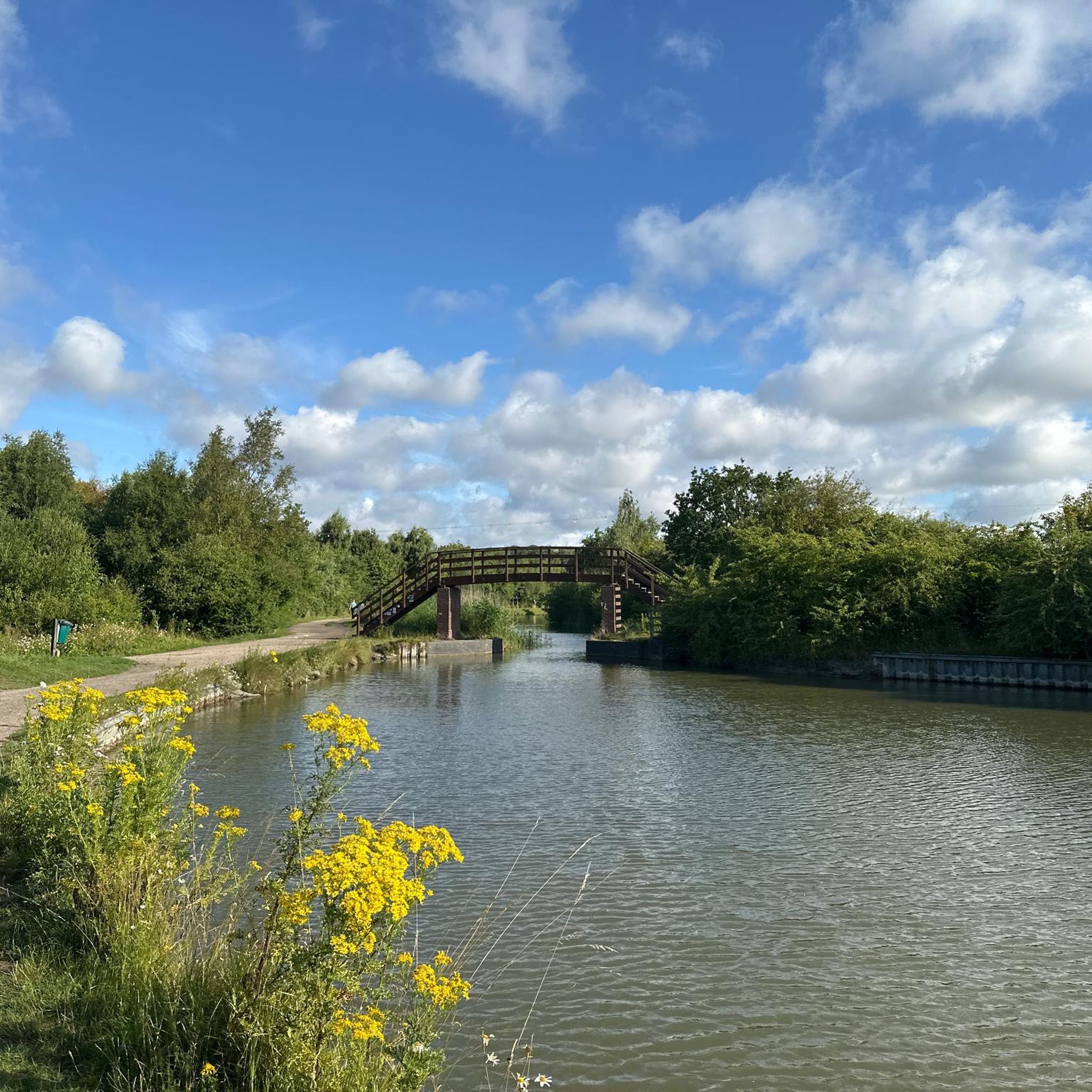
Such a towpath (known in German as a towpath or Leinpfad), which runs alongside the river or canal, was an essential part of the transport infrastructure in earlier times. Before ships could move by motor power, horses walked along the bank, pulling the boat against the current. This activity was called "treideln" in German, and thus the "treidelpfad" got its name. Where these paths – running directly along the bank – have survived to this day, they no longer serve their original purpose, but are still popular: namely, with hikers and cyclists.
0
0

The Honey Pot is no longer trading
0
0

Lovely bit of gravel and a handy cut across the M42
0
0
Towpath is usually in pretty good condition for most of the year. Probably not all suitable for a road bike but anything with 40mm or above tyres is going to be fine.
0
0


A great place to build into a run. A flat canal followed by a bit of ascent to the golden needle (an industrial sized sundial)
1
0


Burnt Sunlight sundial. Great views and fascinating concept
0
0
Frequently Asked Questions
Are there many circular walks starting from Clifton Campville?
Yes, the area is well-suited for circular hikes. The network of public footpaths allows for a variety of loops that start and end in or near the village, taking you through open farmland and along the River Mease. Many routes use the prominent spire of St. Andrew's Church as a landmark for navigation.
What are the walks like in terms of difficulty?
Most hikes around Clifton Campville are considered easy to moderate. The landscape is predominantly flat and gently rolling, making it accessible for most fitness levels. Out of more than 300 routes in the area, the majority are rated as easy, with very few classified as difficult.
Are there any family-friendly walking trails?
Definitely. The gentle terrain and abundance of easy routes make this a great area for family walks. For a straightforward and pleasant outing, consider the Wooden Footbridge Over River loop from Landau Forte Academy Amington. It's a relatively flat path that offers a good introduction to the local scenery.
Can I bring my dog on the walks around Clifton Campville?
Yes, the area is generally dog-friendly, with many public footpaths crossing open fields where dogs can often walk. Pooley Country Park is a popular spot for dog walkers. However, always be mindful that you will be walking through agricultural land, so keep dogs on a lead where livestock is present and respect any local signage.
Where can I find a good walk along the River Mease?
Several footpaths follow the course of the River Mease, which is a designated Site of Special Scientific Interest. These riverside walks are typically very gentle and offer a serene environment. The Wooden Footbridge Over River – Abbey Green Bridge loop from Landau Forte Academy Amington is a longer route that incorporates sections along the river.
What kind of wildlife might I see on a hike?
The River Mease and its surroundings are a haven for wildlife. The river is noted for species like the spined loach and European bullhead. If you're quiet and lucky, you might even spot otters along the riverbanks. The nearby RSPB Middleton Lakes nature reserve is also excellent for birdwatching.
Are there any pubs on or near the walking routes?
While there are no pubs directly on the listed trail routes, the village of Clifton Campville and surrounding areas have options for refreshments after your hike. A short drive away, you can find traditional pubs to relax in. Planning your route to end near a village will give you the best chance to find a local pub.
Where is the best place to park for a walk?
For walks starting in Clifton Campville, on-street parking is available but please park considerately as it is a historic village. For specific routes, dedicated car parks are often the best option. For example, Pooley Country Park has a car park, and some trailheads like the one in Shuttington have small parking areas (CP) that serve as convenient starting points.
What do other hikers enjoy about the Clifton Campville area?
The area is highly rated by the komoot community. Hikers often praise the peaceful, rolling countryside and the well-preserved rural character. The mix of open fields, quiet woodland paths, and serene walks along the River Mease are frequently mentioned as highlights.
Are there any particularly scenic spots or viewpoints?
The main viewpoint is the village of Clifton Campville itself, which sits on a slight hill offering far-reaching views across the surrounding plain. The 210-foot spire of St. Andrew's Church is a magnificent landmark visible for miles. For a different kind of scenery, the Slitting Mill Waterfall is a highly-regarded spot known for its charming cascades and easy-going trails.
How many hiking trails are available around Clifton Campville?
There are over 300 hiking routes to explore in the Clifton Campville region. They range from short, easy loops perfect for a quick stroll to more moderate, longer-distance paths, ensuring there is a trail for every type of walker.
Most popular attractions around Clifton Campville

Get inspired with the komoot mobile app


Explore more
Browse the best Hikes in other regions.
