The best walks and hikes around Ulnes Walton
4.5
(797)
7,711
hikers
456
hikes
Hiking around Ulnes Walton explores the gentle, rolling landscapes of Lancashire. The area is characterized by a network of footpaths through agricultural land, along riverbanks, and into small woodlands. The terrain is generally low-lying and flat, making it accessible for a wide range of fitness levels. These natural features provide varied scenery for outdoor activities.
Best hiking trails around Ulnes Walton
- The most popular hiking route is Bank Hall loop from Croston, a 5.9 miles (9.5 km) trail that takes around 2 hours 25 minutes to complete. This moderate hike passes the historic Bank Hall and follows paths through local farmland.
- Another top favourite among local hikers is Croston countryside and village walk, an easy 3.3 miles (5.3 km) path. This route features a notable stone archway and meanders through a section of woodland.
- Local hikers also love the Bank Hall loop from Bretherton, a 4.1 miles (6.6 km) trail leading through open countryside, often completed in about 1 hour 40 minutes.
- Hiking around Ulnes Walton is defined by riverside paths, walks through farmland, and trails in small woodlands. The network of public footpaths provides options suitable for different ability levels.
- The routes in Ulnes Walton are highly rated by the komoot community with an average score of 4.5 stars from over 700 reviews. More than 6,500 hikers have used komoot to explore Ulnes Walton's varied terrain.
Last updated: June 25, 2026
5.0
(2)
44
hikers
4.31km
01:06
10m
10m
Easy hike. Great for any fitness level. Easily-accessible paths. Suitable for all skill levels.
32
hikers
5.32km
01:21
10m
10m
Easy hike. Great for any fitness level. Easily-accessible paths. Suitable for all skill levels.

Sign up for free
5.0
(4)
14
hikers
9.52km
02:24
20m
20m
Moderate hike. Good fitness required. Easily-accessible paths. Suitable for all skill levels.
8
hikers
7.59km
01:55
10m
10m
Easy hike. Great for any fitness level. Easily-accessible paths. Suitable for all skill levels.
7
hikers
7.30km
01:50
10m
10m
Easy hike. Great for any fitness level. Easily-accessible paths. Suitable for all skill levels.
Get access to more routes and recommendations from other explorers.
Sign up for free
Already have an account?
Our route recommendations are based on thousands of hikes, rides, and runs completed by other people on komoot.
Start today with a free account
Your next adventure awaits.
Login or Signup
Tips from the Community

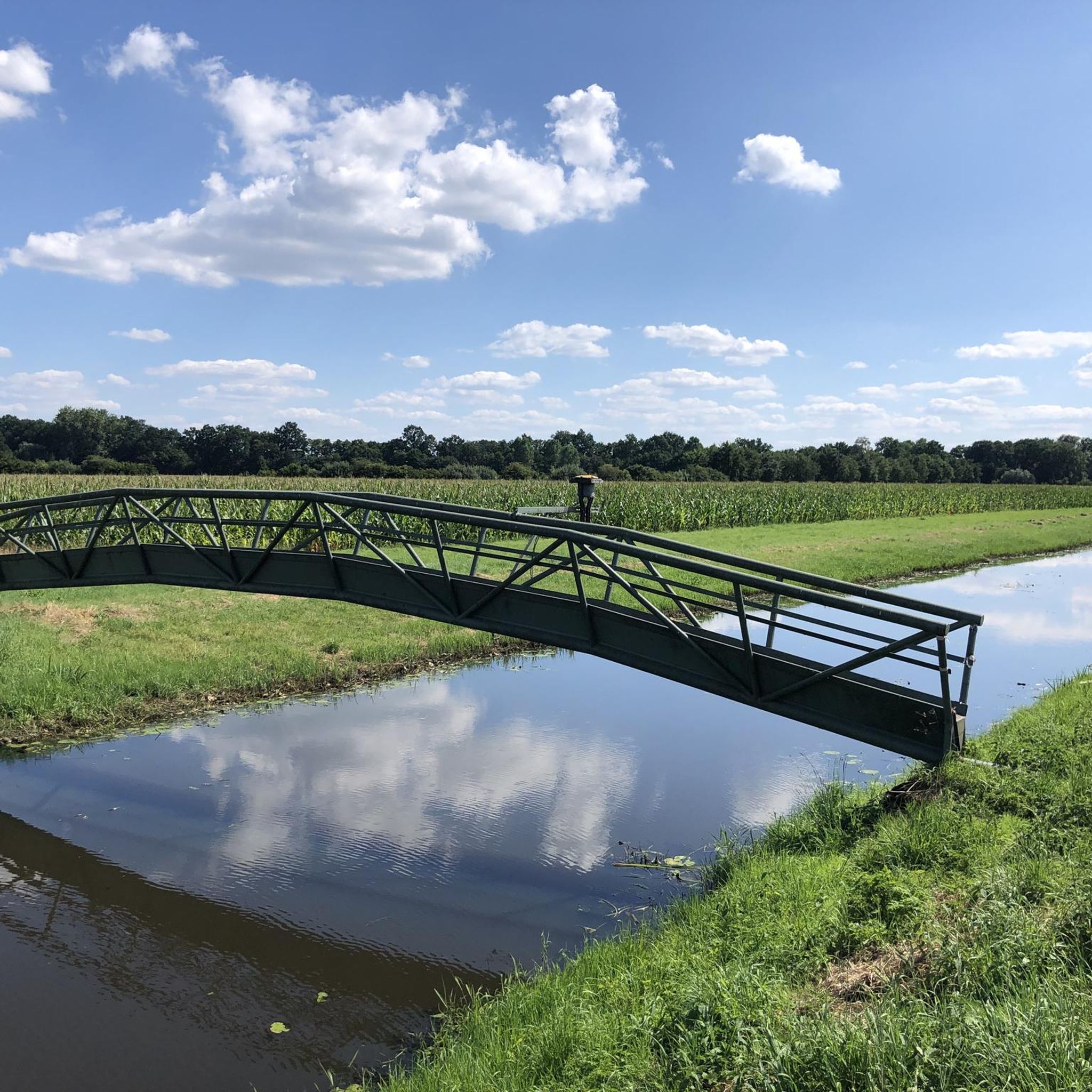
Bank Bridge also known as Tarleton Bridge is an English Heritage, Grade II listed structure as is the Bank Warehouse adjacent to the bridge situated on the Leeds Liverpool Canal Rufford Branch.
2
0


lovely village to stop lots of cafes
0
0

The bridge is in the middle of nowhere so don't expect coffee and cake unless you bring your own! Nice road for cycling though linking Mere Brow and Croston - always quiet and traffic free.
0
0

Agreed on the beauty of the area but if you arrive at the bridge and find it empty, take your pics and vids quickly because the racket caused by cars passing over it is absolutely awful/unbearable. Not sure who designed it with loose individual metal slats in mind but the clatter means a re-think is required! The central rubber 'carpet' (sections of which are missing) might mildly dim noise generated by cyclists but is totally redundant for the main culprit: the car. Speaking of which: a decision needs to be made on whether the lane and bridge should remain accessible by car because at the moment (and with burgeoning sizes of vehicles in future), the purpose of the cycleway is somewhat diminished when riders have to constantly stop while two cars squirm past each other or to allow one to overtake. Perhaps it was just busier on the day I visited but it got very silly indeed!
0
1
Croston was founded in the 7th century when St Aidan arrived at the riverside settlements. In the absence of a church, a cross was erected as a place of worship. The name is derived from the two Old English words 'cross' and 'tūn' (town/homestead/village) and is unique to the village. The parish of Croston was formerly far larger than it is today. It included Chorley, Much Hoole, Rufford, Bretherton, Mawdesley, Tarleton, Hesketh Bank, Bispham, Walmer Bridge and Ulnes Walton. These became independent parishes as a result of a series of separations between 1642 and 1821.[2] A charter granted by Edward I in 1283 permitted an annual medieval fair and market to be held on the village green. Pre-20th Century maps also depict a castle which is believed to have been of a wooden construction because there is no evidence of a stone structure.
4
0
Best to get off and walk over with your bike so it's not so noisy.
5
2
Frequently Asked Questions
Are the hiking trails around Ulnes Walton suitable for families with children?
Yes, the area is great for family walks. The landscape is generally flat and many trails are manageable for younger walkers. For a day out, consider visiting Beacon Fell Country Park, which has well-maintained paths and a sculpture trail. A good specific route is the Easter Monday Walk Trail – Eccleston Village loop from Eccleston, which is an easy walk through the village and surrounding fields.
Can I bring my dog on the walks near Ulnes Walton?
Most trails are dog-friendly, but since many routes pass through active farmland, it's essential to keep your dog on a lead, especially around livestock. For off-lead opportunities, parks like Yarrow Valley Country Park are a popular choice among local dog owners.
Are there any circular walks available?
The Ulnes Walton area is perfect for circular walks, and they are the most common type of route you'll find. A great example of a shorter, easy loop is the Stone Archway in Shaw Wood loop from Victoria Terrace, which takes you through pleasant woodland scenery.
What are some popular places to hike to near Ulnes Walton?
Hikers in the area enjoy a variety of natural and scenic spots. Some of the most popular destinations include:
- Yarrow Valley Country Park: A highly-regarded 700-acre park with a lake, waterfall, and visitor facilities.
- Roddlesworth Waterfall: A well-liked spot to explore, accessible from the surrounding moors.
- Duxbury Weir: A scenic point of interest known for its lovely running water, perfect for a peaceful walk.
- Withnell Nature Trail: An easy walk along a former railway line through mixed woodland and past small lakes.
Are there any walks that feature waterfalls?
Yes, you can find waterfalls in the wider area. Yarrow Valley Country Park features a waterfall within its 700 acres of parkland. For a more focused destination, Roddlesworth Waterfall is another popular spot for walkers looking to enjoy the scenery.
Where can I find an easy, relatively flat walk?
The region is characterized by its gentle terrain, so you'll find many easy options. Over half of the trails are classified as easy. For a particularly straightforward and pleasant walk, try the Bank Hall loop from Bretherton, which is a mostly flat route through open countryside.
How can I get to the Ulnes Walton area by public transport?
The nearby villages of Croston and Leyland have train stations which can serve as starting points for several walks. From there, you can access the network of public footpaths. Many bus services also operate in the region, connecting the main towns and villages.
Are there any good pubs for walkers in the area?
Yes, many of the villages surrounding Ulnes Walton, such as Croston and Eccleston, have traditional pubs that are popular with walkers for a post-hike meal or drink. It's common to plan a circular route that starts and ends near a village pub.
What is the Croston Countryside and Village walk like?
This is a well-known local walk that combines village scenery with countryside paths. It typically follows parts of the River Yarrow and River Douglas, offering a relatively flat route with lovely views. You can find a map and more details on the Chorley Council website.
Are there any nature reserves I can explore on a walk?
The area is close to several excellent nature reserves. Brockholes Nature Reserve, a former quarry, is a fantastic spot for wildlife and features a unique floating visitor village. Cuerden Valley Park also offers 650 acres of varied landscape with miles of paths to explore.
What do other hikers say about the trails around Ulnes Walton?
The routes are highly rated by the komoot community, with an average score of 4.5 stars. Reviewers often praise the peaceful farmland, the well-defined riverside paths, and the accessibility of the trails for different fitness levels.
Most popular attractions around Ulnes Walton

Get inspired with the komoot mobile app


Explore more
Browse the best Hikes in other regions.
