The best walks and hikes around Buchlyvie
4.5
(1295)
8,442
hikers
178
hikes
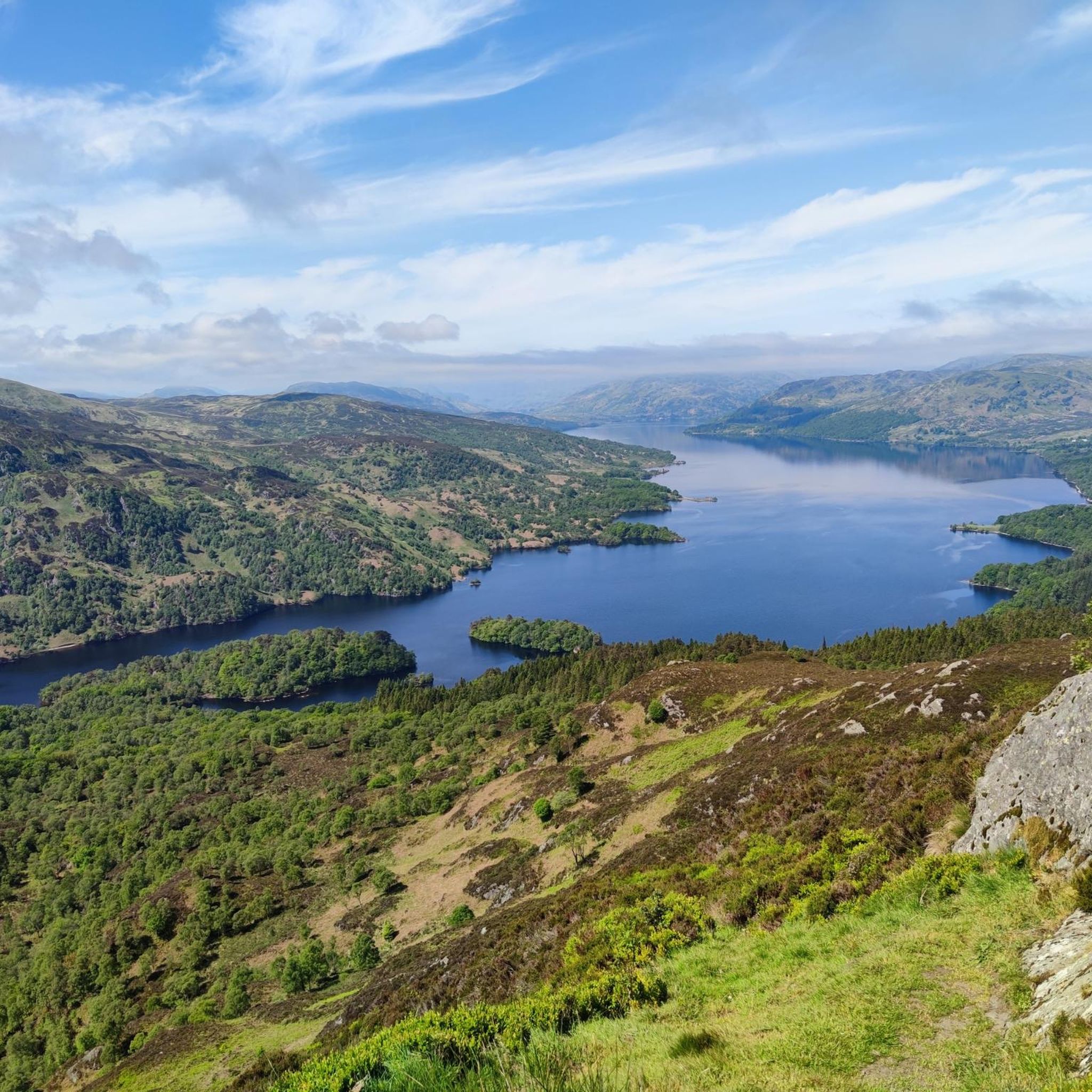
Hiking trails around Buchlyvie are situated in the Stirling council area of Scotland, offering access to diverse natural landscapes. The region is characterized by its proximity to Flanders Moss, a significant raised bog, and the varied terrain of Loch Lomond & The Trossachs National Park, featuring lochs, mountains, and woodlands. To the south, the Campsie Fells provide a more rugged landscape with elevated views.
Best hiking trails around Buchlyvie
- The most popular hiking route is Riverside Path – Faerie Bridge loop from Gartmore, a 2.1 miles (3.4 km) trail that takes about 53 minutes to complete. This easy path follows a riverside route suitable for all skill levels.
- Another top favourite among local hikers is Riverside Path – Doon Hill Fairy Trail loop from Gartmore, an easy 3.1 miles (5.1 km) path. This route offers a gentle walk along a riverside trail, ideal for a relaxed outing.
- Local hikers also love the Cunninghame Graham Memorial – Gravel Path Cycling Section loop from Gartmore, a 7.0 miles (11.2 km) trail leading through varied terrain, often completed in about 2 hours 58 minutes.
- Hiking around Buchlyvie is defined by unique raised bogs, scenic lochs and woodlands, and rugged fells. The network offers options for different ability levels, from gentle riverside strolls to more challenging ascents.
- The routes in Buchlyvie are highly rated by the komoot community with an average score of 4.5 stars from over 1000 reviews. More than 7000 hikers have used komoot to explore Buchlyvie's varied terrain.
Last updated: August 17, 2026
4.5
(2)
20
hikers
3.36km
00:53
20m
30m
Easy hike. Great for any fitness level. Easily-accessible paths. Suitable for all skill levels.
4.5
(2)
18
hikers
5.06km
01:25
100m
100m
Easy hike. Great for any fitness level. Easily-accessible paths. Suitable for all skill levels.

Sign up for free
5.0
(1)
10
hikers
Moderate hike. Good fitness required. Easily-accessible paths. Suitable for all skill levels.
5
hikers
Moderate hike. Good fitness required. Easily-accessible paths. Suitable for all skill levels.
4.0
(1)
5
hikers
4.32km
01:11
70m
70m
Easy hike. Great for any fitness level. Easily-accessible paths. Suitable for all skill levels.
Get access to more routes and recommendations from other explorers.
Sign up for free
Already have an account?
Our route recommendations are based on thousands of hikes, rides, and runs completed by other people on komoot.
Start today with a free account
Your next adventure awaits.
Login or Signup

Tips from the Community


Glasgow has been supplied by the Loch Kathrin water system for over 160 years. Some of the artefacts belonging to this water system can be found along the watercourse.
3
0

Round tower with gratings on top over underground pipeline wich carry water from Loch Katrine to Glasgow. Part of the Glasgow Corporation Water-Works.
0
0
Corrie Aqueduct Bridge - water flows here from Loch Katrine to Glasgow. Part of the Glasgow Corporation Water-Works.
0
0
The growth of Glasgow and the subsequent need for unpolluted water for both human and industrial consumption, resulted in the decision to build an aqueduct to provide water to the city. Loch Katrine was chosen to be the source of the supply. The system (34 miles long) was inaugurated by Queen Victoria on the 14 October 1859. By 1883 an additional supply from Loch Katrine was needed due to the increased consumption of water by the city. An additional aqueduct was constructed from 1885. The new system, measuring 23.5 miles in length, was officially opened on 21st June 1901. Glasgow Corporation Water-Works 1909 https://canmore.org.uk/site/260225/glasgow-corporation-water-works-1855-aqueduct-corrie-aqueduct-bridge http://portal.historicenvironment.scot/designation/LB51153
0
0


A good place to stop halfway between Drymen and Aberfoyle. The viaduct is very impressive. Real sense of solitude here.
1
0

This circular walk/cycle from Aberfoyle climbs mystical Doon Hill, reputed home of the faerie folk. It passes through beautiful native woodland, open countryside and riverside. At the top of the hill is the Fairy tree. (see photos). It is possible to cycle the track round the hill though gets a bit tricky for the inexperienced on the far side. On a mountain bike you can climb to the summit and a decent descent is to be had from there. Alternatively leave your bike at the foot of the marked trail to the top of the hill. It will be watched over by the fairies.
0
0
Frequently Asked Questions
What types of hiking trails can I expect around Buchlyvie?
Buchlyvie offers a diverse range of hiking experiences. You'll find gentle riverside paths, such as the Cunninghame Graham Memorial – Gartmore Shop loop from Gartmore, as well as routes that traverse varied terrain, including gravel paths and more rugged landscapes in the nearby Campsie Fells. The area is characterized by its proximity to the unique raised bogs of Flanders Moss and the scenic lochs and woodlands of Loch Lomond & The Trossachs National Park.
Are there easy hiking trails suitable for beginners or families?
Yes, Buchlyvie has many easy trails perfect for beginners or families. For instance, the Riverside Path – Faerie Bridge loop from Gartmore is an easy 2.1-mile (3.4 km) path that follows a riverside route. Another gentle option is the Riverside Path – Doon Hill Fairy Trail loop from Gartmore, which is 3.1 miles (5.1 km) and ideal for a relaxed outing.
What kind of natural features or landmarks can I see while hiking near Buchlyvie?
The region boasts several notable natural features and landmarks. You can experience the unique ecosystem of Flanders Moss National Nature Reserve, one of Britain's largest remaining raised bogs. Hikers can also enjoy stunning views of Loch Lomond from Conic Hill, explore the mystical Doon Hill Fairy Trail, or visit the scenic Loch Drunkie. For more rugged landscapes, the Campsie Fells offer rewarding views from spots like Earl's Seat Summit.
Are there any challenging hikes for experienced trekkers?
While many trails are easy to moderate, there are options for more experienced hikers. The Campsie Fells to the south of Buchlyvie provide a more rugged landscape with sustained ascents and panoramic views. Routes like the Corrie Aqueduct Bridge – Loch Katrine Waterworks Shafts loop from Bàt a' Charchel offer a moderate challenge over 8.7 miles (13.9 km) with significant elevation gain.
Are there circular hiking routes available around Buchlyvie?
Yes, many of the trails around Buchlyvie are designed as loops, offering convenient circular walks. Examples include the Riverside Path – Faerie Bridge loop from Gartmore and the Cunninghame Graham Memorial – Gravel Path Cycling Section loop from Gartmore, allowing you to start and finish at the same point.
What do other hikers say about the trails in Buchlyvie?
The hiking trails around Buchlyvie are highly regarded by the komoot community, holding an average rating of 4.5 stars from over 1000 reviews. Hikers often praise the diverse scenery, from tranquil riverside paths to the unique bog landscapes and stunning loch views. Over 7000 hikers have used komoot to explore the varied terrain, indicating its popularity and appeal.
Can I bring my dog on the hiking trails near Buchlyvie?
Many trails in the Buchlyvie area are suitable for dogs, especially the numerous woodland and riverside paths. However, when hiking near livestock or in nature reserves like Flanders Moss, it's crucial to keep dogs on a lead and follow local signage to protect wildlife and ensure a pleasant experience for everyone.
What is the best time of year to go hiking in Buchlyvie?
The best time to hike in Buchlyvie generally aligns with spring, summer, and early autumn (April to October) when the weather is milder and daylight hours are longer. Spring brings blooming wildflowers, while autumn offers beautiful foliage. However, the unique landscapes like Flanders Moss can be explored year-round, with boardwalks providing access even in wetter conditions.
Are there any places to eat or drink near the hiking routes in Buchlyvie?
Buchlyvie village itself offers local amenities. For specific recommendations near trailheads, it's best to check local listings or plan your route to pass through villages like Gartmore, which may have cafes or pubs. The region is known for its welcoming local establishments.
How many hiking trails are available around Buchlyvie?
There are nearly 200 hiking routes available around Buchlyvie, offering a wide variety of distances and difficulty levels. This includes 88 easy trails, 87 moderate options, and 11 more challenging routes, ensuring there's something for every hiker.
What are some unique natural areas to explore near Buchlyvie?
Beyond the immediate trails, Buchlyvie is an excellent base for exploring significant natural areas. You can visit the unique raised bog ecosystem of Flanders Moss National Nature Reserve, or venture into the world-famous Loch Lomond & The Trossachs National Park, which offers stunning lochs, mountains, and woodlands. The Campsie Fells also provide a rugged landscape with rewarding views to the south.
Most popular attractions around Buchlyvie

Get inspired with the komoot mobile app


Explore more
Browse the best Hikes in other regions.
