The best walks and hikes around Yetholm And District
4.6
(444)
3,173
hikers
18
hikes
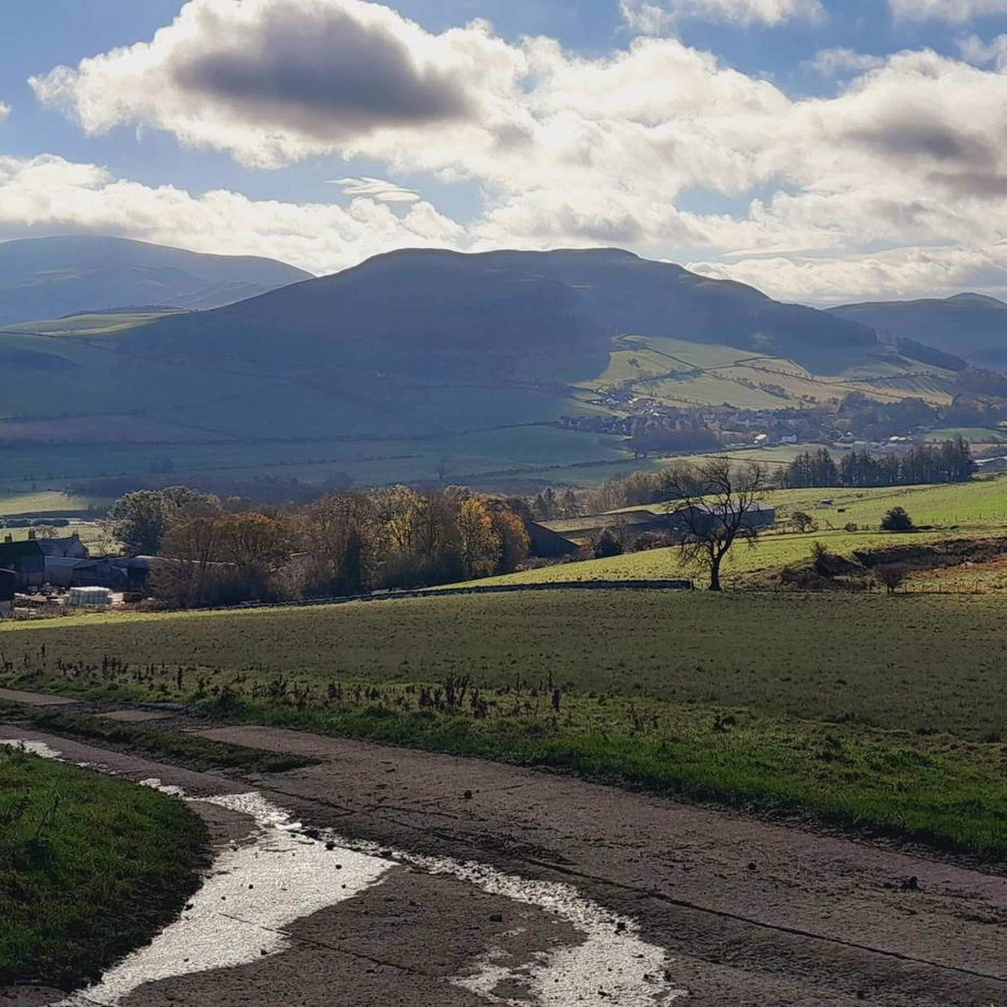
Hikes around Yetholm and District explore the rolling landscape of the Scottish Borders, situated at the northern end of the Pennine Way. The area is characterized by the Cheviot Hills, offering routes with significant elevation gain across open moorland and along historic cross-border paths. The terrain provides a mix of valley walks and more demanding hill climbs, with many trails intersecting long-distance routes like St Cuthbert's Way.
Best hiking trails around Yetholm And District
- The most popular hiking route is The Cheviot loop from Cocklawfoot — Northumberland National Park, a 11.3 mile (18.1 km) trail that takes around 6 hours to complete. This challenging hike involves a significant ascent to the highest point in the Cheviot Hills.
- Another top favourite among local hiking enthusiasts is Windy Gyle and Auchope Cairn loop from Sourhope — Roxburghshire, a difficult 13.2 mile (21.3 km) path. The route features sustained climbs and follows sections of the Pennine Way along the border ridge.
- Local hiking enthusiasts also love the The Street and Windy Gyle loop from Sourhope — Roxburghshire, a 14.2 mile (22.9 km) trail leading through the Cheviot Hills, often completed in about 6 hours 35 minutes.
- Hiking around Yetholm And District is defined by open moorland, rolling hills, and historic cross-border drovers' roads. The network of walking routes offers options for experienced hikers looking for challenging ascents as well as more moderate valley trails.
- The routes in Yetholm And District are highly rated by the komoot community with an average score of 4.4 stars from over 150 reviews. More than 1,300 hikers have used komoot to explore Yetholm And District's varied terrain.
Last updated: August 31, 2026
5.0
(5)
32
hikers
18.1km
06:02
610m
610m
Hike the difficult 11.3-mile Cheviot and Pennine Way Loop, gaining 2011 feet through wild Anglo-Scottish borderlands in Northumberland Natio
11
hikers
21.3km
06:49
660m
660m
Hard hike. Very good fitness required. Sure-footedness, sturdy shoes and alpine experience required.

Sign up for free
4.5
(2)
4
hikers
22.9km
06:37
570m
570m
Hike the challenging 14.2-mile Street and Windy Gyle Loop in Northumberland National Park, featuring ancient routes, panoramic views, and hi
24.8km
08:23
970m
970m
Hard hike. Very good fitness required. Sure-footedness, sturdy shoes and alpine experience required.
5.0
(1)
1
hikers
30.9km
08:42
620m
620m
Hike the difficult 19.2-mile Wideopen Hill and South Cote loop from Town Yetholm, offering panoramic views and a remote feel.
Get access to more routes and recommendations from other explorers.
Sign up for free
Already have an account?
Our route recommendations are based on thousands of hikes, rides, and runs completed by other people on komoot.
Start today with a free account
Your next adventure awaits.
Login or Signup
Other adventures around Yetholm And District

Tips from the Community

Ideally situated refuge hut. People have left helpful items like hand warmers, tea bags, plasters & saline flushes
0
0

The paved path up to the Cheviot.
0
0
Highest mountain in Northumberland national park, a decent path runs through to the summit as its a complete bog fest and there's not really any views as its a large plateau, but the views on the way back down are beautiful.
1
0

This is the summit of Windy Gyle 619mtrs. Approaching this hill you start to be amongst the clouds and visibility becomes less. It can be windy and wet but was not too bad on the day of the trail in late September 2024
0
0

A great spot is to sit on the trigg point and take the 360 views in which is absolutely stunning,one of my favorite places to hike and you will not be disappointed 😀
1
0
Windy gyle. one of the most stunning views you will see in Northumberland 360.
0
0
This area was like a swamp on the day I rode, it is easy enough to ride on the slab stones. Do not go off them though as you will sink into a very boggy surface and will be in a mess. The weather was barren at Cairn Hill summit which is 777mtrs
0
0
Frequently Asked Questions
Are there many circular walks starting from Yetholm?
Yes, the area is excellent for circular hikes. While many trails are sections of long-distance paths, you can find loops that bring you back to your starting point. For a challenging circular route with significant elevation, consider the The Schill and Wildgoose Hill loop from Halter Burn, which offers fantastic views across the Cheviot Hills.
What are the hiking options in the Cheviot Hills from Yetholm?
The Cheviot Hills dominate the landscape and offer the most challenging hiking in the region. Routes often involve steep ascents over open moorland to high, exposed ridges. These trails reward hikers with panoramic views across the border country. Many of the area's difficult-rated hikes, with over 600 meters of climbing, are found within this range.
Are there any easy, family-friendly walks near Yetholm?
While the region is known for its challenging hill climbs, there are easier options suitable for families. Look for walks around Yetholm Loch or along the river valleys which offer gentler terrain. The area has a handful of easy-rated trails that avoid the major ascents of the Cheviot Hills, making for a more relaxed day out.
Can I bring my dog on the trails around Yetholm?
Dogs are welcome on most trails, but it's important to be mindful of the landscape. You will be hiking through open moorland and farmland with livestock, so keeping your dog on a lead is essential. The area is also home to a herd of wild goats. For a walk that is particularly well-regarded by dog owners, you might enjoy The Presidents Route near Kelso.
How does Yetholm connect to the Pennine Way and St Cuthbert's Way?
Yetholm is a key hub for long-distance walkers. Kirk Yetholm marks the official northern terminus of the 268-mile Pennine Way. The village is also a popular overnight stop as it sits roughly at the halfway point of the 62-mile St Cuthbert's Way, which runs from Melrose to Lindisfarne.
What is the terrain like on the final section of the Pennine Way into Kirk Yetholm?
The final leg of the Pennine Way is a memorable and challenging section that crosses the Cheviot Hills. Hikers traverse high, remote moorland, often following the border ridge between Scotland and England. The path can be boggy and is very exposed to the elements before descending into the Bowmont Valley towards Kirk Yetholm.
Where can I park for a walk around Yetholm?
Parking is available in both Town Yetholm and Kirk Yetholm, which serve as excellent starting points for many routes. For trails starting further into the hills, such as those heading up The Cheviot or Windy Gyle, there are often small, informal parking areas at the road ends, like at Cocklawfoot or Sourhope. These can fill up quickly, so arriving early is recommended.
Are there any historical sites to see while hiking?
Yes, the region is rich in history. Many trails follow ancient drovers' roads used for centuries to move livestock across the border. A key historical point of interest is Yeavering Bell, the site of the largest Iron Age hillfort in the region, which is accessible via a hike and offers incredible views alongside its archaeological remains.
What do other hikers enjoy most about the Yetholm area?
The walking routes around Yetholm and District are highly rated by the komoot community, with an average score of 4.4 stars. Reviewers frequently praise the stunning panoramic views from the high ridges and the unique feeling of walking along the Anglo-Scottish border. The sense of remoteness and the challenge of the hill climbs are also common highlights.
How many hiking trails are there around Yetholm?
There are nearly 20 designated hiking routes to explore around Yetholm and District. The collection is weighted towards experienced hikers, with over half of the trails rated as difficult, but there are also several moderate and easy options for those seeking a less strenuous day.
Can I get to the trailheads using public transport?
Bus services connect Yetholm to nearby towns like Kelso, which has wider connections. This makes it possible to access the start of several walks in and around the villages without a car. However, for trailheads deeper in the Cheviot Hills, such as Sourhope, public transport is limited and a car is generally necessary.
Most popular routes around Yetholm And District
Most popular attractions around Yetholm And District

Get inspired with the komoot mobile app


Explore more
Browse the best Hikes in other regions.
