The best running trails in Blm - Animas City Mountain
4.7
(7)
738
runners
117
runs
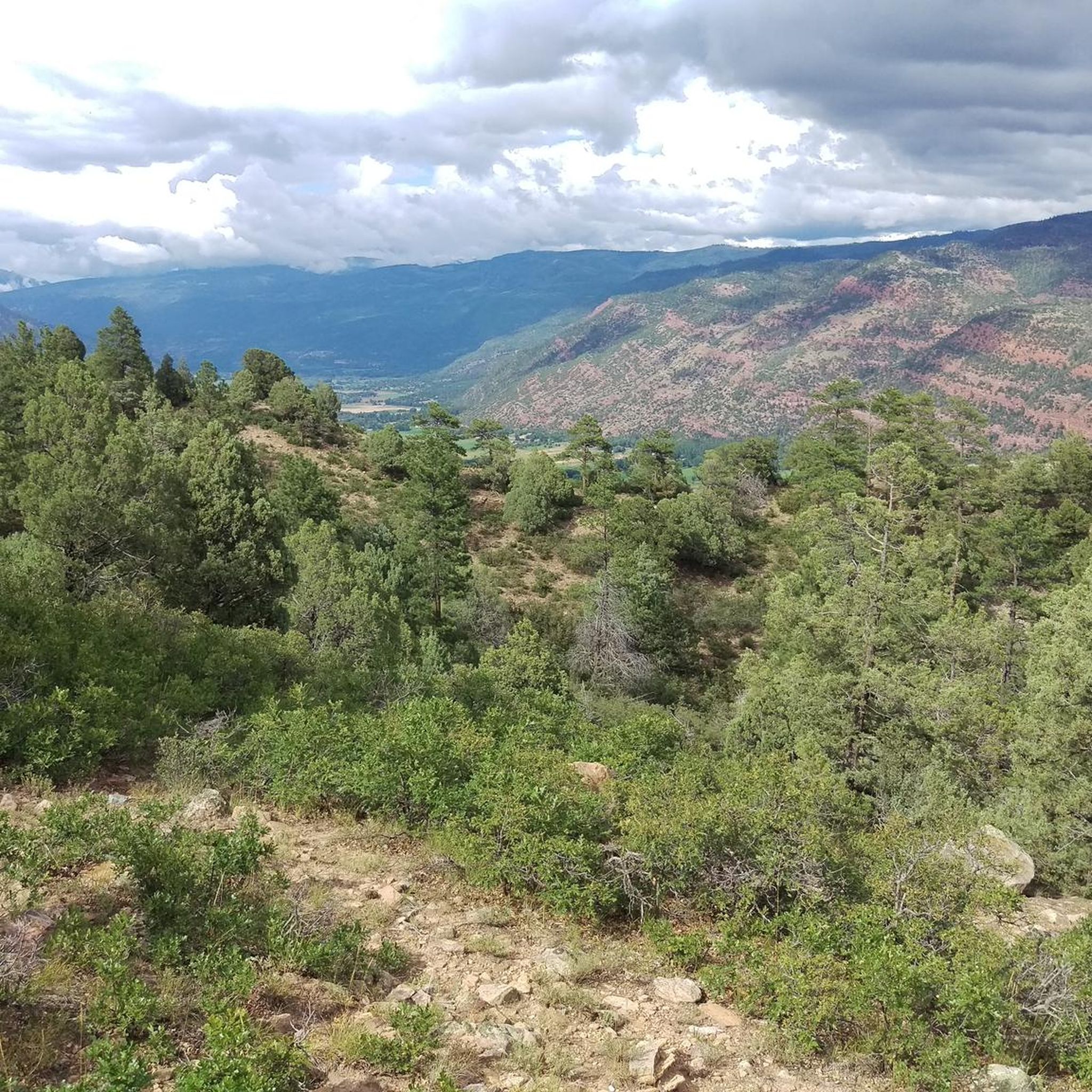
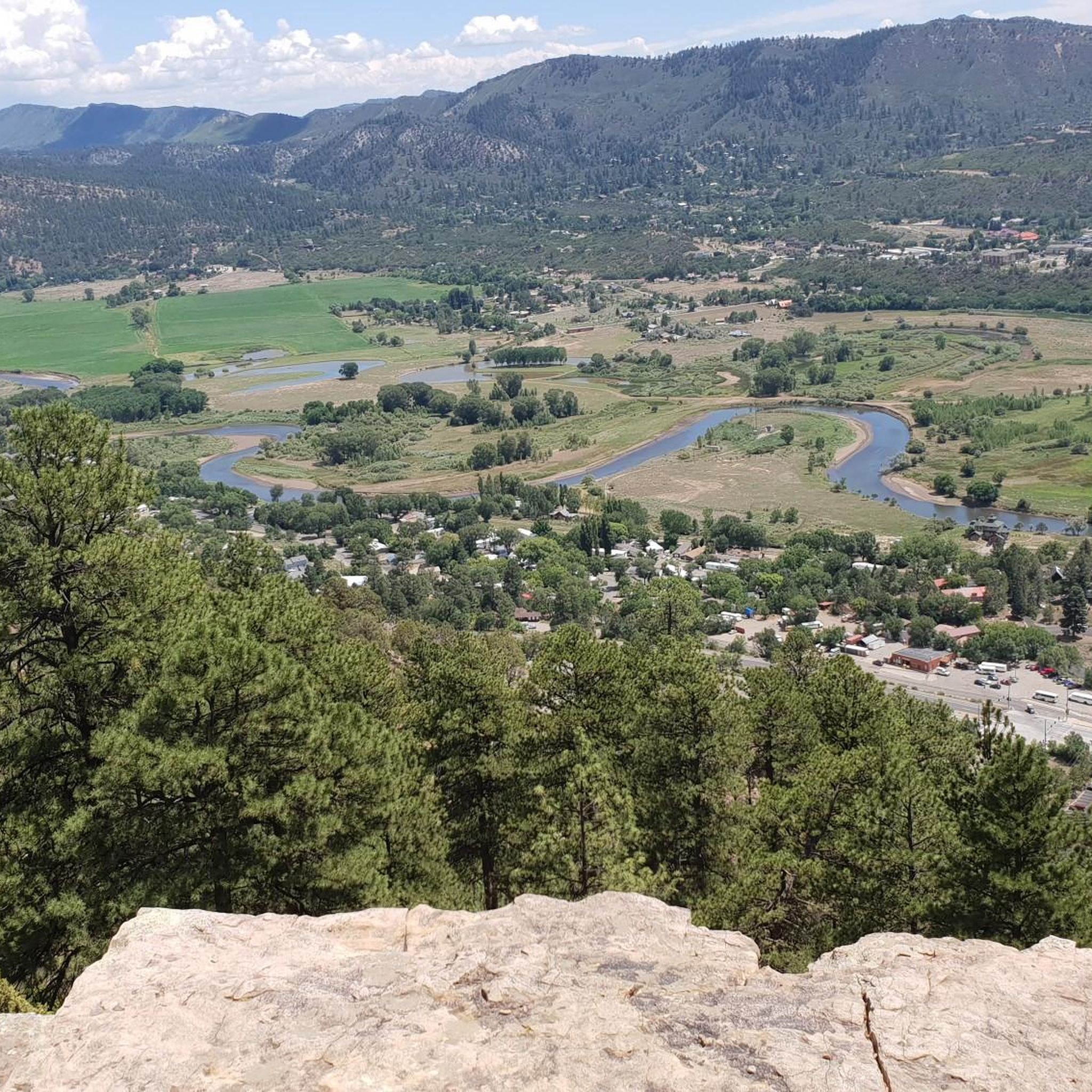
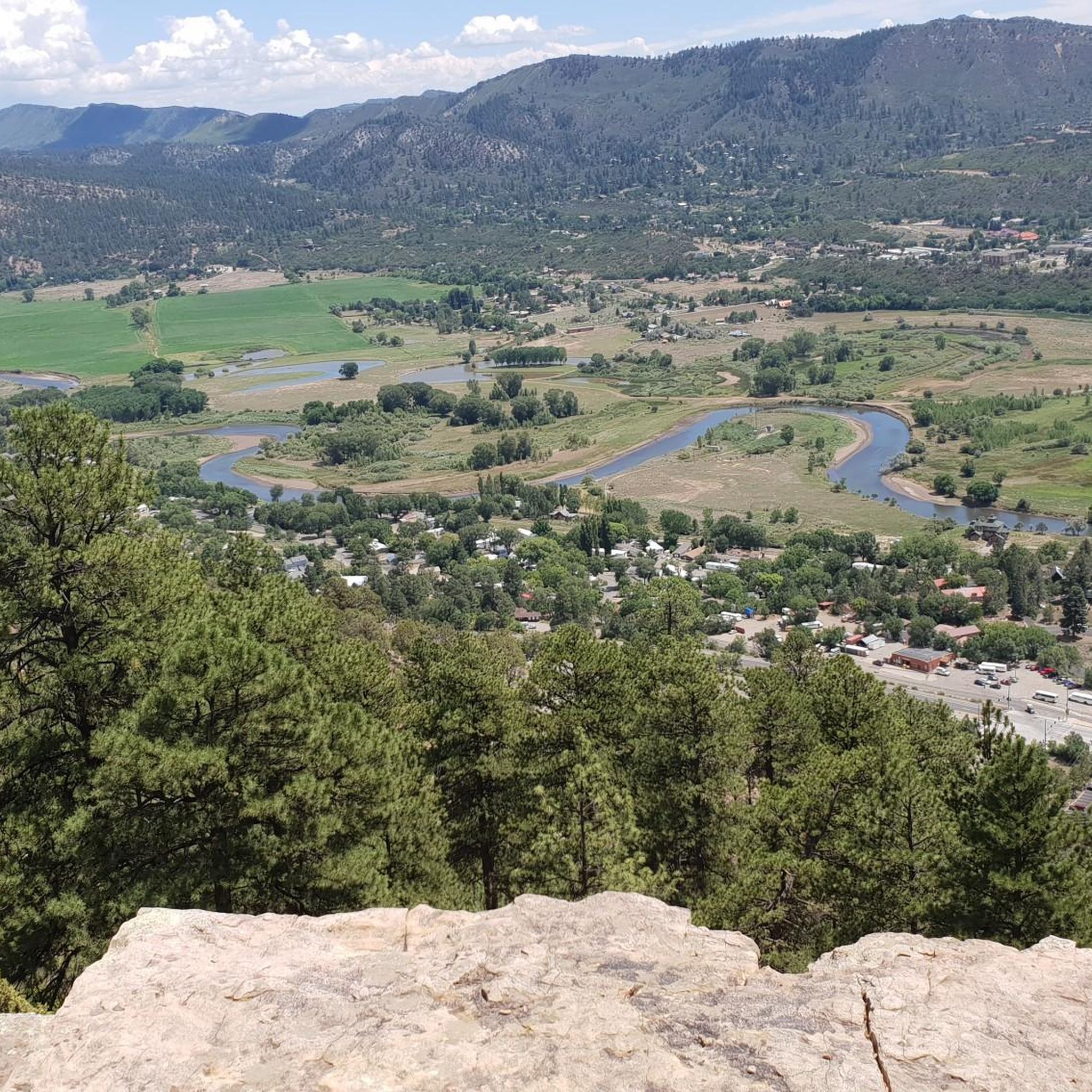
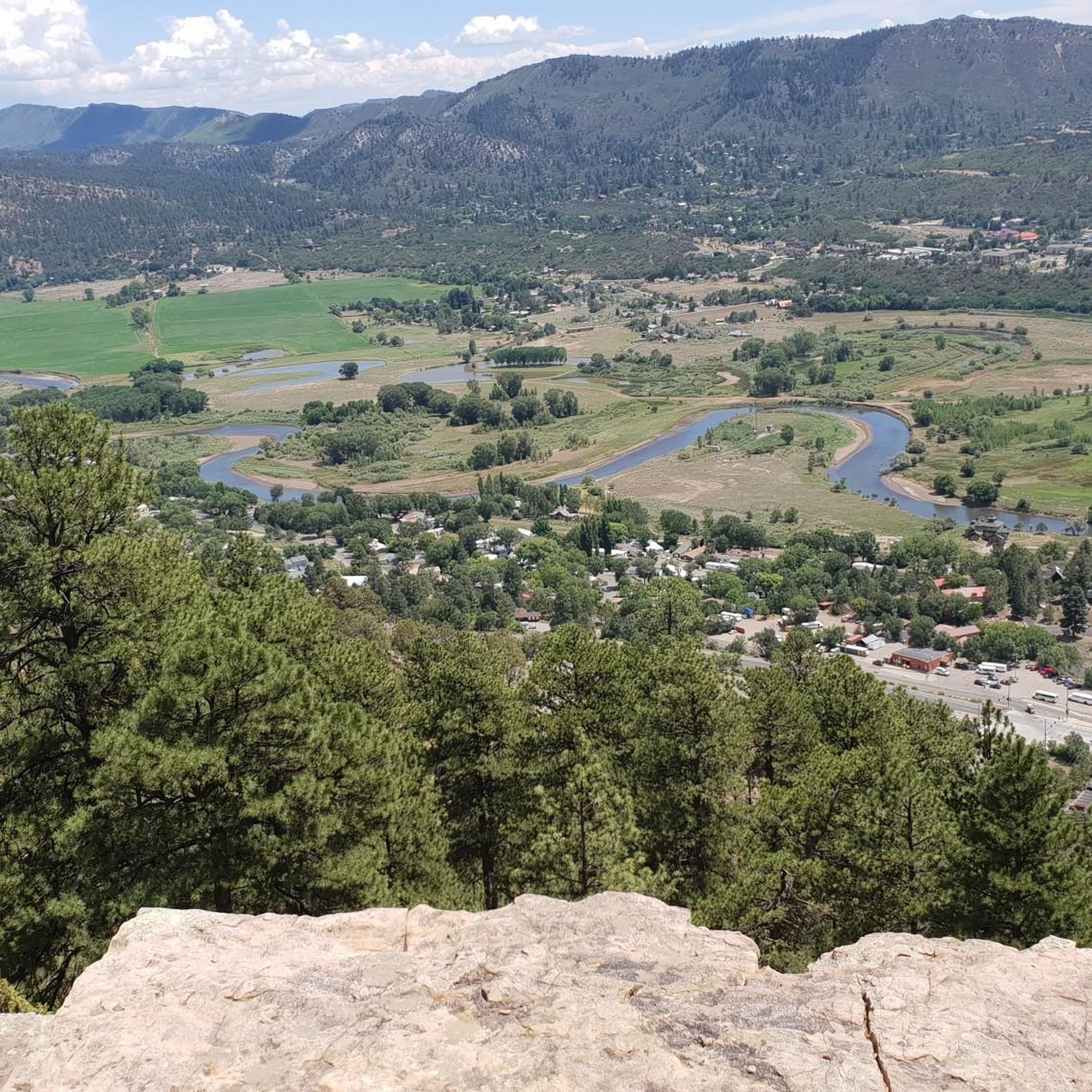
Jogging in Blm - Animas City Mountain provides access to a diverse trail system with elevations ranging from 6,700 to 8,200 feet. The area features a mix of smooth dirt singletrack and rockier sections, offering varied terrain for runners. Panoramic views of the Durango area, the Animas River Valley, and distant San Juan peaks are available from many routes. Its convenient location at the northern end of Durango makes it easily accessible for trail running.
Best jogging routes in Blm…
Last updated: July 8, 2026
13
runners
9.20km
01:22
450m
450m
Hard run. Very good fitness required. Mostly paved surfaces. Suitable for all skill levels.
5
runners
5.09km
00:47
270m
270m
Moderate run. Good fitness required. Mostly paved surfaces. Suitable for all skill levels.

Sign up for free
4.14km
00:30
110m
110m
Moderate run. Good fitness required. Mostly paved surfaces. Suitable for all skill levels.
40
runners
Hard run. Very good fitness required. Mostly paved surfaces. Suitable for all skill levels.
19
runners
9.02km
01:12
280m
280m
Moderate run. Good fitness required. Mostly accessible paths. Some sure footedness required.
Get access to more routes and recommendations from other explorers.
Sign up for free
Already have an account?
Our route recommendations are based on thousands of hikes, rides, and runs completed by other people on komoot.
Start today with a free account
Your next adventure awaits.
Login or Signup
Tips from the Community

The trail is a flat, paved multi-use path which follows the Animas River through Durango between Oxbow Park to the north and Dallabetta Park to the south. There are plenty of access points to jump on and off the trail and connect with other routes around town.
0
0

Oxbow Park marks the northern terminus of the Animas River Trail. The park is fairly new and features some singletrack paths along the water as well as a restroom and picnic tables.
0
0
Oxbow Park marks the northern terminus of the Animas River Trail. The park is fairly new and features some singletrack paths along the water as well as a restroom and picnic tables.
0
0
The trailhead is a small gravel lot that immediately grants access to three different trails. You can head east toward Animas City Mountain Trails, west along the Jacobs Cliff Trail to the heart of Dalla Mountain Park, or straight up via the Cut Off Trail for a steep but expeditious ascent.
0
0
This is one of the relatively more shaded trails in the park. You can run most of the length of Dalla. At its north end the Junction Trail spits you out not too far from the lower access trailhead to the Perins Peak trails, so if you want you can cross the road and climb the ridge to explore westward.
0
0
Dalla Mountain Park has a host of excellent shorter trails which weave back and forth around each other to give you the option to create many routes. The trail system connects with Animas City Mountain in a couple different places. Generally the trails here are a little more technical and offer sparse shade.
0
0
Here the trail runs along the street between East 3rd and the grassy area of Memorial Park. The trail joins up again more closely with the river after this segment. You can catch the bus to Memorial Park, so this can be a good spot to hop on the Animas River Trail.
0
0
Oxbow Park is the northern end of the Animas River Trail and has a couple nice waterside loops you can do along lush singletrack. There is also a beach area that sticks out into a bend of the Animas River and is popular for swimming, paddleboarding, and rafting.
0
0
Frequently Asked Questions
How many running routes are available in Blm - Animas City Mountain?
There are over 100 dedicated running routes in Blm - Animas City Mountain, offering a wide range of options for all skill levels. This includes 13 easy routes, 68 moderate paths, and 35 more challenging trails for experienced runners.
What do other runners enjoy most about the trails in Blm - Animas City Mountain?
The running routes in Blm - Animas City Mountain are highly rated by the komoot community, with an average score of 4.7 stars from over 5 reviews. Runners frequently praise the diverse terrain, the stunning panoramic views of the Durango area and San Juan peaks, and the convenient accessibility from the city.
What kind of terrain can I expect on the jogging trails?
The trails offer a varied experience, from smooth dirt singletrack, particularly on routes like Lupine, to rockier sections, especially on the west side of the mountain. You'll encounter gentle grades through piñon-juniper woodlands and more challenging ascents, providing a dynamic experience for runners.
Are there any family-friendly running options?
Yes, Blm - Animas City Mountain offers trails suitable for various fitness levels, including easier paths that are great for families. While specific 'family-friendly' routes aren't designated, many of the moderate trails can be enjoyed by those looking for a less strenuous run. For example, the Junction and Jacobs Cliff Trail Loop is a moderate 2.6-mile path through woodlands.
Can I bring my dog on the running trails?
Generally, dogs are permitted on trails within Blm - Animas City Mountain. However, it's always recommended to keep your dog on a leash and practice Leave No Trace principles. Please be aware of wildlife and other trail users.
Are there any longer loop routes for extended runs?
Yes, for a more extended run, consider the Animas Mountain Loop. This difficult 5.7-mile (9.2 km) trail takes about 1 hour 22 minutes to complete and offers panoramic views and varied terrain. Another great option is the Animas Mountain East Trailhead – Dalla Mountain Park loop, a moderate 8.9 km route.
What kind of wildlife might I encounter while running?
The area is rich in wildlife. Runners might spot hawks, hummingbirds, horned lizards, mule deer, and elk. The diverse flora includes prickly pear cactus, fir, pine, and spruce trees, with wildflowers blooming from early May throughout the summer, adding to the scenic beauty.
Where can I park when visiting Animas City Mountain for a run?
Trailheads are accessible from various points in Durango, including West 32nd Street and West 4th Avenue. However, parking can be limited, especially during peak times. It's advisable to arrive early or consider alternative transportation.
Are there any seasonal closures I should be aware of?
Yes, certain areas of Animas City Mountain are subject to seasonal closures from December 1 to April 30 to protect wintering wildlife. Some sections may also be closed longer for peregrine falcon nesting. It's important to check current access information before your visit. You can find more details on the Bureau of Land Management's website: BLM Closures.
Are there routes with scenic viewpoints?
Absolutely. Many routes on Animas City Mountain reward runners with breathtaking vistas. You'll find panoramic views of the Durango area, the Animas River Valley, and the distant San Juan peaks. Scenic overlooks are scattered along the trails, providing perfect spots to pause and appreciate the surroundings.
What are the elevation changes like on the trails?
The trails on Animas City Mountain feature elevations ranging from 6,700 feet to 8,200 feet. This means you can expect a variety of ascents and descents, from gentle grades to more challenging climbs, providing a good workout and diverse running experience.
Is Animas City Mountain accessible by public transport from Durango?
Animas City Mountain's convenient location at the northern end of Durango makes it easily accessible. While specific public transport routes directly to all trailheads might vary, its proximity to the city means trailheads are available from various points, making it feasible to reach by local transport or a short ride.
Most popular routes in Blm - Animas City Mountain

Get inspired with the komoot mobile app


Explore more
Browse the best Running Trails & Routes in other regions.
