The best walks and hikes in Mount Rainier Gateway Protected Area
4.6
(38)
550
hikers
15
hikes
Hiking in Mount Rainier Gateway Protected Area provides access to a landscape shaped by an active stratovolcano, featuring Mount Rainier, the highest peak in the Cascade Range. The region is characterized by extensive old-growth forests, numerous alpine lakes, and subalpine meadows that burst with wildflowers in summer. Trails often lead to high-elevation viewpoints offering sweeping vistas of the mountain and surrounding peaks.
Best hiking trails in Mount Rainier Gateway Protected Area
- The most popular hiking route is Lake George and camp/shelter – Gobbler's Knob Lookout loop from Ashford, a 4.6 miles (7.4 km) trail that takes 2 hours 37 minutes to complete. The path leads to Lake George and a shelter before climbing toward the lookout.
- Another top favourite among local hikers is Osborne Mountain Trail #250, a moderate 4.9 miles (7.9 km) path. This trail offers challenging climbs with panoramic views of the surrounding peaks.
- Local hikers also love the Gobbler's Knob Lookout & Lake George Camp – Mount Rainier National Park, a 10.8 miles (17.4 km) trail leading through forest and past Lake George, often completed in about 6 hours 2 minutes.
- Hiking in Mount Rainier Gateway Protected Area is defined by its dense old-growth forests, ascents to alpine lakes, and access to high-elevation viewpoints. The trail network provides a variety of options suitable for different fitness and experience levels.
- The routes in Mount Rainier Gateway Protected Area are highly rated by the komoot community with an average score of 4.6 stars from more than 30 reviews. More than 500 hikers have used komoot to explore Mount Rainier Gateway Protected Area's varied terrain.
Last updated: June 25, 2026
7.93km
03:11
850m
210m
The Osborne Mountain Trail #250 offers a diverse hiking experience, leading you through dense old-growth forests with steep climbs. You will cover 4.9 miles (7.9 km) and gain 2778 feet (847 metres) in elevation, making it a moderate difficulty route that typically takes about 3 hours and 11 minutes. As you ascend, you can expect panoramic views of Mount Rainier and the Nisqually River Valley. The trail also provides access to beautiful alpine lakes such as Pothole Lake, Lower Bertha May, and Granite Lakes, adding to the scenic rewards of your effort.
When planning your hike, be aware that snow can linger at higher elevations, especially outside of the summer months, which might lead to icy conditions. The trail is shared with motorcyclists, equestrians, and mountain bikers, so you should be prepared for varying trail conditions, including potential rutting. Always check the current weather and trail status before you head out to ensure a safe and enjoyable trip.
This route is situated within the vast Gifford Pinchot National Forest, known for its rugged landscapes and rich natural environment. The significant elevation changes you encounter are a defining feature of the trail, providing a true challenge for hikers seeking a rewarding climb. The opportunity to reach pristine alpine lakes and witness expansive views makes this trail a notable option for exploring the region's wilderness.
10.5km
03:11
450m
180m
Embark on a moderate winter hike to Copper Creek Hut, a journey through a pleasant forest that spans 6.5 miles (10.5 km) with an elevation gain of 1482 feet (452 metres). This route typically takes about 3 hours and 10 minutes to complete. As you make your way, you will catch glimpses of Mount Rainier, with a clear sliver of the mountain visible from the hut itself, especially when the landscape is covered in snow.
Planning your visit requires attention to seasonal details, as this trail is primarily a winter destination, generally open from November 15th through April 15th. It is a popular spot for snowshoeing and cross-country skiing during these months. Please note that dogs are not permitted on this trail, so make arrangements for your furry friends. If you intend to stay overnight at the Copper Creek Hut, remember that reservations are required to secure your spot.
The trail is nestled within the beautiful Nisqually Community Forest, offering a unique outdoor experience. The Copper Creek Hut stands as a significant feature along the route, providing a warm refuge for hikers. Inside, you will find amenities like a cook stove and sleeping pads, making it a comfortable stop or overnight stay. This combination of forest scenery and a well-equipped hut makes the route a notable winter adventure in the region.

Sign up for free
2
hikers
8.06km
02:52
690m
170m
Embark on the High Hut Snowshoe Trail, a moderate hiking route that challenges you with a sustained uphill climb. This 5.0 miles (8.1 km) journey involves a significant elevation gain of 2270 feet (692 metres), typically taking around 2 hours and 51 minutes to complete. As you ascend, you will pass through a second-growth forest, with occasional clearings offering glimpses of the surrounding peaks and the promise of expansive views ahead.
Before you head out, remember that a Discover Pass is necessary for parking at the trailhead throughout the year. Additionally, if you plan to visit between November and March, you will also need a Sno-Park pass. While day use of the High Hut itself is generally free, if you are considering an overnight stay, be aware that reservations and a fee are required. Always check current conditions before your trip.
The High Hut Snowshoe Trail is particularly notable for its destination: the High Hut, perched at 4,760 feet. This vantage point provides spectacular 360-degree panoramic views, allowing you to see Mount Rainier, Mount Adams, Mount St. Helens, and even the distant Olympic Mountains on a clear day. It is a rewarding experience that makes the continuous uphill effort worthwhile.
17.4km
06:03
980m
980m
Hard hike. Very good fitness required. Easily-accessible paths. Suitable for all skill levels.
2
hikers
12.4km
03:39
340m
350m
Embark on the Lower Elkspur and Beaver Creek Loop, a moderate hiking route spanning 7.7 miles (12.4 km) with an elevation gain of 1132 feet (345 metres). You can expect to complete this journey in about 3 hours and 38 minutes. As you hike, you will move through dense, forested sections, eventually reaching creek bottoms where you might spot impressive old-growth trees, offering a varied and engaging outdoor experience. The trail provides a good workout while immersing you in the natural beauty of the area.
Planning your visit to the Lower Elkspur and Beaver Creek Loop is straightforward, as the trail is generally accessible year-round, giving you flexibility for your hiking schedule. Parking information is typically available at the various trailheads within Elbe Hills State Forest. Always remember to check local conditions before you head out, especially regarding weather or any potential trail closures, to ensure a safe and enjoyable trip.
This loop is situated within the Elbe Hills State Forest, known for its blend of natural features, including both managed forest areas and untouched creek ecosystems. The route highlights the region's characteristic terrain, from areas of past logging to vibrant natural habitats. It offers a distinct perspective on the forest's evolution and its ongoing natural processes, making it a notable option for exploring the local environment.
Get access to more routes and recommendations from other explorers.
Sign up for free
Already have an account?
Our route recommendations are based on thousands of hikes, rides, and runs completed by other people on komoot.
Start today with a free account
Your next adventure awaits.
Login or Signup
Popular around Mount Rainier Gateway Protected Area
Tips from the Community

At Gobbler's Knob you will finally leave the cover of the pine trees and emerge into sunlight. Although the cabin is locked to the public, you can peek in through the windows and take a scenic break at the wooden perimeter of the lookout with views toward Mount Rainier and the Tahoma Glacier. In good weather conditions you can even spot the volcanoes Mount Saint Helens, Mount Adams and Mount Hood.
2
0
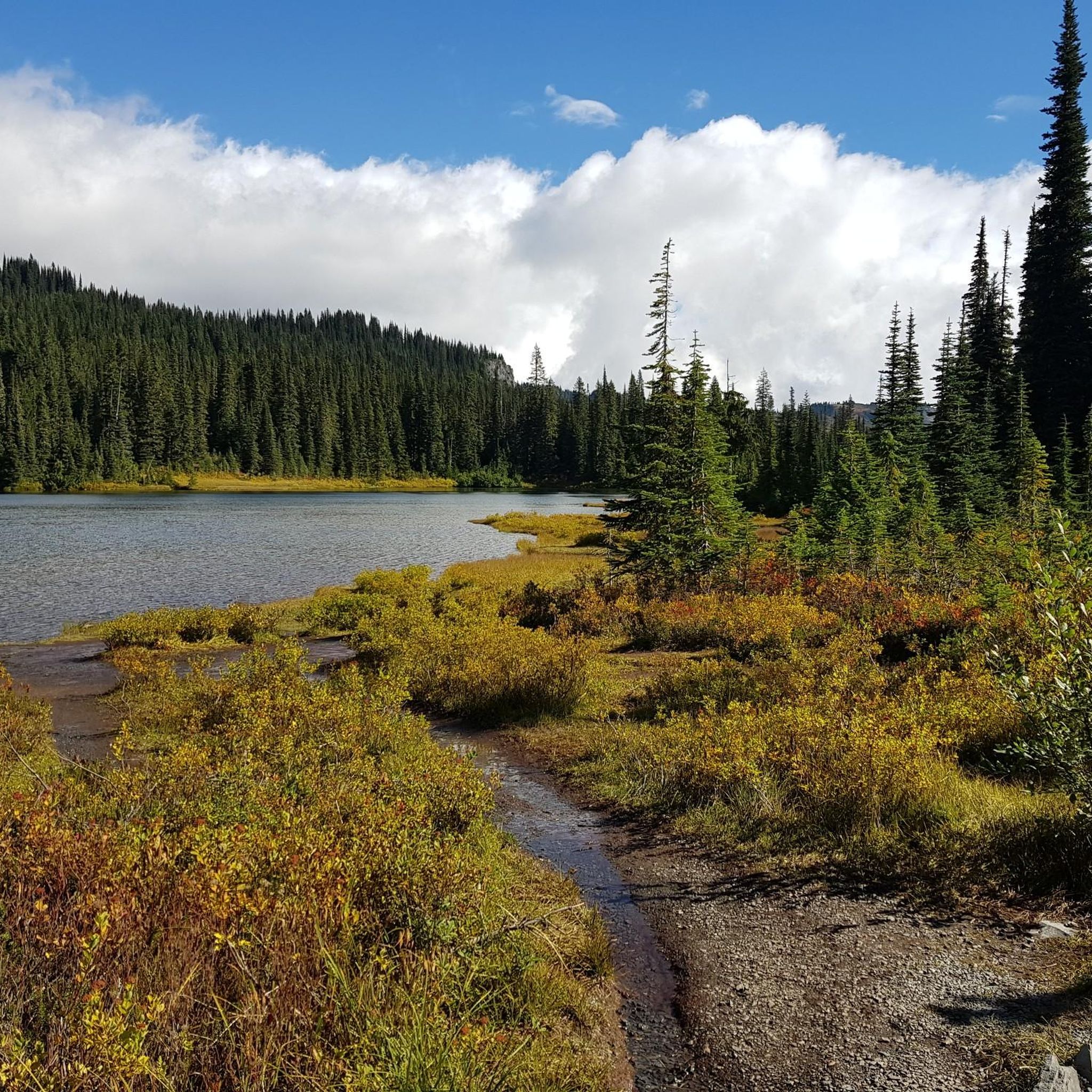
Lake George is a fairly large alpine lake at 4,305 feet and surrounded by beautiful pine forest. There is a really neat wooden Patrol Cabin and just a few yards further, you can spend the night or a break at a three-sided shelter.
1
0
On you ascent to Gobbler's Knob Lookout Tower, you will pass this romantic lake surrounded by thick pine forest.
1
0
Frequently Asked Questions
Are there any easy, family-friendly hikes in the Mount Rainier Gateway area?
Yes, the region offers several great options for families. For a gentle walk to two beautiful lakes, consider the Bertha May and Granite Lake via Teeley Creek Trail #251. Another excellent choice within the National Park is the Trail of the Shadows, a very easy 0.7-mile loop in the Longmire area that is perfect for all ages and offers glimpses into the area's history and nature.
Can I bring my dog on hikes near the Mount Rainier Gateway?
Dogs are generally not permitted on trails within Mount Rainier National Park. However, they are allowed on a leash in campgrounds, parking lots, and on paved roads. For trail options with your dog, you'll need to explore trails in the adjacent Gifford Pinchot National Forest or other state lands where regulations are different. Always check the specific rules for the trail you plan to hike.
What's a good hike for seeing wildflowers?
The best wildflower displays are typically found in the subalpine meadows of Mount Rainier National Park during the summer months, usually July and August. While many higher-elevation trails will feature them, the Emerald Ridge Trail to Aurora Lake & Klapache Camp offers a challenging journey into areas known for their vibrant floral carpets against the backdrop of the mountain.
Are there any hikes with waterfalls in this area?
While the immediate trails in this guide focus more on lakes and viewpoints, the broader Mount Rainier region is famous for its waterfalls. Many are accessible via short walks or are visible from the road, such as Christine Falls and Narada Falls along the road to Paradise. Exploring trails that follow the Nisqually River or its tributaries will often reward you with views of cascades and smaller falls.
Do I need a permit to hike in the Mount Rainier Gateway area?
For day hiking, you will need to pay an entrance fee to access trails within Mount Rainier National Park. No separate permit is typically required for a day hike. However, if you plan on camping overnight in the backcountry, a wilderness permit is mandatory. The Mount Rainier Gateway Protected Area itself has limited public access and no maintained trails, so most hiking occurs within the National Park or surrounding National Forests, each with its own fee and permit system.
What is the best time of year for hiking here?
The prime hiking season is typically from July to September when the trails are mostly snow-free and the weather is mild. This is also the best time for viewing wildflowers in the high-country meadows. Fall, particularly late September and October, offers beautiful autumn colors from the vine maples and fewer crowds, though you should be prepared for cooler, more unpredictable weather.
Are there any good circular hikes or loops?
Yes, there are some excellent loop trails. For a moderately challenging option with great rewards, the Lake George and camp/shelter – Gobbler's Knob Lookout loop from Ashford is a fantastic choice. It's a 4.6-mile (7.4 km) circuit that takes you past a lake and up to a historic fire lookout with stunning views.
What kind of wildlife might I see?
The area supports a rich variety of wildlife. It's common to spot deer and various bird species, including woodpeckers and grouse, in the forested areas. At higher elevations or in more remote parts of the park, you might be lucky enough to see elk, marmots, and occasionally black bears. Always remember to keep a safe distance and never feed wildlife.
I'm looking for a challenging, full-day hike. What do you recommend?
For experienced hikers seeking a strenuous outing, the Gobbler's Knob via Westside Road is a demanding trek. This route covers over 13 miles (21 km) and involves a significant amount of elevation gain, rewarding your effort with incredible panoramic views from the historic lookout.
What do other hikers say about the trails in this region?
The trails in and around the Mount Rainier Gateway are highly regarded by the komoot community, with an average rating of 4.6 stars. Hikers frequently praise the majestic old-growth forests, the stunning views of Mount Rainier, and the beauty of the alpine lakes. The variety, from easy walks to challenging ascents, is also a commonly highlighted feature.
Can I go snowshoeing near the Mount Rainier Gateway in winter?
Absolutely. When snow covers the landscape, many of the hiking trails become popular snowshoeing routes. The area around Longmire and Paradise in Mount Rainier National Park are particularly well-known for snowshoeing. The road to Paradise is maintained in winter, providing access to numerous trails suitable for all skill levels, but always check road status and avalanche conditions before you go.
What is the difference between the Gateway Protected Area and the National Park?
The Mount Rainier Gateway Protected Area is a corridor of conserved land managed by the Nisqually Land Trust, primarily for wildlife habitat and scenic preservation. It has very limited public access and no developed trails. It serves as a 'gateway' to Mount Rainier National Park, which is a large, federally protected area with extensive visitor facilities, campgrounds, and a vast network of maintained hiking trails for public recreation.
Most popular routes in Mount Rainier Gateway Protected Area

Get inspired with the komoot mobile app


Explore more
Browse the best Hikes in other regions.
