The best running trails in Grizzly Mountain
20
runners
5
runs
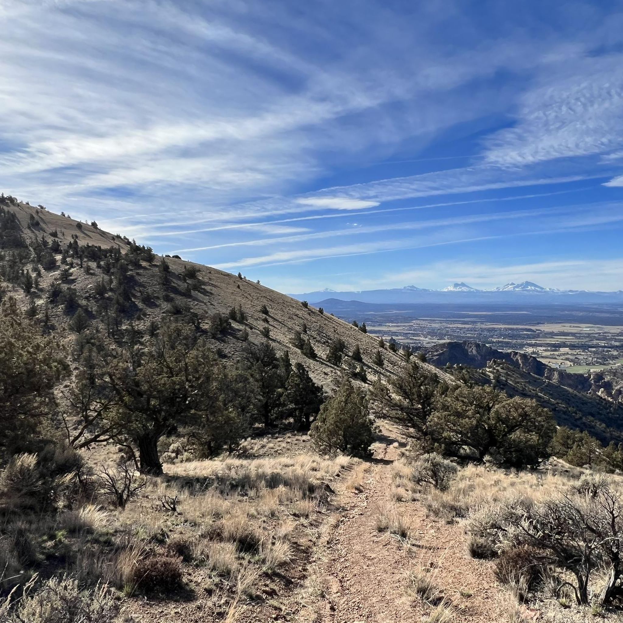
Jogging routes in Grizzly Mountain traverse a rugged landscape characterized by significant elevation changes and varied terrain. The region features prominent buttes and river valleys, offering challenging running experiences. With all routes classified as difficult, runners can expect substantial climbs and demanding paths.
Best jogging routes in Grizzly Mountain
- The most popular jogging route is Crooked River – Gray Butte loop from Skull Hollow Trailhead, a 23.5 miles (37.8 km) trail that takes 5 hours 10 minutes to complete.…
Last updated: May 13, 2026
7
runners
14.1km
01:56
610m
610m
Hard run. Very good fitness required. Mostly paved surfaces. Suitable for all skill levels.
4
runners
Hard run. Very good fitness required. Mostly paved surfaces. Suitable for all skill levels.

Sign up for free
4
runners
Hard run. Very good fitness required. Mostly paved surfaces. Suitable for all skill levels.
10.8km
01:40
540m
540m
Hard run. Very good fitness required. Mostly accessible paths. Some sure footedness required.
Our route recommendations are based on thousands of hikes, rides, and runs completed by other people on komoot.
Start today with a free account
Your next adventure awaits.
Login or Signup
Popular around Grizzly Mountain
Tips from the Community

This orchard dates back 130 years to the McCoin family who planted the apple trees on their homestead. The trees still bear fruit because of the efforts of volunteers who prune them each spring.
0
0
Gray Butte is the tallest point in the Smith Rock State Park trail system. If you want great views and/or a hard workout, getting to the top of the butte is the way to do it!
0
0
This volcanic butte is the highest point in Smith Rock, so if you're looking for views, you'll find them up here! A great destination when you need to do some climbing training.
0
0

Discover Crenson Viewpoint nestled just below Gray Butte Summit. Behold exceptional vistas showcasing the beauty of the Cascades, Ochocos, and expansive high desert. This spot invites you to immerse yourself in the diverse and captivating landscapes of Central Oregon.
0
0

In the western reaches of Ochoco National Forest, the majestic Gray Butte, rising to 5,091 feet (1.55 km), awaits. To reach its peak, follow the enchanting combination of the Cole Loop Trail and forest roads. From this summit, you're greeted with awe-inspiring views of Smith Rock State Park to the southwest.
0
0

Gray Butte is a 5,091-foot tall peak located in the western edges of Ochoco National Forest. The summit is reached via a combination of the Cole Loop Trail and forest roads. Great views of Smith Rock State Park to the southwest can be seen from the vista.
0
0
Gray Butte is a 5,091 foot tall peak located in the western edges of Ochoco National Forest. The summit is reached via a combination of the Cole Loop Trail and forest roads. Great views of Smith Rock State Park to the southwest can be seen from the vista.
0
0
This 25 mile loop is shared by hikers, mountain bikers, and horse riders. The trail is accessible from three different trails: Trail Crossing Corrals, Cyrus, and Scales Corral. The path traverses around multiple peaks including Gray Butte.
0
0
Frequently Asked Questions
What is the general difficulty level of running routes in Grizzly Mountain?
Running routes in Grizzly Mountain are generally considered difficult. They feature significant elevation changes and rugged terrain, making them ideal for experienced runners seeking a strenuous workout. All 6 routes listed in this guide are classified as difficult.
Are there any loop running trails in Grizzly Mountain?
Yes, several running routes in Grizzly Mountain are loops. For example, the Crooked River – Gray Butte loop from Skull Hollow Trailhead is a challenging 23.5-mile loop, and the Julius & Sarah McCoin Orchard loop from Terrebonne offers a 9.7-mile loop experience.
What kind of landscapes can I expect on the jogging routes in Grizzly Mountain?
Jogging routes in Grizzly Mountain traverse diverse landscapes, including mixed forests of fir and pine, areas showing regeneration after wildfires, prominent buttes, and river valleys. You'll experience dynamic visual changes throughout your run.
What are some notable natural features or viewpoints along the running trails?
While specific viewpoints for the listed routes aren't detailed, the broader Grizzly Peak area in Oregon is known for panoramic views of the Rogue Valley, the city of Ashland, and prominent Cascade Mountains like Mount McLoughlin and Mount Shasta. The trails often offer continuous vistas as you gain elevation.
What is the typical elevation gain on running routes in Grizzly Mountain?
The running routes in Grizzly Mountain feature substantial elevation gains. For instance, the Crooked River – Gray Butte loop from Skull Hollow Trailhead involves over 3,970 feet (1,210 m) of ascent, providing a significant challenge for runners.
Are the running trails in Grizzly Mountain suitable for families?
The running routes listed in this guide are all classified as difficult due to significant elevation changes and rugged terrain, making them more suitable for experienced runners. For a more moderate, family-friendly outdoor experience in the broader Grizzly Peak area (Oregon), trails like the Grizzly Peak Trail offer a good workout without being overly strenuous.
What is the best time of year for jogging in Grizzly Mountain?
The trails in the Grizzly Peak area are generally open year-round. However, late spring and early summer are particularly rewarding for jogging, as you can experience spectacular displays of wildflowers. During winter months, snow may restrict access, especially at higher elevations.
How long do the running routes in Grizzly Mountain typically take to complete?
The duration varies significantly based on the route's length and elevation. For example, the challenging Crooked River – Gray Butte loop from Skull Hollow Trailhead, at 23.5 miles, typically takes around 5 hours 10 minutes. Shorter routes, like the Julius & Sarah McCoin Orchard loop from Skull Hollow Trailhead (9.6 miles), can be completed in about 2 hours 3 minutes.
Is there parking available at the trailheads for jogging routes?
Yes, for the Grizzly Peak Trail in Oregon, restrooms are available at the trailhead, implying designated parking facilities. For specific routes like those starting from Skull Hollow Trailhead or Terrebonne, parking is generally available to access these popular running paths.
What wildlife might I encounter while running in Grizzly Mountain?
The recovering burn areas along trails in the Grizzly Peak region support thriving wildlife. Joggers may have opportunities to observe songbirds, squirrels, deer, and elk, adding to the natural experience of your run.
Are there any specific attractions or points of interest along the running trails?
While the routes themselves are the main attraction, the Grizzly Peak area is known for its natural beauty. You'll find diverse forests, wildflower displays in season, and expansive views of the Rogue Valley and Cascade Mountains. The experience is more about the scenic journey than specific man-made landmarks.
How many runners have explored Grizzly Mountain's trails using komoot?
More than 50 runners have used komoot to explore the varied and challenging terrain of Grizzly Mountain, indicating a vibrant community of outdoor enthusiasts enjoying these routes.
Most popular routes in Grizzly Mountain

Get inspired with the komoot mobile app


Explore more
Browse the best Running Trails & Routes in other regions.
