The best walks and hikes in Forêt De La Bourdonnaye
4.4
(142)
766
hikers
79
hikes
Hiking in Forêt De La Bourdonnaye offers a network of trails through dense woodlands and varied terrain. The region is characterized by its forest environment, featuring gentle elevations and natural ponds. Many routes also provide access to historical sites, such as ancient menhirs, integrating cultural interest with outdoor activity.
Best hiking trails in Forêt De La Bourdonnaye
- The most popular hiking route is Quéhéon Pond – Menhirs of Monteneuf loop from Menhirs de Monteneuf, a 3.8 miles (6.1 km)…
Last updated: May 23, 2026
5.0
(3)
15
hikers
Easy hike. Great for any fitness level. Easily-accessible paths. Suitable for all skill levels.
5.0
(5)
15
hikers
13.9km
03:45
170m
170m
Moderate hike. Good fitness required. Easily-accessible paths. Suitable for all skill levels.

Sign up for free
4.4
(5)
10
hikers
6.32km
01:41
70m
70m
Easy hike. Great for any fitness level. Easily-accessible paths. Suitable for all skill levels.
8
hikers
Moderate hike. Good fitness required. Easily-accessible paths. Suitable for all skill levels.
5.0
(1)
3
hikers
4.77km
01:16
50m
50m
Easy hike. Great for any fitness level. Easily-accessible paths. Suitable for all skill levels.
Get access to more routes and recommendations from other explorers.
Sign up for free
Already have an account?
Our route recommendations are based on thousands of hikes, rides, and runs completed by other people on komoot.
Start today with a free account
Your next adventure awaits.
Login or Signup



Tips from the Community


a meeting place with stone giants: the menhirs and it is a cultural place
0
0
enriching walk
0
0

Nonsense! Reporting toilets as unavoidable... We've seen it all! 🤦
1
1

nice educational place
1
0
Frequently Asked Questions
How many hiking trails are there in Forêt De La Bourdonnaye?
Forêt De La Bourdonnaye offers a diverse network of over 70 hiking trails. These routes cater to various skill levels, including 31 easy trails, 37 moderate options, and 4 more challenging paths.
Are there easy hikes suitable for beginners or families in Forêt De La Bourdonnaye?
Yes, Forêt De La Bourdonnaye is very welcoming for beginners and families, with over 30 easy trails. A great option is the Quéhéon Pond – Menhirs of Monteneuf loop from Menhirs de Monteneuf, an easy 3.8-mile (6.1 km) route that takes about 1 hour 36 minutes to complete, featuring views of the pond and ancient menhirs.
What are the typical durations for hikes in Forêt De La Bourdonnaye?
Hike durations in Forêt De La Bourdonnaye vary significantly. Shorter, easy trails like the Belle allée – Menhirs of Monteneuf loop from Menhirs de Monteneuf can be completed in just over an hour, while longer, moderate routes such as the Tombstone – Menhirs of Monteneuf loop from Menhirs de Monteneuf can take around 3 hours 45 minutes.
Are there circular walks available in Forêt De La Bourdonnaye?
Yes, many of the trails in Forêt De La Bourdonnaye are designed as circular routes, allowing you to start and end at the same point. For example, the Menhirs of Monteneuf – Tombstone loop from Menhirs de Monteneuf is a popular 3.9-mile (6.3 km) circular trail.
What kind of natural features or landmarks can I expect to see on the trails?
The trails in Forêt De La Bourdonnaye are characterized by dense woodlands and gentle elevations. You'll encounter natural ponds, such as Quéhéon Pond, and significant historical sites, including ancient menhirs. These megalithic structures add a unique cultural dimension to the natural landscape.
What do other hikers enjoy most about hiking in Forêt De La Bourdonnaye?
The area is highly rated by the komoot community, with an average score of 4.3 stars from over 140 reviews. Hikers frequently praise the tranquil forest environment, the well-maintained paths, and the unique combination of natural beauty with ancient historical sites like the menhirs.
Is Forêt De La Bourdonnaye suitable for dog walking?
While specific regulations for dogs can vary, generally, forests in France are dog-friendly, especially if dogs are kept on a leash to protect wildlife and ensure the safety of other hikers. It's always recommended to check local signage upon arrival.
Are there any viewpoints or scenic spots along the trails?
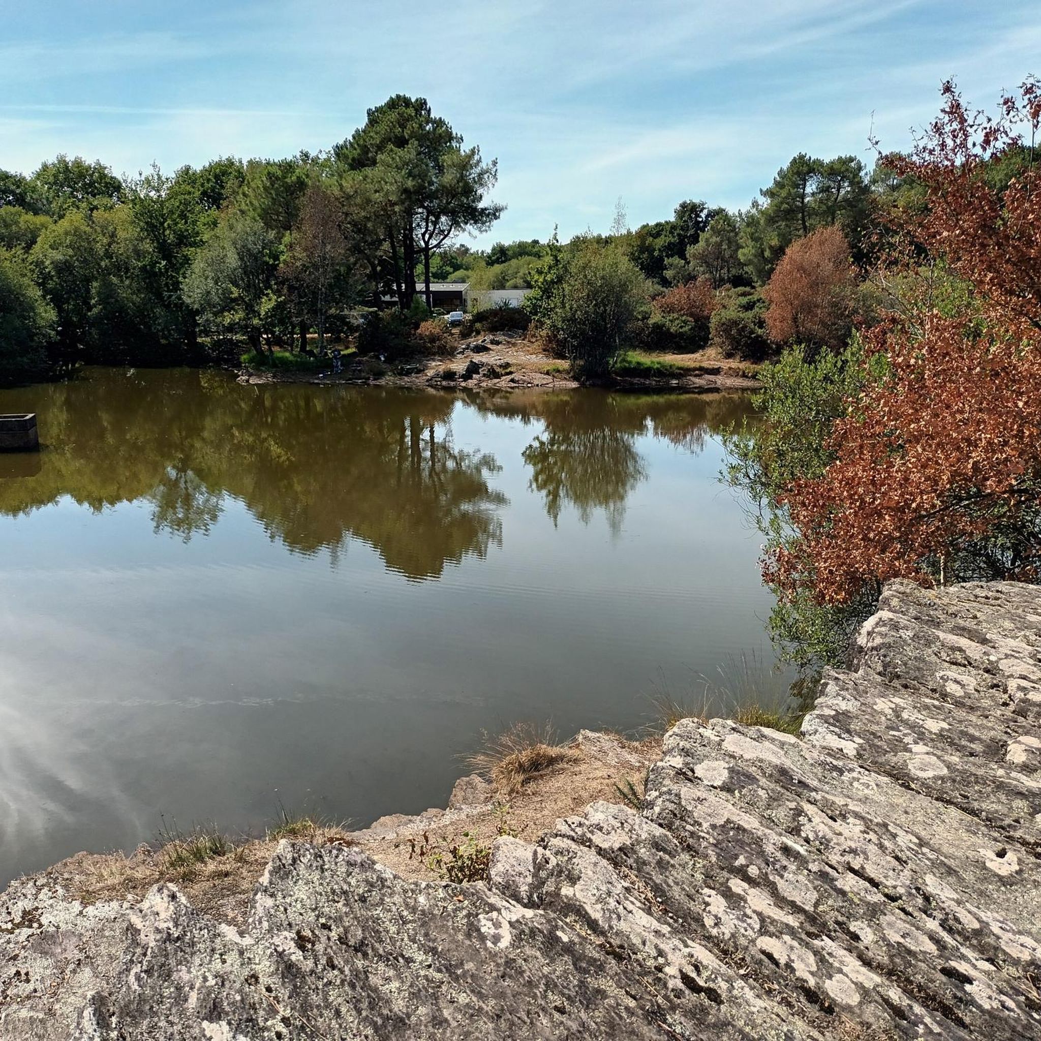
While Forêt De La Bourdonnaye is primarily dense woodland, many trails offer picturesque views of natural ponds, such as Quéhéon Pond, and clearings within the forest. The ancient menhirs also provide unique points of interest and photo opportunities.
What is the best time of year to hike in Forêt De La Bourdonnaye?
The forest is enjoyable throughout much of the year. Spring and autumn offer pleasant temperatures and beautiful foliage. Summer provides lush greenery and longer daylight hours, while winter can offer a quiet, serene experience, though paths might be damp or muddy.
Are there facilities like cafes or restrooms near the hiking trails?
Forêt De La Bourdonnaye is a natural forest area, so dedicated facilities like cafes or public restrooms directly on the trails are limited. It's advisable to plan your visit by bringing your own refreshments and using facilities in nearby towns or villages before or after your hike.
What are the parking options for accessing the hiking trails?
Access points to the trails, particularly near popular starting points like the Menhirs de Monteneuf, typically offer designated parking areas. These are usually well-marked and provide convenient access to the trailheads.
Is public transport an option to reach Forêt De La Bourdonnaye's hiking areas?
Public transport options directly to the heart of Forêt De La Bourdonnaye's trailheads may be limited. It's generally recommended to travel by car to access the most convenient starting points. However, local bus services might connect to nearby villages, from which you could potentially walk or cycle to the forest.
What should I wear for hiking in Forêt De La Bourdonnaye?
Given the varied terrain and potential for damp conditions, especially after rain, sturdy hiking shoes or boots are recommended. Layered clothing is always a good idea, as forest temperatures can fluctuate. In summer, light, breathable clothing is suitable, while in cooler months, waterproof and warmer layers are advisable.
Most popular routes in Forêt De La Bourdonnaye

Get inspired with the komoot mobile app


Explore more
Browse the best Hikes in other regions.
