The best running trails in Bois Des Gâts
4.3
(4)
530
runners
142
runs
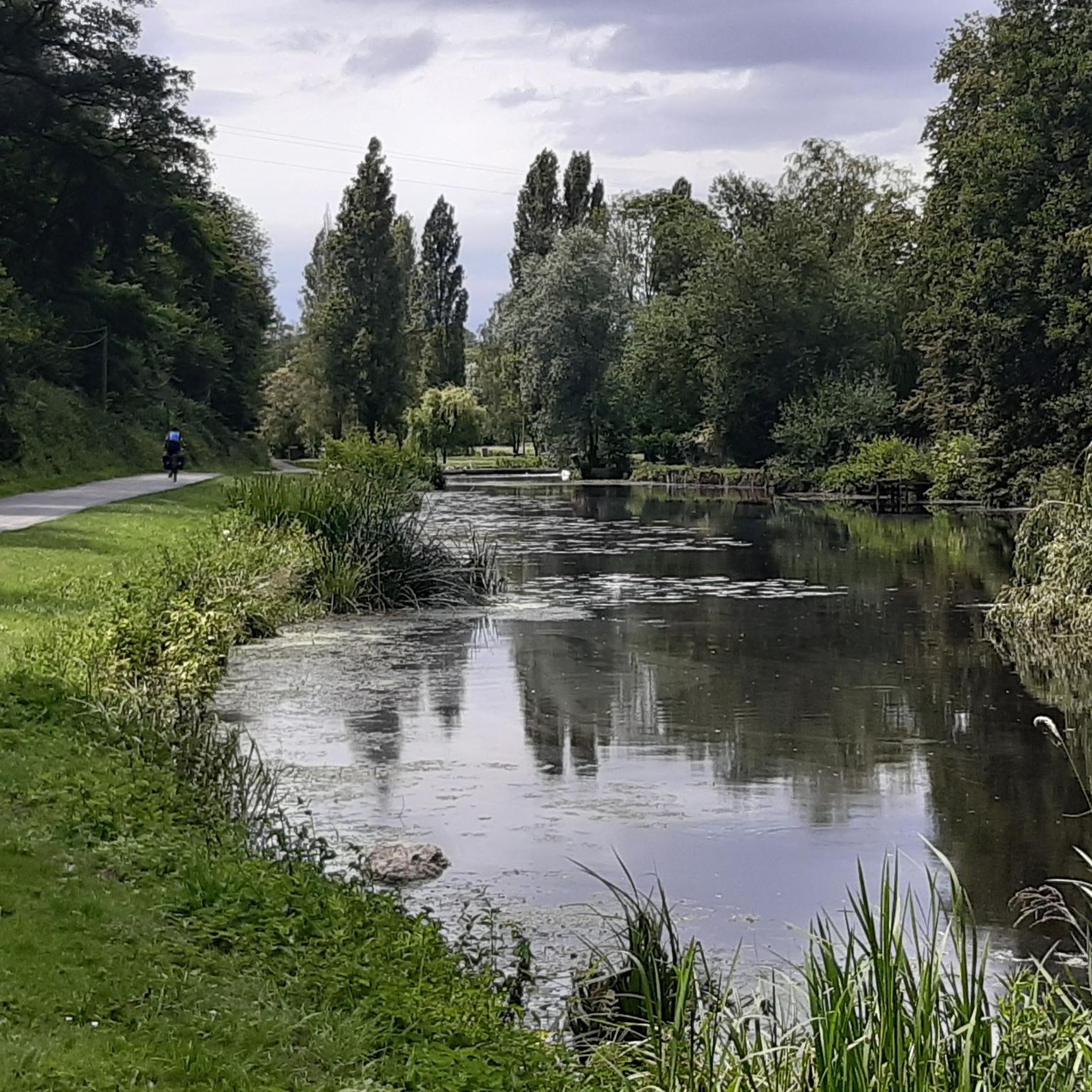
Jogging routes in Bois Des Gâts offer a protected natural environment along the Loir river, making it an ideal location for outdoor activity. This 23-hectare area, classified as a Natura 2000 site, features diverse paths through wooded areas and riverside settings. The terrain varies from easy walks to more challenging routes, suitable for different fitness levels. Joggers can explore an extensive trail network that winds through the forest, providing shade and a natural atmosphere.
Best jogging routes in Bois Des Gâts
- The most popular jogging route is Running loop from Marboué, a 6.6 miles (10.5 km) trail that takes 1 hour 8 minutes to complete. This route offers a moderate challenge through the natural landscape.
- Another top favourite among local runners is Bois des Gâts loop from Marboué, a moderate 8.0 miles (12.9 km) path. This route provides varied terrain through the heart of the woods, often alongside the Loir river.
- Local runners also love the Châteaudun Castle – Saint-Valérien Church loop from Châteaudun, a 7.9 miles (12.7 km) trail leading through wooded areas and offering views of the historic town, often completed in about 1 hour 22 minutes.
- Jogging in Bois Des Gâts is defined by dense woodlands, riverside paths, and varied terrain, including a dedicated health course. The network offers options for different ability levels, from easy loops to more challenging runs.
- The routes in Bois Des Gâts are highly rated by the komoot community with an average score of 4.4 stars from 5 reviews. More than 600 runners have used komoot to explore Bois Des Gâts's varied terrain.
Last updated: May 23, 2026
5.0
(1)
12
runners
10.5km
01:07
60m
60m
Moderate run. Good fitness required. Mostly paved surfaces. Suitable for all skill levels.
5
runners
11.8km
01:16
80m
80m
Moderate run. Good fitness required. Mostly paved surfaces. Suitable for all skill levels.

Sign up for free
5.0
(1)
11
runners
13.4km
01:29
60m
60m
Moderate run. Good fitness required. Mostly paved surfaces. Suitable for all skill levels.
4
runners
3.12km
00:22
20m
20m
Easy run. Great for any fitness level. Mostly paved surfaces. Suitable for all skill levels.
6
runners
7.57km
00:53
50m
50m
Moderate run. Good fitness required. Mostly paved surfaces. Suitable for all skill levels.
Get access to more routes and recommendations from other explorers.
Sign up for free
Already have an account?
Our route recommendations are based on thousands of hikes, rides, and runs completed by other people on komoot.
Start today with a free account
Your next adventure awaits.
Login or Signup
Popular around Bois Des Gâts



Tips from the Community

This small village (Wikipedia lists only 148 inhabitants at the beginning of 2022) has a truly grand name: Saint Christopher. The choice of this patron saint is very fitting for a place located on the banks of a river. According to tradition, Christopher was a giant who carried people across a river. One day, a child (who was Jesus, though he didn't know it) called to him, and he took the child on his shoulders and waded through the water. Hence his name, which means "Christ-bearer."
0
0


A marvel to discover along the connie
0
0
Along the Connie, you will cross this metal bridge with a wash house on its right and a mill on its left. The exceptional heritage of these places is worth a look.
1
0

Very cute village in the middle of Beauce. Worth the detour.
0
0

A beautiful early 20th century bridge spanning the Conie. While crossing it, you can enjoy a beautiful view of an old mill camped on the edge of the river. On the other, you can see the old washhouse with a rouche roof.
2
0
Frequently Asked Questions
How many running routes are available in Bois des Gâts?
Bois des Gâts offers a wide selection of running routes, with nearly 130 different options to explore. These range from easy strolls to more challenging runs, ensuring there's something for every fitness level.
What kind of terrain can I expect on the jogging trails in Bois des Gâts?
The terrain in Bois des Gâts is quite varied, offering a dynamic experience for runners. You'll find dense woodlands, tranquil riverside paths along the Loir River, and a mix of elevations as the area sits at the natural boundary between the Beauce and Perche regions. There's even a dedicated health course for those looking to incorporate exercise stations into their run.
Are there any easy running routes suitable for beginners or a relaxed jog?
Yes, Bois des Gâts has several easy running routes perfect for beginners or a leisurely pace. One great option is the Running loop from Les Garennes, which is just over 3 km and offers a gentle introduction to the area's natural beauty.
What do other runners enjoy most about jogging in Bois des Gâts?
The komoot community highly rates the running experience in Bois des Gâts, with an average score of 4.4 stars. Runners often praise the protected natural environment, the variety of paths through wooded areas, and the peaceful riverside settings that make for a refreshing outdoor activity.
Are there any circular running routes in Bois des Gâts?
Absolutely! Many of the running routes in Bois des Gâts are circular, allowing you to start and finish in the same location. For a moderate challenge, consider the Running loop from Marboué, which covers about 10.5 km and takes you through diverse landscapes.
Can I bring my dog on the running trails in Bois des Gâts?
While the guide doesn't specify dog-friendly regulations for every trail, Bois des Gâts is a natural site generally welcoming to outdoor activities. It's always best to keep your dog on a leash and ensure you clean up after them to preserve the natural environment. Check local signage for any specific restrictions.
Are there any viewpoints or landmarks to see while running in Bois des Gâts?
Yes, the varied topography of Bois des Gâts offers stunning views, particularly of the Loir valley. Some routes, like the Châteaudun Castle – Saint-Valérien Church loop from Châteaudun, even provide glimpses of historical sites like the Château de Châteaudun and the old town, blending natural beauty with cultural exploration.
Is Bois des Gâts suitable for family-friendly jogging or walks?
Yes, Bois des Gâts is a family-friendly destination. Beyond jogging, it features picnic areas and play areas for children. The network of trails includes easier, shorter options that are suitable for families looking to enjoy a run or walk together in nature.
What is the best time of year to go running in Bois des Gâts?
Bois des Gâts is enjoyable year-round, but spring and autumn offer particularly pleasant conditions with mild temperatures and beautiful foliage. Spring brings impressive white blooms from the acacia trees, while autumn showcases vibrant colors. The woodlands provide good shade during warmer summer months, and winter runs can be serene, though conditions may vary.
Are there any longer distance running trails for experienced runners?
Experienced runners will find plenty of longer routes. For example, the Bois des Gâts loop from Marboué is a moderate 12.9 km path that provides varied terrain through the heart of the woods, often alongside the Loir river, offering a good challenge.
How can I access Bois des Gâts by public transport for a run?
Bois des Gâts is located near Châteaudun. While specific public transport routes directly to the trailheads aren't detailed, Châteaudun itself is accessible by public transport. From the town, you can likely reach the Bois des Gâts, which serves as a 'green lung' for the city, by a short walk or local connection. It's advisable to check local bus schedules in Châteaudun for the most current information.
Are there parking facilities available near the running trails?
Yes, given its popularity for outdoor activities, parking facilities are generally available around the Bois des Gâts. Many routes, such as those starting from Marboué or Châteaudun, are designed with convenient access in mind, suggesting nearby parking options for runners.
Most popular routes in Bois Des Gâts

Get inspired with the komoot mobile app


Explore more
Browse the best Running Trails & Routes in other regions.
