The best walks and hikes in Pfannenstiel
4.6
(3446)
26,425
hikers
24
hikes
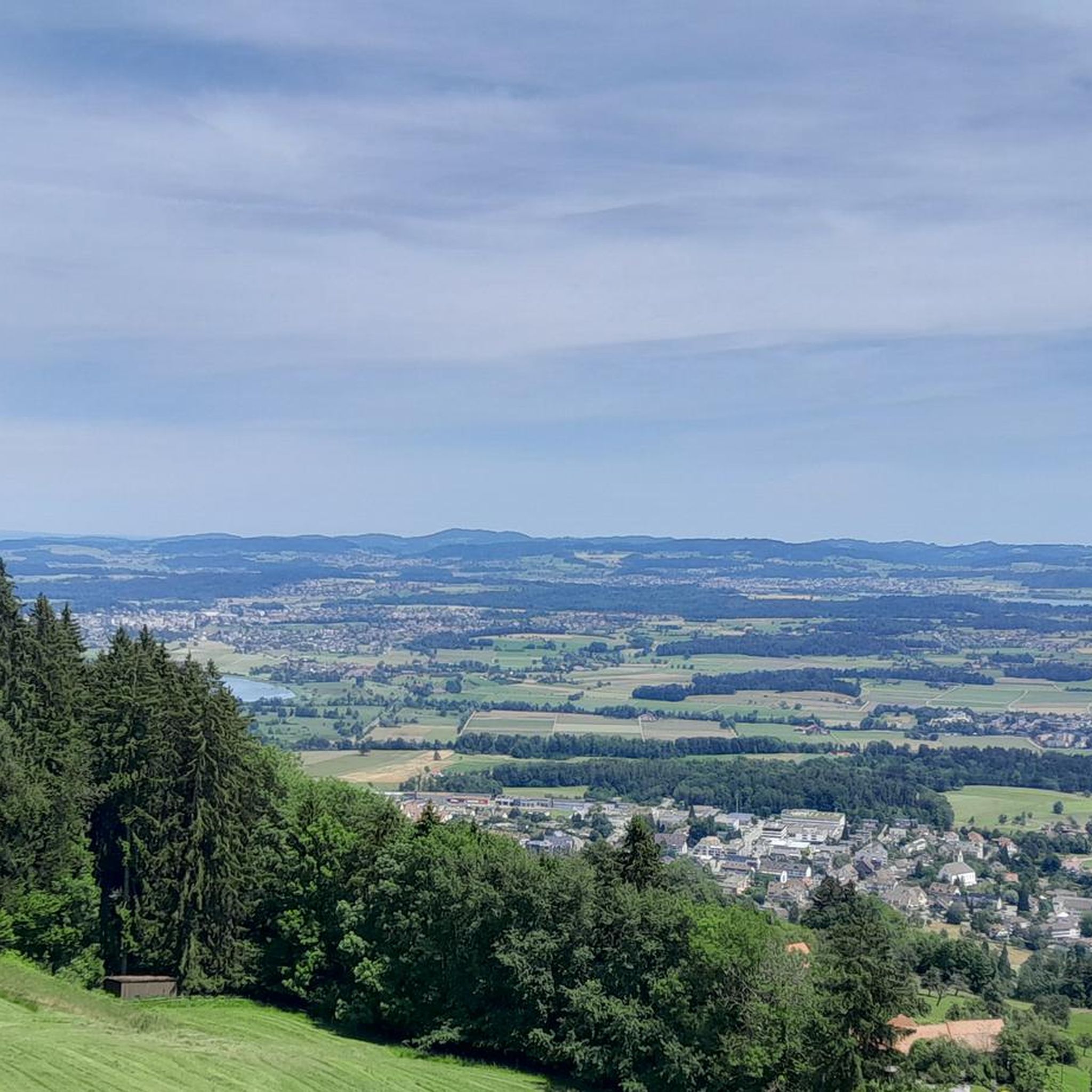
Hiking in Pfannenstiel features diverse landscapes with well-maintained trails. The region is characterized by wooded hills, ravines, and ridge walks that offer panoramic views of Lake Zurich and the surrounding countryside. Trails wind through dense forests and along streams, providing varied terrain for hikers. The area includes a 35-meter-tall observation tower, which provides expansive vistas.
Best hiking trails in Pfannenstiel
- The most popular hiking route is Barbecue area with a view – Pfannenstiel Summit loop from Bezirk Meilen, a 3.6 miles (5.8 km) trail that takes 1 hour 46 minutes to complete. This easy route offers views from the summit area.
- Another top favourite among local hikers is View from the Pfannenstiel summit – Barbecue area with a view loop from Guldenen, an easy 4.1 miles (6.7 km) path. This trail provides consistent scenic outlooks across the ridge.
- Local hikers also love the Barbecue area with a view – Pfannenstiel Summit loop from Pfannenstiel, a 5.5 miles (8.9 km) trail leading through wooded hills, often completed in about 2 hours 30 minutes.
- Hiking in Pfannenstiel is defined by ridge walks, dense forests, and views of Lake Zurich. The network offers options for different ability levels, from easy paths to moderate ascents.
- The routes in Pfannenstiel are highly rated by the komoot community with an average score of 4.6 stars from over 800 reviews. More than 4000 hikers have used komoot to explore Pfannenstiel's varied terrain.
Last updated: October 1, 2026
4.6
(26)
133
hikers
5.77km
01:46
210m
210m
Easy hike. Great for any fitness level. Easily-accessible paths. Suitable for all skill levels.
4.6
(15)
100
hikers
6.52km
01:49
130m
120m
Easy hike. Great for any fitness level. Easily-accessible paths. Suitable for all skill levels.

4.5
(11)
54
hikers
8.90km
02:31
190m
190m
Moderate hike. Good fitness required. Easily-accessible paths. Suitable for all skill levels.
4.5
(4)
27
hikers
7.58km
02:11
190m
190m
Moderate hike. Good fitness required. Easily-accessible paths. Suitable for all skill levels.
4.6
(5)
26
hikers
6.05km
01:45
150m
150m
Easy hike. Great for any fitness level. Easily-accessible paths. Suitable for all skill levels.
Get access to more routes and recommendations from other explorers.
Already have an account?
Our route recommendations are based on thousands of hikes, rides, and runs completed by other people on komoot.
Start today with a free account
Your next adventure awaits.
Tips from the Community


With good drinking opportunity for dogs. My 🐾 knows the place
0
0

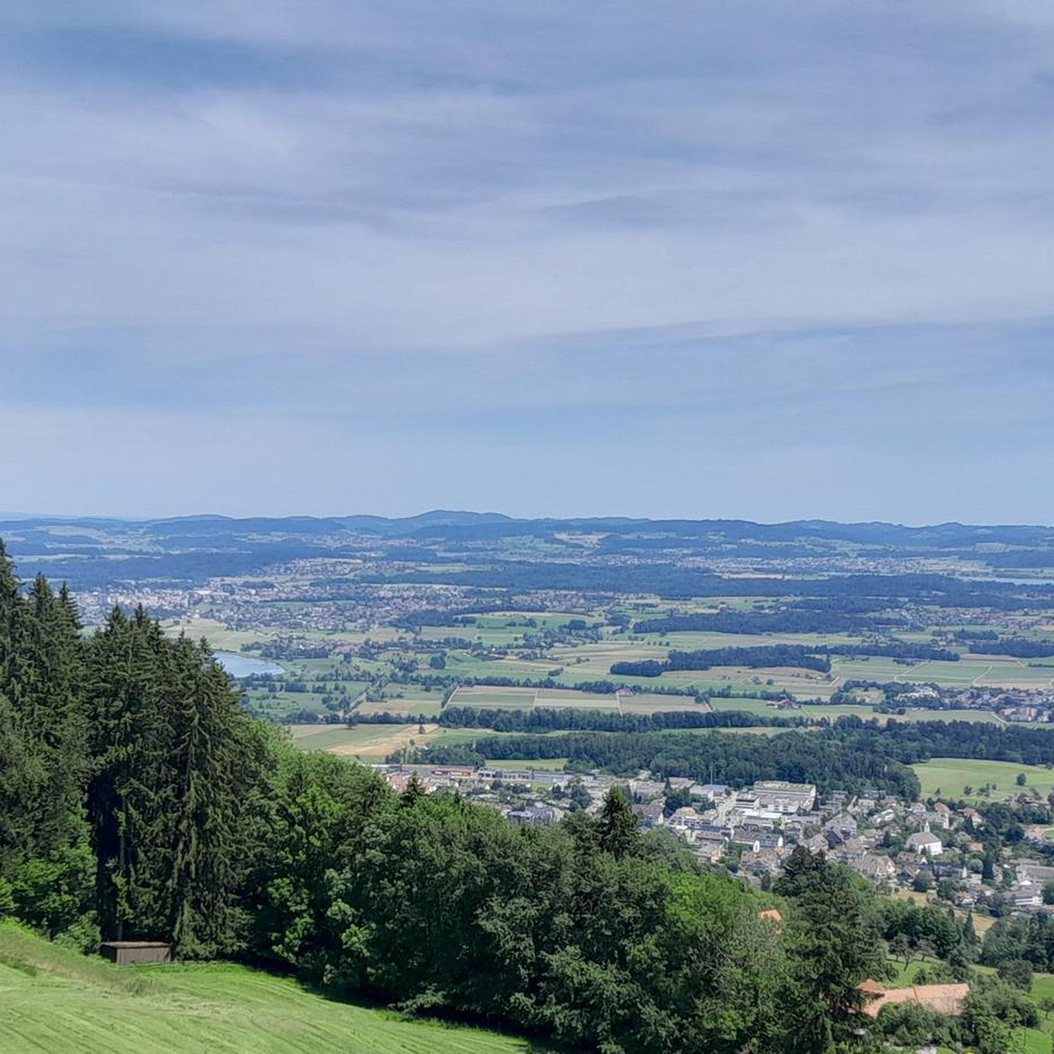
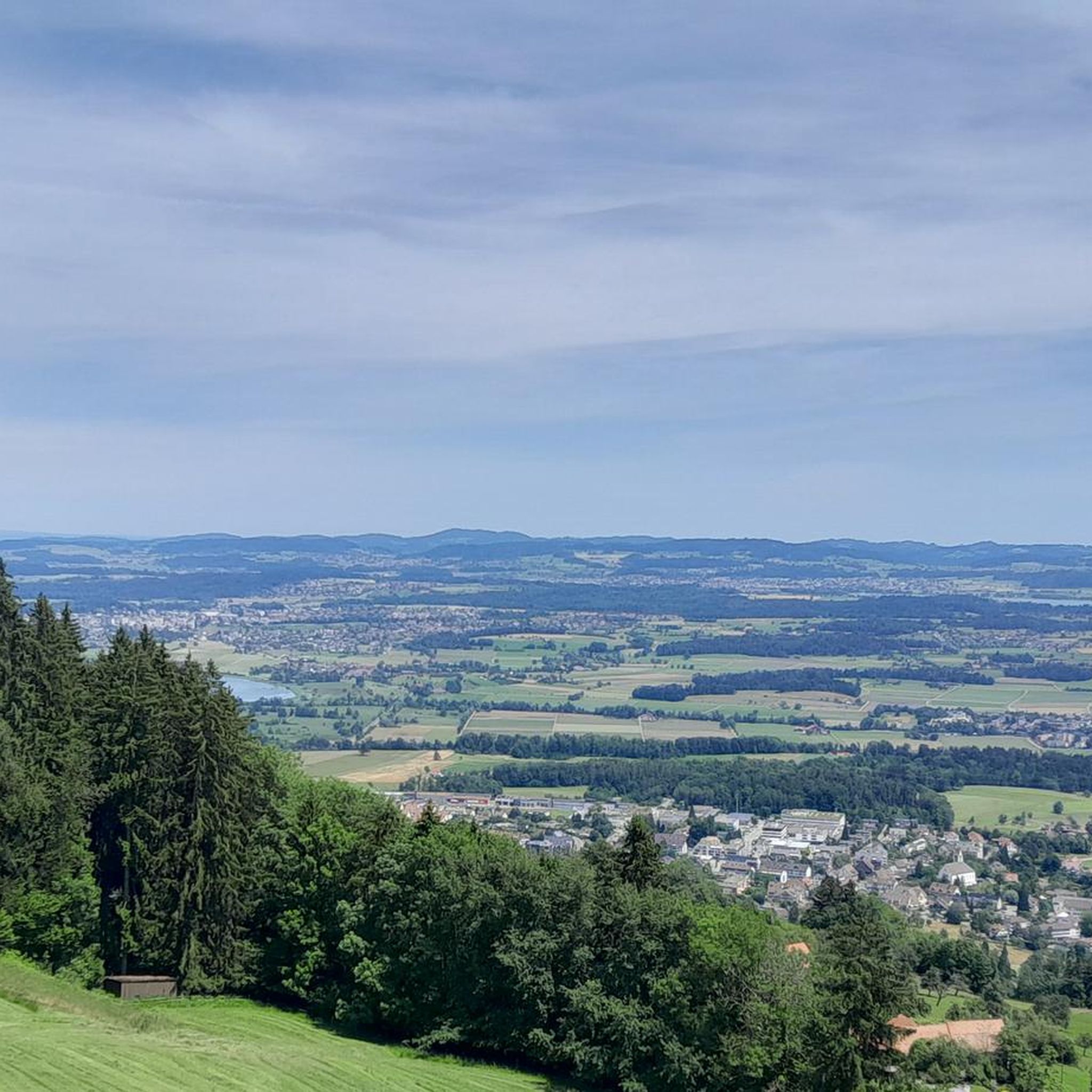
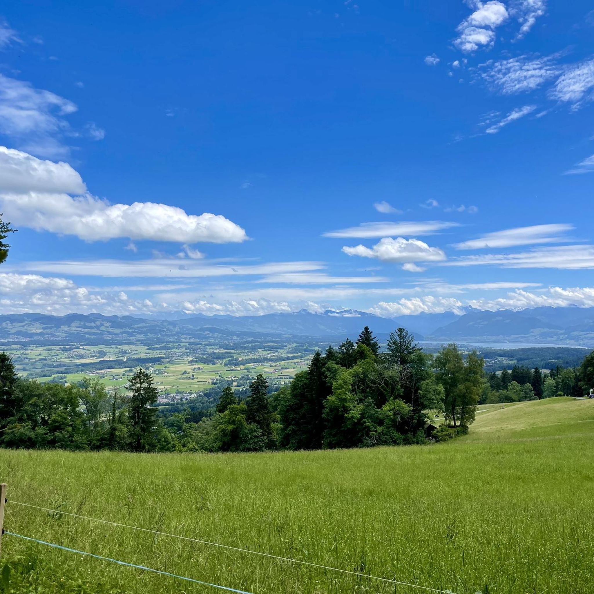
View in all directions
0
0

In front of the forest hut, there's a huge forecourt that can be used for a variety of activities. The nearby fountain is an ideal water source for both two-legged and four-legged friends.
0
0

The Hochwacht is located just above the Pfannenstiel
0
0
And if you look closely you can see two lakes
0
0
Frequently Asked Questions
How many hiking trails are available in Pfannenstiel?
Pfannenstiel offers a diverse network of over two dozen hiking trails. These range from easy paths suitable for leisurely walks to more moderate ascents, ensuring options for various fitness levels.
What kind of views can I expect on a hike in Pfannenstiel?
Hikers in Pfannenstiel are treated to spectacular panoramic views. Many trails traverse the ridge, offering consistent scenic outlooks over Lake Zurich, the surrounding countryside, and distant mountains like Pilatus, Rigi, and the Churfirsten ranges. The 35-meter-tall Hochwacht Tower on the Pfannenstiel is a key highlight for expansive vistas.
Are there any family-friendly hiking options in Pfannenstiel?
Yes, Pfannenstiel has several trails suitable for families. Some sections feature wide, dirt paths that can accommodate strollers, while others offer varied terrain with gentle ascents. The area also includes amenities like playgrounds and picnic areas, making it enjoyable for all ages. An easy option is the Barbecue area with a view – Pfannenstiel Summit loop from Bezirk Meilen, which is 3.6 miles long.
What is the best time of year to go hiking in Pfannenstiel?
While Pfannenstiel is beautiful year-round, the autumn season, specifically from mid-October to early November, is highly recommended. During this time, the vibrant fall foliage creates a particularly picturesque hiking experience.
Are there any circular hiking routes in Pfannenstiel?
Yes, many of the trails in Pfannenstiel are designed as circular routes, allowing you to start and end at the same point. For example, the View from the Pfannenstiel summit – Barbecue area with a view loop from Guldenen is an easy 4.1-mile circular path offering consistent scenic outlooks.
What are some interesting natural features or landmarks to see along the trails?
Beyond the panoramic views, you can explore diverse natural features. Trails wind through dense forests and picturesque ravines, often following streams down towards Lake Zurich. Notable spots include the Upper Section of the Meilemer Tobel and the Hochwacht Tower on the Pfannenstiel, which offers a fantastic viewpoint.
How accessible is Pfannenstiel by public transport?
Pfannenstiel is very accessible by public transport. Many trails conveniently start or end near train stations, such as Forch and Meilen, making it easy to reach the hiking areas without a car.
Are there amenities like restaurants or picnic spots along the hiking routes?
Yes, along the trails, especially near the observation tower, you'll find convenient amenities. There are restaurants, such as the Hochwacht restaurant, and designated picnic areas, some equipped with grills, perfect for a break during your hike.
What do other hikers enjoy most about Pfannenstiel?
The komoot community highly rates Pfannenstiel, with an average score of 4.7 stars from over 800 reviews. Hikers frequently praise the diverse landscapes, the well-maintained trails, and the spectacular panoramic views of Lake Zurich and the surrounding mountains.
Are there any moderate difficulty hikes for those looking for a bit more challenge?
Yes, Pfannenstiel offers several moderate hikes. For instance, the Barbecue area with a view – Pfannenstiel Summit loop from Pfannenstiel is a 5.5-mile trail leading through wooded hills, often completed in about 2 hours 30 minutes. Another moderate option is the Gubelweg – Guldenen Trail loop from Forch.
Can I bring my dog on the hiking trails in Pfannenstiel?
Many trails in Pfannenstiel are dog-friendly, offering a great opportunity to explore the varied terrain with your canine companion. It's always a good idea to keep dogs on a leash, especially in areas with wildlife or near other hikers, and to check local regulations for specific trail sections.
Are there any trails that offer views of Lake Zurich?
Absolutely. Many trails in Pfannenstiel provide stunning views of Lake Zurich. The View of Lake Zurich – Bridge and tunnel loop from Bezirk Meilen is a 6.6-mile moderate route specifically designed to showcase these beautiful lake vistas.
Most popular routes in Pfannenstiel
Most popular attractions in Pfannenstiel

Get inspired with the komoot mobile app


Explore more
Browse the best Hikes in other regions.
