The best road cycling routes in Wörishofener Wald
4.5
(500)
5,276
riders
480
rides
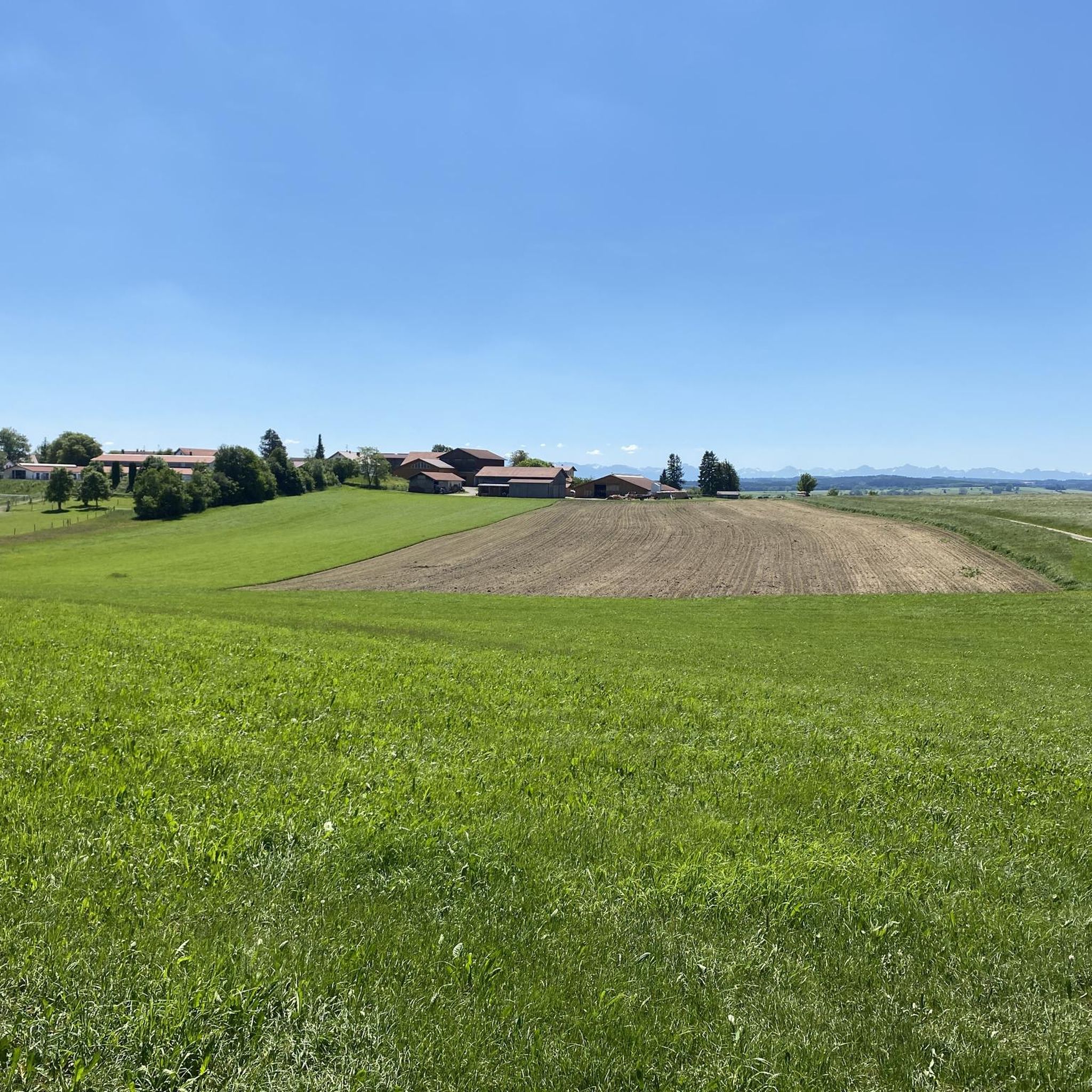
Road cycling in Wörishofener Wald offers varied terrain across gently rolling hills, expansive fields, and lush woodlands. The region features an extensive network of cycling paths, predominantly asphalted and following quiet rural roads. These routes provide views of the Allgäu Alps and pass natural features such as the Wertach River and Bingstetter See.
Best road cycling routes in Wörishofener Wald
- The most popular road cycling route is Lohofer Weiher – Asphalt Farm Track (Rammingen) loop from Altensteig, a 28.8 miles (46.3 km) trail that takes 1 hour 49 minutes to complete. This easy route features asphalt farm tracks and scenic loops.
- Another top favourite among local road cyclists is Asphalt Farm Track (Rammingen) – Old town of Mindelheim loop from Bad Wörishofen, an easy 24.5 miles (39.5 km) path. This route combines rural asphalt tracks with a visit to the old town of Mindelheim.
- Local road cyclists also love the Asphalt Farm Track (Rammingen) – Country road near Schnerzhofen loop from Bad Wörishofen, a 24.8 miles (39.9 km) trail leading through quiet country roads, often completed in about 1 hour 36 minutes.
- Road cycling in Wörishofener Wald is defined by gently rolling hills, expansive fields, and lush woodlands. The network offers options for easy, moderate, and difficult ability levels.
- The routes in Wörishofener Wald are highly rated by the komoot community with an average score of 4.6 stars from over 390 reviews. More than 4000 road cyclists have used komoot to explore Wörishofener Wald's varied terrain.
Last updated: August 21, 2026
4.8
(6)
21
riders
Easy road ride. Great for any fitness level. Mostly well-paved surfaces and easy to ride.
12
riders
54.8km
02:10
160m
160m
Moderate road ride. Good fitness required. Mostly well-paved surfaces and easy to ride.

Sign up for free
4.5
(4)
32
riders
Easy road ride. Great for any fitness level. Mostly well-paved surfaces and easy to ride.
4.9
(9)
69
riders
Easy road ride. Great for any fitness level. Mostly well-paved surfaces and easy to ride.
4.2
(9)
63
riders
35.1km
01:37
210m
210m
Moderate road ride. Great for any fitness level. Some segments of this route may be unpaved and difficult to ride.
Get access to more routes and recommendations from other explorers.
Sign up for free
Already have an account?
Our route recommendations are based on thousands of hikes, rides, and runs completed by other people on komoot.
Start today with a free account
Your next adventure awaits.
Login or Signup
Other adventures in Wörishofener Wald

Tips from the Community

The Obere Tor, also called Haberntor, is the most famous of the three gates. It marks the entrance from Krumbacher Straße into the old town and is traditionally decorated with the "world's largest Durahansl" during carnival.
0
0

Well-maintained cycle path along the stream
0
0

Beautiful vintage-look signpost.
0
0

The ice cream machine sells delicious farm ice cream.
0
0
A great monastery and a super nice restaurant next door.
0
0

A stop here is almost a must. It's about halfway through the tour, after all.
0
0

Mindelheim's old town takes you on a journey through time through centuries-old alleys and magnificent town houses. A living history book in the open air.
1
1
An impressive example of medieval city fortifications and a perfect photo stop during your walk through the old town.
1
1
Frequently Asked Questions
What kind of terrain can I expect when road cycling in Wörishofener Wald?
The Wörishofener Wald region offers a diverse landscape for road cyclists, characterized by gently rolling hills, expansive fields, and lush woodlands. You'll find an extensive network of cycling paths, many of which are predominantly asphalted and follow quiet rural roads. The terrain ranges from flat stretches to moderate ascents, providing varied experiences for different cycling styles.
How many road cycling routes are available in Wörishofener Wald?
There are over 460 road cycling routes available in Wörishofener Wald. This includes a wide range of options, with approximately 170 easy routes, 270 moderate routes, and a smaller selection of more challenging paths.
Are there any easy road cycling routes suitable for beginners in Wörishofener Wald?
Yes, Wörishofener Wald offers numerous easy road cycling routes. For instance, the Lohofer Weiher – Asphalt Farm Track (Rammingen) loop from Altensteig is an easy 28.8-mile (46.3 km) route featuring asphalt farm tracks and scenic loops. Another great option is the Asphalt Farm Track (Rammingen) – Old town of Mindelheim loop from Bad Wörishofen, an easy 24.5-mile (39.5 km) path that combines rural tracks with a visit to Mindelheim's old town.
What are some notable natural features or landmarks to look out for along the cycling routes?
As you cycle through Wörishofener Wald, you can enjoy views of the majestic Allgäu Alps. Routes also pass by natural features such as the Wertach River and the scenic Bingstetter See (Bingstetter Lake). Within the forest itself, you might encounter unique attractions like the Forest Sculptures of Gnomes and Trolls, the refreshing Kneipp Water-Treading Facility, or the striking Red Wedge Memorial to Storm Wiebke.
What do other road cyclists say about their experience in Wörishofener Wald?
The road cycling routes in Wörishofener Wald are highly rated by the komoot community, with an average score of 4.6 stars from over 390 reviews. Cyclists often praise the varied terrain, the well-maintained asphalt paths, and the quiet rural roads that provide a pleasant riding experience.
Are there any moderate or challenging road cycling routes in the area?
Yes, Wörishofener Wald offers a good selection of routes for more experienced cyclists. There are approximately 270 moderate routes and 17 difficult routes. An example of a moderate route is the Pforzen–Rieden Path – Irsee Abbey loop from Bad Wörishofen, which covers 34.9 miles (56.2 km) with notable elevation changes.
What is the best time of year to go road cycling in Wörishofener Wald?
The region is generally suitable for road cycling from spring through autumn. The extensive network of paths and varied terrain make it enjoyable across these seasons, with lush greenery in spring and summer, and vibrant colors in autumn. Always check local weather conditions before heading out.
Are there circular road cycling routes available?
Yes, many of the road cycling routes in Wörishofener Wald are designed as loops, allowing you to start and end at the same point. Examples include the Asphalt Farm Track (Rammingen) – Country road near Schnerzhofen loop from Bad Wörishofen, a 24.8-mile (39.9 km) trail through quiet country roads, and the Irsee Abbey – Pforzen–Rieden Path loop from Bad Wörishofen.
Is Wörishofener Wald suitable for family-friendly road cycling?
Yes, the region is well-suited for family-friendly road cycling, especially given the abundance of easy routes and predominantly asphalted, quiet rural roads. The gently rolling terrain and scenic views provide a pleasant environment for cyclists of all ages. The presence of attractions like the Forest Sculptures of Gnomes and Trolls can also add an element of fun for children.
Where can I find parking for road cycling routes in Wörishofener Wald?
While specific parking locations are not detailed in the route descriptions, Bad Wörishofen, as a central hub, typically offers various parking options. Many routes start from or pass through towns and villages where public parking is usually available, often near trailheads or local amenities.
Can I reach Wörishofener Wald cycling routes using public transport?
Bad Wörishofen is generally well-connected by public transport, including train services, which can provide access to the region. From the town, many cycling routes are easily accessible, allowing you to start your tour without needing a car. It's advisable to check local bus and train schedules for the most convenient access points.
Most popular routes in Wörishofener Wald
Most popular attractions in Wörishofener Wald

Get inspired with the komoot mobile app


Explore more
Browse the best Road cycling routes in other regions.
