The best mountain hikes in Tschirgantwald
4.8
(84)
784
hikers
36
hikes
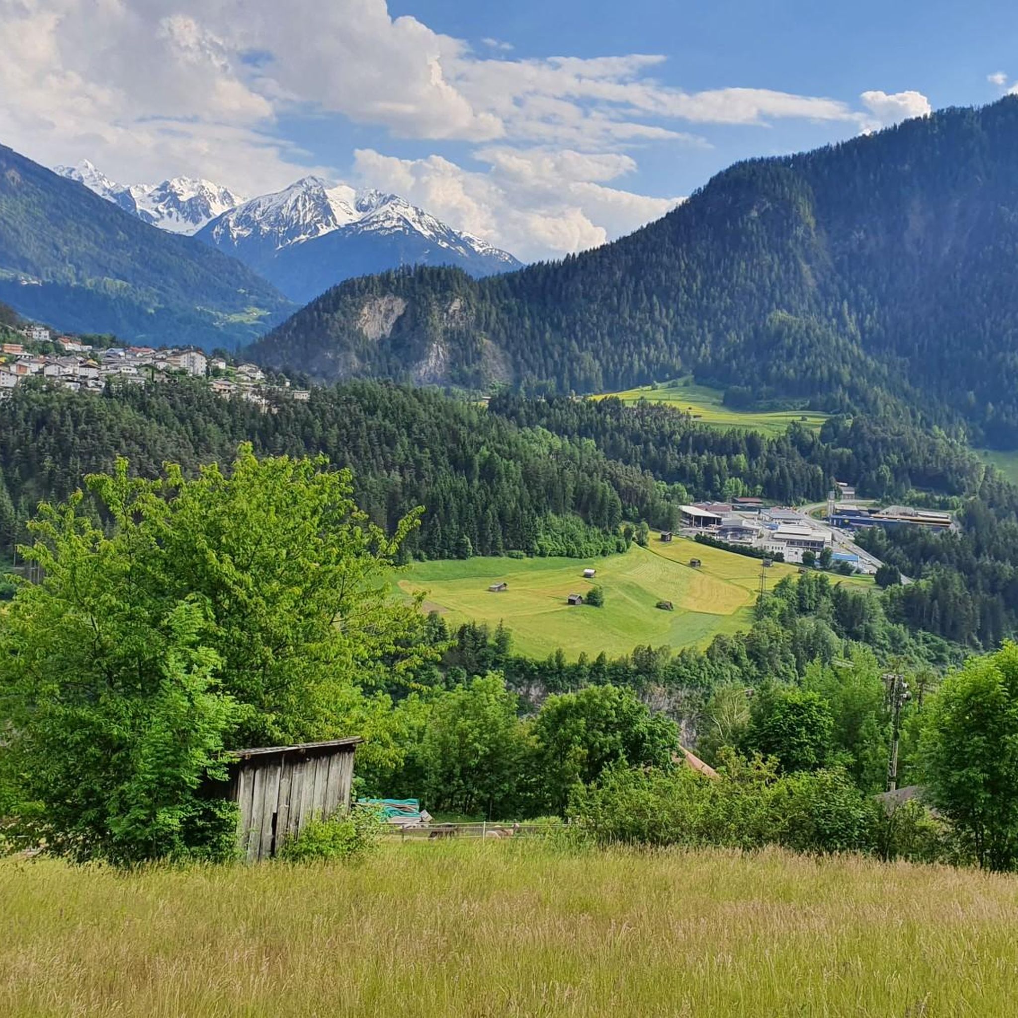
Mountaineering in Tschirgantwald offers a diverse landscape characterized by prominent summits, dense woodlands, and expansive views over the Imst region. The terrain includes challenging ascents to peaks like Tschirgant Summit, providing significant elevation gain. Routes often traverse forested slopes before opening up to alpine environments.
Best mountaineering routes in Tschirgantwald
- The most popular mountaineering route is View of Imst – Tschirgant Summit loop from Karrösten, a difficult 8.9 miles (14.3 km) trail that takes 7 hours 13 minutes to…
Last updated: June 24, 2026
5.0
(2)
26
hikers
15.1km
07:13
1,310m
1,310m
Hard mountaineering route. Very good fitness required. Sure-footedness, sturdy shoes and alpine experience required.
4.3
(3)
25
hikers
8.29km
04:50
830m
830m
Hard mountaineering route. Good fitness required. Sure-footedness, sturdy shoes and alpine experience required.

Sign up for free
5.0
(1)
13
hikers
16.7km
07:47
1,350m
1,350m
Hard mountaineering route. Very good fitness required. Sure-footedness, sturdy shoes and alpine experience required.
5.0
(1)
6
hikers
5km
03:32
650m
650m
Hard mountaineering route. Good fitness required. Sure-footedness, sturdy shoes and alpine experience required.
5.0
(1)
21
hikers
5.64km
01:50
250m
250m
Easy mountaineering route. Great for any fitness level. Easily-accessible paths. Suitable for all skill levels.
Get access to more routes and recommendations from other explorers.
Sign up for free
Already have an account?
Our route recommendations are based on thousands of hikes, rides, and runs completed by other people on komoot.
Start today with a free account
Your next adventure awaits.
Login or Signup

Tips from the Community

A very beautiful alpine pasture; unfortunately, the sympathy we were used to has gone down the drain with the new tenant. And if the good lady is reading this – if you're going to criticize someone (at the alpine pasture), it's best to do it at a low volume. But fortunately, this isn't the only alpine pasture in the region.
0
0

Entrance to the Rosengarten Gorge with rock formations into which residential buildings have been integrated. Historically, these houses, built into the rock, served as homes and workplaces. Their origins are closely linked to the geological composition of the Bergl, formed by the Inn Valley glacier some 26,000 years ago. The use of the rock as an integral part of the buildings not only provided protection from the elements but also natural insulation. Today, the Bergl houses are an important cultural heritage site in Imst and a popular photo opportunity for visitors. They symbolize historic architecture and the impressive ability of people to adapt to their natural environment. A walk through this district provides a fascinating insight into the history and lifestyles of past generations.
6
0

Via mountain rescue trail to Tschirgant
1
0

It is very beautiful here.
0
2

beautiful, well-developed path to the alpine pasture
0
0

Very nice, small, artificially created bathing lake, which invites you to take a cooling bath or at least a foot bath.
1
0
The special thing about the Blue Grotto is the story of its creation: 2000 years ago, in Roman times, people were working diligently here and searching for silver-containing galena. The geologist Peter Gstrein suspects that the fire-setting method was already being used for mining in the first centuries after the birth of Christ; The rock's rock became brittle due to the heating and could therefore be chipped away more easily. This is how the Blue Grotto was created, which is probably unique in Tyrol. The blue grotto is located at the end of the Rosengartenschlucht just before the hiking trail arrives in Hoch-Imst. In the opposite direction from Hoch-Imst, the Blue Grotto can be reached in less than 10 minutes. Imst.at
5
0
Frequently Asked Questions
How many mountaineering routes are available in Tschirgantwald?
Tschirgantwald offers a wide selection of mountaineering routes, with over 35 different tours to explore. These range in difficulty from easy to difficult, ensuring options for various skill levels.
Are there any easy mountaineering routes for beginners in Tschirgantwald?
Yes, Tschirgantwald has several easier mountaineering options. For instance, the Old Town of Imst – Wetterkreuz Imst Viewpoint loop from Imst is classified as easy, covering about 5.7 km and typically taking around 1 hour 50 minutes. This route offers a gentler introduction to the region's beauty.
What is the best time of year for mountaineering in Tschirgantwald?
The prime season for mountaineering in Tschirgantwald generally runs from late spring through early autumn (May to October). During these months, trails are typically clear of snow, and weather conditions are more stable, offering the best experience for summit ascents and panoramic views.
Are there any circular mountaineering routes in Tschirgantwald?
Many of the mountaineering routes in Tschirgantwald are designed as circular tours, allowing you to start and end at the same point. An example is the challenging View of Imst – Tschirgant Summit loop from Karrösten, which is an 8.9-mile (14.3 km) loop offering extensive views.
What kind of viewpoints can I expect on Tschirgantwald mountaineering routes?
Mountaineering routes in Tschirgantwald are known for their rewarding viewpoints, often providing panoramic vistas of the Imst region and surrounding alpine landscapes. Many trails lead directly to the Tschirgant Summit, offering spectacular 360-degree views after a challenging ascent.
Are there any mountain huts or cafes along the mountaineering trails in Tschirgantwald?
Yes, some routes incorporate mountain huts where you can rest and refuel. For example, the Tschirgant Summit – Bergwacht Mountain Hut loop from Karrösten includes a visit to a mountain hut, providing a welcome stop during your tour. You can also find the Karröster Alm, a popular hut in the area.
What do other mountaineers enjoy most about Tschirgantwald?
The komoot community highly rates mountaineering in Tschirgantwald, with an average score of 4.8 stars from over 70 reviews. Mountaineers frequently praise the challenging summit ascents, the diverse terrain combining dense forests with alpine environments, and the rewarding panoramic views, especially from the Tschirgant Summit.
Are there any historical or natural landmarks to see near the mountaineering routes?
Yes, Tschirgantwald offers several interesting landmarks. You can explore the Mining open-air museum Knappenwelt Gurgltal, discover the Old Mine Tunnel, or walk the Via Gemunden Mining Monument and Forest Path. These sites provide a glimpse into the region's mining history and natural beauty.
What is the typical elevation gain on mountaineering routes in Tschirgantwald?
Mountaineering routes in Tschirgantwald often involve significant elevation gain, reflecting the region's prominent summits. For example, the View of Imst – Tschirgant Summit loop from Tarrenz, while shorter at 8.1 km, still features an ascent of over 800 meters.
Is public transport available to reach the trailheads in Tschirgantwald?
While specific public transport options vary by trailhead, the region around Tschirgantwald is generally accessible. It's advisable to check local bus schedules for connections to villages like Karrösten or Tarrenz, which serve as common starting points for many mountaineering routes.
Are there any shorter, yet challenging, mountaineering routes to the Tschirgant Summit?
For those seeking a challenging summit experience without an extremely long duration, the View of Tschirgant – Tschirgant Summit loop from Karrösten is a good option. This difficult route is about 4.9 km long and typically takes around 3 hours 30 minutes to complete, offering a direct path to the summit.
Most popular routes in Tschirgantwald
Most popular attractions in Tschirgantwald

Get inspired with the komoot mobile app


Explore more
Browse the best Mountain Hikes & Routes in other regions.
