The best mountain hikes in Schoberwald
4.8
(105)
1,144
hikers
47
hikes
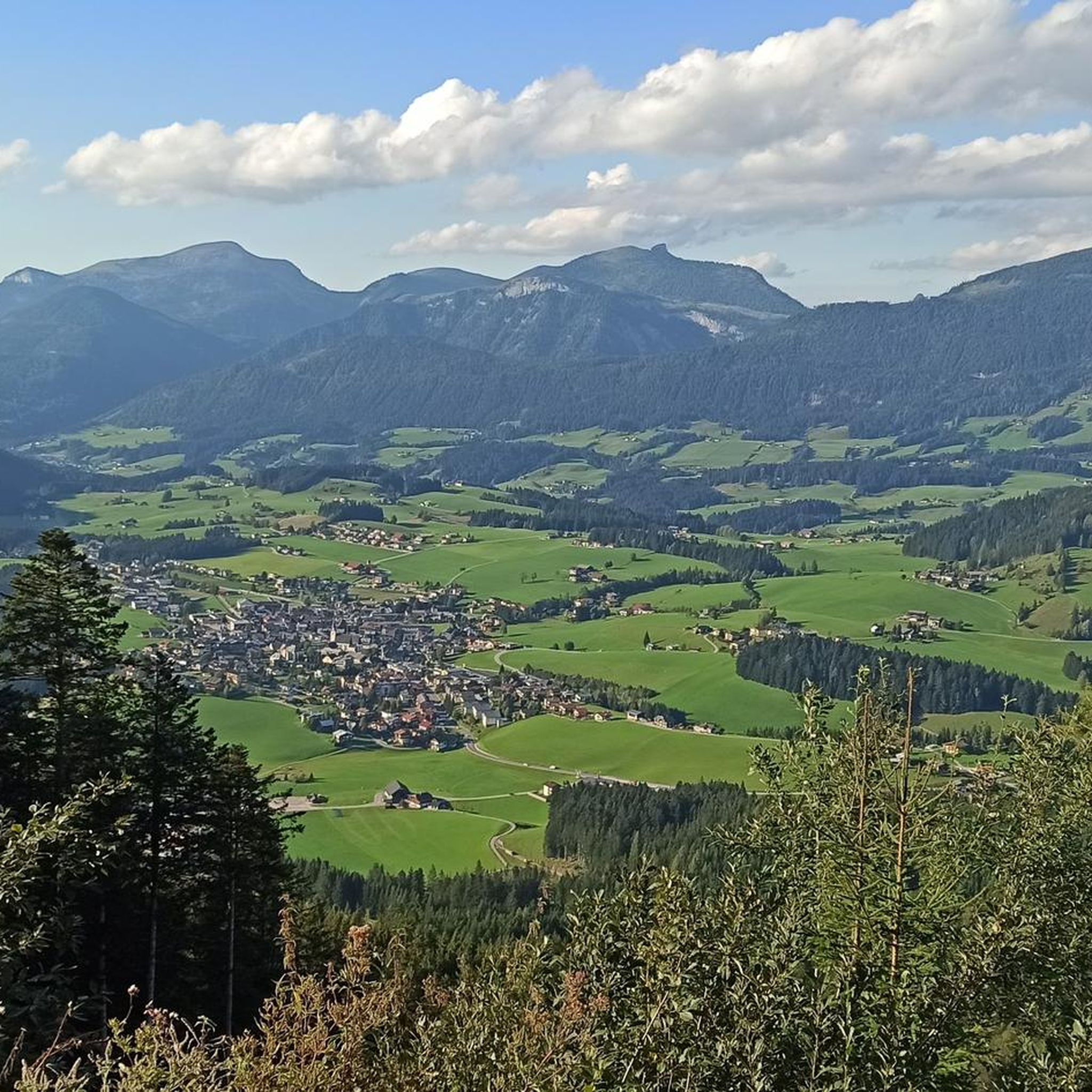
Mountaineering routes in Schoberwald traverse a landscape characterized by dense forests, rolling hills, and significant elevation changes. The region features extensive woodlands and offers challenging trails with considerable ascent. Mountaineers can expect varied terrain, including paths leading to panoramic viewpoints.
Best mountaineering routes in Schoberwald
- The most popular mountaineering route is Water Source at Wandalm – Laufener Hütte loop from Karalm, an 8.9 miles (14.3 km) trail that takes 7 hours 42 minutes to complete. This difficult route features…
Last updated: July 1, 2026
5.0
(1)
33
hikers
7.93km
04:30
750m
750m
Hard mountaineering route. Good fitness required. Sure-footedness, sturdy shoes and alpine experience required.
5.0
(2)
27
hikers
14.1km
07:38
1,220m
1,220m
Hard mountaineering route. Very good fitness required. Sure-footedness, sturdy shoes and alpine experience required.

Sign up for free
4.8
(4)
17
hikers
9.10km
05:11
860m
860m
Hard mountaineering route. Very good fitness required. Sure-footedness, sturdy shoes and alpine experience required.
5.0
(1)
14
hikers
11.1km
05:16
880m
880m
Hard mountaineering route. Very good fitness required. Sure-footedness, sturdy shoes and alpine experience required.
5.0
(3)
12
hikers
7.40km
03:45
640m
640m
Moderate mountaineering route. Good fitness required. Mostly accessible paths. Sure-footedness required.
Get access to more routes and recommendations from other explorers.
Sign up for free
Already have an account?
Our route recommendations are based on thousands of hikes, rides, and runs completed by other people on komoot.
Start today with a free account
Your next adventure awaits.
Login or Signup

Tips from the Community

If there's no menu on the table, ask - there's plenty of good food! Very friendly crew
0
0
Fantastic panorama, about 20 minutes above the Gsengalm, hiking or at least trekking shoes recommended
0
0

Every year I take my mobility scooter up to the top (the employees are very helpful) and drive down the mountain.
1
0

Inscription on the cross: Bright days - do not cry because they are over, but give thanks that they have been.
0
0

After 400 meters uphill on the train you are here!
5
0
Everything was great, food was great, service was great
7
1

Tennengebirge: Gsengalm as a great starting point and stop on the descent
0
0
Easily overlooked when descending from the ridge
0
0
Frequently Asked Questions
What kind of terrain can I expect on mountaineering routes in Schoberwald?
Mountaineering in Schoberwald is characterized by dense woodlands, rolling hills, and significant elevation changes. You'll find extensive forests and varied terrain, including paths that lead to panoramic viewpoints. The region offers challenging trails with considerable ascent, similar to the diverse landscapes found in the Black Forest, featuring both mystical woodlands and open vistas.
How many mountaineering routes are available in Schoberwald?
There are over 45 mountaineering routes available in Schoberwald, catering to various skill levels. The majority, about 36, are classified as difficult, with 10 moderate and a couple of easier options.
Are there any family-friendly mountaineering options in Schoberwald?
While many routes are challenging, there are a few moderate options that might be suitable for families with older, experienced children. For example, the Gsengalm and Surroundings – Gsengalmhütte loop from Karalm is a moderate 7.1 km trail that takes about 3 hours 40 minutes, offering a less strenuous experience through alpine pastures and forested sections. Always check the specific route details for elevation gain and distance to ensure it matches your family's capabilities.
Can I bring my dog on the mountaineering trails in Schoberwald?
Many trails in Schoberwald are dog-friendly, allowing you to enjoy the natural beauty with your canine companion. However, it's always advisable to keep your dog on a leash, especially in forested areas or near livestock, and to be mindful of other hikers and wildlife. Ensure your dog is fit enough for the chosen route, as many involve significant elevation changes.
What are some notable landmarks or viewpoints along the routes in Schoberwald?
Schoberwald offers several points of interest and stunning viewpoints. You can discover the Berliner Kreuz, enjoy the hospitality at Gsengalm Hut, or take in expansive vistas from the View below Kleiner Traunstein and the View of Abtenau from Schober. These spots provide excellent opportunities to appreciate the region's natural beauty.
Are there any circular mountaineering paths in Schoberwald?
Yes, Schoberwald features several circular routes that allow you to start and end at the same point. A popular example is the Gsengalmhütte – Kleiner Traunstein (1,652 m) loop from Abtenau, a challenging 11.1 km path offering expansive views. Another is the Water Source at Wandalm – Laufener Hütte loop from Karalm, which is 14.3 km long and features substantial elevation gain.
What is the best season for mountaineering in Schoberwald?
The best season for mountaineering in Schoberwald is generally from late spring to early autumn (May to October), when the weather is most stable and trails are clear of snow. During these months, you can fully enjoy the dense woodlands and panoramic views. Winter mountaineering is possible but requires specialized equipment and experience due to snow and ice conditions, similar to other high-altitude areas in the Black Forest.
Are there any cafes or huts along the mountaineering routes for refreshments?
Yes, you'll find places like the Gsengalm Hut along some routes, offering opportunities for refreshments and a break. These huts are often nestled in scenic locations, providing a welcome stop during your mountaineering adventure. It's always a good idea to check opening times before you set out.
What do other mountaineers enjoy most about Schoberwald?
The mountaineering routes in Schoberwald are highly rated by the komoot community, with an average score of 4.8 stars from over 100 reviews. Mountaineers often praise the challenging nature of the trails, the significant elevation gains, and the rewarding panoramic views. The diverse terrain, from dense forests to alpine pastures, is also a frequently highlighted aspect.
How can I access the mountaineering trails in Schoberwald using public transport?
While specific public transport details for each trailhead vary, many regions in the wider Black Forest area, which shares similar characteristics with Schoberwald, are accessible by bus or train. It's recommended to research local bus schedules to trailheads or consider starting points that are well-connected. For routes like the Gsengalmhütte – Kleiner Traunstein (1,652 m) loop, starting from Abtenau might offer better public transport connections.
Are there any particularly challenging routes for experienced mountaineers?
Absolutely. Schoberwald is known for its difficult routes, with 36 out of 48 trails classified as such. For experienced mountaineers seeking a significant challenge, the Laufener Hütte – Gsengalmhütte loop from Karalm is a demanding 13.4 km route with over 1,175 meters of ascent. Another option is the Water Source at Wandalm – Tennengebirge First Summit loop from Karalm, covering 10.6 km with over 1,150 meters of elevation gain.
What kind of wildlife might I spot while mountaineering in Schoberwald?
The dense forests and natural landscapes of Schoberwald, much like the Black Forest, provide a habitat for various wildlife. You might encounter deer, foxes, and a variety of bird species. Keep an eye out for local flora and fauna, especially in quieter sections of the trails. Respecting their habitat by staying on marked paths and keeping noise to a minimum will increase your chances of a sighting.
Most popular routes in Schoberwald
Most popular attractions in Schoberwald

Get inspired with the komoot mobile app


Explore more
Browse the best Mountain Hikes & Routes in other regions.
