The best mountain hikes in Pylli I Rragamit
4.7
(44)
198
hikers
4
hikes
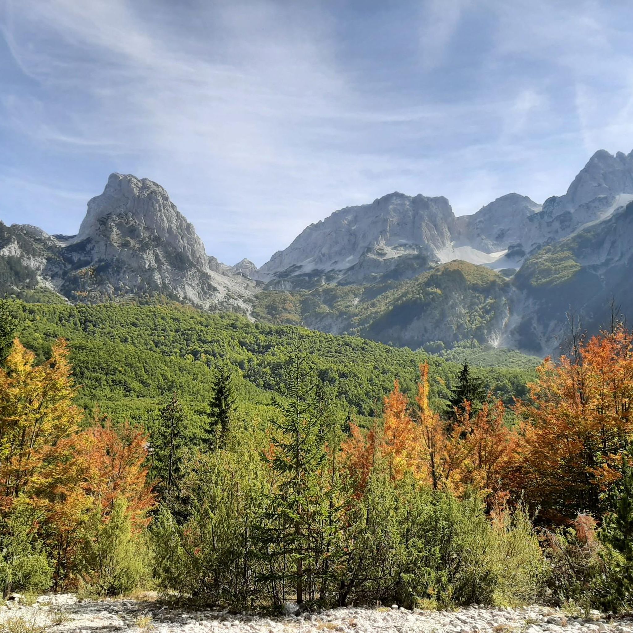
Mountaineering in Pylli I Rragamit, a forest in Kukës County, Albania, offers challenging terrain within the Dinaric Alps. The region is characterized by its elevation of 1,437 meters and proximity to significant peaks like Jezercë (2,694 meters) and Maja e Rosit (2,524 meters). Diverse mountaineering routes traverse dense forests and lead to notable natural features such as waterfalls and high mountain passes. The area provides a range of experiences for those with alpine experience and good fitness.
Best mountaineering routes…
Last updated: October 4, 2026
4.8
(19)
74
hikers
Hard mountaineering route. Very good fitness required. Sure-footedness, sturdy shoes and alpine experience required.
4.5
(6)
19
hikers
7.22km
02:35
200m
200m
Moderate mountaineering route. Good fitness required. Mostly accessible paths. Sure-footedness required.

4.5
(2)
11
hikers
11.1km
06:06
950m
950m
Hard mountaineering route. Very good fitness required. Sure-footedness, sturdy shoes and alpine experience required.
5.0
(3)
6
hikers
6.25km
04:45
860m
860m
Hard mountaineering route. Good fitness required. Sure-footedness, sturdy shoes and alpine experience required.
4.9
(14)
84
hikers
9.94km
04:50
870m
870m
Hard mountaineering route. Good fitness required. Sure-footedness, sturdy shoes and alpine experience required.
Our route recommendations are based on thousands of hikes, rides, and runs completed by other people on komoot.
Start today with a free account
Your next adventure awaits.
Popular around Pylli I Rragamit
Tips from the Community

Camping Zorgji is located in the lower part of the Theth Valley, close to the river and surrounded by dense beech forests. It is a small-scale, simple campsite with a few flat grassy areas for tents. The atmosphere is typical for Theth: peace, nature, and a direct connection to the hiking trails towards the church, the Kulla e Ngujimit, and the river paths. The campsite is run locally and offers mainly basic facilities.
7
0
A narrow wooden suspension bridge spans the turquoise water of the Blue Eye River. The planks wobble slightly under your feet, while the crystal-clear water flows over the stones beneath you. On both sides of the bridge lie rocks and trees that filter the light into a green-blue spectacle — a natural photo spot where hikers pause for the view.
6
0
Idyllic, picturesque place. Worth the hike. The restaurant upstairs offers a pleasant break and is the ideal photo spot.
6
0
Deep in the valley of Theth lies the Blue Eye: a clear blue spring that forms in a natural pool between limestone and moss. The water comes directly from an underground karst spring and remains ice-cold, even in the middle of summer. Around the pool are smooth rocks, small waterfalls, and turquoise streams that together form one of the most photogenic spots in Theth National Park. The path to it winds along the river, through narrow passages and over wooden bridges, until you reach the pool where light and water create an almost surreal color.
6
0
In 08/2026 the bridge is no more... What was once a sturdy footbridge is now a weathered ruin of wood and stone. The beams are crooked, some have disappeared, and amidst the greenery, nature is slowly reclaiming the path. The bridge still marks the old trail through the Grunas Gorge — a silent reminder of past travellers, now surrounded by moss, rocks, and autumn light. Fortunately, there is a bypass.
4
0
Narrow, powerful waterfall dropping 25–30 meters down a vertical limestone wall on the west flank of the Theth Valley. The source lies directly above the fall, fed by a high-altitude karst spring and meltwater, ensuring the water remains clear and cold even in summer. Since 2002, the waterfall has been an official nature monument. The path to it is short but steep, with wet, slippery stones and a river crossing that can be challenging in rain. Its location — wedged between rocks and greenery — makes this one of Theth's most characterful spots.
6
1

It's worth walking and taking a break so far. Refreshing, relaxing and beautiful
2
0

To get to the waterfall, turn right and follow the watercourse to the left.
1
0
Frequently Asked Questions
What is the general difficulty level of mountaineering routes in Pylli I Rragamit?
Mountaineering in Pylli I Rragamit offers a range of experiences. While there are no easy routes listed, you'll find 1 moderate route and 3 difficult routes, catering to those with good fitness and alpine experience. The terrain is generally challenging, characteristic of the Dinaric Alps.
Are there any routes suitable for those looking for a moderate challenge?
Yes, for a moderate challenge, consider the Grunas Waterfall – Grunas Waterfall loop from Thethi National Park. This 4.5-mile (7.2 km) trail takes you through forested areas and past the Grunas Waterfall, typically completed in about 2 hours 35 minutes.
Can I find routes that feature waterfalls in Pylli I Rragamit?
Absolutely. The region is known for its stunning water features. A popular route that explores both the Grunas Waterfall and the Blue Eye River is the difficult Grunas Waterfall – Bridge Over the Blue Eye River loop from Thethi National Park, covering 12.0 miles (19.3 km).
What are some of the more challenging mountaineering routes in the area?
For experienced mountaineers seeking a challenge, the Zorzit Peak (1,660 m) loop from Thethi National Park is a difficult 6.9-mile (11.1 km) path offering panoramic views. Another demanding option is the Попадија/Maja e Popadijes – Valušnica loop from Maja Karanfil, which is 9.9 miles (15.9 km) long and also rated as difficult.
What notable peaks are accessible or visible from mountaineering routes in Pylli I Rragamit?
Pylli I Rragamit is strategically located near several impressive mountains. You can find routes that ascend to Zorzit Peak (1,660 m), offering great views. Additionally, the region provides vistas of majestic peaks like Jezercë (2,694 m), the highest peak in the Dinaric Alps, and Maja e Rosit (2,524 m), located on the Albanian–Montenegrin border.
Are there any circular mountaineering routes available?
Yes, several routes in Pylli I Rragamit are designed as loops, allowing you to start and end at the same point. Examples include the Grunas Waterfall – Grunas Waterfall loop from Thethi National Park and the Zorzit Peak (1,660 m) loop from Thethi National Park.
What is the best time of year to go mountaineering in Pylli I Rragamit?
The best time for mountaineering in Pylli I Rragamit is generally during the warmer months, from late spring to early autumn, when trails are clear of snow and weather conditions are more stable. The challenging terrain and alpine nature of the region mean that winter mountaineering requires specialized equipment and significant experience.
Are there any family-friendly options for exploring the area around Pylli I Rragamit?
While the listed mountaineering routes are generally moderate to difficult, the surrounding region, particularly Thethi National Park, offers diverse experiences. For families, consider exploring the charming villages like Thethi and Valbonë, or shorter, less strenuous walks in the valleys, though specific family-friendly mountaineering routes are not highlighted here.
What do other mountaineers enjoy the most about mountaineering in Pylli I Rragamit?
The area is highly rated by the komoot community, with an average score of 4.8 stars from over 30 reviews. Reviewers often praise the dramatic alpine landscapes, the pristine nature, and the stunning natural features like the Grunas Waterfall and the Blue Eye. The challenging yet rewarding trails are also a significant draw.
Are there any cafes or pubs near the mountaineering trails in Pylli I Rragamit?
While Pylli I Rragamit itself is a forest, the nearby traditional villages such as Thethi and Valbonë serve as hubs for explorers. These villages offer local guesthouses and small establishments where you can find refreshments and traditional Albanian hospitality after your mountaineering adventures.
What kind of natural features can I expect to see along the routes?
Mountaineering routes in Pylli I Rragamit traverse dense forests and dramatic alpine landscapes. You can expect to encounter stunning natural features such as the Grunas Waterfall, the crystal-clear Blue Eye crater pool, and enjoy views of high mountain passes and impressive peaks like Jezercë and Maja e Rosit.
Is public transport available to reach the Pylli I Rragamit region?
Access to the Pylli I Rragamit region often involves reaching nearby villages like Thethi or Valbonë. While direct public transport to the forest itself might be limited, the Komani Lake ferry offers a scenic entry or exit point to the wider Albanian Alps region, connecting to areas from which you can arrange further transport to trailheads.

Get inspired with the komoot mobile app


