The best cycling routes in Volkenrodaer Forst
4.6
(1489)
5,928
riders
173
rides
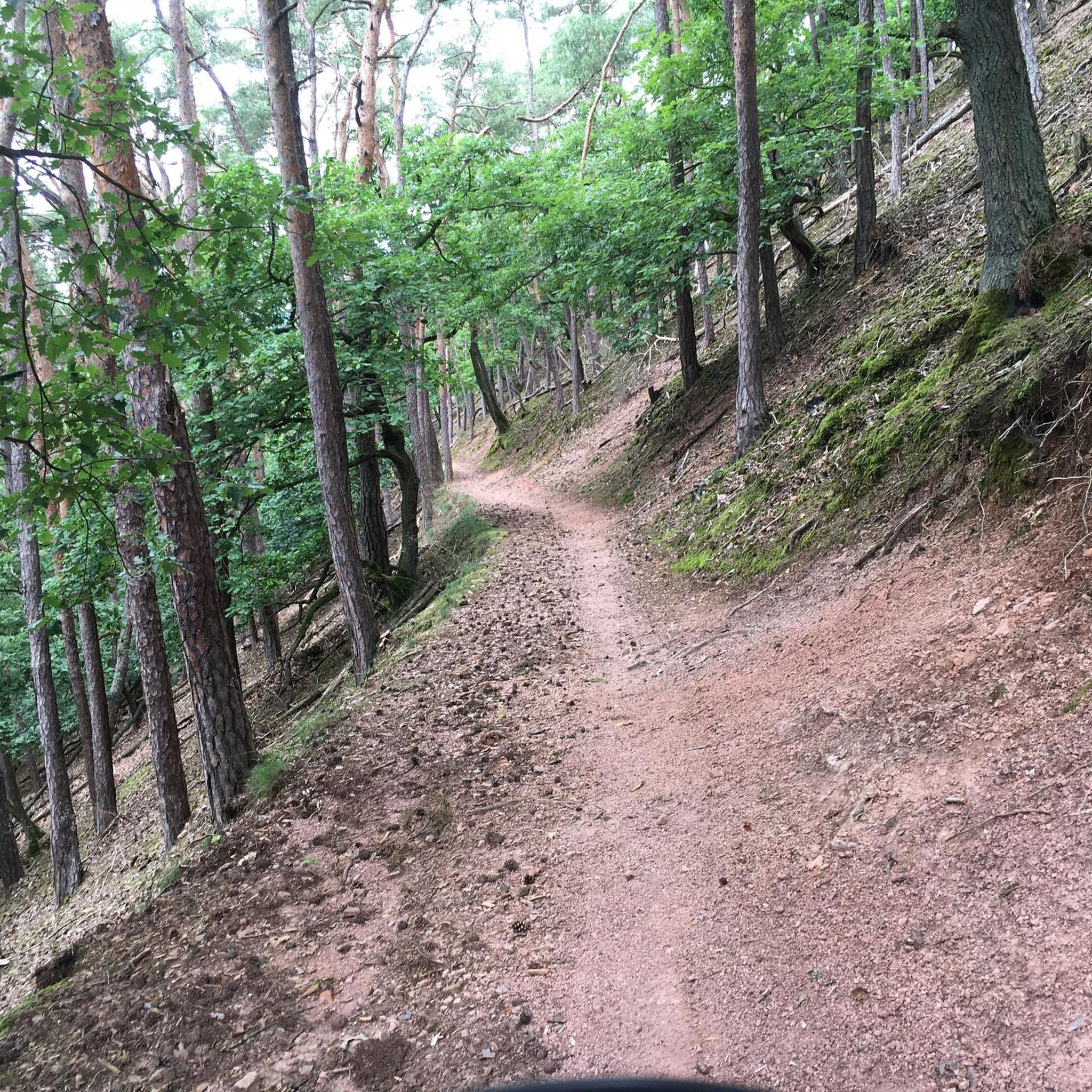
Touring cycling in Volkenrodaer Forst offers routes through a 670-hectare mixed forest characterized by its unique Muschelkalk-Geologie. This geological makeup creates varied terrain, including karst phenomena like dolines and the prominent dry valley known as Schaftal. Elevations within the forest range from approximately 270 meters to 364.1 meters, providing diverse landscapes for cyclists. The region's well-maintained paths are suitable for touring cyclists seeking both gentle stretches and more challenging ascents.
Best touring cycling routes in Volkenrodaer Forst
- The most popular touring cycling route is Mühlhausen Old Town – Outer Frauentor (Mühlhausen) loop from Volkenroda, an 18.0 miles (29.0 km) trail that takes 1 hour 43 minutes to complete, connecting the forest with a historic town.
- Another top favourite among local touring cyclists is Buchsee – Parking Area loop from Obermehler, a moderate 17.6 miles (28.3 km) path that winds through varied forest terrain and passes by Buchsee pond.
- Local touring cyclists also love the Unstrut Cycle Path at Zella – St. Martin Church Helmsdorf loop from Obermehler, a 32.2 miles (51.8 km) trail leading through the wider region, often completed in about 3 hours 12 minutes.
- Touring cycling in Volkenrodaer Forst is defined by mixed forests, Muschelkalk-Geologie, and the distinctive Schaftal dry valley. The network offers options for different ability levels, from easy forest paths to longer, more challenging routes.
- The routes in Volkenrodaer Forst are highly rated by the komoot community with an average score of 4.6 stars from over 1,500 reviews. More than 6,000 touring cyclists have used komoot to explore Volkenrodaer Forst's varied terrain.
Last updated: May 12, 2026
4.7
(33)
156
riders
29.0km
01:44
140m
140m
Easy bike ride. Great for any fitness level. Mostly paved surfaces. Suitable for all skill levels.
5.0
(2)
8
riders
28.3km
01:49
340m
340m
Moderate bike ride. Good fitness required. Mostly paved surfaces. Suitable for all skill levels.

Sign up for free
5.0
(1)
5
riders
Hard bike ride. Very good fitness required. Mostly paved surfaces. Suitable for all skill levels.
4
riders
73.8km
04:35
710m
710m
Hard bike ride. Very good fitness required. Mostly paved surfaces. Suitable for all skill levels.
4.0
(1)
3
riders
53.4km
03:17
510m
510m
Hard bike ride. Very good fitness required. Mostly paved surfaces. Suitable for all skill levels.
Get access to more routes and recommendations from other explorers.
Sign up for free
Already have an account?
Our route recommendations are based on thousands of hikes, rides, and runs completed by other people on komoot.
Start today with a free account
Your next adventure awaits.
Login or Signup
Tips from the Community

The inner, oldest city wall of Mühlhausen was almost 2.8 kilometers long (of which 2.2 kilometers are preserved to this day) and enclosed an area of around 50 hectares. This area had the shape of a slightly rounded and not entirely regular rectangle, whose maximum east-west extent is almost twice as long (1000 meters) as its maximum north-south extent (500 meters). Its original structure included the four main gates, namely the Görmartor in the northeast, the Erfurter Tor in the southeast, the Felchtaer Tor in the southwest, and the Frauentor, named after the Marienkirche (=Frauenkirche), in the northwest, as well as probably four posterns: the Eselspforte and the Burgpforte on the north side, and the - unnamed - postern at the exit of Brunnenkreßstraße and another, only inferred, postern to Spielbergstraße on the south side. It is unclear whether the original main access to the castle via Breitenstraße was already closed with the construction of the wall between the castle and the city before 1251 or only after the demolition of the castle from 1256 onwards. As material for the inner (and later also outer) city wall, including the gates and towers, the travertine found in Mühlhausen and quarried here was used, a geologically young freshwater limestone. The inner city wall was constructed as a double-shell masonry. Its thickness up to the height of the rampart varies between approximately 1.5 meters and - reached only exceptionally - a maximum of 2 meters. Source: https://www.muehlhausen.de/tourismus/erkunden/sehenswuerdigkeiten/besondere-baudenkmaeler/stadtmauer/
1
0
Mühlhausen is known as „Muhlhusia turrita“, the tower-adorned Mühlhausen with once 59 towers of churches and city walls. 11 medieval churches and a preserved inner city wall ring with numerous defensive towers allow visitors to experience the tower-adorned Mühlhausen of modern times. They will encounter not only sacred spaces, but also the unique secular use of church buildings, for example as a city library, museum, or theatre stage. The old town is the second-largest monument in Thuringia, which attentive visitors can recognise by the red street signs. In addition to the multitude of churches and museum institutions, guests can discover lovingly restored half-timbered and bourgeois houses, special architectural monuments, and former mills. Source: https://www.muehlhausen.de/tourismus/sehenswuerdigkeiten/
1
0
The Inner Frauen Gate (Innere Frauentor) in Mühlhausen is an important relic of the medieval city fortifications and one of the city's most significant historical structures. It is located in the northwest of the old town and formerly served as one of the central entrances to the city. Merchants, travelers, and visitors entered the city through this gate, thus playing an important role both economically and militarily. The Frauen Gate owes its name to the street that led directly to St. Mary's Church, the so-called Frauenkirche (Church of Our Lady). Architecturally, it is a so-called double gate system, consisting of a high gate tower and a gatehouse situated in front of it. Between these two parts was a narrow, specially secured area known as the zwinger. This construction method served defensive purposes, as attackers could be trapped between the gates in an emergency and repelled more easily. The original gate was built in the Middle Ages, presumably in the 13th century. After a city fire, it was rebuilt in 1655 in the form in which it can still be seen today. Over time, the city structure changed, and parts of the fortifications were demolished or added to. For example, another Frauen Gate disappeared in 1830, the outline of which is still indicated in the street paving today. Today, the Inner Frauen Gate is the only preserved gate of Mühlhausen's inner city wall and thus a particularly valuable testimony to the city's history. It is part of one of the best-preserved medieval city fortifications in Germany and attracts many visitors. Together with the remaining sections of the wall, it provides a vivid impression of how strongly fortified and organized medieval cities once were.
1
0

Here, the promenade is a lovely place to stroll, and on weekdays, there's also a wide selection of good snacks. At the end, the highlight, St. Mary's Church, awaits.
0
0

The green trees and the Gothic facade of the church provide a wonderful contrast in summer.
0
0
The very well-preserved Frauentor (Women's Gate) in the city wall is also worth seeing.
0
0

A beautiful piece of contemporary history! Highly recommended!
1
0

Mühlhausen - Journey into a time long gone The ensemble of city walls, 11 medieval churches, town and half-timbered houses and idyllic alleyways transports visitors to a time long gone. Mühlhausen is crowned by St. Mary's Church in the upper town. This is where the reformer Thomas Müntzer preached. The city's second main church, the Divi Blasii parish church, is located on the lower market square. It is closely associated with the name of Johann Sebastian Bach, who worked here as an organist in 1707-1708. The city can be discovered from a bird's eye view by visiting the historic fortifications. From the Rabenturm you can enjoy a panoramic view of the city and the surrounding area.
0
0
Frequently Asked Questions
How many touring cycling routes are available in Volkenrodaer Forst?
Volkenrodaer Forst offers a wide selection of touring cycling routes, with over 170 options to explore. These routes cater to various skill levels, including 62 easy, 64 moderate, and 46 difficult trails.
What kind of terrain can I expect when touring cycling in Volkenrodaer Forst?
The region is characterized by a 670-hectare mixed forest with unique Muschelkalk-Geologie (shell limestone geology). This creates varied terrain, including karst phenomena like dolines and the prominent dry valley known as Schaftal. Elevations range from approximately 270 meters to 364.1 meters, offering both gentle stretches and more challenging ascents through scenic forest environments.
Are there any family-friendly touring cycling routes in the area?
Yes, Volkenrodaer Forst has numerous options suitable for families. With 62 easy routes, you can find paths that are less demanding and perfect for a leisurely ride with children. These routes often wind through the serene mixed forests, providing a pleasant and safe environment.
What are some notable landmarks or natural features to see along the touring cycling routes?
Cyclists can discover several interesting points along the routes. The Pilgrim Monument “Beginning and End” in Volkenroda is a cultural landmark. For a peaceful break, the Calf Pond offers an idyllic spot. The distinctive Schaftal dry valley is also a prominent natural feature you'll encounter on many rides.
Are there any circular touring cycling routes in Volkenrodaer Forst?
Yes, many routes in Volkenrodaer Forst are designed as loops, allowing you to start and end at the same point. An example is the moderate Buchsee – Parking Area loop from Obermehler, which takes you through varied forest terrain and past the picturesque Buchsee pond.
What do other touring cyclists enjoy most about cycling in Volkenrodaer Forst?
The routes in Volkenrodaer Forst are highly rated by the komoot community, with an average score of 4.6 stars from over 1,500 reviews. Cyclists often praise the well-maintained paths, the refreshing mixed forest air, and the diverse landscapes that offer both tranquil stretches and engaging ascents.
Can I connect to broader regional cycling networks from Volkenrodaer Forst?
Yes, Volkenrodaer Forst offers connections to wider regional cycling networks. For instance, the difficult Unstrut Cycle Path at Zella – St. Martin Church Helmsdorf loop from Obermehler leads through the broader region, indicating integration with larger cycling paths like the Unstrut-Werra bike path.
Are there any challenging touring cycling routes for experienced riders?
Absolutely. For experienced touring cyclists seeking a challenge, Volkenrodaer Forst offers 46 difficult routes. An example is the Waldhausen Cycling Path – Pond in Thalebra loop from Obermehler, which covers a significant distance and elevation gain, providing a demanding ride through the varied landscape.
What is the best time of year for touring cycling in Volkenrodaer Forst?
The mixed forests of Volkenrodaer Forst offer a refreshing environment throughout much of the year. Spring and autumn are particularly pleasant, with milder temperatures and beautiful foliage. Summer provides lush greenery, while winter can offer unique snowy landscapes, though some paths might be less accessible.
Are there options for longer touring cycling trips that extend beyond the immediate forest area?
Yes, some routes extend beyond the immediate forest, allowing for longer excursions. The difficult Ebeleben Palace Park – Military Tank Storage Yard loop from Obermehler is a good example, taking you through the wider region and past various points of interest, making it suitable for a longer day trip.
Is it possible to combine touring cycling with exploring nearby towns?
Yes, several routes connect Volkenrodaer Forst with nearby towns, offering a blend of nature and culture. The easy Mühlhausen Old Town – Outer Frauentor (Mühlhausen) loop from Volkenroda is a popular choice, linking the forest with the historic town of Mühlhausen for a diverse cycling experience.
Most popular routes in Volkenrodaer Forst
Most popular attractions in Volkenrodaer Forst

Get inspired with the komoot mobile app


Explore more
Browse the best Cycling routes in other regions.
