The best MTB trails in Heinrichthaler Forst
4.7
(3548)
9,269
riders
525
rides
Mountain biking in Heinrichthaler Forst offers a network of trails through dense woodlands and rolling hills within the Spessart Nature Park. The region is characterized by its forested terrain, providing varied gradients and natural surfaces suitable for mountain biking. Riders can expect a mix of singletrack and wider forest paths, navigating through the natural landscape of this German forest.
Best mountain bike trails in Heinrichthaler Forst
- The most popular mountain bike trail is Marian Grotto in the Bächlesgrund – Heigenbrücken…
Last updated: October 4, 2026
5.0
(1)
6
riders
Easy mountain bike ride. Great for any fitness level. Suitable for all skill levels.
7
riders
Moderate mountain bike ride. Good fitness required. Advanced riding skills necessary.

4.6
(38)
50
riders
29.5km
02:12
320m
320m
Moderate mountain bike ride. Good fitness required. Advanced riding skills necessary.
5.0
(2)
14
riders
26.0km
02:29
610m
610m
Moderate mountain bike ride. Good fitness required. Advanced riding skills necessary.
4.6
(11)
35
riders
28.3km
02:24
540m
540m
Moderate mountain bike ride. Good fitness required. Advanced riding skills necessary.
Get access to more routes and recommendations from other explorers.
Already have an account?
Our route recommendations are based on thousands of hikes, rides, and runs completed by other people on komoot.
Start today with a free account
Your next adventure awaits.
Tips from the Community

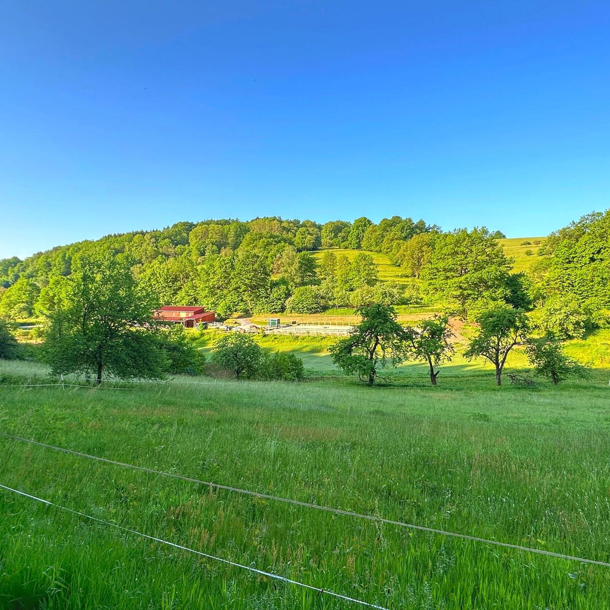
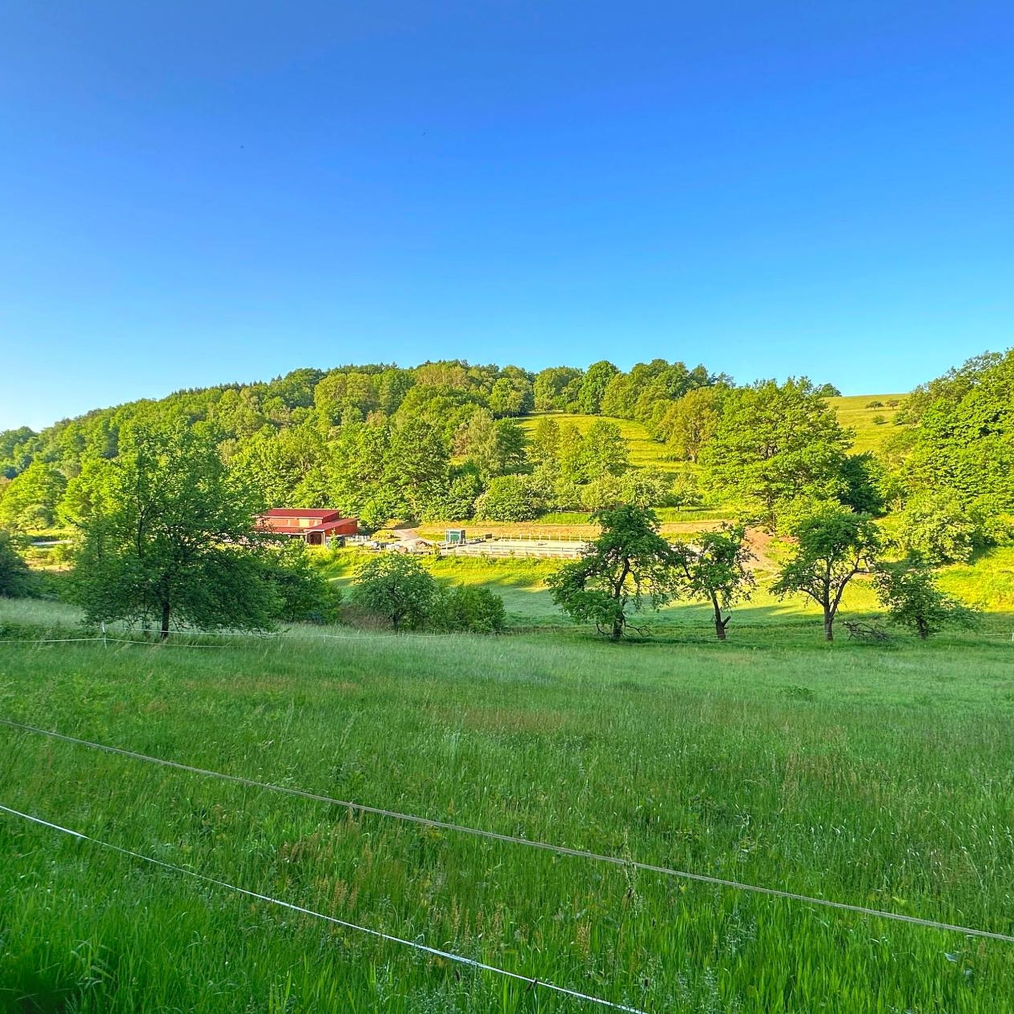
With a bit of luck, you might also see deer in the meadow.
2
0
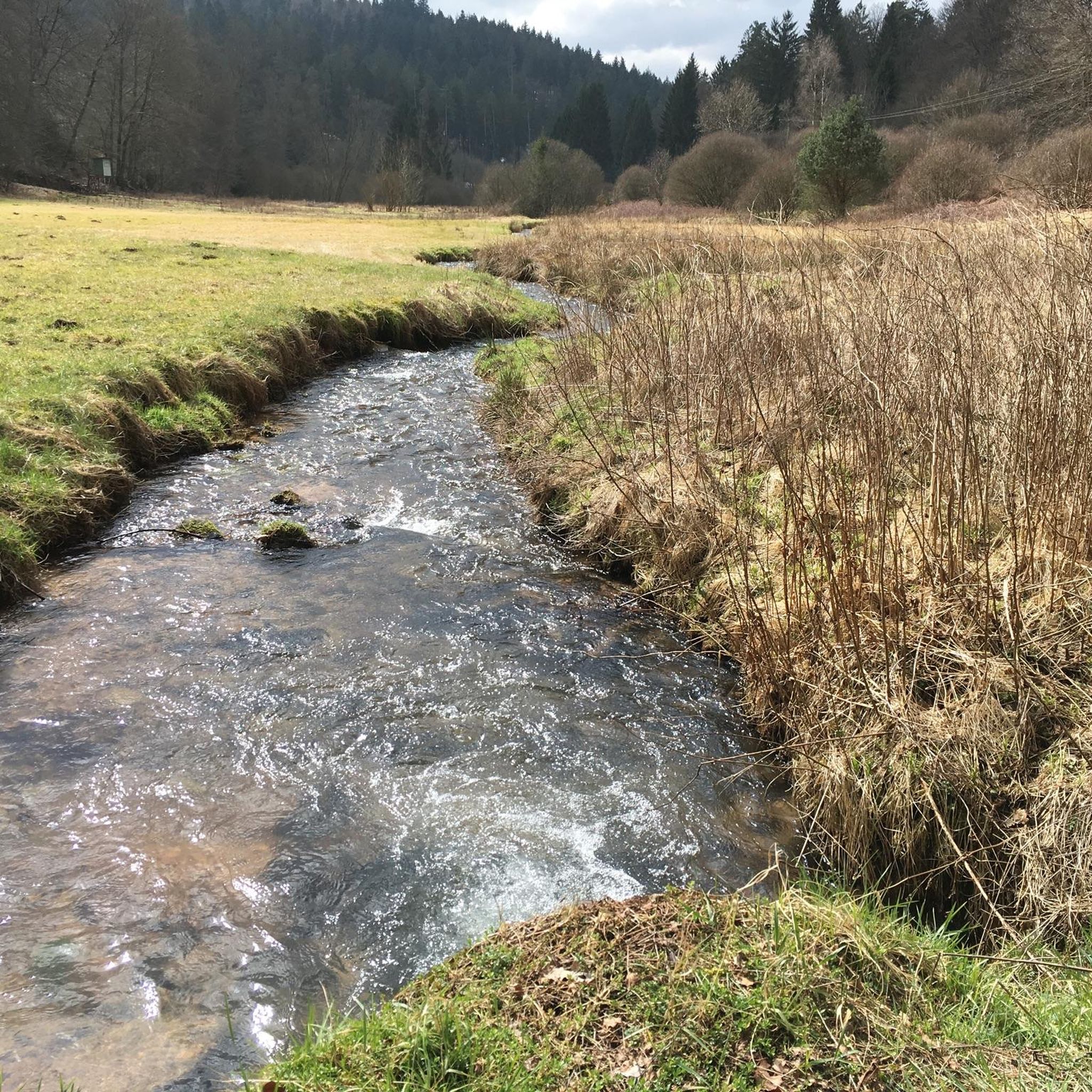
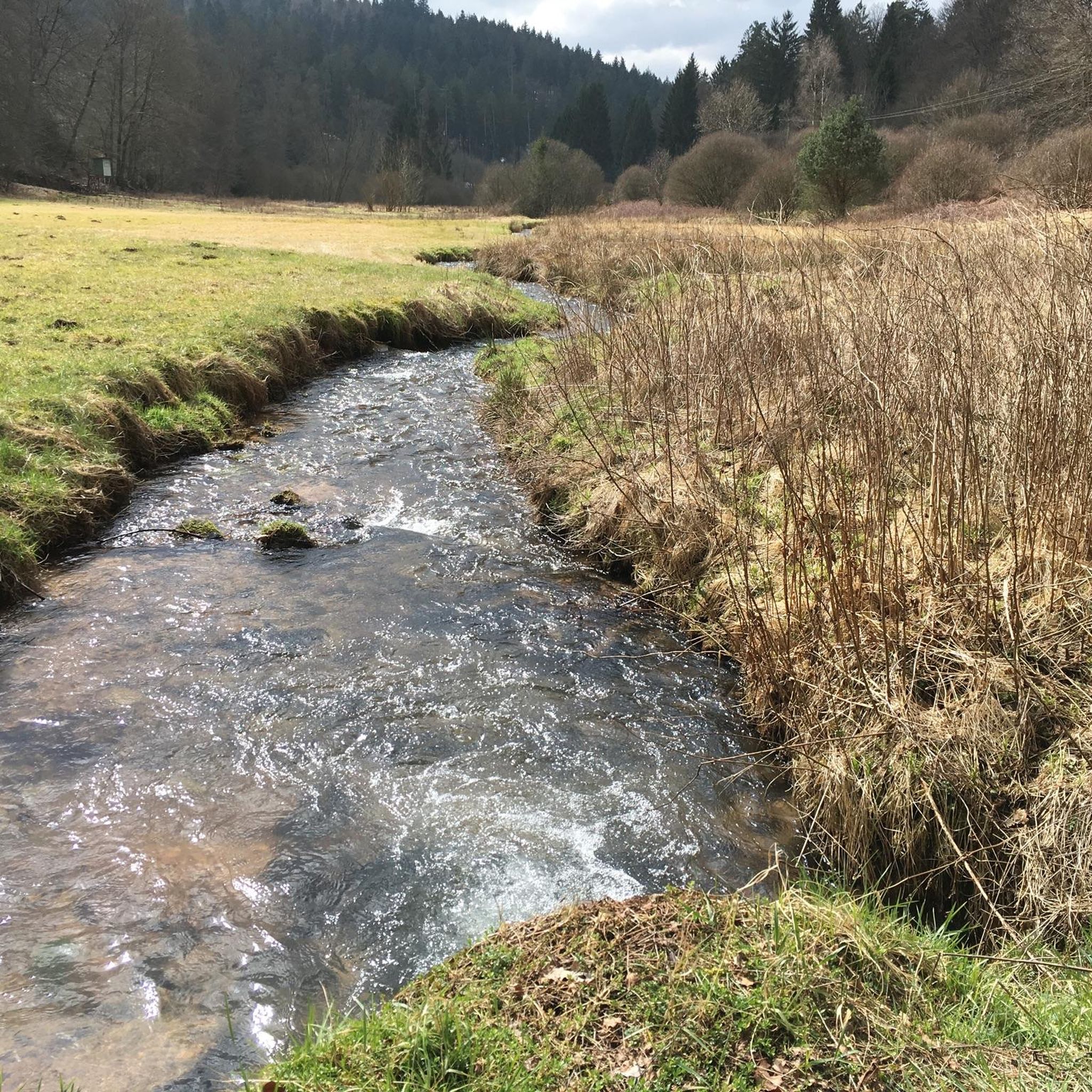
The Aubach is a small stream/river that meanders gently through the idyllic Aubach valley in its upper reaches. After more than 20 km, the Aubach flows into the Lohr,
2
0
It is a classic arched viaduct, as were usually built on the "Ludwigs-Westbahn" at that time.
2
0

Large wetland, where water buffalo will soon be grazing.
0
0

unproblematic to drive in both directions
0
0
It's a very nice path.
1
0

Heinrichsthal is a municipality in the Lower Franconian district of Aschaffenburg and a member of the Heigenbrücken administrative community. It is the highest municipality in the entire Spessart and the smallest municipality in the Aschaffenburg district. The municipality is located in the Bavarian Lower Main region at the upper end of the Lohrbach Valley. The highest point in the municipality is the peak of Schindershöh at 522 m above sea level (location), and the lowest is at the Lohrbach stream near Unterlohrgrund at 313 m above sea level (location). The Kahltal-Spessart cycle path runs through the village. In 1636, the name of the master of a glassworks located in this region first appeared: Heinrich Fleckenstein of the glassworks in Wollersbuch. Another master glassworks owner, Jacob Fleckenstein, is also mentioned in 1639. In 1647, Heinrich Fleckenstein's glassworks was located in the Lohrgrund, but it burned down for less than 34 weeks. An account book from 1652 reveals that Heinrich and Jacob were brothers. In 1664, the two place names "Heinrichs grundt and Jacobs thael" first appeared as location designations. The latter became the present-day village of Jakobsthal. A new stage in the village's history began in 1678, when Heinrichsthal was first mentioned as a village. The first taxes had to be paid for seven houses and ten head of cattle. Heinrich Fleckenstein's initials were incorporated into the Heinrichsthal coat of arms. Source: Wikipedia
1
0

bad road, cool bridge
0
0
Frequently Asked Questions
How many mountain bike trails are available in Heinrichthaler Forst?
Heinrichthaler Forst offers a comprehensive network of over 500 mountain bike trails. These routes cater to various skill levels, from easy forest paths to more challenging ascents and descents.
What are the difficulty levels of mountain bike trails in Heinrichthaler Forst?
The trails in Heinrichthaler Forst are categorized into different difficulty levels. You'll find approximately 85 easy routes, over 370 moderate routes, and about 65 difficult routes, ensuring options for all experience levels.
Are there family-friendly mountain bike trails in Heinrichthaler Forst?
Yes, Heinrichthaler Forst has around 85 easy mountain bike routes that are well-suited for families or beginners. These trails typically feature gentle gradients and smooth forest paths, providing a pleasant experience for all.
Are there any circular mountain bike routes in Heinrichthaler Forst?
Many mountain bike routes in Heinrichthaler Forst are designed as circular loops, allowing you to start and end at the same point. An example of a moderate circular route is the Birklergrund Forest Shrine – Aubachtal Valley loop from Heinrichsthal, which covers 22.2 miles (35.7 km).
What kind of terrain can I expect on mountain bike trails in Heinrichthaler Forst?
The terrain in Heinrichthaler Forst is characterized by dense woodlands and rolling hills within the Spessart Nature Park. Riders can expect a mix of natural surfaces, including singletrack and wider forest paths, with varied gradients that offer both gentle sections and some ascents and descents.
What can I see along the mountain bike trails in Heinrichthaler Forst?
Along the trails, you can discover various points of interest. Notable natural monuments include the Witch Tree and the Steinborn Spring. You might also encounter the Patrona Bavariae shelter or the scenic Reifgrundsee lake.
What do other mountain bikers enjoy most about Heinrichthaler Forst?
The area is highly rated by the komoot community, with an average score of 4.7 stars from over 2,700 reviews. Reviewers often praise the diverse terrain, the extensive network of forest paths, and the natural beauty of the dense woodlands.
Are there any longer mountain bike routes for experienced riders?
Yes, for more experienced riders looking for longer routes, the Birklergrund Forest Shrine – Aubachtal Valley loop from Heinrichsthal is a moderate 22.2 miles (35.7 km) path that traverses varied forest terrain with significant ascents and descents. Another option is the Birklergrund Trail – Heigenbrücken Biotopes loop from Heinrichsthal, which is 16.3 miles (26.2 km) long.
What is the best season for mountain biking in Heinrichthaler Forst?
While mountain biking is generally possible year-round, the spring and autumn months are often ideal. During these seasons, the weather is typically milder, and the forest scenery is particularly beautiful, with blooming flora in spring and vibrant foliage in autumn. Summer can also be pleasant, especially on shaded forest trails.
Are there any specific trails known for good views?
While Heinrichthaler Forst is primarily known for its dense woodlands, many trails offer scenic glimpses through the trees and across rolling hills. Routes that traverse higher elevations or open sections of the forest will provide more expansive views of the Spessart Nature Park. For example, the Eselsweg at Waldhaus Engländer – Forest Inn "Zum Engländer" loop from Heinrichsthal offers varied forest landscapes.
What should I wear for mountain biking in Heinrichthaler Forst?
Given the varied terrain and potential for changing weather, it's advisable to wear appropriate cycling gear. This includes a helmet, comfortable padded shorts, moisture-wicking layers, and sturdy cycling shoes. Depending on the season, consider bringing a waterproof jacket and gloves. Always check the weather forecast before heading out.
Can I find cafes or places to eat near the mountain bike trails?
While the guide doesn't list specific cafes directly on the trails, the villages surrounding Heinrichthaler Forst, such as Heigenbrücken and Heinrichsthal, offer various dining options where you can refuel after your ride. It's a good idea to plan your route to pass through or near these villages if you intend to stop for refreshments.
Most popular routes in Heinrichthaler Forst
Most popular attractions in Heinrichthaler Forst

Get inspired with the komoot mobile app


Explore more
Browse the best MTB trails in other regions.
