The best road cycling routes in Belair National Park
4.6
(27)
4,646
riders
103
rides
Road cycling routes in Belair National Park traverse the diverse landscape of South Australia's oldest national park, situated within the Mount Lofty Ranges. The region features varied gradients, from gentle ascents to challenging climbs, characteristic of the Adelaide Hills. Cyclists can find paved surfaces winding through woodlands, past lakes, and along creeks, offering a range of experiences. This area is recognized for its integration into broader cycling networks, providing options for different fitness levels.
Best road cycling routes in Belair National Park
- The most popular road cycling route is Cherry Gardens Road Climb – Moritz-Schuller Road loop from Glenalta, a 48.7 miles (78.4 km) trail that takes 4 hours 6 minutes to complete. This difficult route features significant elevation gain through the Adelaide Hills.
- Another top favourite among local road cyclists is Uraidla Republic Café & Bakery – Mount Lofty Summit Viewpoint loop from Glenalta, a moderate 30.0 miles (48.3 km) path. This route offers scenic views and passes notable points of interest.
- Local road cyclists also love the Cherry Gardens Road Climb loop from Pinera, a 19.8 miles (31.9 km) trail leading through varied terrain, often completed in about 1 hour 53 minutes.
- Road cycling in Belair National Park is defined by the challenging terrain of the Adelaide Hills, native woodlands, and varied gradients. The network offers options for different ability levels, from moderate rides to difficult climbs.
- The routes in Belair National Park are highly rated by the komoot community with an average score of 4.5 stars from over 20 reviews. More than 4000 road cyclists have used komoot to explore Belair National Park's varied terrain.
Last updated: May 24, 2026
11
riders
79.4km
04:10
1,210m
1,210m
Hard road ride. Very good fitness required. Mostly well-paved surfaces and easy to ride.
6
riders
Moderate road ride. Good fitness required. Some segments of this route may be unpaved and difficult to ride.

Sign up for free
6
riders
33.0km
01:56
710m
710m
Moderate road ride. Good fitness required. Mostly well-paved surfaces and easy to ride.
4
riders
81.5km
04:33
1,470m
1,470m
Hard road ride. Very good fitness required. Mostly well-paved surfaces and easy to ride.
13
riders
62.1km
03:13
920m
920m
Hard road ride. Very good fitness required. Some segments of this route may be unpaved and difficult to ride.
Get access to more routes and recommendations from other explorers.
Sign up for free
Already have an account?
Our route recommendations are based on thousands of hikes, rides, and runs completed by other people on komoot.
Start today with a free account
Your next adventure awaits.
Login or Signup
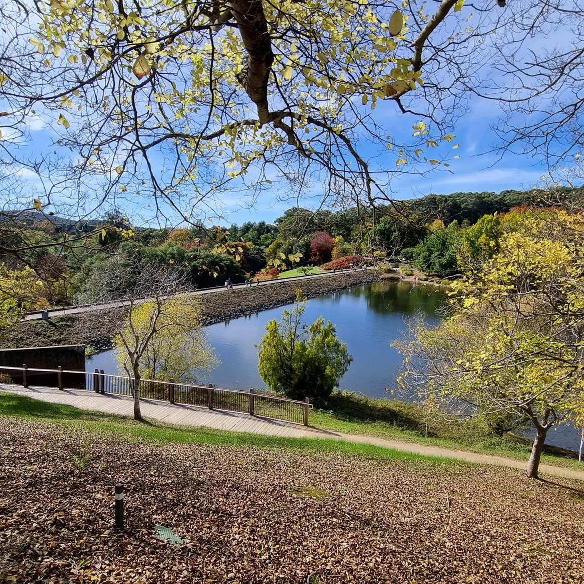
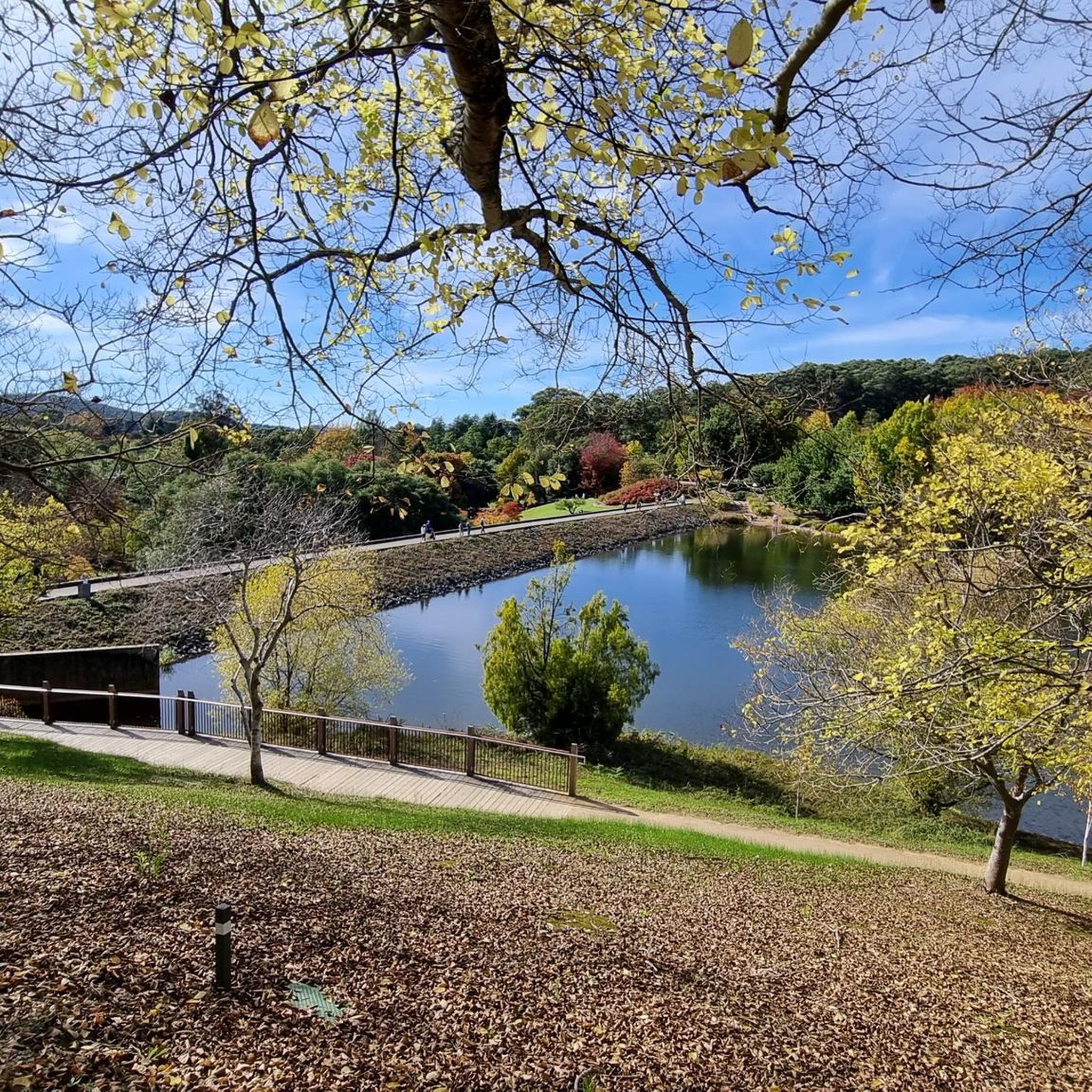
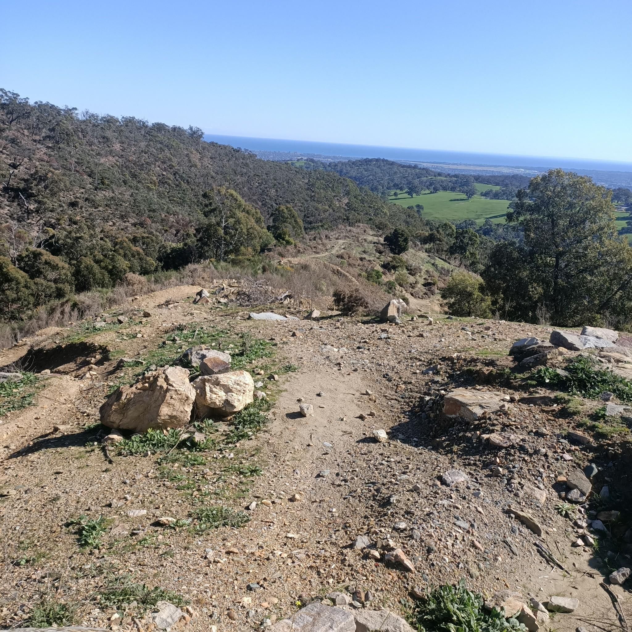
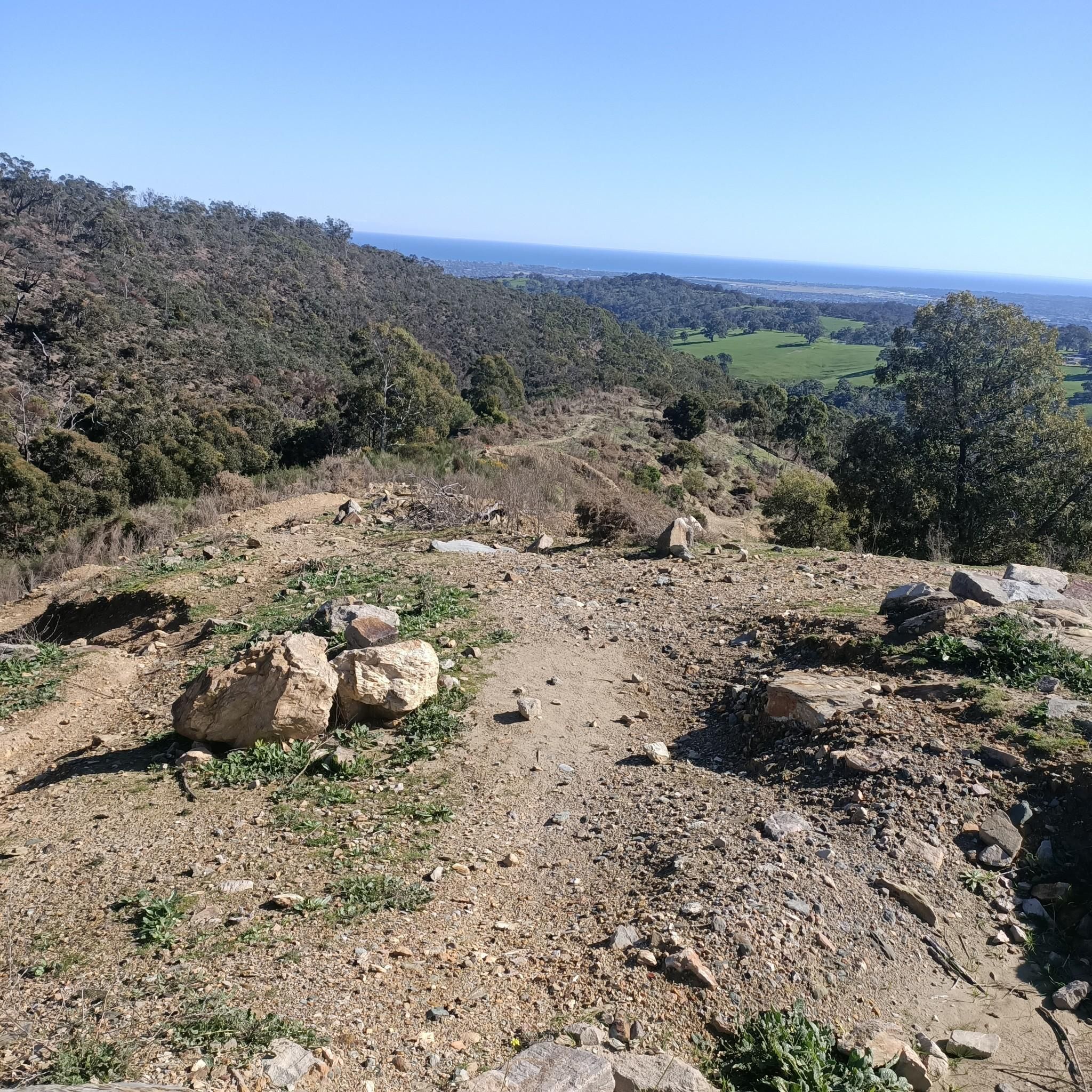

Tips from the Community

Windy Point Lookout is a well-known scenic lookout in the Adelaide Hills overlooking the city of Adelaide. From the viewing area, the expansive views stretch across the Adelaide plains to the coastline of Gulf St Vincent, with the city skyline visible below. This spot is especially popular at sunset and after dark, when the city lights spread across the plain beneath the hills.
0
0
Mount Lofty is the highest point in the Mount Lofty Ranges and offers sweeping panoramic views across the city of Adelaide and the coastline of Gulf St Vincent. The summit features a well-known lookout, visitor facilities, and access to walking trails that pass through native bushland in the surrounding hills. Its elevated vantage point makes it one of the most popular viewpoints in the Adelaide Hills and a highlight of many nearby hiking routes.
0
0

Adelaide's iconic climb, short and fairly steady. Surrounded, like most hills, by eucalyptus trees. Generally lightly trafficked. Often windy.
0
0

This place always reminds me of Mary Poppins - though it’s small, it’s got something. There’s a water fountain, too.
1
0

Very scenic and slightly ondulating road between Ashton and Greenhill Road with beautiful panoramic views across some vinyards.
1
0

Enhance Your Outdoor Experience with the Perfect Merlot For those planning to explore this breathtaking region—whether by bike, on foot, or through an invigorating hike—it is essential to come prepared. While the area is renowned for its scenic landscapes and diverse outdoor activities, finding an ideal location to unwind with a glass of wine can be challenging. Bringing your own premium Merlot allows you to elevate your adventure with a well-deserved moment of relaxation. Whether you choose to pause at a panoramic viewpoint or celebrate your journey after an active day, having your favorite wine on hand ensures a seamless blend of exploration and indulgence. Plan ahead, pack accordingly, and turn your outdoor excursion into an unforgettable experience.
0
0

Frequently Asked Questions
How many road cycling routes are available in Belair National Park?
Belair National Park offers a wide range of road cycling experiences, with over 100 routes available. These routes cater to various skill levels, including 8 easy, 59 moderate, and 36 difficult options.
What kind of terrain can I expect when road cycling in Belair National Park?
Road cycling in Belair National Park and the surrounding Adelaide Hills features diverse terrain. You'll encounter varied gradients, from gentle ascents to challenging climbs, characteristic of a world-class cycling destination. Routes often wind through native woodlands, past lakes, and along creeks, providing scenic paved surfaces.
Are there challenging road cycling routes in Belair National Park?
Yes, Belair National Park is known for its challenging terrain, particularly within the Adelaide Hills. Routes like the Cherry Gardens Road Climb – Moritz-Schuller Road loop from Glenalta, a difficult 78.4 km ride with significant elevation gain, are popular among experienced cyclists. Another demanding option is the Old Freeway Bike Path – Mount Lofty Summit Viewpoint loop from Glenalta, covering 82.2 km with over 1500 meters of ascent.
Are there any easier road cycling options for beginners or families?
While the region is known for its challenging climbs, Belair National Park does offer easier road cycling options. There are 8 routes classified as easy, providing gentler gradients and scenic rides suitable for those seeking a less strenuous experience or for family outings. These routes often feature minimal traffic, especially during weekdays.
What are some notable points of interest or natural features I might see while cycling?
As you cycle through Belair National Park, you can expect to see diverse natural features within the Mount Lofty Ranges. The park preserves native vegetation, woodlands, lakes, and creeks. Keep an eye out for geological formations like Amphitheatre Rock, and you might even spot picturesque waterfalls along some trails. The Uraidla Republic Café & Bakery – Mount Lofty Summit Viewpoint loop from Glenalta, for instance, offers scenic views and passes notable points of interest.
Can I spot wildlife while road cycling in Belair National Park?
Yes, Belair National Park is a sanctuary for native animals, and wildlife spotting is a common occurrence. Cyclists often report seeing Western Grey Kangaroos, Koalas, Short-beaked Echidnas, Emus, and various bird species, especially on quieter routes or during early morning rides. Sheoak Road, adjacent to the park, is particularly noted for wildlife sightings.
What do other road cyclists enjoy most about road cycling in Belair National Park?
The road cycling routes in Belair National Park are highly rated by the komoot community, with an average score of 4.5 stars from over 20 reviews. Cyclists frequently praise the challenging terrain of the Adelaide Hills, the beauty of the native woodlands, and the varied gradients that offer options for different ability levels. Many appreciate the integration into broader cycling networks and the scenic views.
Are there any loop trails for road cycling in Belair National Park?
Yes, many road cycling routes in Belair National Park are designed as loops, allowing you to start and finish at the same point. An example is the Cherry Gardens Road Climb loop from Pinera, a 31.9 km trail that leads through varied terrain and brings you back to your starting point.
Is there parking available for cyclists at Belair National Park?
Belair National Park offers various parking facilities for visitors. While specific parking areas for cyclists are not explicitly detailed, general parking is available within the park, providing convenient access to the cycling routes. It's advisable to check the park's official website for the most current parking information and any associated fees.
Are there any entry fees or permits required for cycling in Belair National Park?
Belair National Park is a protected area, and entry fees may apply. For the most up-to-date information on entry fees and any required permits for cycling, it is best to consult the official Parks SA website: parks.sa.gov.au.
What is the best time of year to go road cycling in Belair National Park?
The Adelaide Hills region, including Belair National Park, offers good cycling conditions for much of the year. Spring and autumn generally provide the most pleasant weather with mild temperatures, ideal for tackling the varied gradients. Summer can be hot, so early morning rides are recommended, while winter can bring cooler temperatures and occasional rain.
Are there cafes or pubs near the road cycling routes in Belair National Park?
Yes, the Belair National Park area, being part of the Adelaide Hills, is well-serviced with amenities. You'll find cafes and pubs in nearby towns and villages, offering opportunities for refreshments and meals before or after your ride. The Uraidla Republic Café & Bakery – Mount Lofty Summit Viewpoint loop from Glenalta even includes a cafe in its name, indicating nearby options.
Most popular routes in Belair National Park
Most popular attractions in Belair National Park

Get inspired with the komoot mobile app


Explore more
Browse the best Road cycling routes in other regions.
