The best running trails in Beerburrum West State Forest
4.0
(2)
43
runners
9
runs
Jogging in Beerburrum West State Forest offers access to an extensive network of trails, characterized by varied terrain suitable for different fitness levels. The landscape features a mix of logging roads, fire trails, and some single tracks, with sections of undulating hills and flat running paths. This area is set against the backdrop of the Glass House Mountains, providing scenic views. Diverse natural environments, including pine plantations and open eucalypt forests, define the region.
Best jogging routes in Beerburrum West…
Last updated: July 4, 2026
3
runners
11.2km
01:23
110m
110m
Moderate run. Good fitness required. Mostly paved surfaces. Suitable for all skill levels.
17
runners
14.2km
01:38
190m
190m
Moderate run. Good fitness required. Mostly paved surfaces. Suitable for all skill levels.

Sign up for free
9
runners
26.6km
03:03
310m
310m
Hard run. Very good fitness required. Mostly paved surfaces. Suitable for all skill levels.
3
runners
13.5km
01:33
200m
200m
Moderate run. Good fitness required. Mostly paved surfaces. Suitable for all skill levels.
3
runners
10.2km
01:07
140m
140m
Moderate run. Good fitness required. Mostly paved surfaces. Suitable for all skill levels.
Get access to more routes and recommendations from other explorers.
Sign up for free
Already have an account?
Our route recommendations are based on thousands of hikes, rides, and runs completed by other people on komoot.
Start today with a free account
Your next adventure awaits.
Login or Signup
Popular around Beerburrum West State Forest
Tips from the Community

This is one of the main junctions on the track, marked by a sign pointing toward Beerburrum trailhead, Soldier Settlers’ Trail, and the Trachyte Circuit. The paths split in different directions through open forest, with sandy ground and loose leaf litter underfoot. It’s an easy place to check your route, especially if you’re linking different sections rather than sticking to the main circuit.
0
0

Glass House Mountains National Park is a cluster of volcanic plugs rising from the flatlands. These plugs are what's left of the cores of ancient volcanoes from millions of years ago. This park holds great cultural significance for the Jinibara people and is open to bushwalking and climbing.
1
0

Soldier Settlers’ Trail is a shared walking and cycling path that passes through bushland and rural landscapes near the Glass House Mountains. The route crosses land once allocated to returned soldiers after World War I, when the area was opened for small farming settlements. Today, the trail quietly traces that history while connecting local tracks and natural areas around the national park.
0
0
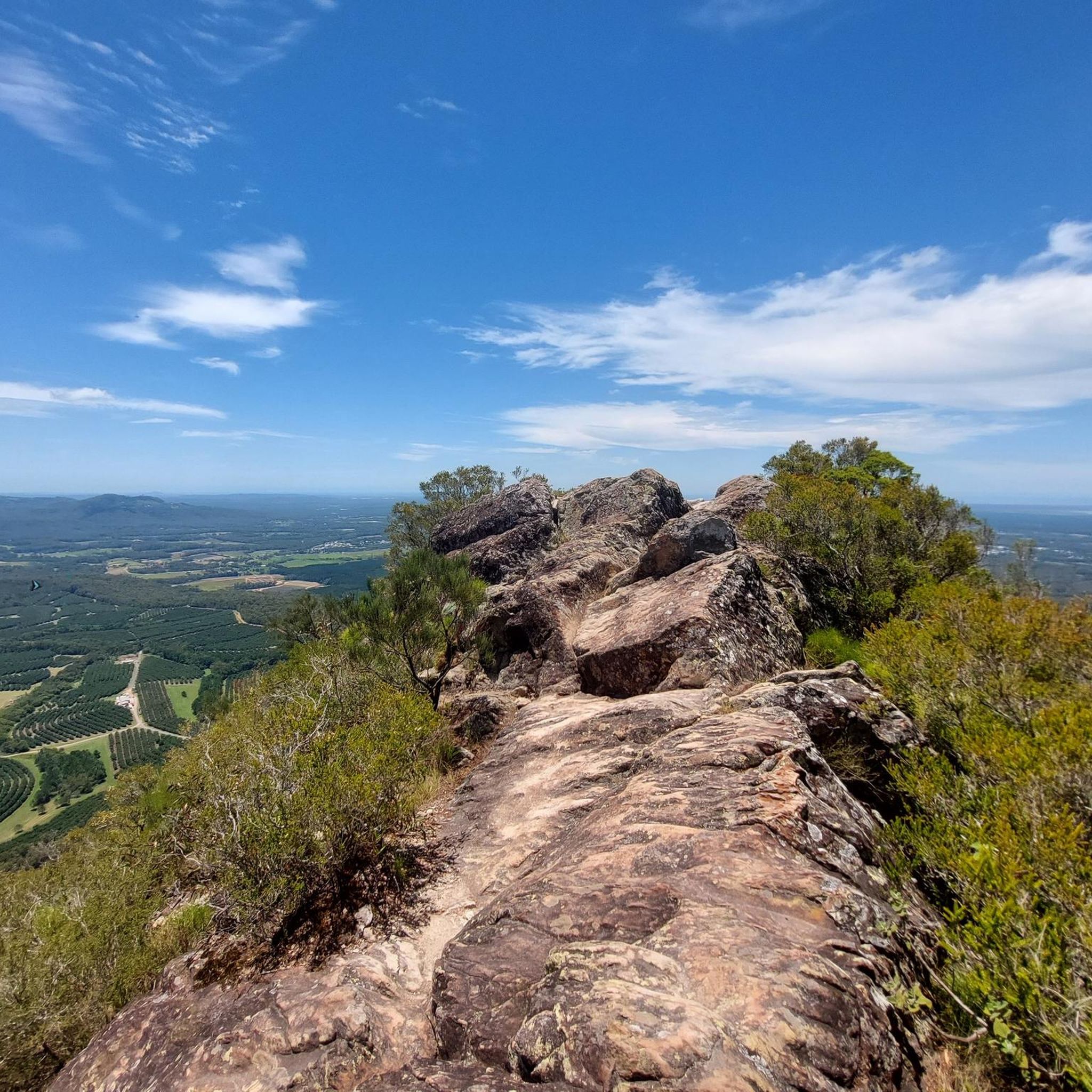
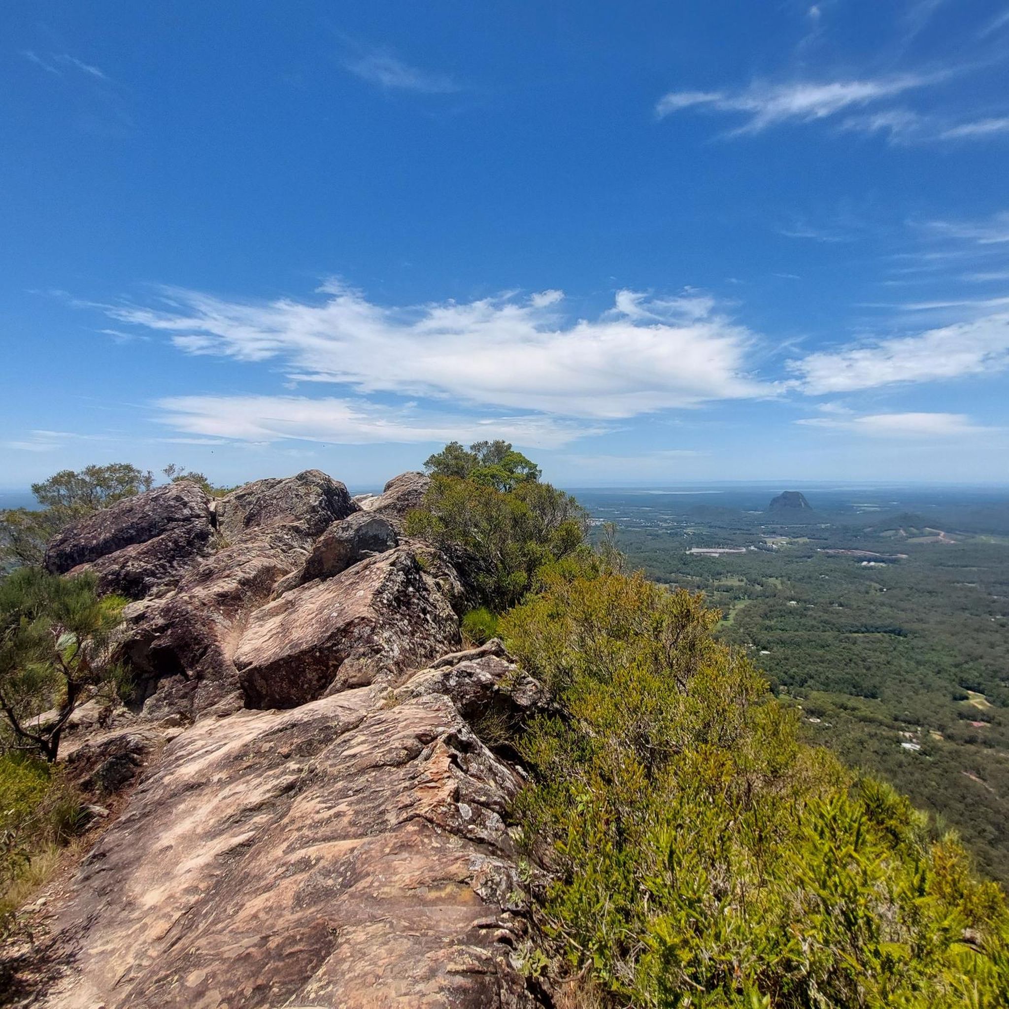
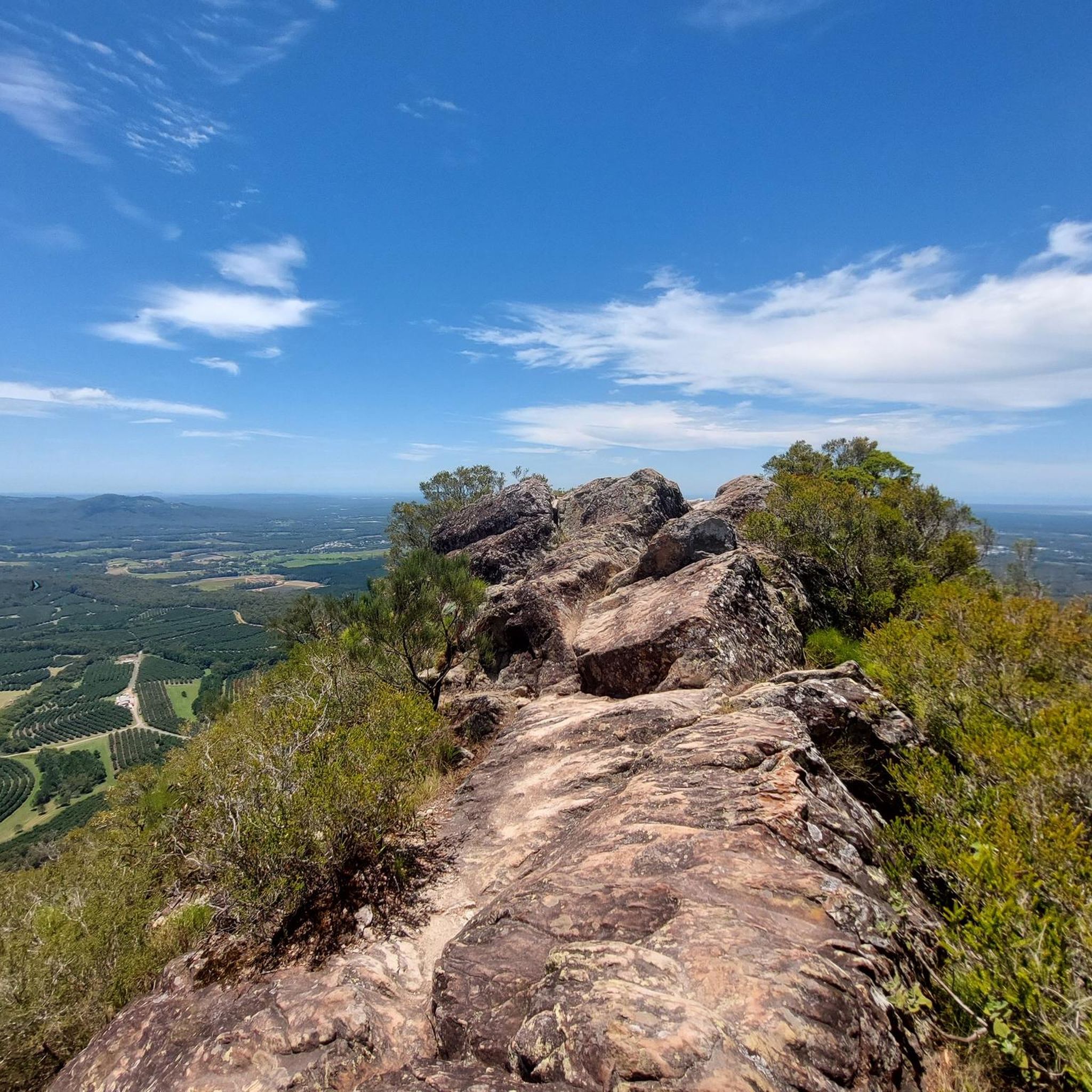
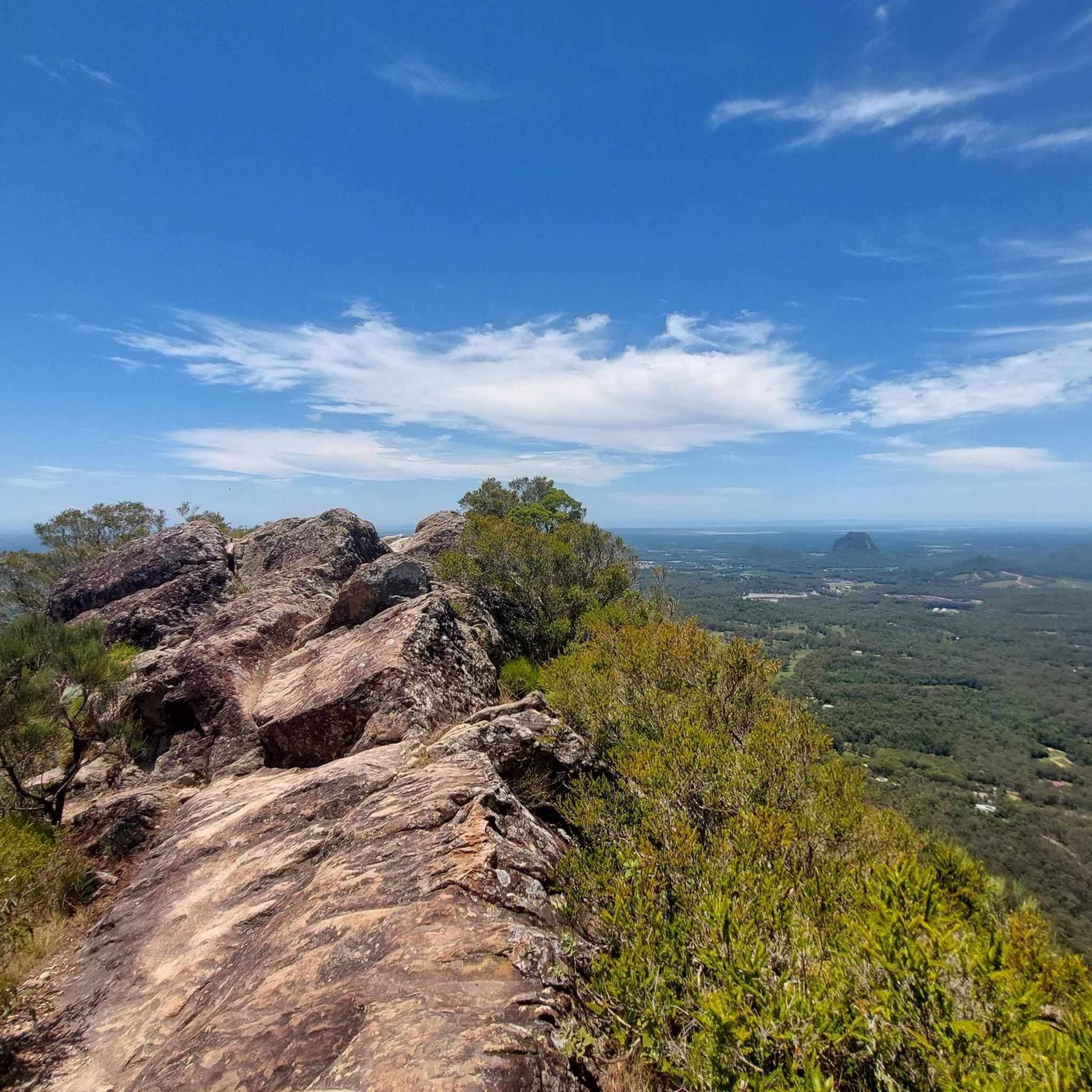
This is a picturesque vantage point on the Trachyte Ridge with panoramic views of the surrounding volcanic peaks, especially the distinctive outline of Mount Tibrogargan and other nearby Glass House Mountains. From this elevated spot, you can take in sweeping landscape vistas across the eucalypt‑covered hinterland, making it a fantastic spot to capture a few memorable photos and an ideal place for a break along the track.
0
0

Very worth seeing, you have to see it
0
0
Very worth seeing, you have to see it
0
0
Very worth seeing, you have to see it
0
0
Very worth seeing, you have to see it
0
0
Frequently Asked Questions
What kind of terrain can I expect on the running trails in Beerburrum West State Forest?
The forest offers a diverse range of terrains, including logging roads, fire trails, and some single tracks. You'll encounter sections with undulating hills as well as flatter running paths, providing a dynamic experience for runners.
Are there running routes suitable for beginners or those looking for an easy jog?
Yes, Beerburrum West State Forest has options for all fitness levels. For an easy and accessible run, consider the Cooee View loop from Mt Tibrogargan Carpark, which is 2.6 miles (4.2 km) long and features a mix of logging roads and fire trails. Another easy option is the Running loop from Beerburrum, a 2.3 miles (3.8 km) trail through open eucalypt forests.
What scenic views or natural features can I see while running in the forest?
Jogging in Beerburrum West State Forest offers spectacular views of the iconic Glass House Mountains, including peaks like Mount Beerburrum and Mount Tibrogargan. The forest itself features diverse natural environments, from exotic pine plantations to open eucalypt forests and remnants of rainforest, creating a picturesque backdrop for your run.
Are there any longer or more challenging running routes for experienced trail runners?
Absolutely. For a more challenging experience, the Mountain View Lookout – Beerburrum Lookout loop from Glass House Mountains is a difficult 11.5 miles (18.6 km) trail offering expansive views. Another demanding option is the Ngungun View – Jack Ferris Lookout loop from Beerburrum, which spans 10.1 miles (16.3 km) with significant elevation changes.
Is Beerburrum West State Forest suitable for family-friendly running or walks?
Yes, the forest offers trails that can be enjoyed by families. The varied trail network includes easier, flatter sections and shared trails that accommodate walkers and runners of different ages. The diverse natural environments and potential for wildlife spotting can make it an engaging experience for children.
Can I bring my dog on the running trails in Beerburrum West State Forest?
The Beerburrum West State Forest is generally dog-friendly, but it's important to check specific trail regulations and signage, as rules can vary. Always keep your dog on a leash and ensure you clean up after them to preserve the natural environment for everyone.
What facilities are available for runners, such as parking or picnic areas?
Car parks are available at various trail entrances, such as the McConnell Road entrance for the running trails. Additionally, picnic areas with facilities like toilets, picnic tables, and drinking water can be found at locations such as the Glass House Mountains lookout day-use area, perfect for a post-run break.
What is the best time of year to go running in Beerburrum West State Forest?
The region generally offers good running conditions year-round. However, the cooler months (autumn and winter) are often preferred for outdoor activities to avoid the peak heat and humidity of summer. Always check the local weather forecast before heading out.
Are there any circular running routes available in the forest?
Yes, many of the routes in Beerburrum West State Forest are designed as loops, allowing you to start and finish at the same point. Examples include the Cooee View loop from Mt Tibrogargan Carpark and the Running loop from Beerburrum, providing convenient options for your run.
What kind of wildlife might I encounter while running?
The forest is home to a variety of wildlife. You might spot koalas, goannas, echidnas, and grey kangaroos. Birdwatchers can look out for kookaburras, cockatoos, lorikeets, rosellas, and even the vulnerable glossy black-cockatoo. Remember to observe wildlife from a distance and do not disturb them.
How many running trails are available in Beerburrum West State Forest on komoot?
There are over 10 dedicated running routes in Beerburrum West State Forest documented on komoot, offering a wide selection for different preferences and fitness levels.
Where can I find a map of the Beerburrum West State Forest trails?
For a detailed map of the Glass House Mountains National Park and Beerburrum State Forest, which includes many of the trails, you can refer to the official Queensland Parks and Wildlife Service map: Glass House Mountains National Park and Beerburrum State Forest Map.
Most popular routes in Beerburrum West State Forest

Get inspired with the komoot mobile app


Explore more
Browse the best Running Trails & Routes in other regions.
