The best walks and hikes in Michaux State Forest
4.7
(42)
401
hikers
37
hikes
If you've ever tried to plan hiking in Michaux State Forest, you know how quickly the options can feel overwhelming. With miles of trails crisscrossing 85,500 acres, it's tough to tell which routes are genuinely worth your time and effort, and which are just filler. We get it, and we're here to help.
That's where komoot comes in. Our community has explored, mapped, and reviewed these trails, creating a curated shortlist of the best hikes in Michaux State Forest. We've done the legwork so you don't have to, promising to save you the guesswork and point you straight to the routes worth your legs. Michaux State Forest is a true gem, characterized by its rolling forested hillsides, extensive oak woodlands, and rocky ridgelines, sitting where the Blue Ridge Mountains transition into the Alleghenies. You'll find everything from gentle strolls around reservoirs to demanding climbs with rewarding vistas.
If you only do one hike, we'd start with the Sunset Rocks and Appalachian Trail Loop. This moderate 7.6 miles (12.3 km) route offers a fantastic taste of the Appalachian Trail and leads to iconic rock formations. For a different experience, the Rocky Knob Trail is a solid choice, a moderate 6.2 miles (10.0 km) loop that winds through diverse forests and offers glimpses of the valley. Dive in and discover your next adventure with komoot.
Last updated: May 10, 2026
5.0
(1)
15
hikers
10.0km
02:57
330m
170m
The Rocky Knob Trail offers a delightful immersion into the diverse ecosystems of Michaux State Forest, guiding you through fire-dependent habitats, heath barrens, and classic Appalachian oak-hickory woodlands. As you navigate this 6.2-mile (10.0 km) loop, you'll encounter a mix of narrow rocky single tracks and wider paths, with the eastern side providing impressive lookout points over the Appalachian Mountains and the Long Pine Run Reservoir. Keep an eye out for the abundant mountain laurel, especially beautiful when in bloom, and the prominent boulder fields near Rocky Knob hill itself.
This moderate hike, with its 1079 feet (329 metres) of elevation gain, typically takes around 2 hours and 56 minutes, making it a perfect half-day adventure. While specific parking information isn't detailed, the trail is part of the larger Flat Rock Trail System within Michaux State Forest, suggesting multiple access points. For the best experience, consider hiking in spring for wildflowers or fall for foliage, and always plan to start early to secure parking and enjoy the tranquility.
Beyond its natural beauty, the Rocky Knob Trail holds a touch of history; its road portion was originally constructed by the Civilian Conservation Corps in 1937. The trail also briefly intersects with the famous Appalachian Trail, adding a layer of connection to a much larger hiking network. Numbered posts along the route highlight points of interest, and the area is known for excellent birdwatching, making it a hidden gem for nature enthusiasts.
14
hikers
3.90km
01:22
270m
130m
If you're seeking a rewarding hike with diverse terrain and stunning scenery, the Pole Steeple Trail delivers. This 2.4-mile (3.9 km) route, with its 880 feet (268 metres) of elevation gain, leads you through rocky sections up Piney Mountain to the iconic Pole Steeple Overlook. From this white and maroon quartzite outcropping, you'll be treated to expansive views of Laurel Lake and the Michaux State Forest, making the 1 hour and 21 minute journey feel incredibly worthwhile.
Planning your visit is straightforward, but keep in mind that the trail can get busy, especially during peak seasons like autumn. Parking is available, and leashed pets are welcome to join you on this easy-rated hike. While the main blue-blazed trail offers a steep climb, an alternative, longer route with switchbacks is available for a less strenuous ascent, catering to different fitness levels.
What makes the Pole Steeple Trail truly notable is its prominent Pole Steeple Overlook, a natural feature that provides postcard-worthy views. The trail also offers a short link to the famous Appalachian Trail, opening up possibilities for extended adventures. Its proximity to Laurel Lake adds to the scenic beauty and provides a pleasant starting point for your hike.

Sign up for free
5.0
(1)
6
hikers
12.3km
03:34
320m
320m
The Sunset Rocks and Appalachian Trail Loop is a moderate 7.6-mile (12.3 km) hike that delivers a true taste of Pennsylvania's rocky terrain, including a challenging rock scramble along Little Rocky Ridge. You'll gain 1039 feet (317 metres) over approximately 3 hours and 34 minutes, traversing hardwood forests and enjoying views from Sunset Rocks, which are particularly rewarding during the fall. The route offers a dynamic experience, blending smoother sections of the Appalachian Trail with rugged, hand-over-foot climbing.
Start your adventure from Pine Grove Furnace State Park, where you'll find ample parking and facilities like the Appalachian Trail Museum. While the trail is generally well-marked with white and blue blazes, it's wise to download a map for navigation through various junctions. For the best panoramic views, plan your visit during the fall foliage season, though be mindful of snakes that can be present in warmer months.
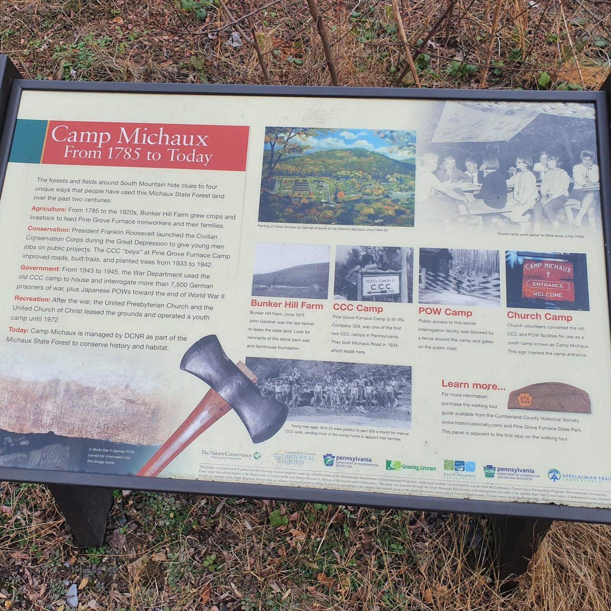
This loop is notable for its connection to the Appalachian Trail, passing by the unofficial halfway point where thru-hikers often celebrate. Beyond the exhilarating rock scramble, the area is rich in history, with remnants of an iron works community and the site of Camp Michaux nearby. You'll also pass the well-equipped Toms Run Shelter, offering a convenient rest stop along the way.
5.0
(2)
6
hikers
16.3km
04:42
430m
270m
The Long Pine Run Reservoir via Stillhouse Hollow Rd and Beaver Trail Loop offers a deeply immersive forest experience, perfect for those seeking quiet reflection and beautiful scenery. As you traverse this moderate 10.1-mile (16.3 km) route, you'll enjoy consistent views of the 150-acre Long Pine Run Reservoir, especially along the distinctive Beaver Trail. The air is often filled with the fresh scent of pines, particularly in the dense evergreen sections, and you'll pass through areas rich with mountain laurel and rhododendron, making it a treat for the senses.
Planning your visit to this Michaux State Forest gem means preparing for a backcountry feel; there are no picnic areas, camping spots, or restrooms directly on the trail. The route, which includes Stillhouse Hollow Rd trail features views, requires good fitness due to its 1414 feet (431 metres) of elevation gain and varied terrain, typically taking around 4 hours and 41 minutes. While dogs are generally allowed, always check for local leash requirements.
This loop stands out for its tranquil atmosphere and consistent waterside views, making it a fantastic option if you're looking for less crowded hikes near Long Pine Run Reservoir. The
2
hikers
9.26km
02:42
270m
230m
The Traverse Extended Loop via Moss Trail offers a delightful immersion into a lush, green world, perfect for those who appreciate the unique beauty of moss-draped old-growth forests. This moderate 5.8-mile (9.3 km) hiking route, with its 870 feet (265 metres) of elevation gain, provides a more extended experience than a typical nature walk, taking about 2 hours and 42 minutes. You'll find yourself surrounded by towering evergreens and maples, creating a truly verdant and serene atmosphere throughout the journey.
Planning your visit to the Traverse Extended Loop via Moss Trail is straightforward, though specific details on parking or public transport aren't provided. Given its moderate difficulty and length, starting earlier in the day is advisable to allow ample time to complete the loop comfortably. Always carry enough water, especially during warmer months, and wear sturdy shoes suitable for varied terrain, as the path may include some roots and rocks.
This trail stands out for its potential blend of an easy, family-friendly moss trail experience with the added challenge of an extended loop, making it a versatile option for many hikers. While the exact location and official designation of the "Traverse Extended Loop via Moss Trail" are not widely known, it likely combines the best features of a tranquil forest walk with the physical engagement of a longer route. This makes it a notable choice for exploring the natural beauty of the Cumberland County region.
Get access to more routes and recommendations from other explorers.
Sign up for free
Already have an account?
Our route recommendations are based on thousands of hikes, rides, and runs completed by other people on komoot.
Start today with a free account
Your next adventure awaits.
Login or Signup


Tips from the Community

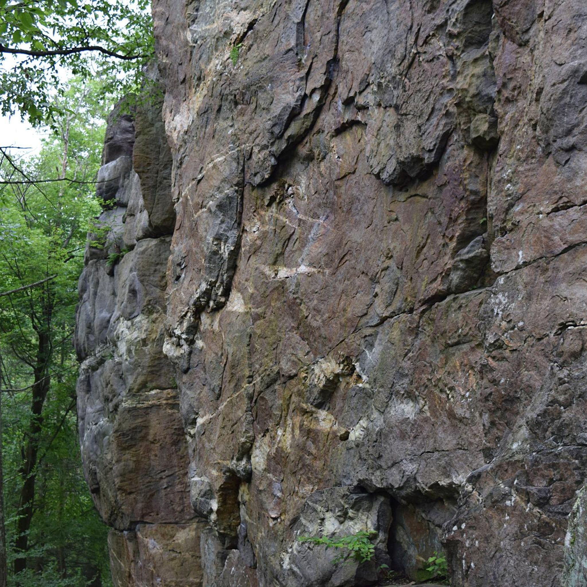
Nice spot to take a break and enjoy the view. You need to climb up onto the top of the rock, which is not very tall, to get the view, so make sure you are physically able to before attempting to get on the rock.
1
0

Visitors to the museum can check out displays chronicling the trail's origins, development, and significance. There is information about historical hikers as well as the Appalachian Trail's natural surroundings. This Appalachian Trail museum is located almost exactly at the halfway point of the trail between Georgia and Maine.
0
0

Long Pine Run Reservoir is a picturesque body of water situated in Michaux State Forest. The reservoir offers opportunities for fishing and boating. It's also a great place to have a rest off the bike.
0
0
Long Pine Run Reservoir is a picturesque body of water situated in Michaux State Forest. The reservoir offers opportunities for fishing and boating. It's also a great place to have a rest off the bike.
0
0
Long Pine Run Reservoir is a picturesque body of water situated in Michaux State Forest. The reservoir offers opportunities for fishing and boating. It's also a great place to have a rest off the bike.
0
0
Long Pine Run Reservoir is a popular summer destination for fishing, boating, running and hiking. It's a beautiful body of water surrounded by woodland.
0
0
Long Pine Run Reservoir is a picturesque body of water situated in Michaux State Forest. The reservoir offers opportunities for fishing, boating and nice walks along its shore.
2
0

Long Pine Run Reservoir is a beautiful lake surrounded by dense forests.
1
0
Frequently Asked Questions
Are dogs allowed on the trails in Michaux State Forest?
Yes, dogs are generally permitted on trails in Michaux State Forest, but they must be kept on a leash and under control at all times. Please be sure to clean up after your pet to help keep the forest beautiful for everyone.
Are there any easy, family-friendly hikes in the area?
Absolutely. The forest offers several easier walks suitable for families. A great option is the Middle Creek Trail loop, a relatively flat 3.5-mile (5.6 km) path that's perfect for a relaxed outing in the woods.
What is the best time of year to hike in Michaux State Forest?
Hiking is possible year-round, but many visitors find autumn to be the most spectacular season due to the vibrant fall foliage of the oak-hickory forest. Spring is also beautiful, with blooming mountain laurel and rhododendron, especially along trails like the Hosack Trail Loop.
Are there any good circular or loop trails?
Yes, the forest has many excellent loop trails so you can end your hike where you started without retracing your steps. For a longer day out, consider the 6.9-mile (11.1 km) Abigail Trail Loop, which takes you through the heart of the woodland.
What are the trail conditions like in Michaux State Forest?
The trails vary significantly. You'll find everything from gentle, wide paths to steep, rocky climbs. The area is known for its quartzite rock outcroppings, so expect some rugged and uneven terrain, particularly on trails leading to viewpoints. Sturdy hiking footwear is recommended.
Where can I find a good trail map?
While komoot provides detailed digital maps for navigation, you can also find official maps and information on the Pennsylvania Department of Conservation & Natural Resources website. For specific details on hiking trails, their page at pa.gov is a valuable resource.
Are there opportunities for backpacking or long-distance hiking?
Yes, Michaux State Forest is an excellent destination for backpacking. A 37-mile section of the iconic Appalachian Trail runs through the forest, offering multi-day hiking opportunities. There are also several designated backpacking loops and shelters available for overnight stays.
What kind of wildlife might I see?
The forest is home to a diverse range of wildlife. It's common to see white-tailed deer, squirrels, and a variety of songbirds. If you're lucky, you might also spot a black bear, red fox, or wild turkey. Always observe wildlife from a safe and respectful distance.
How difficult are the hikes in Michaux State Forest?
There is a wide range of difficulty levels. The guide includes over 20 trails, with the majority rated as moderate. These often involve some elevation gain and rocky sections. There are also a handful of easy walks and a couple of difficult climbs for those seeking a serious challenge.
What do other hikers enjoy about Michaux State Forest?
The area is highly regarded by the komoot community. Reviewers frequently praise the well-maintained trails, the beautiful quartzite rock formations, and the scenic overlooks. The quiet, dense woodlands and the experience of hiking a piece of the legendary Appalachian Trail are also major highlights.
Are there any trails with great views?
Many trails lead to rewarding vistas. The Pole Steeple Trail is famous for its panoramic view over Laurel Lake from a quartzite outcropping. For a different perspective, the hike to Buzzard Peak also offers fantastic views of the surrounding forest and mountains.
What is the geology of the area like?
The landscape of Michaux State Forest is defined by the South Mountain region's geology. The most prominent features are the hard, weather-resistant quartzite rock formations, which create the rocky ridges and scenic overlooks like Pole Steeple and Sunset Rocks. These formations are part of the ancient Appalachian Mountains.
Most popular routes in Michaux State Forest
Most popular attractions in Michaux State Forest

Get inspired with the komoot mobile app


Explore more
Browse the best Hikes in other regions.
