The best walks and hikes in Loch Stiapavat
4.9
(101)
585
hikers
8
hikes
Hiking in Loch Stiapavat explores the northern part of the Isle of Lewis, an area designated as a Local Nature Reserve. The landscape is characterized by coastal paths along high cliffs, expansive sandy beaches, and unique machair grasslands. The region also features a large, shallow loch and wetlands, providing diverse habitats. Trails are generally accessible, with low elevation gain across the wetlands and shoreline.
Best hiking trails in Loch Stiapavat
- The most popular hiking route is The Butt of Lewis…
Last updated: October 29, 2026
4.9
(73)
428
hikers
Moderate hike. Good fitness required. Easily walkable paths.
5.0
(1)
18
hikers
Easy hike. Easily walkable paths.

5
hikers
Easy hike. Easily walkable paths.
4.6
(27)
100
hikers
14.0km
03:41
120m
120m
Embark on a moderate hiking journey around the Butt of Lewis, covering 8.7 miles (14.0 km) with an elevation gain of 380 feet (116 metres). This route offers dramatic, exposed…
8
hikers
Easy hike. Easily walkable paths.
Get access to more routes and recommendations from other explorers.
Already have an account?
Our route recommendations are based on thousands of hikes, rides, and runs completed by other people on komoot.
Start today with a free account
Your next adventure awaits.
Popular around Loch Stiapavat
Tips from the Community

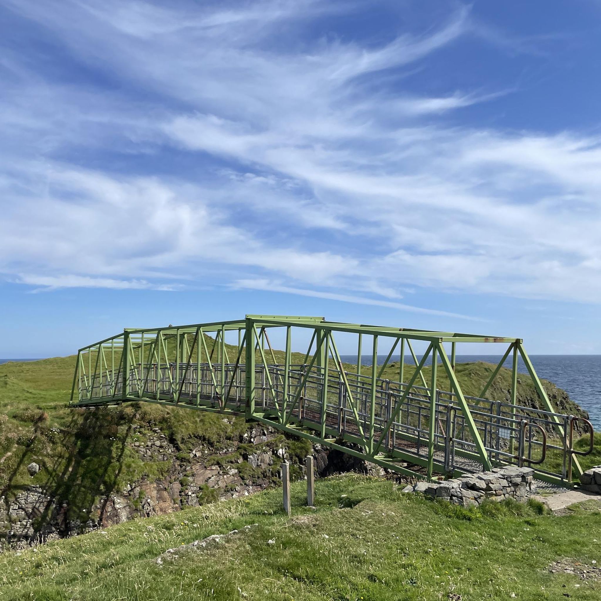
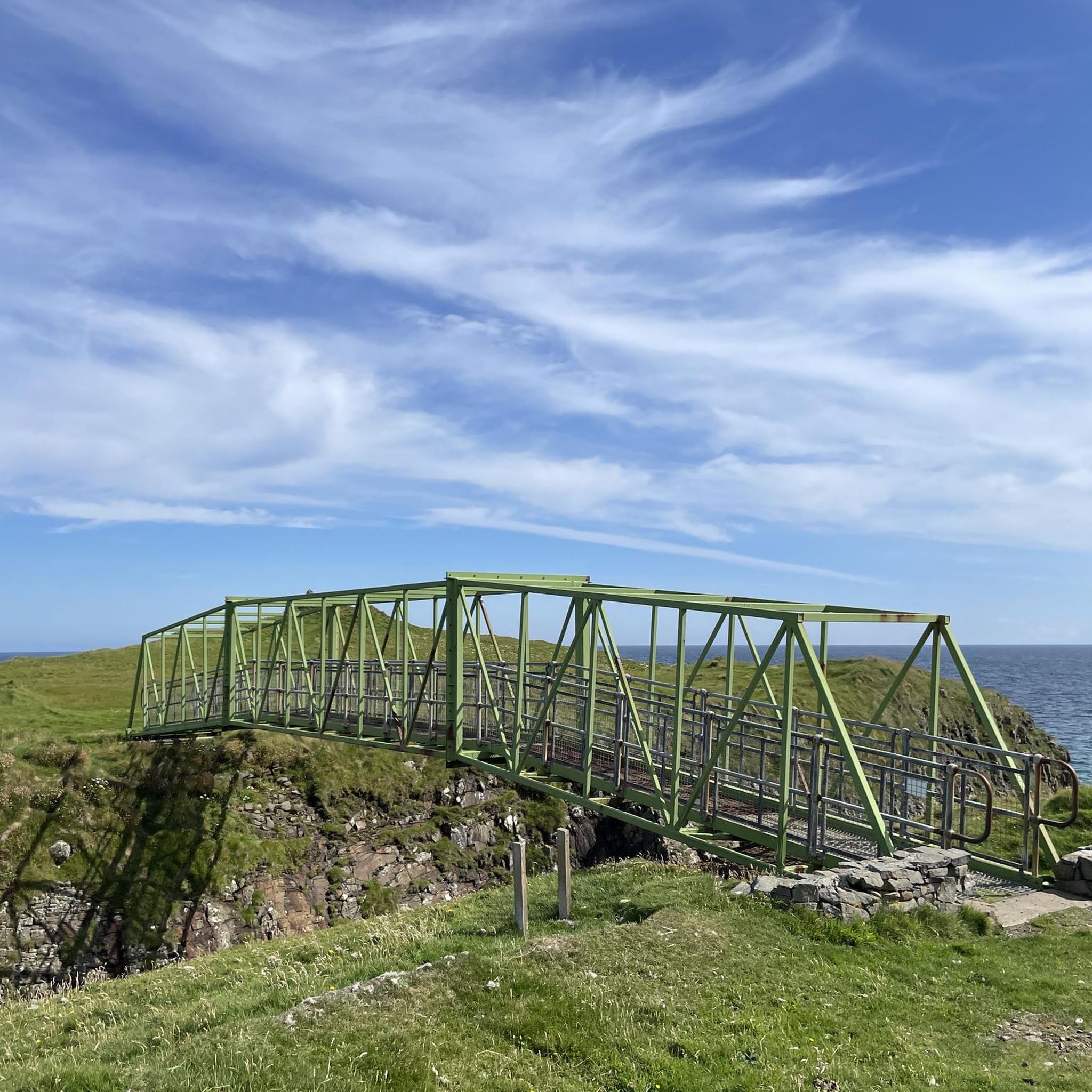
The bridge is unfortunately still closed (May 2026), but the beautiful coastal path to the lighthouse and around the butt is open and wonderful 🤩 💚👌🏼.
0
0

One of the few restaurants in the area, great pizza, also available for takeaway. There isn't a lot of space, but it's worth a try; they'll do their best to accommodate you.
0
0
Recommended reading: Peter May's *The Blackhouse* (also available in German) is set right here. After reading it, you'll see the place in a completely different light.
0
0
Picturesque harbor and a beautiful beach with an adjacent restaurant-café.
0
0
There's also a small parking lot here—in theory. It's also popular with RVers!
1
0

Beautiful contrast, steep cliffs and a hidden beach
0
0

In June the cave is full of nesting birds and the noise is enormous.
1
0

Please note that at present the bridge to Dùn Èistean is CLOSED until further notice, whilst structural repairs are awaited.
1
0
Frequently Asked Questions
Are the hiking trails around Loch Stiapavat suitable for beginners?
Yes, many trails are accessible for beginners. The area is characterized by low elevation gain across wetlands and shoreline. For an easy, shorter coastal walk, consider the Butt of Lewis Lighthouse – Traigh Mheilein Beach loop from Knockaird, which is a relatively flat 4.0-mile (6.4 km) path.
Are there any circular walks available?
The region offers several excellent circular routes. A great option that includes varied coastal scenery is The Butt of Lewis loop from Port of Ness — Isle of Lewis. This moderate trail covers about 8.7 miles (14 km) and provides a comprehensive tour of the area's dramatic cliff-tops and beaches.
Can I bring my dog on the trails?
Dogs are generally welcome on the trails, but it's crucial to keep them under control, especially on routes that pass through croftland where livestock may be grazing. The coastal paths are often more suitable. Always be mindful of wildlife, particularly ground-nesting birds, and adhere to local signage.
What kind of wildlife can I expect to see while hiking?
Loch Stiapavat is a premier birdwatching destination. The loch is a key stopover for migratory birds, so you might spot Whooper Swans and various geese. The area also supports nesting birds like Dunlin and Lapwing. Keep an eye out for birds of prey such as peregrines and hen harriers. The surrounding machair grasslands are rich with wildflowers in the summer.
Are there any trails with historical points of interest?
Yes, you can combine hiking with history. The Port of Port of Ness – Dùn Èistean loop from Port of Ness is an easy 2.9-mile (4.7 km) walk that takes you to the historic Dùn Èistean, a fortified sea stack that was a stronghold of the Clan Morrison.
What should I pack for a hike in Loch Stiapavat?
The weather can change quickly. Waterproof and windproof clothing is essential, even on sunny days, as many trails are exposed to the Atlantic. Sturdy, waterproof hiking boots are recommended for the uneven coastal paths. Also, bring water, snacks, and a map or a fully charged phone with the route downloaded.
How long do the hikes around Loch Stiapavat typically take?
Hike durations vary. You can find short walks of about an hour or longer routes that take around three hours. For example, the Traigh Mheilein Beach – Stream with Wildflowers loop from Fivepenny is a moderate 5.1-mile (8.2 km) trail that most people complete in about 2 hours and 10 minutes.
What is the landscape like on the trails?
The terrain is a unique mix of dramatic, high cliff-top paths, expansive sandy beaches, and vibrant machair. Machair is a rare coastal grassland that becomes a carpet of colourful wildflowers in the summer. The loch itself is surrounded by lush wetlands and traditional croftland, offering a varied and scenic backdrop for hiking.
Where can I learn more about the local birdlife?
Loch Stiapavat is a designated Local Nature Reserve and a key part of the Bird of Prey Trail. A purpose-built Nature Observatory with a hide provides excellent views over the loch. For more detailed information on the species you might encounter, you can consult resources from local nature organizations, such as the Bird of Prey Trail guide.
What do other hikers think of the routes in Loch Stiapavat?
The trails in this area are highly regarded by the komoot community. With an average rating of 4.9 stars, hikers often praise the stunning coastal views, the sense of remoteness, and the unique opportunity to walk through the beautiful machair grasslands.
How many hiking trails are in the Loch Stiapavat area?
There are around 9 curated hiking routes available in the Loch Stiapavat guide, ranging from easy strolls to more moderate coastal circuits. These trails offer a great introduction to the region's distinctive landscape.

Get inspired with the komoot mobile app


Explore more
Browse the best Hikes in other regions.
