The best walks and hikes around Općina Rasinja
4.7
(82)
345
hikers
17
hikes
Hiking around Općina Rasinja features varied terrain, with the prominent Kalnik Mountain area providing a significant draw for outdoor activities. The region is characterized by a network of trails that traverse natural features such as peaks and historical castle ruins. Hikers can find routes ranging from easy walks to more challenging ascents, catering to different fitness levels. This area provides opportunities for exploring both natural beauty and cultural landmarks.
Best hiking trails around Općina Rasinja
- The most popular hiking route…
Last updated: October 8, 2026
4.6
(16)
90
hikers
9.85km
03:27
340m
330m
Hard hike. Good fitness required. Sure-footedness, sturdy shoes and alpine experience required.
4.9
(11)
21
hikers
11.0km
03:38
460m
460m
Hard hike. Good fitness required. Sure-footedness, sturdy shoes and alpine experience required.

5.0
(4)
11
hikers
14.7km
04:29
430m
430m
Hard hike. Good fitness required. Sure-footedness, sturdy shoes and alpine experience required.
5.0
(1)
7
hikers
9.55km
03:27
310m
310m
Hard hike. Good fitness required. Sure-footedness, sturdy shoes and alpine experience required.
5.0
(1)
12
hikers
8.78km
02:23
130m
130m
Moderate hike. Good fitness required. Easily-accessible paths. Suitable for all skill levels.
4.5
(4)
7
hikers
2.35km
00:57
130m
130m
Hard hike. Great for any fitness level. Sure-footedness, sturdy shoes and alpine experience required.
4.8
(5)
7
hikers
13.6km
03:50
280m
280m
Moderate hike. Good fitness required. Easily-accessible paths. Suitable for all skill levels.
4.5
(2)
5
hikers
23.3km
06:10
220m
220m
Hard hike. Very good fitness required. Easily-accessible paths. Suitable for all skill levels.
4
hikers
4.89km
01:15
10m
10m
Easy hike. Great for any fitness level. Easily-accessible paths. Suitable for all skill levels.
5
hikers
7.85km
02:18
220m
220m
Moderate hike. Good fitness required. Easily-accessible paths. Suitable for all skill levels.
Get access to more routes and recommendations from other explorers.
Already have an account?
Our route recommendations are based on thousands of hikes, rides, and runs completed by other people on komoot.
Start today with a free account
Your next adventure awaits.
Tips from the Community

Beautiful viewpoint with wide open views. On a clear day, you can see up to 100 km.
0
0
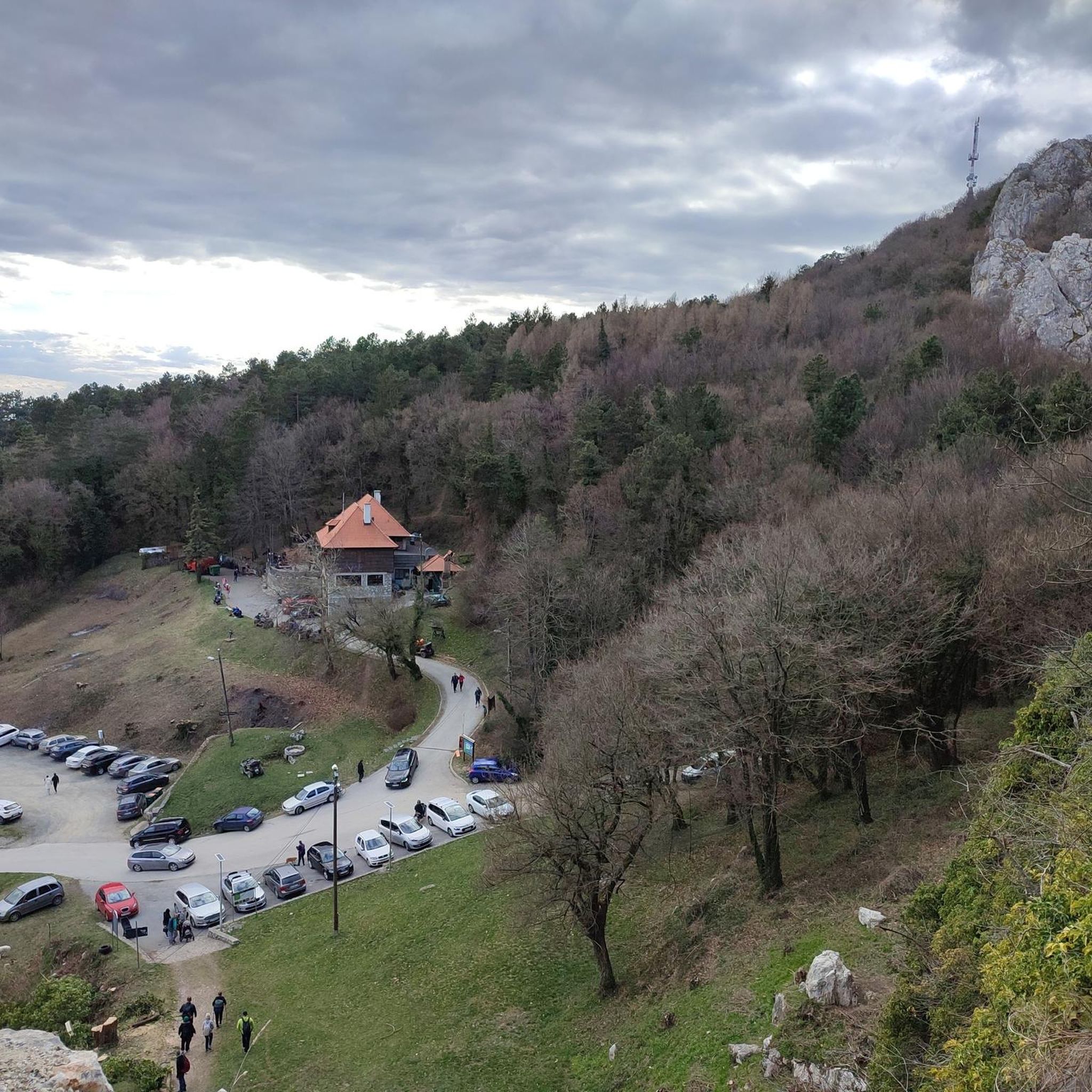
Very nice and cosy mountain hut. Good food and accommodation. In summer there are various evening/night activities (e.g. outdoor cinema, workshops, outdoor escape room...). Recommended.
0
0

It's interesting when there are flyers.
0
0

Nice view when fog is not around. Ivanšćica can be seen from this peak
0
0

A place to rest and enjoy the view at the bottom of the peak
0
0

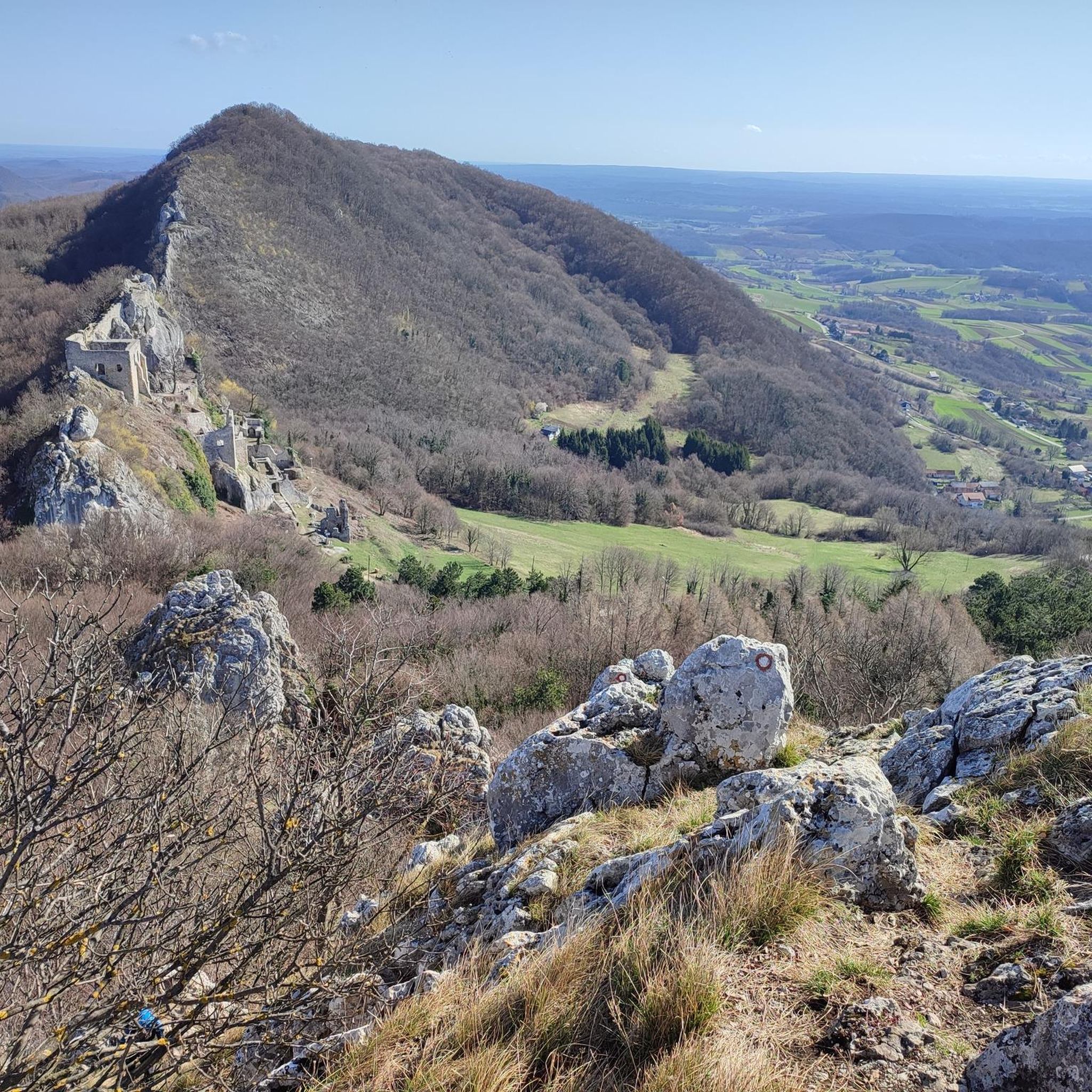
Nino has already copied a very valuable text about the old town, I would only add that it looks impressive in all seasons and is worth a look. There are signs prohibiting entry on the driveways.
1
0
The highest peak of Kalnik, 643 meters above sea level. From the mountain lodge, or the parking lot, a series of rocks called Seven Teeth leads to it. A fantastic trail, including rock climbing, only for the experienced! For those with less experience, there is a simpler approach from the southeast side.
2
0
Frequently Asked Questions
How many hiking trails are available in Općina Rasinja?
Općina Rasinja offers a diverse network of 18 hiking trails. These routes cater to various skill levels, including 4 easy, 6 moderate, and 8 difficult options.
What kind of terrain can I expect on hikes in Općina Rasinja?
The terrain in Općina Rasinja is varied, primarily centered around the Kalnik Mountain area. You'll find trails traversing mountainous landscapes, leading to peaks like Vranilac, and exploring historical sites such as the Veliki Kalnik Castle Ruins. Some paths are gentle, while others involve more challenging ascents requiring good fitness and sturdy shoes.
Are there any easy hiking trails suitable for beginners or families in Općina Rasinja?
Yes, Općina Rasinja has several easy trails. For a relaxed walk, consider the Dvorac Batthyany loop from Ludbreg, which is about 4.9 km long. Another easy option is the Interspar Supermarket loop from Koprivnica, covering approximately 7.7 km.
What are some challenging hikes for experienced trekkers in the region?
Experienced hikers can tackle several difficult routes. The Veliki Kalnik Castle Ruins – Vranilac Peak loop from Kalnik is a demanding 9.9 km trail. For a longer challenge, the Stankov Vrh (309 m) loop from Koprivnica extends for about 23.2 km.
Are there any circular hiking routes in Općina Rasinja?
Many of the trails in Općina Rasinja are circular, offering convenient starting and ending points. Examples include the Vranilac Peak – Kalnik Mountain Hut loop from Ljubelj Kalnički and the Kalnik Mountain Hut – Veliki Kalnik Castle Ruins loop from Kamešnica, both providing comprehensive exploration of the Kalnik area.
What historical landmarks or natural features can I explore while hiking?
Hikers can explore significant historical and natural landmarks. The Veliki Kalnik Castle Ruins offer a glimpse into the region's past, while Vranilac Peak provides scenic views. The Kalnik Mountain Hut (Planinarska kuća Rudi Jurić) also serves as a notable point of interest and a potential rest stop.
What do other hikers say about the trails in Općina Rasinja?
The hiking trails in Općina Rasinja are highly regarded by the komoot community, holding an average rating of 4.8 out of 5 stars from over 70 reviews. Hikers frequently praise the diverse landscapes, the well-maintained paths, and the rewarding views from peaks and historical sites.
Are there any trails that lead to a mountain hut for rest or refreshments?
Yes, the Kalnik Mountain Hut (Planinarska kuća Rudi Jurić) is a key feature in the region. Trails like the Planinarska kuća Rudi Jurić loop from Zvirišće or the Planinarska kuća Rudi Jurić loop from Crna gora incorporate this hut, offering a convenient stop during your hike.
What is the typical elevation gain on hikes in Općina Rasinja?
Elevation gains vary significantly depending on the trail's difficulty. Easy routes might have minimal elevation, while difficult trails in the Kalnik Mountain area can feature ascents of over 400 meters. For example, the Vranilac Peak – Kalnik Mountain Hut loop involves an elevation gain of approximately 457 meters.
How long do hikes in Općina Rasinja typically take?
Hike durations vary widely based on distance and difficulty. Shorter, easy trails like the Dvorac Batthyany loop can be completed in under 1.5 hours. More challenging and longer routes, such as the Kalnik Mountain Hut – Veliki Kalnik Castle Ruins loop (14.8 km), may take around 4.5 hours or more.
Is there parking available near the hiking trailheads in Općina Rasinja?
While specific parking details for every trailhead are not provided, the presence of numerous loops starting from various villages like Kalnik, Ljubelj Kalnički, and Kamešnica suggests that parking options are generally available in these areas to facilitate access to the trails.

Get inspired with the komoot mobile app


Explore more
Browse the best Hikes in other regions.
