The best walks and hikes around Općina Donja Motičina
4.7
(29)
180
hikers
8
hikes
Hiking trails around Općina Donja Motičina traverse a diverse landscape characterized by rolling hills, forests, and meadows. The region's proximity to the Drava River and features like Orahovačko jezero contribute to its varied natural beauty. Elevated viewpoints offer panoramas of the surrounding terrain. This area provides a range of hiking experiences across different natural environments.
Best hiking trails around Općina Donja Motičina
- The most popular hiking route is Lake Orahovačko – Ružica Grad Castle Ruins loop from Duzluk, a…
Last updated: July 1, 2026
4.9
(10)
52
hikers
10.0km
03:33
540m
540m
Moderate hike. Good fitness required. Mostly accessible paths. Sure-footedness required.
4.3
(6)
36
hikers
15.1km
04:56
630m
630m
Moderate hike. Good fitness required. Mostly accessible paths. Sure-footedness required.

Sign up for free
4.2
(5)
33
hikers
Hard hike. Very good fitness required. Mostly accessible paths. Sure-footedness required.
5.0
(5)
37
hikers
Moderate hike. Good fitness required. Mostly accessible paths. Sure-footedness required.
5.0
(1)
10
hikers
1.92km
00:41
110m
110m
Easy hike. Great for any fitness level. Easily-accessible paths. Suitable for all skill levels.
4
hikers
7.08km
02:00
160m
160m
Moderate hike. Good fitness required. Easily-accessible paths. Suitable for all skill levels.
3
hikers
5.45km
01:26
40m
40m
Easy hike. Great for any fitness level. Easily-accessible paths. Suitable for all skill levels.
4.5
(2)
5
hikers
8.66km
02:31
210m
210m
Moderate hike. Good fitness required. Easily-accessible paths. Suitable for all skill levels.
Our route recommendations are based on thousands of hikes, rides, and runs completed by other people on komoot.
Start today with a free account
Your next adventure awaits.
Login or Signup
Popular around Općina Donja Motičina

Tips from the Community

Good starting point for a circular trip
1
0
The highest peak of Osijek-Baranja County
0
0

Turković Castle in Kutjevo, Croatia is a must-visit. Tucked away in the picturesque region of Slavonia, this hidden gem offers a unique blend of history, architectural beauty and natural surroundings.
9
0

The small plateau of the peak (701m) on which the red canopy for the SPP box (KT-21 of SPP) is assembled
1
0

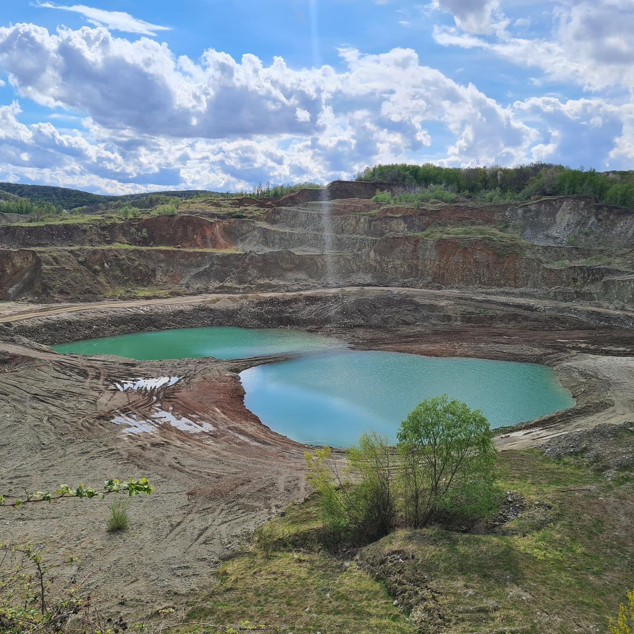
Lake Orahovič is an artificial lake located at the foot of Mount Papuka, not far from Ružica town. It is the main and most visited destination of Orahovica during summer days. It is 208 meters long, its width varies from 48.8 to 85.2 meters. Its surface is variable, depending on the water level, and ranges from 1.52 to 1.7 hectares. It contains 65,000 cubic meters of drinking water. The greatest recorded depth is on its northern side and is 9 meters. The length of the coast is 570 meters. The coast is arranged as a promenade. There are deciduous forests around the lake. The town of Ružica is located above the lake.
4
0

Be careful last 300m before the peak since there might be downhill mountain bikers riding/jumping next to hiking paths.
1
0

Built in the 14th century, the castle is located on top of a 378-meter high mountain next to the village of Duzluk. From the quarry below, a gravel path leads up to the castle
3
0
Frequently Asked Questions
What types of landscapes can I expect to see while hiking in Općina Donja Motičina?
Općina Donja Motičina offers a diverse range of landscapes, including rolling hills, dense forests, and open meadows. The region's proximity to the Drava River and features like Orahovačko jezero (Lake Orahovac) also contribute to its varied natural beauty, providing scenic riverside paths and lake views. Elevated viewpoints, such as those found along the Veliki Krš hill trail, offer panoramic vistas of the surrounding terrain.
Are there hiking trails suitable for beginners or families in Općina Donja Motičina?
Yes, Općina Donja Motičina caters to all levels of hikers, including beginners and families. There are 2 easy routes available. For a shorter, less intense walk, consider the Ružica Grad Castle Ruins – Lake Orahovačko loop from Duzluk, which is just under 2 km. Another easy option is the Mali dvorac loop from Našice, covering about 5.4 km.
What historical landmarks or points of interest can I explore on the trails?
Several trails in the region incorporate historical landmarks. You can explore the notable Ružica Grad Castle Ruins and the Ruins of Stari Grad (Old Town) on routes like the Ružica Grad Castle Ruins – Ruins of Stari Grad (Old Town) loop from Manastir Orahovica. Another route, the Mačevo Brdo – Turković Castle loop from Kutjevo, allows you to visit Turković Castle.
Are there any circular hiking routes available in Općina Donja Motičina?
Yes, many of the hiking routes in Općina Donja Motičina are circular, offering convenient starting and ending points. Examples include the Lake Orahovačko – Ružica Grad Castle Ruins loop from Duzluk, the Ružica Grad Castle Ruins – Ruins of Stari Grad (Old Town) loop from Manastir Orahovica, and the Mali dvorac loop from Našice.
What is the best time of year to go hiking in Općina Donja Motičina?
The region offers beautiful hiking experiences throughout the year. Spring brings vibrant wildflowers along riverbanks, while autumn showcases mesmerizing golden foliage. Forested areas provide shaded paths, making them ideal for hiking even during warmer summer days. The diverse terrain transforms with the seasons, offering unique scenery for each visit.
What do other hikers say about the trails in Općina Donja Motičina?
The hiking trails in Općina Donja Motičina are highly rated by the komoot community, with an average score of 4.8 stars from over 20 reviews. Hikers often praise the varied terrain, the picturesque views, and the well-marked paths that lead through forests, meadows, and past historical sites.
Are there any trails that feature water bodies like lakes or rivers?
Yes, the region's natural beauty is enhanced by its water features. The nearby Drava River offers scenic riverside paths, and Orahovačko jezero (Lake Orahovac) is a prominent feature on several routes. For example, the Lake Orahovačko – Ružica Grad Castle Ruins loop from Duzluk directly connects to the lake.
How many hiking trails are there in Općina Donja Motičina?
There are 8 hiking trails documented in Općina Donja Motičina, offering a range of experiences from easy strolls to more challenging ascents. These routes traverse diverse landscapes, including forests, meadows, and riverside paths.
Are there any challenging hikes for experienced hikers?
Yes, for experienced hikers seeking a challenge, there is 1 difficult route available. The Ružica Grad Castle Ruins – Ruins of Stari Grad (Old Town) loop from Duzluk is a demanding 16.6 km trail with significant elevation gain, typically taking around 5 hours 38 minutes to complete.
Can I find accommodation or places to eat along the hiking routes?
Yes, to enhance the hiking experience, accommodations and rustic lodges that offer food services are conveniently located along several key hiking routes in the broader region. These provide a welcome respite after strenuous activities, though specific details for each route would require local inquiry.
What kind of terrain should I expect on the hiking trails?
The terrain in Općina Donja Motičina is quite varied. You can expect to encounter paths through lush forests, open meadows, and along riverbanks. Some routes involve rolling hills and ascents to elevated viewpoints, while others offer more gentle, flat sections. This diversity allows for a wide range of hiking experiences.
Most popular routes around Općina Donja Motičina

Get inspired with the komoot mobile app


Explore more
Browse the best Hikes in other regions.
