The best walks and hikes around Pomiechówek
4.6
(41)
804
hikers
93
hikes
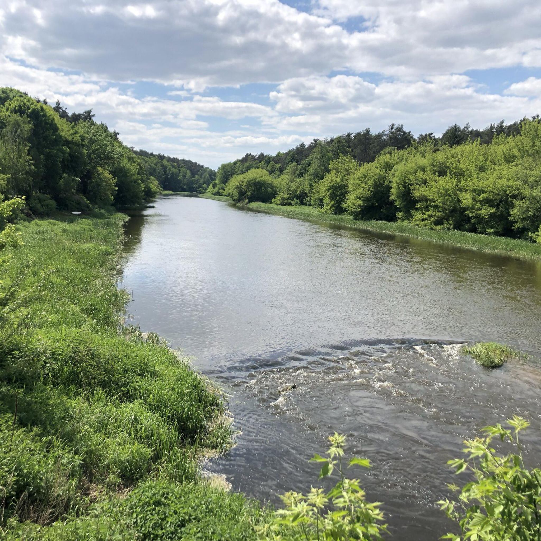
Hiking around Pomiechówek offers diverse routes through a landscape shaped by the confluence of the Wkra and Narew rivers. The region is characterized by extensive forests, including the Pomiechówek Forests, and several nature reserves, providing a rich natural environment for exploration. Trails often follow the gentle meanders of the Wkra Valley, offering scenic views and a tranquil setting. The terrain is generally low-lying, with modest elevation changes, making it accessible for various fitness levels.
Best hiking trails around Pomiechówek
- The…
Last updated: August 23, 2026
4.0
(1)
11
hikers
10.2km
02:37
40m
40m
Moderate hike. Good fitness required. Easily-accessible paths. Suitable for all skill levels.
5.0
(2)
13
hikers
Moderate hike. Good fitness required. Easily-accessible paths. Suitable for all skill levels.

Sign up for free
4.5
(2)
23
hikers
Moderate hike. Good fitness required. Easily-accessible paths. Suitable for all skill levels.
5.0
(2)
14
hikers
10.1km
02:37
50m
50m
Moderate hike. Good fitness required. Easily-accessible paths. Suitable for all skill levels.
3.0
(1)
9
hikers
4.06km
01:01
10m
10m
Easy hike. Great for any fitness level. Easily-accessible paths. Suitable for all skill levels.
Get access to more routes and recommendations from other explorers.
Sign up for free
Already have an account?
Our route recommendations are based on thousands of hikes, rides, and runs completed by other people on komoot.
Start today with a free account
Your next adventure awaits.
Login or Signup
Tips from the Community

The gate was built in 1837. It was located in the curtain wall between Bastions III and IV. The gate is single-story, constructed of brick with reinforced ashlar elements. It was guarded by two artillery positions in two openings on the sides. It received a neo-Gothic façade on the exterior, with one decorative axe surviving to this day. The gate's external thresholds were located high above the fortress ditch at the edge of the ramparts. A wooden bridge once led to the gate, of which only 16 brick pillars remain. The bridge curved slightly closer to the gate so that the gate and the bridge were not aligned during firing. General Dąbrowski Street once began at the bridge. The gate is now a ruin.
0
0
To commemorate the heroic struggle, the Monument to the Defenders of Modlin from September 1939 was erected. The unveiling was performed by the commander of the 1939 Modlin defense, Brigadier General Wiktor Thommee, in the presence of numerous soldiers from his September campaign. The ceremony took place on September 29, 1957, the anniversary of the surrender of Modlin Fortress. The initiative to build the monument came from the command of the 15th Bomber Division, and its design was presented by Sergeant Ryszard Lasota, a non-commissioned officer of the Military Police. Two Soviet cannons were added to the monument. The motive was the Red Army's participation in the liberation of Modlin from Nazi occupation. The monument was erected on the site of a monument to Marshal Józef Piłsudski, unveiled in 1928, which was destroyed only in the early 1950s when the Marshal's bust and baton were removed from its pedestal. Until the unveiling of the next monument, this place was forgotten and neglected.
0
0
Object located on the north side of the redoubt on the Front of Prince of Warsaw. Brick-built, three-faced, covered by an earth embankment. The corners of the individual parts of the structure have stone rustication. The front elevation features paired artillery firing galleries. In the outer section, positioned higher than the rest, above the redoubt's rampart, are analogous artillery firing positions. The rear elevations, from the east side, are successively one, three, and two-bay, with entrances closed by semicircular arches. Rusticated lower parts with a cordon cornice. The whole is crowned with stone cornices.
0
0
The Reduta lunety Frontu Księcia Warszawskiego is a brick, mushroom-shaped structure with an earthen embankment, part of the Modlin Fortress, serving as barracks and a warehouse, located in the neck of the lunette (a defensive salient). This historical element, built by the Russians (1832-1841) as part of the polygonal fortification system, provided defense and support for the lunette's front battery. It is currently private property
0
0
A convenient place from which you can see the ruins of a granary and parts of wrecks sticking out of the water.
1
0
A brick defensive wall with embrasures, either on the slope of a rampart or at its foot in a fortress ditch, used in fortifications primarily in the first half of the 19th century. The wall could contain embrasures for small arms. The purpose of the Carnot wall was to make it difficult for an enemy to cross the ditch. It was first used by the French military engineer General Lazare Nicolas Carnot in his 1772 drawing. Some bricks clearly bear the names of the brickworks where they were made. Source: https://pl.wikipedia.org/wiki/Mur_Carnota
0
0
An artillery tower built around 1900 on a J-shaped plan, made of brick with stone detailing, known as the "elevator" (elevator). Located on the Vistula River, it was two and three stories high, originally covered with earth, now with a roof. On the inner side (courtyard), rooms were designated as soldiers' quarters; on the outer side, these rooms were the combat section of the tower, where cannons could be positioned if necessary. Since there was no military activity during the Russians' stay in the Novogiergievsk Fortress, the Russians converted it into a grain warehouse (elevator) to utilize it. Together with the mill, flour warehouse, and bakery, they formed the so-called "supply line." Source: https://Twierdzamodlin.pl/Twierdza-modlin/najciekawsze-budowle/#elewator
0
0
A monument in the form of a plaque with text and an anchor commemorating the first port of the reborn Second Polish Navy. It was unveiled on June 21, 1997, at the initiative of members of the Maritime League Association and the residents of Nowy Dwór Mazowiecki. The monument is situated on the right bank of the Narew River, directly opposite the entrance to the former naval port located near the Lieutenant Feliks Pancer Bridge.
0
0
Frequently Asked Questions
How many hiking trails are available in Pomiechówek?
Pomiechówek offers a diverse network of over 40 hiking routes. These include a good mix of easy, moderate, and some more challenging trails, catering to various fitness levels and preferences.
Are there family-friendly hiking options in Pomiechówek?
Yes, Pomiechówek is an excellent destination for families. There are 28 easy trails, many of which follow the gentle meanders of the Wkra River through forests and meadows. The Hiking loop from Pomiechówek is a shorter, easy option. Additionally, the modern Park Dolina Wkry offers recreational facilities like playgrounds and a treetop walk, making it ideal for a family outing.
What kind of natural features can I expect to see while hiking in Pomiechówek?
The landscape of Pomiechówek is defined by the confluence of the Wkra and Narew rivers, extensive forests, and several nature reserves. You'll encounter picturesque river valleys, dense woodlands, and protected natural areas like the Pomiechówek Nature Reserve and Wieliszewskie Łęgi Nature Reserve. The area is rich in biodiversity, offering opportunities to spot various birds, fish, and even beavers.
Are there any circular hiking routes in Pomiechówek?
Yes, many of the trails in Pomiechówek are designed as loops, allowing you to start and end at the same point. A popular example is the Pętla Pomiechówek - Dolina Wkry - Rezerwat Pomiechówek, which explores the Wkra Valley and the Pomiechówek Nature Reserve.
What historical landmarks can be seen near the hiking trails?
The vicinity of the Modlin Fortress adds a historical dimension to your hikes. You can explore routes that combine natural scenery with historical sites, such as the Tank at Modlin Fortress – Defenders of Modlin Monument (1939) loop from Modlin. Other notable historical points include the Modlin Fortress — Cadets' Gate and the Józef Piłsudski Bridge over the Vistula.
What is the best time of year for hiking in Pomiechówek?
Pomiechówek is enjoyable for hiking throughout much of the year. Spring and autumn offer pleasant temperatures and vibrant natural colors, making them ideal. Summer is also popular, especially along the rivers, though it can be warmer. The extensive forests provide shade, and the area's microclimate is generally beneficial for outdoor activities.
Can I bring my dog on the hiking trails in Pomiechówek?
Generally, dogs are welcome on many hiking trails in Pomiechówek, especially if kept on a leash. However, as the area includes nature reserves and protected areas, it's always advisable to check for specific local regulations or signage regarding pets in certain zones to ensure a pleasant experience for everyone and protect the wildlife.
Are there any easy hikes suitable for beginners in Pomiechówek?
Yes, Pomiechówek offers a good selection of easy hikes perfect for beginners or those looking for a relaxed stroll. With 28 easy routes available, you can find paths with minimal elevation changes that wind through scenic woodlands and along the Wkra River, such as the Hiking loop from Pomiechówek.
What do other hikers enjoy most about hiking in Pomiechówek?
The komoot community highly rates hiking in Pomiechówek, with an average score of 4.6 stars from over 30 reviews. Hikers often praise the tranquil setting of the Wkra Valley, the well-maintained paths through dense woodlands, and the unique experience of the treetop walk. The combination of natural beauty and accessible trails makes it a favorite.
Are there any unique attractions or viewpoints along the trails?
Absolutely. A unique attraction is the treetop walk in the Wkra valley, offering a distinct perspective of the natural surroundings. There's also an observation tower that provides extensive views, including glimpses of the Modlin Fortress ruins. The Footbridge Over the Wkra River loop from Pomiechówek offers scenic river views.
Is public transport available to reach the hiking trailheads in Pomiechówek?
Pomiechówek is accessible by public transport, primarily by train, which connects to nearby larger towns. The train station in Pomiechówek is centrally located, making it convenient to reach several trailheads directly from there. For specific routes, it's recommended to check local bus schedules or train connections to plan your journey effectively.
Are there places to eat or drink near the hiking trails?
While specific cafes or pubs directly on every trail might be limited, the main town of Pomiechówek and surrounding villages offer dining options where you can refuel after your hike. It's a good idea to pack snacks and water, especially for longer routes, and then enjoy a meal or drink in town afterwards.
Most popular routes around Pomiechówek
Most popular attractions around Pomiechówek

Get inspired with the komoot mobile app


Explore more
Browse the best Hikes in other regions.
