The best walks and hikes around gmina Przerośl
4.7
(79)
757
hikers
94
hikes
Hiking around gmina Przerośl offers a variety of trails through diverse natural settings. The region is characterized by its valleys, such as the Czarna Hańcza, and features within the Suwałki Landscape Park. Hikers can expect to encounter areas with historical structures like the Stańczyki Bridges and natural markers. The landscape includes a mix of open areas and forested sections, providing varied terrain for exploration.
Best hiking trails around gmina Przerośl
- The most popular hiking route is Educational path "Through the…
Last updated: June 25, 2026
5.0
(2)
7
hikers
Easy hike. Great for any fitness level. Easily-accessible paths. Suitable for all skill levels.
4.0
(2)
105
hikers
1.50km
00:25
20m
20m
Easy hike. Great for any fitness level. Easily-accessible paths. Suitable for all skill levels.

Sign up for free
76
hikers
3.45km
00:57
50m
50m
Easy hike. Great for any fitness level. Easily-accessible paths. Suitable for all skill levels.
5.0
(2)
18
hikers
4.47km
01:11
40m
40m
Easy hike. Great for any fitness level. Easily-accessible paths. Suitable for all skill levels.
4.5
(2)
18
hikers
10.6km
02:47
80m
80m
Moderate hike. Good fitness required. Easily-accessible paths. Suitable for all skill levels.
Get access to more routes and recommendations from other explorers.
Sign up for free
Already have an account?
Our route recommendations are based on thousands of hikes, rides, and runs completed by other people on komoot.
Start today with a free account
Your next adventure awaits.
Login or Signup

Tips from the Community

Fairytale land! Recommend visiting.
0
0

The bridges in Stańczyki, often called the "Aqueducts of the Romincka Forest," are among the highest railway bridges in Poland – 180 meters long and reaching a height of 36.5 meters. Built between 1912 and 1918 in a style reminiscent of Roman aqueducts, they were intended to be part of a major railway line, but the line operated only as a local route until 1945. Today, the tracks no longer exist, and the impressive structures have become a tourist attraction and a bungee jumping site. Situated on the Błędzianka River and surrounded by picturesque scenery, they are a destination for bicycle tours and a good place to rest. Admission to the bridges is charged, but the view and history of the site are definitely worth a visit.
2
0
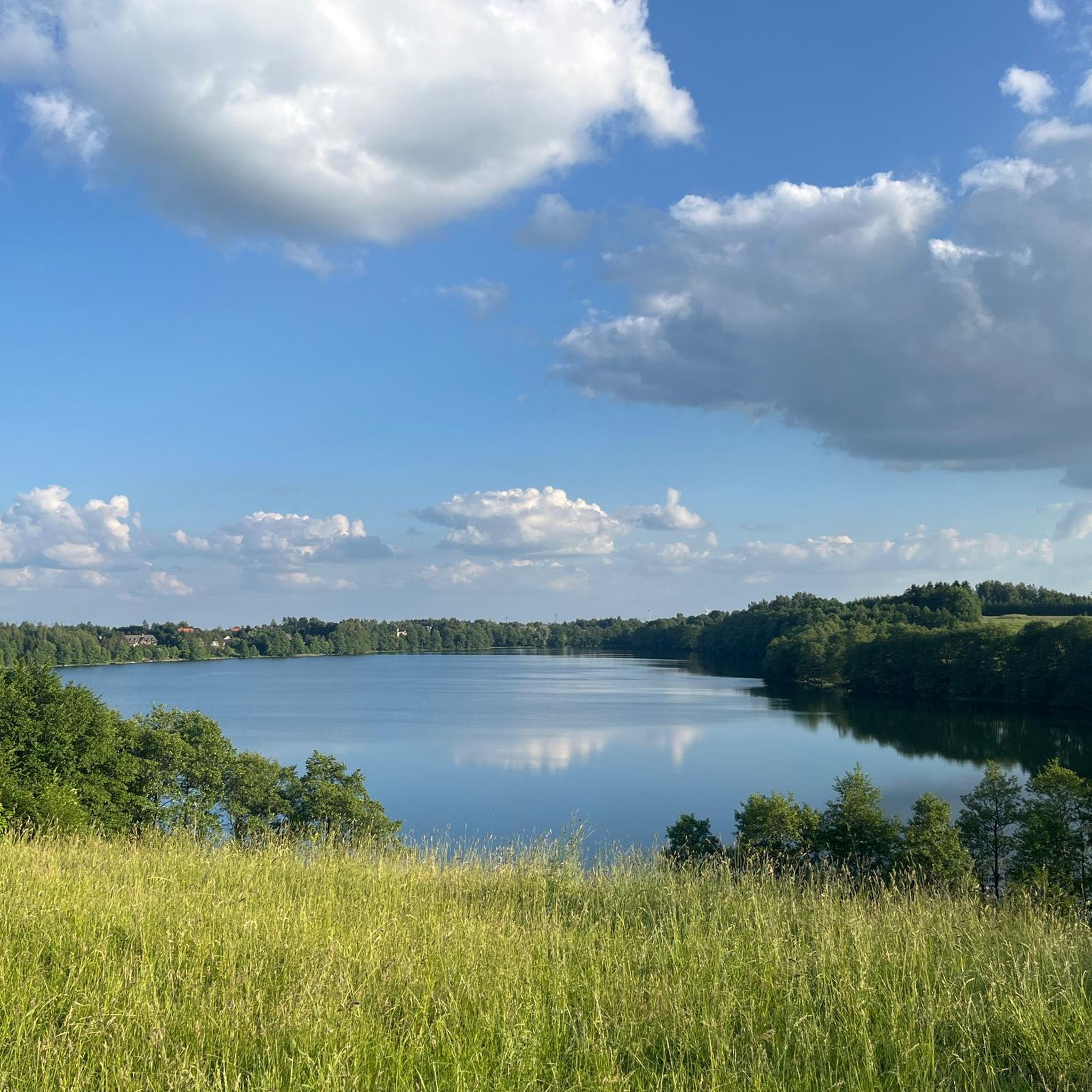
Lake Hańcza is the deepest lake in Poland, with a maximum depth of 108.5 meters. It is located in the Suwałki Region, surrounded by the picturesque hills and forests of the Suwałki Landscape Park. The lake boasts crystal-clear waters, attracting not only anglers and kayakers but also divers from across the country. Cyclists can enjoy attractive, undulating trails around the lake, offering beautiful views of the lake and numerous erratic boulders. This is also the starting point of the "Poglacial Gully of Lake Hańcza" educational trail—a hiking trail approximately 10 km long that leads from Stara Hańcza, with its historic manor house and park, along the eastern shore of Lake Hańcza, and then through the Czarna Hańcza River valley to Turtul. The trail features shelters, campfire areas, and educational information boards.
3
0

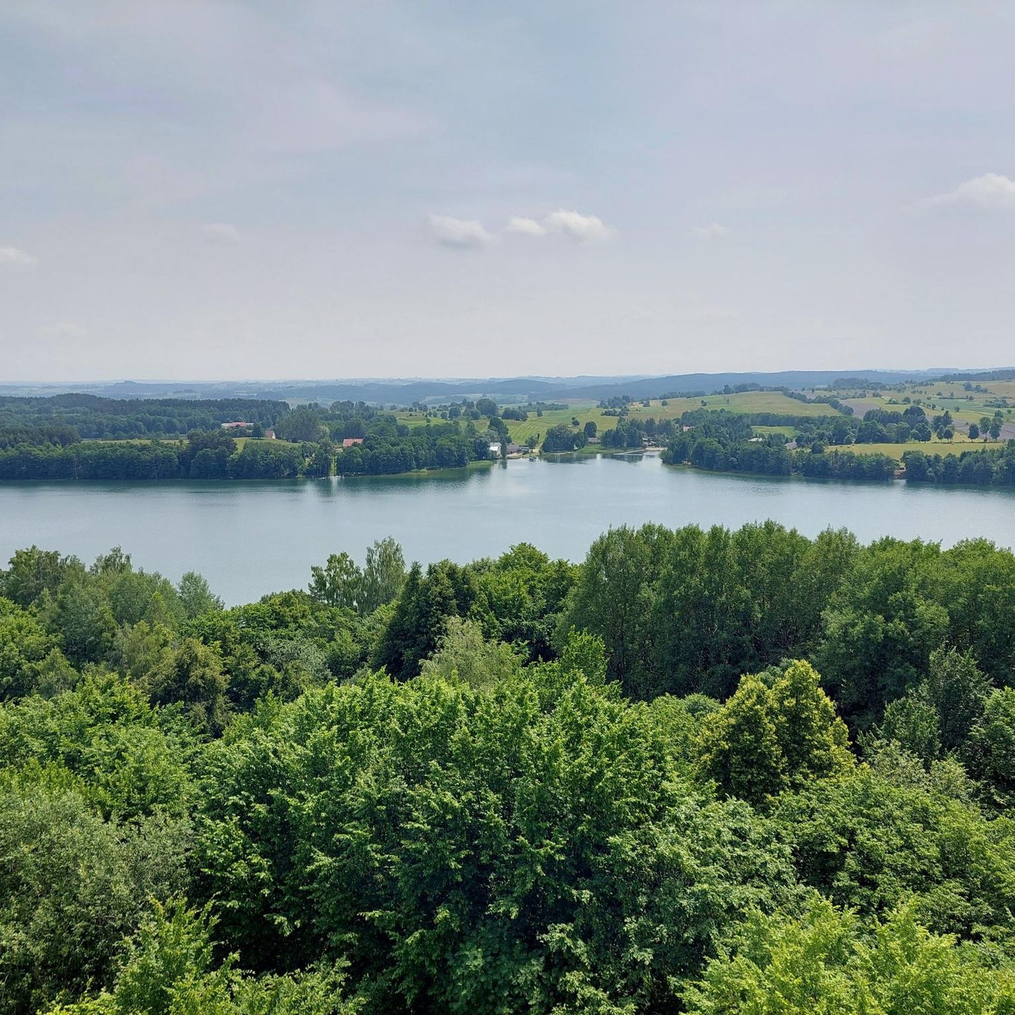
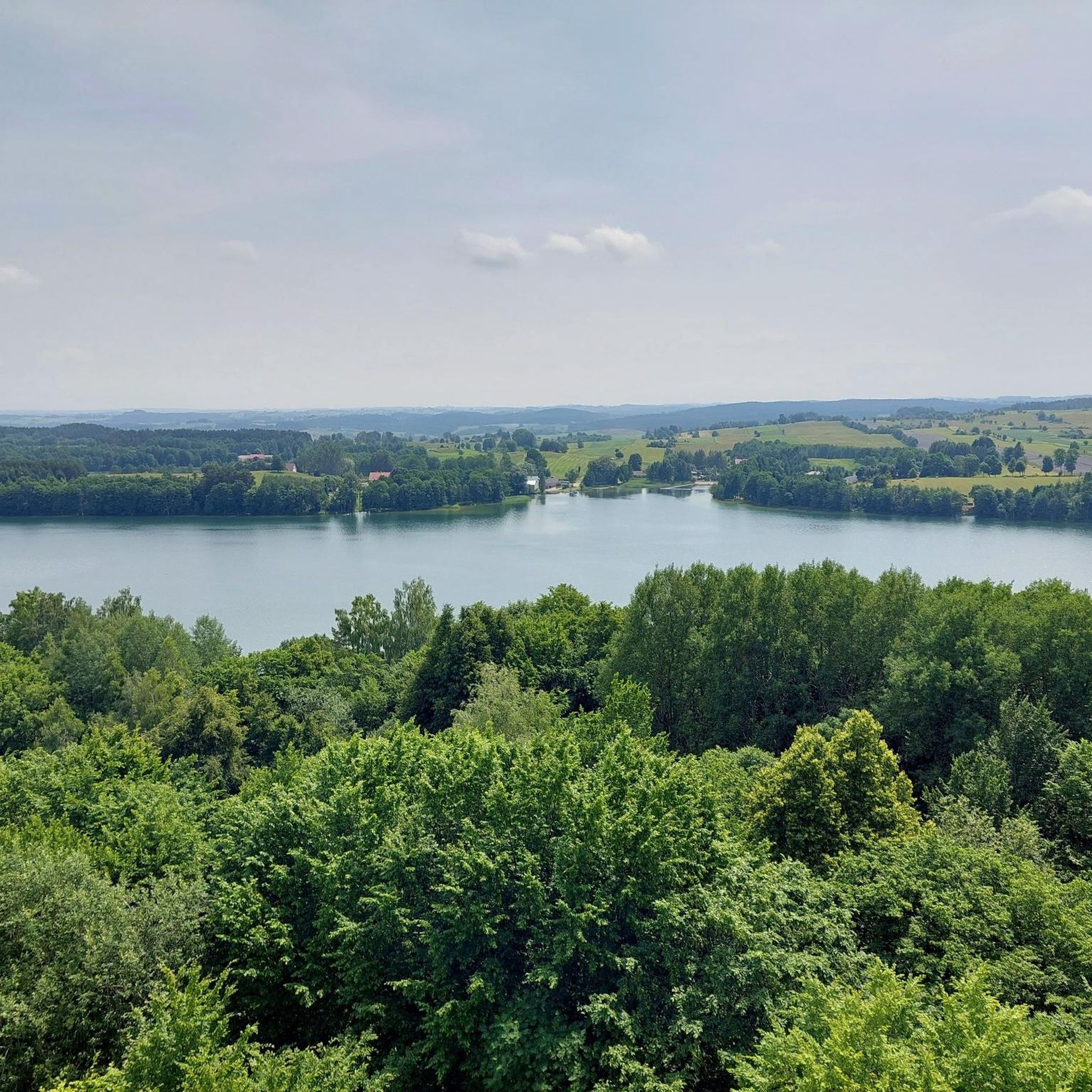
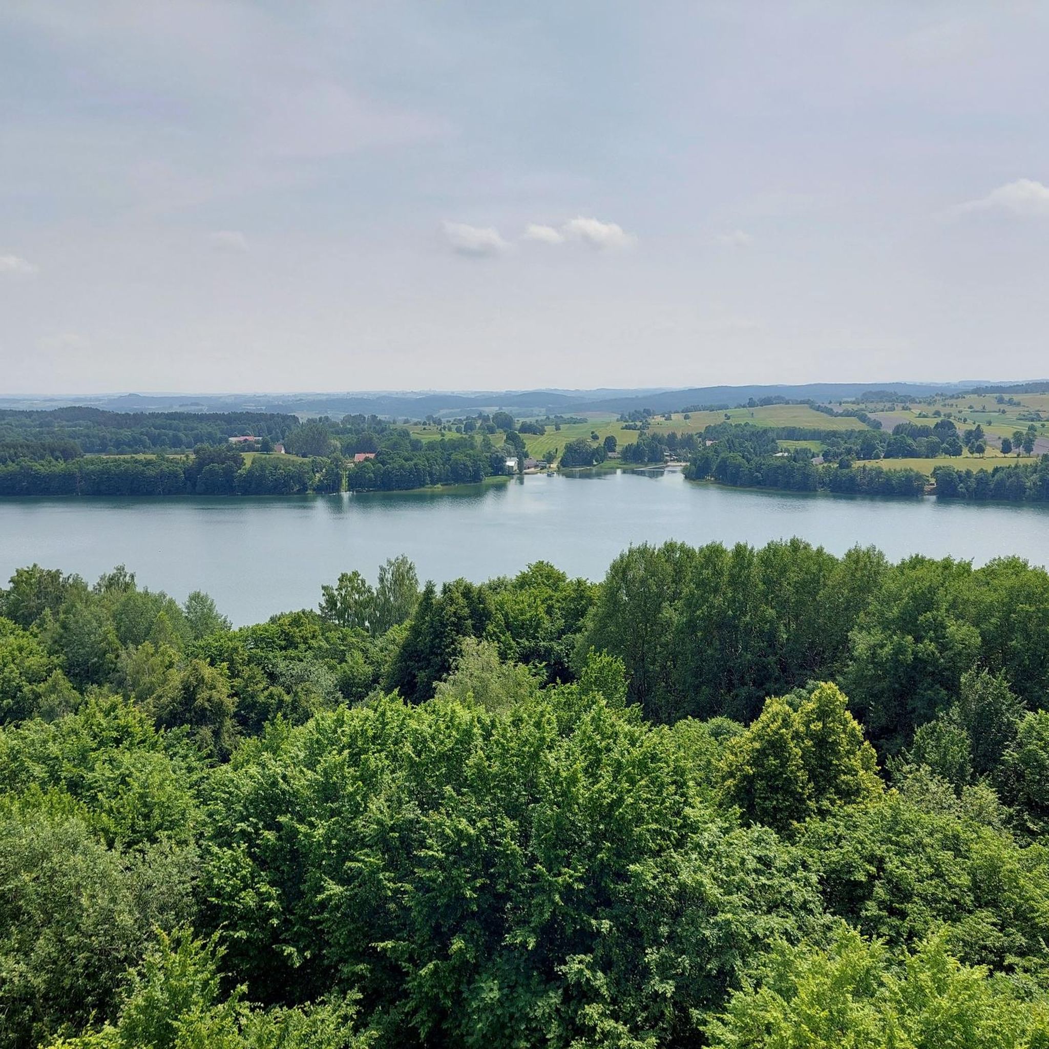
Beautiful views - like from a fairy tale...
0
0
The observation tower in Stańczyki is an interesting point on the Green Velo Eastern Cycling Trail. The wooden and steel structure is 20 meters high, and from the platform at a height of 15 meters you can admire the railway bridges in Stańczyki, the Błędzianka Valley and nearby lakes. The tower is accessible all year round and is located right next to an asphalt road, so you can easily get there by bike.
4
0

A very interesting shelter in the center of Bachanów - a great starting point for a hike along Czarna Hańcza (there is also a parking space here, so even better). You will also find useful information about the most interesting places in the Suwałki Landscape Park, and a series of signs for several trails right next to it invites you to set off somewhere right away.
0
0
A great and tall observation tower allowing you to enjoy the magnificent views over Czarna Hańcza, including the Głazowisko Reserve on the other side of the river. So stretch your legs and climb up.
0
0
Frequently Asked Questions
How many hiking trails are available in gmina Przerośl?
There are over 80 hiking routes in gmina Przerośl, offering a variety of experiences through its diverse natural settings. These include trails through river valleys and within the Suwałki Landscape Park.
Are there easy hiking trails suitable for beginners or families in gmina Przerośl?
Yes, gmina Przerośl offers a good selection of easy trails. Approximately 30 of the routes are classified as easy, making them suitable for beginners or families. An example is the Educational path "Through the Valley of Czarna Hancza": Suwałki Landscape Park, which is 1.9 miles (3.1 km) long.
What types of landscapes and features can I expect to see while hiking in gmina Przerośl?
Hikers in gmina Przerośl can expect to encounter diverse landscapes, including river valleys like the Czarna Hańcza, sections of the Suwałki Landscape Park, and a mix of open areas and forested sections. The region is also known for historical structures such as the Stańczyki Bridges.
Are there any circular hiking routes in gmina Przerośl?
Yes, there are several circular routes available. For instance, the Stańczyki Bridges loop from Błąkały is an easy 0.9 miles (1.5 km) path that provides views of the historic bridges. Another option is the Stańczyki Bridges – Observation tower in Stańczyki loop from Błąkały, a 2.1 miles (3.4 km) trail.
What are some notable attractions or landmarks to look out for on the trails?
Along the hiking trails, you can explore several interesting landmarks. The Stańczyki Bridges are a prominent historical feature. Nature lovers might appreciate Hańcza Lake or the Pobłędzie Observation Tower for scenic views. There's also the Lithuania–Poland–Russia Tripoint Monument.
What do other hikers say about the trails in gmina Przerośl?
The hiking trails in gmina Przerośl are highly rated by the komoot community, with an average score of 4.7 out of 5 stars from over 80 reviews. Hikers often praise the diverse natural settings, the well-maintained paths, and the opportunity to explore both natural beauty and historical sites.
Is gmina Przerośl suitable for dog-friendly hikes?
Many trails in gmina Przerośl are suitable for hiking with dogs, especially those through forested areas and open landscapes. It's always recommended to keep dogs on a leash and ensure they are well-behaved, particularly in nature reserves or areas with wildlife.
Are there any trails that offer unique or 'hidden gem' experiences?
For a unique experience, consider the Boundary boulder loop from Błaskowizna. This moderate 6.6 miles (10.6 km) route offers a different perspective of the region, leading to a significant boundary marker and allowing for exploration away from the more frequented paths.
What is the best time of year to go hiking in gmina Przerośl?
The best time for hiking in gmina Przerośl is typically from spring through autumn (May to October), when the weather is mild and the natural scenery is at its most vibrant. Summer offers lush greenery, while autumn brings beautiful fall colors. Some trails may also be accessible for winter hiking, depending on snow conditions.
Are there any specific considerations for winter hiking in gmina Przerośl?
Winter hiking in gmina Przerośl can be a beautiful experience, especially in the snow-covered landscapes of the Suwałki Landscape Park. However, conditions can be challenging. It's important to wear appropriate warm clothing, waterproof footwear, and be aware of shorter daylight hours. Some trails might be less maintained in winter, so check local conditions before heading out.
Where can I find parking for hiking trails in gmina Przerośl?
Parking is generally available near popular trailheads and attractions. For routes around the Stańczyki Bridges, you can often find designated parking areas in villages like Błąkały. It's advisable to check specific route descriptions on komoot for detailed parking information or local signage upon arrival.
What kind of wildlife might I encounter on the hiking trails?
The diverse natural environment of gmina Przerośl, particularly within the Suwałki Landscape Park and along river valleys, supports various wildlife. Hikers might spot different bird species, small mammals, and insects. Keep an eye out for signs of larger animals, especially in forested and less disturbed areas.
Most popular routes around gmina Przerośl
Most popular attractions around gmina Przerośl

Get inspired with the komoot mobile app


Explore more
Browse the best Hikes in other regions.
