The best road cycling routes around São Miguel Do Mato
4.6
(24)
1,251
riders
40
rides
Road cycling around São Miguel Do Mato features varied terrain, including routes along river valleys and through rural villages. The region presents a mix of landscapes, with significant elevation changes on many routes. Cyclists can expect to encounter both moderate climbs and longer, more challenging ascents.
Best road cycling routes around São Miguel Do Mato
- The most popular road cycling route is Sousa River Mouth – Dom Luís I Bridge loop from Campidouro, a 34.2 miles (55.0 km) trail…
Last updated: June 28, 2026
4.8
(6)
345
riders
55.0km
02:32
620m
620m
Moderate road ride. Good fitness required. Mostly well-paved surfaces and easy to ride.
142
riders
115km
06:11
2,280m
2,280m
Hard road ride. Very good fitness required. Mostly well-paved surfaces and easy to ride.

Sign up for free
5.0
(1)
22
riders
43.8km
02:07
590m
590m
Moderate road ride. Good fitness required. Mostly well-paved surfaces and easy to ride.
20
riders
75.9km
04:25
1,730m
1,730m
Hard road ride. Very good fitness required. Mostly well-paved surfaces and easy to ride.
3.0
(1)
10
riders
69.4km
03:40
1,290m
1,290m
Hard road ride. Very good fitness required. Mostly well-paved surfaces and easy to ride.
Get access to more routes and recommendations from other explorers.
Sign up for free
Already have an account?
Our route recommendations are based on thousands of hikes, rides, and runs completed by other people on komoot.
Start today with a free account
Your next adventure awaits.
Login or Signup


Tips from the Community

The Arda Ecoway, stretching from Arouca to Rossas, is a scenic riverside trail ideal for walking, running, and cycling, combining sport with nature along the Arda River. With easy terrain, lush landscapes, and charming rural villages along the way, it offers a peaceful and authentic outdoor experience.
1
0


In charming Arouca you will find the Arouca Monastery, an architectural and historical landmark, and the picturesque streets and squares that exude ancient charm. The local gastronomy, in particular the conventual sweets, is an attraction in itself. The Arouca Geopark is famous for its Paiva Walkways, offering spectacular trails and views over the Paiva River, as well as trilobite fossils, highlighting an important geological and natural heritage.
0
0

Monument in Homage to the Victims of the Entre-os-Rios Tragedy.
0
0

That bridge is a real eye-catcher
19
0

Water supply point, or stop for a coffee 👌🏼
0
0

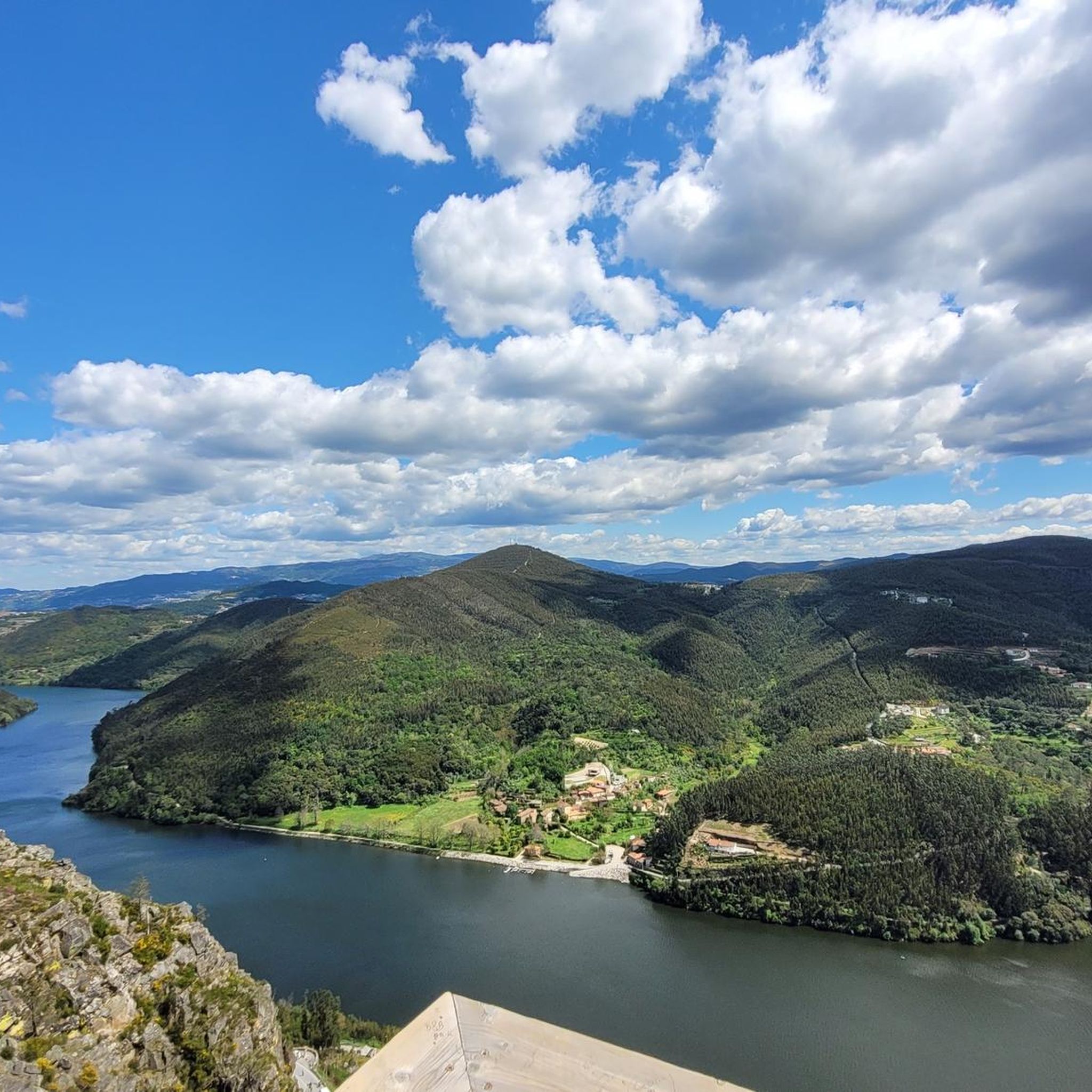
Stunning views of the Douro River from the bridge over the old town.
25
0
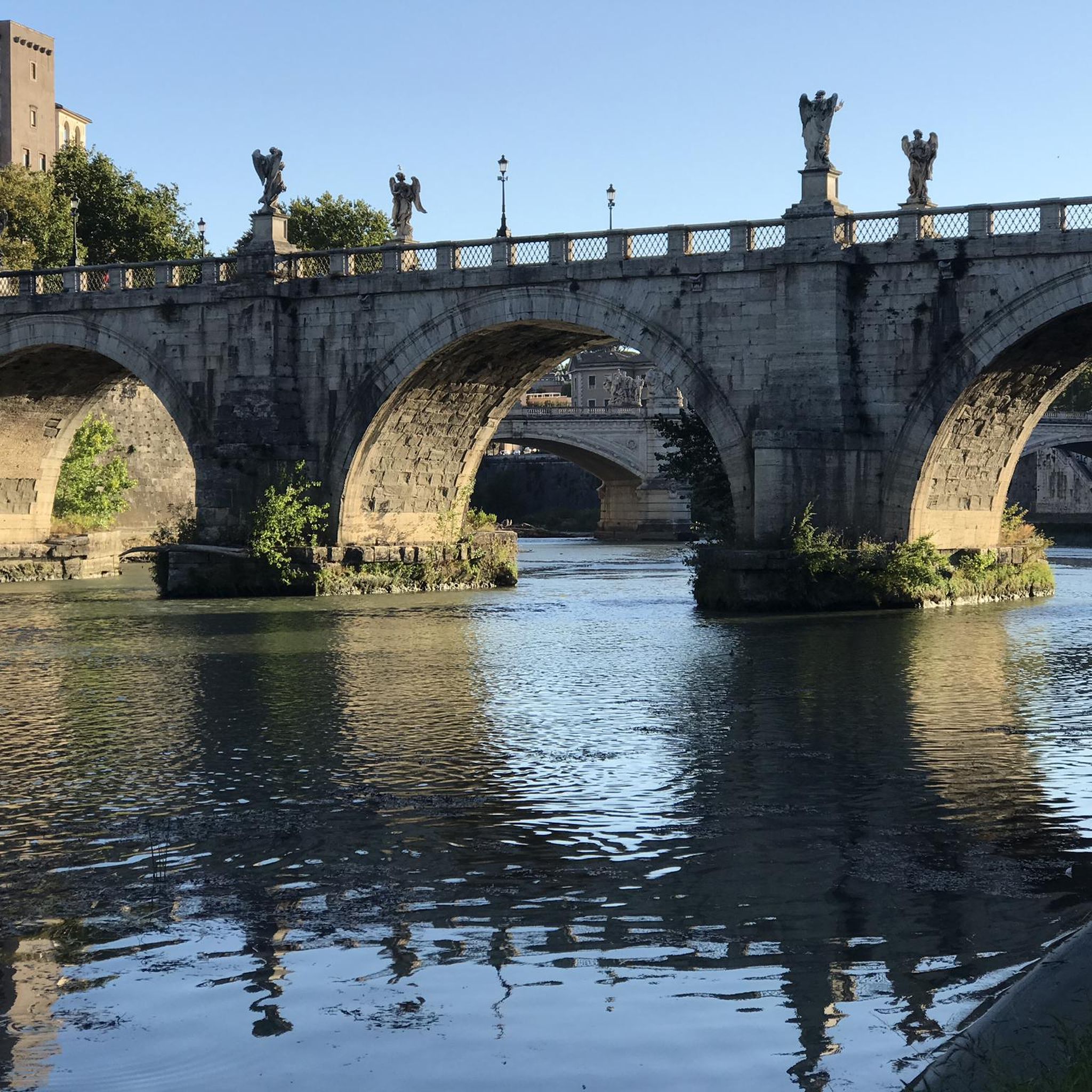
The Douro River is crossed by several bridges as it passes through Porto. The most famous of them is the Don Luis I Bridge (Ponte Dom Luís I in Portuguese), which connects the city with Vila Nova de Gaia. Inaugurated at the end of the 19th century, this iron bridge is one of the most emblematic images of Porto.🌉
26
2
Frequently Asked Questions
What is the overall character of road cycling in São Miguel Do Mato?
Road cycling in São Miguel Do Mato is characterized by diverse terrain, including routes along river valleys and through rural villages. The region features a mix of landscapes with significant elevation changes, offering both moderate climbs and longer, more challenging ascents.
How many road cycling routes are available in São Miguel Do Mato?
There are over 40 road cycling routes available around São Miguel Do Mato, catering to various skill levels. This includes 1 easy route, 22 moderate routes, and 17 difficult routes.
What kind of elevation can I expect on road cycling routes in São Miguel Do Mato?
Cyclists should be prepared for significant elevation changes. For example, the Sousa River Mouth – Dom Luís I Bridge loop from Campidouro, a moderate route, includes over 2,000 feet (600 meters) of elevation gain. More challenging routes, like the Catapeixe Viewpoint loop from Sebolido, feature substantial climbing with over 7,600 feet (2,300 meters) of elevation gain.
Are there any family-friendly road cycling options in São Miguel Do Mato?
While many routes feature significant elevation, there is at least one easy road cycling route available. For families, it's advisable to check the route profiles for minimal elevation gain and shorter distances to ensure a comfortable experience.
What do other road cyclists enjoy most about the routes in São Miguel Do Mato?
The road cycling routes in São Miguel Do Mato are highly rated by the komoot community, with an average score of 4.7 stars from over 20 reviews. Cyclists often praise the varied terrain, from river valleys to rural roads, and the rewarding challenge of the climbs.
What are some notable landmarks or viewpoints I can encounter on road cycling routes?
As you cycle, you might pass by interesting points such as Arouca Town Center or the Main Church of Santa Maria da Feira. For scenic views, consider routes that pass near viewpoints like Doll's Swing, Sebolido Viewpoint, or Alto do Monte de Avelheira and Chapel.
Are there any natural attractions or monuments near the cycling routes?
Yes, the region offers natural attractions such as the Climb to Serra da Freita and the Gruta das Banjas. These natural features add to the scenic beauty and exploration opportunities around the cycling paths.
Can I find circular road cycling routes in São Miguel Do Mato?
Yes, many of the road cycling routes in São Miguel Do Mato are designed as loops. Examples include the Sousa River Mouth – Dom Luís I Bridge loop from Campidouro and the Praça de São João da Madeira loop from Cesar, allowing you to start and finish in the same location.
What is the best time of year for road cycling in São Miguel Do Mato?
São Miguel, the larger island in the Azores, is known for its lush, verdant landscapes year-round. While specific weather data for São Miguel Do Mato isn't provided, the general climate of the region suggests pleasant cycling conditions for much of the year, though cyclists should be prepared for potential elevation changes and varying weather.
Are there options for long-distance road cycling in the area?
Yes, São Miguel Do Mato offers long-distance road cycling trails. The Catapeixe Viewpoint loop from Sebolido is a difficult 73.0-mile (117.4 km) path, providing a substantial challenge for those looking for extended rides.
Where can I find parking for road cycling routes in São Miguel Do Mato?
While specific parking locations for each route are not detailed, many routes start from villages or towns like Campidouro, Sebolido, or Cesar, where public parking facilities are typically available. It's recommended to check local information for parking options at your chosen starting point.
Most popular routes around São Miguel Do Mato
Most popular attractions around São Miguel Do Mato

Get inspired with the komoot mobile app


Explore more
Browse the best Road cycling routes in other regions.
