The best road cycling routes around Souto
3.9
(111)
2,221
riders
152
rides
Road cycling around Souto is characterized by its varied elevations and undulating landscape within the picturesque region of Vila de Cruces, Galicia. The terrain ranges from 223 meters to 625 meters, providing diverse gradients for cyclists. Routes often follow lush valleys shaped by rivers such as the Ulla, Arnego, and Deza, offering scenic views. The area is also rich in Atlantic forest species, including chestnut and oak trees, contributing to a verdant environment for rides.
Best road cycling routes around…
Last updated: July 1, 2026
1
riders
25.0km
01:11
270m
270m
This easy 15.5-mile (25.0 km) road cycling route from Santa Maria da Feira to Ovar offers coastal views, rural landscapes, and the Ria de Av
50
riders
64.9km
02:48
510m
510m
Moderate road ride. Good fitness required. Mostly well-paved surfaces and easy to ride.

Sign up for free
3.9
(17)
42
riders
Moderate road ride. Good fitness required. Mostly well-paved surfaces and easy to ride.
4.0
(3)
22
riders
51.8km
02:49
1,020m
1,020m
Hard road ride. Very good fitness required. Mostly well-paved surfaces and easy to ride.
3.0
(1)
13
riders
43.7km
02:14
770m
770m
Moderate road ride. Good fitness required. Mostly well-paved surfaces and easy to ride.
Get access to more routes and recommendations from other explorers.
Sign up for free
Already have an account?
Our route recommendations are based on thousands of hikes, rides, and runs completed by other people on komoot.
Start today with a free account
Your next adventure awaits.
Login or Signup
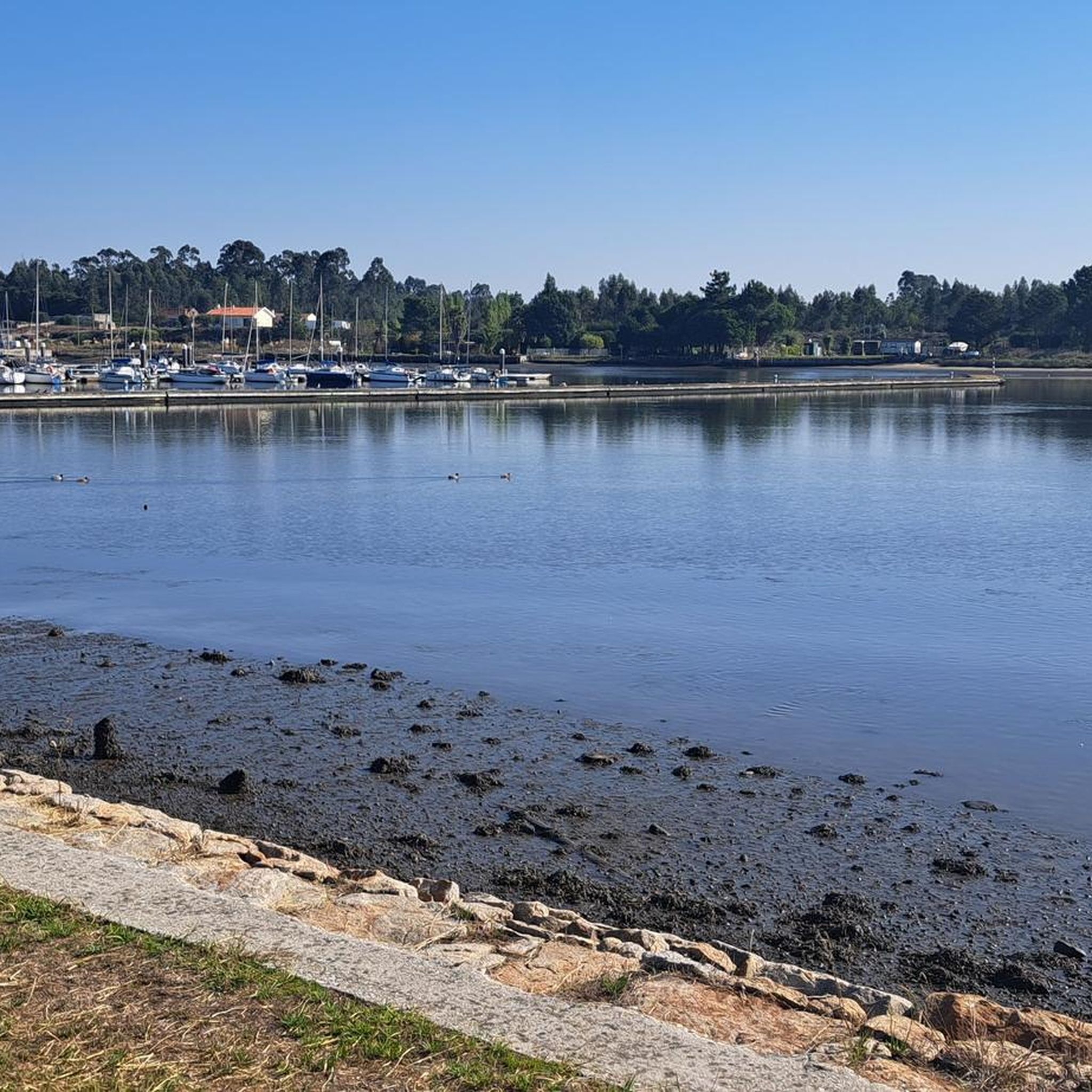
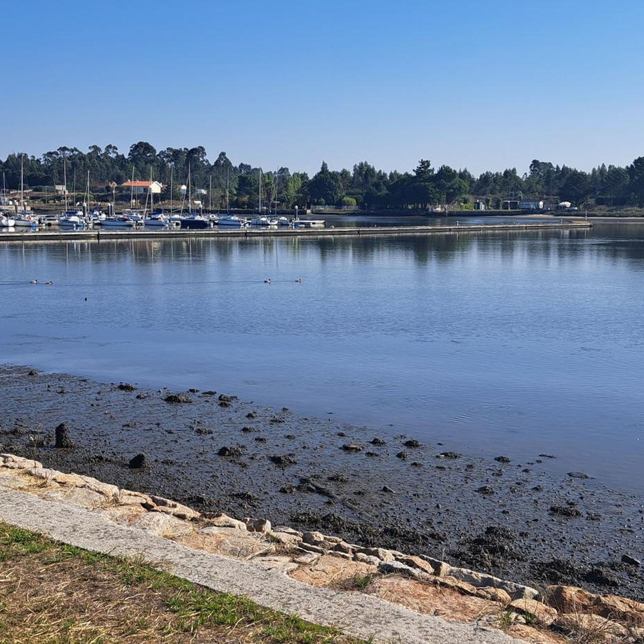
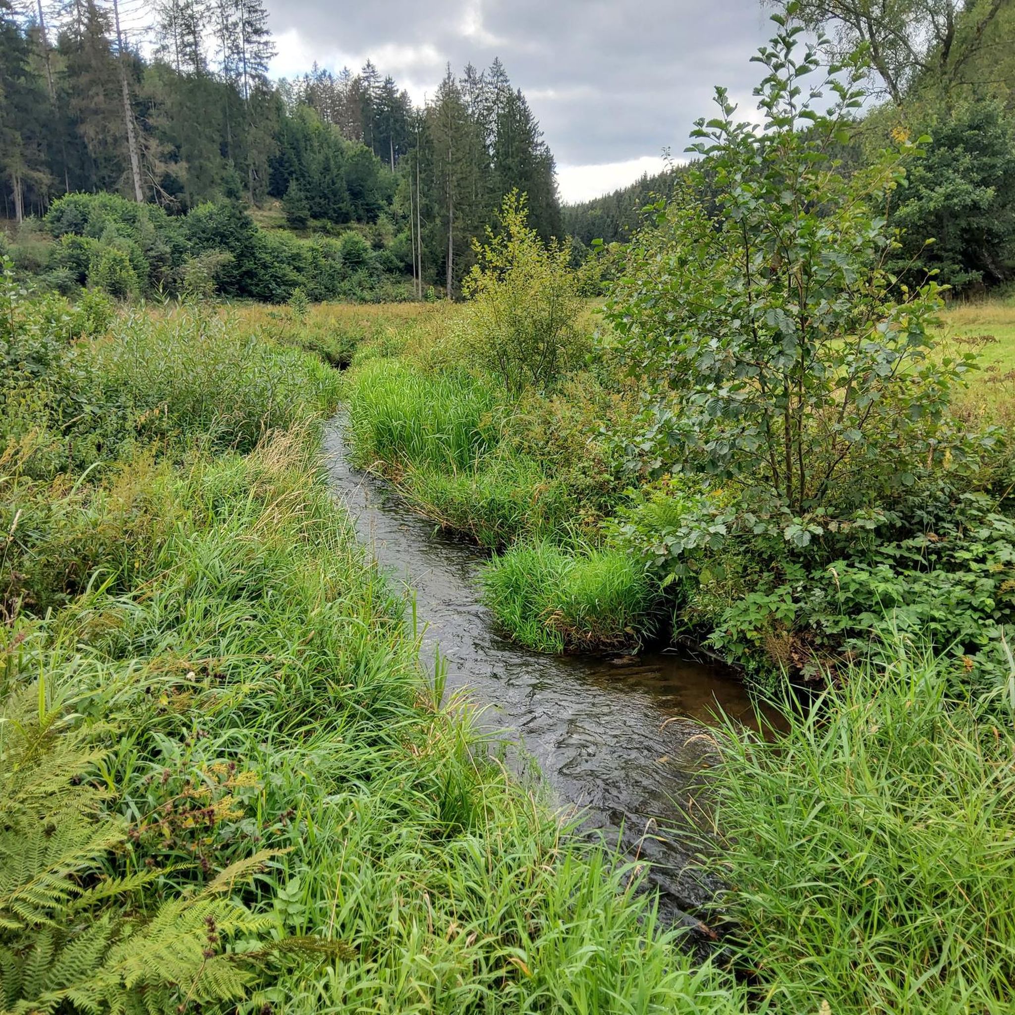
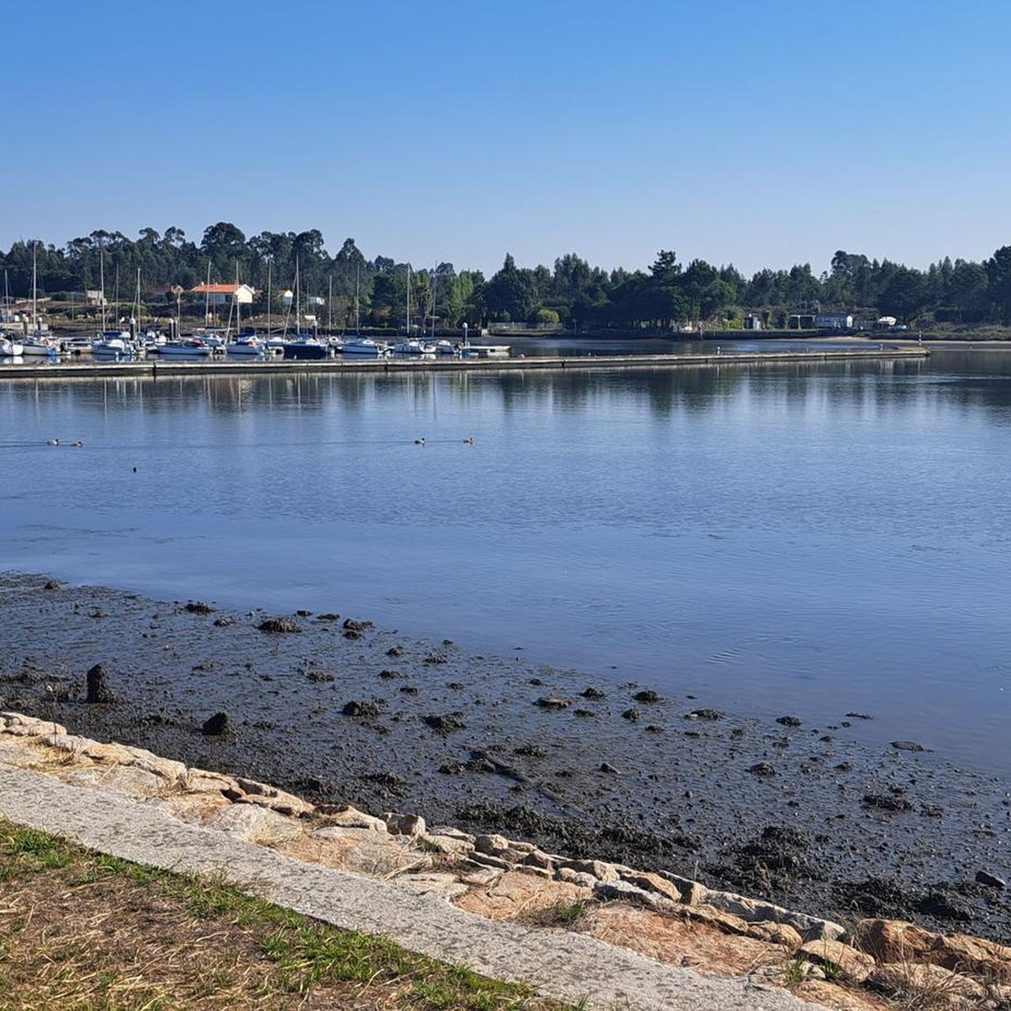
Tips from the Community

Old Leirosa road parallel to the national road
0
0

Cool view of a beautiful house
1
0


I recommend it very beautiful
1
0

View of the hills in the area of Estrada. Enjoy this stunning view and stop to take a picture to remember this moment.
0
0
The top of Monte de Avelheira offers a magnificent view, allowing you to admire the landscape all the way to the coast, a panorama that combines the sacred with the natural spectacle. There is also the chapel of the same name, dating from the 1930s. It is a Marian sanctuary with a small chapel, stage, bandstand, and crosses.
0
0


The cycle path along the coast towards Porto is great. Unfortunately it ends at Duro and you cycle to Porto on a road without a cycle path. Watch out for the broken manhole covers. Danger of falling!
1
0
Frequently Asked Questions
How many road cycling routes are available around Souto?
Souto offers a wide variety of road cycling routes, with over 160 different tours to explore. This includes options for all skill levels, from easy rides to more challenging ascents.
What kind of terrain can I expect when road cycling in Souto?
The terrain around Souto is characterized by varied elevations, ranging from 223 meters to 625 meters. You'll encounter an undulating landscape with diverse gradients, from gentle slopes to more demanding climbs. Routes often wind through lush valleys shaped by rivers like the Ulla, Arnego, and Deza, and are surrounded by Atlantic forests with chestnut and oak trees.
Are there road cycling routes suitable for beginners or families in Souto?
Yes, Souto offers several routes suitable for beginners and families. There are 13 easy routes available, providing a gentler introduction to road cycling in the region. These routes often feature less challenging gradients and can be a great way to enjoy the scenic landscapes at a relaxed pace.
What are some challenging road cycling routes around Souto?
For experienced cyclists seeking a challenge, Souto has 41 difficult routes with significant climbs and varied terrain. While specific challenging routes are numerous, the region's undulating landscape and higher elevations provide ample opportunities for demanding rides.
Can I find circular road cycling routes in the area?
Yes, many of the road cycling routes around Souto are designed as loops, allowing you to start and finish in the same location. An example is the Ponte da Varela – Chapel Among Cornfields loop from Vila da Feira, which offers a moderate 40.5-mile ride through agricultural landscapes.
What natural features or landmarks can I see along the road cycling routes?
Road cycling routes around Souto often pass through lush valleys and Atlantic forests. You can also encounter beautiful natural attractions such as the Ovar Canal and the Barrinha de Esmoriz Nature Reserve. The wider region of Vila de Cruces is also home to the impressive Toxa Waterfalls and picturesque river beaches like the Gres Islands.
Are there any historical sites accessible by road bike in the Souto area?
While Souto itself is a small locality, the broader Vila de Cruces area offers historical gems. The magnificent Carboeiro Monastery, an architectural blend of Romanesque and Gothic styles, is set in a beautiful natural area on the banks of the Deza River and can be a rewarding destination or stop on a longer ride.
What do other cyclists say about road cycling in Souto?
The road cycling experience in Souto is highly rated by the komoot community, with an average score of 3.96 stars from over 110 reviews. Cyclists often praise the varied terrain, the lush landscapes, and the opportunities for both scenic and challenging rides. Over 2,300 road cyclists have used komoot to explore the area.
When is the best time of year for road cycling in Souto?
The region's mild climate, typical of Galicia, generally makes it suitable for road cycling for much of the year. Spring and autumn often offer pleasant temperatures and vibrant scenery, while summer can be warm but still enjoyable, especially on routes that pass through shaded forest areas or along rivers.
Are there options for parking or public transport access to the routes?
While specific parking details for every route start point are not provided, the region of Vila de Cruces, where Souto is located, is generally accessible. For public transport, options may be limited to local bus services connecting smaller towns. It's advisable to check local transport schedules if planning to use public transport to reach route starting points.
Can I find places to rest or eat along the road cycling routes?
The routes often pass through or near small towns and villages within the Vila de Cruces municipality. While not explicitly detailed for every route, these localities typically offer cafes, restaurants, or small shops where cyclists can refuel and rest. The Ovar Town Centre, for example, provides amenities for visitors.
Are there any routes that offer scenic viewpoints?
Given the undulating landscape and varied elevations, many routes naturally offer scenic viewpoints, especially those climbing to higher ground or following river valleys. The region's 'sublime combination of ocean, forests and mountains' ensures picturesque vistas throughout your ride.
How does the elevation vary on road cycling routes around Souto?
The elevation on road cycling routes around Souto varies significantly, with the region's terrain ranging from a minimum of 223 meters to a maximum of 625 meters. This provides a dynamic cycling experience, with routes featuring both gentle ascents and more challenging climbs, ensuring diverse gradients for all levels of cyclists.
Are there any routes that follow rivers or coastal areas?
Yes, the region is rich in rivers such as the Ulla, Arnego, and Deza, which create lush valleys. Many routes follow these waterways, offering picturesque views and varied gradients. For example, the Torreira Marina – Ponte da Varela loop from Vila da Feira leads through coastal areas and riverine environments.
Most popular routes around Souto
Most popular attractions around Souto

Get inspired with the komoot mobile app


Explore more
Browse the best Road cycling routes in other regions.
