The best walks and hikes around Santo Amaro
4.3
(823)
3,619
hikers
62
hikes
Hiking around Santo Amaro, located on Pico Island in the Azores, offers diverse terrain characterized by coastal paths, elevated viewpoints, and lush green landscapes. The region features a mix of moderate ascents and descents, with trails often leading through areas with rich vegetation and offering panoramic ocean views. The geology of Pico, including its volcanic origins, contributes to varied ground conditions, though specific volcanic features are not always prominent on every trail.
Best hiking trails around Santo Amaro
- The most…
Last updated: August 28, 2026
4.0
(5)
17
hikers
14.1km
04:18
490m
490m
Hike the moderate 8.7-mile Canadas da Ribeirinha trail on Pico Island, exploring ancient paths, lush forests, and coastal views.
4.4
(5)
36
hikers
10.8km
03:31
450m
450m
Moderate hike. Good fitness required. Easily-accessible paths. Suitable for all skill levels.

Sign up for free
4.5
(4)
20
hikers
10.2km
03:22
450m
450m
Moderate hike. Good fitness required. Easily-accessible paths. Suitable for all skill levels.
5.0
(2)
29
hikers
Moderate hike. Good fitness required. Easily-accessible paths. Suitable for all skill levels.
4.5
(2)
27
hikers
5.16km
01:47
270m
270m
Easy hike. Great for any fitness level. Easily-accessible paths. Suitable for all skill levels.
Get access to more routes and recommendations from other explorers.
Sign up for free
Already have an account?
Our route recommendations are based on thousands of hikes, rides, and runs completed by other people on komoot.
Start today with a free account
Your next adventure awaits.
Login or Signup
Popular around Santo Amaro
Tips from the Community

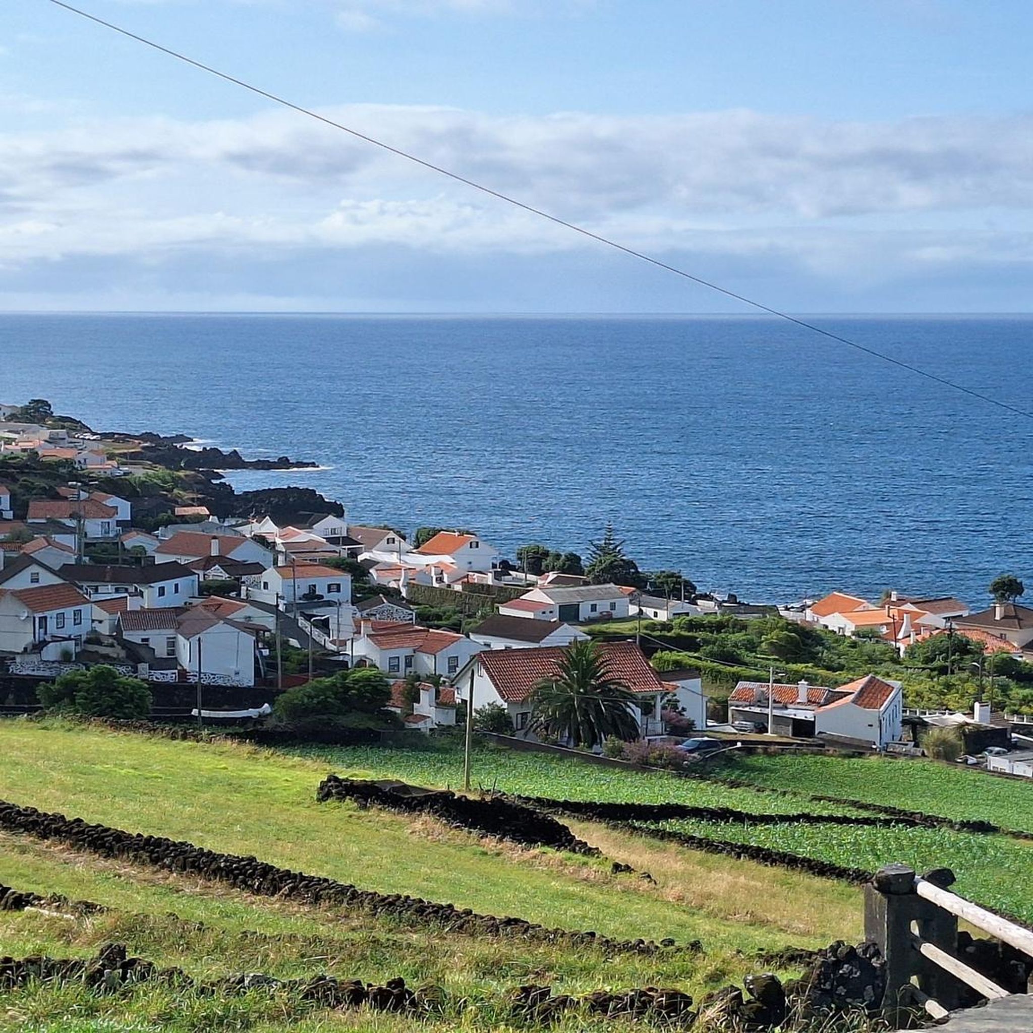
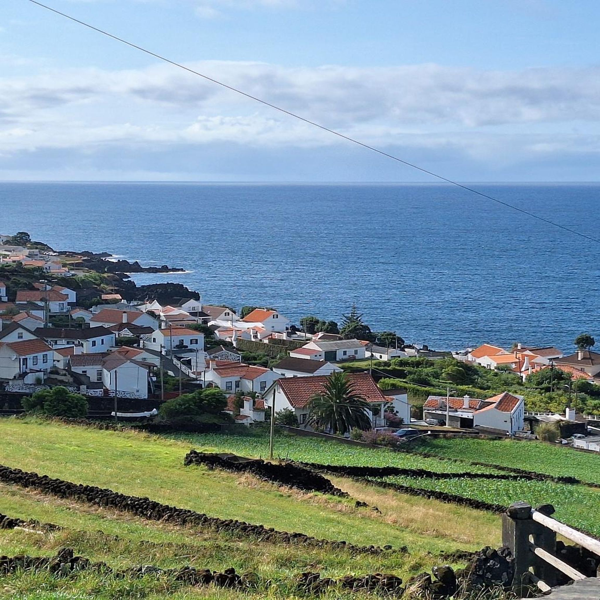
Wonderful view over the bay. Corn is grown right up to the water's edge. A steep, rustic path leads to Terra Alta (Magma Restaurant, closed on Thursdays) nearby.
0
0
A rustic path with a great view; once you reach the top, you'll be rewarded with a stop at Magma. The outdoor terrace is fantastic.
0
0
Small, well-stocked corner shop with lots of fresh fruit and vegetables.
0
0

Near the Baixa location there is a small pier. It is located on the side of a "beach", which despite the rocks and the unique access, offers a fantastic place to enter the sea.
1
0
The Alto dos Cedros Viewpoint offers a privileged view of the so-called Protected Area for the Management of Habitats or Highland Species. The long name does justice to the landscape; It is a place of pure beauty on the cliffs of Pico Island.
0
0
A restaurant worthy of Azorean cuisine. A very convenient (practically obligatory) stopping point for anyone who is on site or is traveling the PR 7 trail. It offers typical dishes from the archipelago, as well as a well-designed wine list.
2
0
Pico Island has more than 20 protected areas, with Terra Alta occupying the northwest portion of the island. This viewpoint, also called Terra Alta, is an observation point for practically every site. There is a parking lot nearby and it serves as a starting point for the so-called Caminho das Voltas.
1
0

Frequently Asked Questions
How many hiking trails are available around Santo Amaro?
There are over 60 hiking routes around Santo Amaro, offering a diverse range of experiences from easy coastal walks to more challenging trails through varied landscapes. You'll find options suitable for different fitness levels and preferences.
Are there easy hiking trails suitable for beginners or families in Santo Amaro?
Yes, Santo Amaro offers a good selection of easy hikes. For example, the Terra Alta Viewpoint loop from Santo Amaro is an easy 5.2 km trail. Another accessible option is the Café Rego – Baía do Canto loop from Santo Amaro, which is 5.6 km long and also rated easy.
What kind of terrain can I expect on hikes around Santo Amaro?
Hiking around Santo Amaro features diverse terrain, including coastal paths with panoramic ocean views, elevated viewpoints, and trails winding through lush green valleys. The volcanic origins of Pico Island contribute to varied ground conditions, though specific volcanic features are not always prominent on every trail.
Are there any circular hiking routes in Santo Amaro?
Yes, many routes around Santo Amaro are circular, allowing you to start and end at the same point. Examples include the moderate Magma Restaurant & Bar – Terra Alta Viewpoint loop from Santo Amaro (9.3 km) and the easier Terra Alta Viewpoint loop from Santo Amaro (5.2 km).
What are some notable natural attractions or landmarks to see while hiking in Santo Amaro?
Hikers can discover several interesting natural attractions. The Terra Alta Viewpoint offers stunning vistas. You can also explore the unique Lava Coastal Trail and Natural Arch – Ponta da Ilha or the dramatic Lava Rock Coastline. There are also serene spots like Caiado Lagoon and Dry Lagoon.
What do other hikers say about the trails in Santo Amaro?
The hiking routes in Santo Amaro are highly rated by the komoot community, with an average score of 4.3 stars from over 600 reviews. Hikers often praise the diverse landscapes, from coastal paths to green valleys, and the rewarding elevated viewpoints.
Are there any longer, more challenging hikes available in the area?
While most trails are easy to moderate, there are options for longer hikes. The Ribeirinha Paths Trail is a moderate 14.1 km route that takes approximately 4 hours 18 minutes to complete, offering varied landscapes and a good workout.
Can I find trails that lead to viewpoints in Santo Amaro?
Yes, many trails in Santo Amaro lead to elevated viewpoints offering spectacular scenery. The Terra Alta Viewpoint is a popular destination, accessible via several routes, including the Terra Alta Viewpoint – Magma Restaurant & Bar loop.
Are there any cultural or historical sites near the hiking trails?
Beyond natural beauty, you can visit the Whalers' Museum, which offers insight into the region's maritime history. It's a great addition to a hiking trip, providing a cultural context to the island's heritage.
What is the best way to access the trailheads in Santo Amaro?
Access to trailheads in Santo Amaro is generally by car, with parking often available near popular starting points. While specific public transport details for each trailhead are not provided, local bus services on Pico Island connect main towns, and taxis are also an option for reaching more remote starting points.
Are there any trails that pass by cafes or restaurants?
Yes, some routes offer convenient stops. For instance, the Magma Restaurant & Bar – Terra Alta Viewpoint loop from Santo Amaro is designed to include a stop at a restaurant, allowing hikers to refuel and enjoy local cuisine during their trek.
Most popular attractions around Santo Amaro

Get inspired with the komoot mobile app


Explore more
Browse the best Hikes in other regions.
