The best walks and hikes around Belinho
4.2
(184)
1,075
hikers
52
hikes
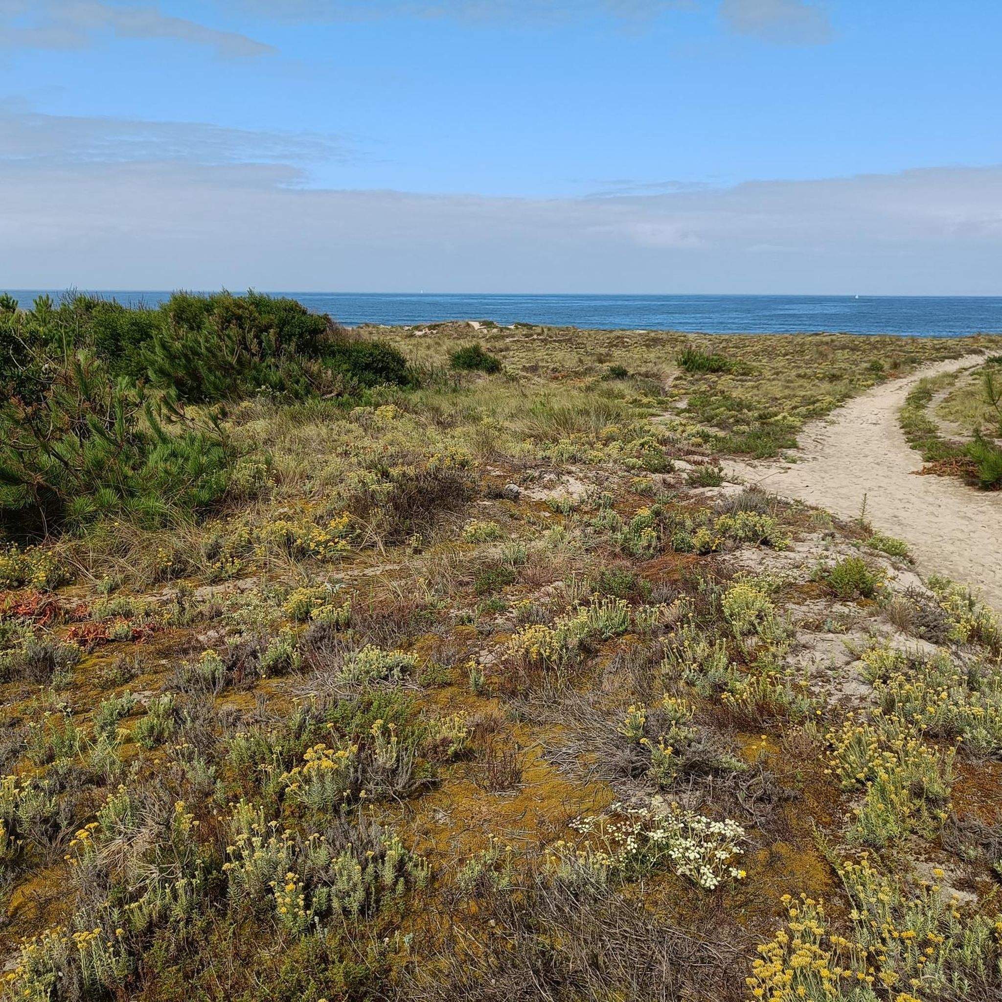
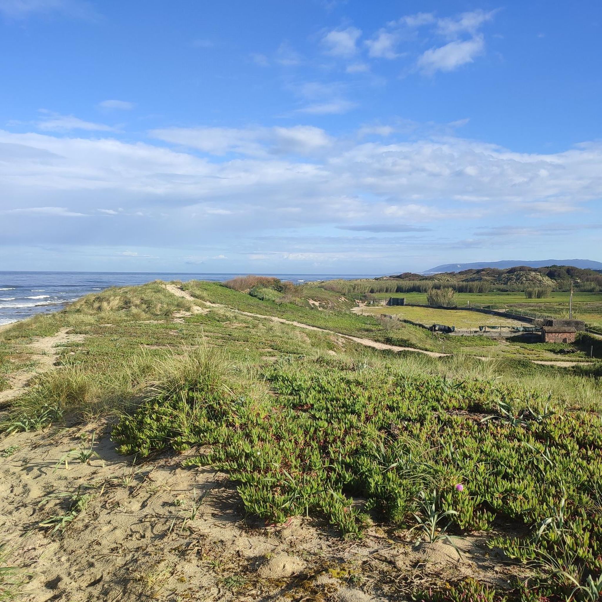
Hiking around Belinho offers diverse terrain within and near the Parque Natural do Litoral Norte. The region features expansive Atlantic dune systems, significant river estuaries like the Cávado and Neiva, and stretches of pine forests. Its Atlantic coastline includes sandy and pebbled beaches, with viewpoints such as Senhora da Guia providing panoramic views of the sea and inland hills. This landscape provides varied environments for outdoor exploration.
Best hiking trails around Belinho
- The most popular hiking route is Casa da Azenha Branca Bridge – Neiva River Trail loop from Antas, a 7.2 miles (11.6 km) trail that takes 3 hours 12 minutes to complete. This moderate route explores the Neiva River area.
- Another top favourite among local hikers is Neiva River Trail – Casa da Azenha Branca Bridge loop from São Romão de Neiva, a moderate 7.7 miles (12.4 km) path. This trail also follows the Neiva River, offering similar riparian scenery.
- Local hikers also love the Mouth of the Cávado River – Fão Bridge loop from Mar, a 10.7 miles (17.2 km) trail leading through coastal areas and river estuaries, often completed in about 4 hours 22 minutes.
- Hiking around Belinho is defined by expansive dune systems, river estuaries, and coastal paths along the Atlantic. The network offers options for different ability levels, from moderate river loops to longer coastal explorations.
- The routes in Belinho are highly rated by the komoot community with an average score of 4.1 stars from over 130 reviews. More than 900 hikers have used komoot to explore Belinho's varied terrain.
Last updated: November 3, 2026
4.1
(9)
44
hikers
11.6km
03:12
190m
190m
Moderate hike. Good fitness required. Easily walkable paths.
4.1
(10)
44
hikers
12.4km
03:22
190m
180m
Moderate hike. Good fitness required. Easily walkable paths.

4.3
(13)
63
hikers
17.2km
04:20
30m
30m
Moderate hike. Good fitness required. Easily walkable paths.
4.1
(7)
44
hikers
8.97km
02:18
40m
40m
Moderate hike. Good fitness required. Easily walkable paths.
4.0
(6)
17
hikers
12.0km
03:07
80m
80m
Moderate hike. Good fitness required. Easily walkable paths.
Get access to more routes and recommendations from other explorers.
Already have an account?
Our route recommendations are based on thousands of hikes, rides, and runs completed by other people on komoot.
Start today with a free account
Your next adventure awaits.
Tips from the Community

A wonderfull nature walk reminding me of walks in Newcastle, NSW Australia
0
0

The Metal Bridge of Fão (Esposende) Location: It crosses the Cávado River, on National Road 13 (EN13), in the parish of Fão, in Esposende. Alternative Name: It is frequently referred to as the D. Luís Filipe Bridge. History: It is a significant example of iron architecture in Portugal, inaugurated on August 7, 1892. Characteristics: The bridge, which is a Property of Public Interest, has an extensive metal structure and has recently been rehabilitated.
2
0
In Esposende, the main historical bridge that crosses the Cávado River is the Ponte Metálica de Fão, also known locally as Ponte D. Luís Filipe.
2
0
Key Information Location: Neiva River, on the border of the municipalities of Esposende and Viana do Castelo, Portugal. History: The original bridge was built in 1930 at the behest of the owner of a watermill and a fishing lodge that existed on the site at that time. Renovation: Over time, the bridge suffered damage due to the impact of fallen trees during storms. In 2020, the reconstruction of the bridge was announced, in a project financed in equal parts by the two neighboring municipalities. North Coast Ecovia: The stone bridge (reconstructed or restored) is part of a set of green infrastructures that make up the North Coast Ecovia, a pedestrian and cycle path that enhances the Neiva River estuary and connects the two municipalities, offering a bucolic and tranquil environment for walks. The bridge is a picturesque spot, frequently visited by those traveling along the ecovia, inviting a peaceful stroll and observation of the surrounding nature.
2
0
The Stone Bridge over the Neiva River, also known as Sebastião's Bridge, is a historic bridge that connects the banks of the Neiva River, serving as a border between the municipalities of Esposende (Antas parish) and Viana do Castelo (Castelo do Neiva parish), in Portugal.
2
0
Other Bridges Cávado Bridge (Planned): There is a project underway by the municipality of Esposende to build a pedestrian and cycle bridge over the Cávado River, which will connect the Cávado Ecovia to the North Coast Ecovia.
2
0
The Bridge over the Neiva River Location: The bridge is located in the parish of Antas, in the municipality of Esposende, near the mouth of the Neiva River. Characteristics: It is a pedestrian and cycle bridge with a modern design and remarkable architecture, inaugurated in 2019, which integrates perfectly into the bucolic environment of the riverbanks. Access and Use: The bridge is a crossing point on the North Coast Ecovia, accessible 24 hours a day, and invites leisurely walks or bike rides along the river. The site is wheelchair accessible and has accessible parking.
2
0
The North Coast Ecovia features a remarkable pedestrian and cycle bridge over the Neiva River, which is one of the highlights of the route. The municipality of Esposende also has plans for a new bridge on the Cávado Ecovia to connect with the North Coast Ecovia.
2
0
Frequently Asked Questions
How many hiking trails are available around Belinho?
Belinho offers a wide variety of hiking experiences, with over 50 trails available. These routes cater to different preferences, including easy walks, moderate explorations, and a few more challenging options.
What kind of terrain can I expect on hikes in Belinho?
Hiking in Belinho offers diverse terrain. You'll find expansive Atlantic dune systems, river estuaries like the Cávado and Neiva, and stretches of pine forests. Many trails also feature coastal paths along sandy and pebbled beaches, providing a mix of natural landscapes.
Are there family-friendly hiking options in Belinho?
Yes, Belinho has several easy hiking routes suitable for families. These trails often feature gentler gradients and shorter distances, allowing everyone to enjoy the natural beauty of the region, including coastal areas and riverbanks.
Are dogs allowed on hiking trails in Belinho?
Generally, dogs are welcome on many of the natural trails around Belinho, especially within the Parque Natural do Litoral Norte. However, it's always recommended to keep them on a leash, especially in protected areas or near wildlife, and to check specific trail regulations if available.
Are there circular hiking routes available in Belinho?
Yes, many of the hiking routes around Belinho are designed as loops, allowing you to start and end at the same point. For example, the Neiva River Trail – Belinho Beach loop from Belinho e Mar offers a moderate 12 km circular path combining river and coastal scenery.
What are the options for public transport to reach hiking trailheads?
While some trailheads might be accessible by local bus services, public transport options can be limited in rural areas like Belinho. It's advisable to check local bus schedules in advance or consider using a car for more flexible access to various starting points. For more detailed information on local transport, you might consult the Esposende tourism website: visitesposende.com.
Is parking available at the trailheads in Belinho?
Parking availability varies by trailhead. Many popular starting points, especially near beaches or villages, offer designated parking areas. For more remote trails, you might find informal roadside parking. It's always a good idea to plan your route and check for parking information beforehand.
What is the best time of year to hike in Belinho?
The best time to hike in Belinho is generally during spring (April to June) and autumn (September to October) when the weather is mild and pleasant. Summers can be warm, especially along the coast, while winters are typically mild but can be rainy. These shoulder seasons offer comfortable temperatures for exploring the diverse landscapes.
Are there any interesting landmarks or sights to see along the trails?
Yes, the trails around Belinho offer several points of interest. You can encounter historical bridges like the Stone Bridge over the Neiva River or the Fão Bridge. The region is also known for its natural beauty, including the Rio Neiva Estuary and various beaches like Belinho Beach, all within the Parque Natural do Litoral Norte.
What do other hikers say about the trails in Belinho?
The hiking trails in Belinho are highly regarded by the komoot community, with an average rating of 4.1 stars from over 130 reviews. Hikers often praise the region's diverse landscapes, from coastal dunes and beaches to river estuaries and pine forests, and the variety of routes suitable for different skill levels.
Can I find beaches or coastal views on hikes near Belinho?
Absolutely. Belinho is located along the Atlantic coastline, and many trails offer stunning coastal views and access to beaches. The Parque Natural do Litoral Norte, which encompasses Belinho, is famous for its extensive dune systems and beautiful stretches of sand and pebbles. The Mouth of the Cávado River – Fão Bridge loop from Mar is a great option for coastal exploration.
Are there any viewpoints offering panoramic scenery?
Yes, the viewpoint of Senhora da Guia in Belinho is a prime location to admire an extensive stretch of the Atlantic coastline, reaching towards Viana do Castelo. Looking inland, you can also appreciate the elevations of Serra da Nogueira, Monte Crasto, and Serra d'Arga, offering a comprehensive view of the region's diverse landscape.
Where can I find places to eat or drink after a hike?
Belinho and its surrounding villages offer local restaurants and cafes where you can enjoy traditional Portuguese cuisine and refreshments. Many establishments are located near the coast or in the village centers, providing convenient options to refuel after your hike.
Most popular attractions around Belinho

Get inspired with the komoot mobile app


Explore more
Browse the best Hikes in other regions.
