The best cycling routes around Larinho
34
riders
6
rides
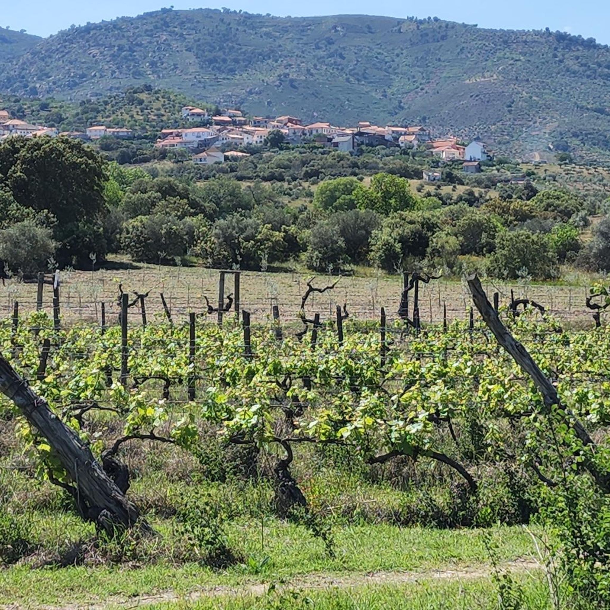
Larinho location and characteristics include a diverse topography, with 44% hills and 43% low mountains, providing varied terrain for touring cyclists. The region is nestled within Portugal's Bragança district, offering a landscape primarily composed of natural areas. It is situated near the Douro River catchment area, with the Albufeira do Pocinho reservoir located 8.9 km away. This environment supports a range of cycling experiences, from undulating roads to more strenuous climbs.
Best touring cycling routes around Larinho
- The most popular…
Last updated: May 16, 2026
9
riders
59.7km
05:33
1,520m
1,520m
Hard bike ride. Very good fitness required. Mostly paved surfaces. Suitable for all skill levels.
9
riders
73.7km
07:14
1,710m
1,700m
Hard bike ride. Very good fitness required. Mostly paved surfaces. Suitable for all skill levels.

Sign up for free
7
riders
38.8km
04:02
1,080m
1,080m
Hard bike ride. Very good fitness required. Mostly paved surfaces. Suitable for all skill levels.
3
riders
29.7km
02:01
450m
450m
Moderate bike ride. Good fitness required. Mostly paved surfaces. Suitable for all skill levels.
2
riders
35.2km
02:23
560m
560m
Hard bike ride. Very good fitness required. Mostly paved surfaces. Suitable for all skill levels.
Our route recommendations are based on thousands of hikes, rides, and runs completed by other people on komoot.
Start today with a free account
Your next adventure awaits.
Login or Signup
Popular around Larinho
Tips from the Community

Old Carmelite convent that is located on one side of the road and that allows us to see incredible views of the monastery and its walls.
0
0
Nice road, which leaves us at the entrance to Urros, on a hilly and winding road, good for riding.
0
0
Nice bridge that helps cross this stretch of the Sabor River on a big, tall bridge. Good views of the valley and the surrounding hills.
1
0
Impressive viewpoint on this descent/ascent where these two viewpoints are located, the one at this point and one further north, called the Miradouro do Vale do Sabor.
1
0

nice view along flavor ecopista
0
0
Frequently Asked Questions
How many touring cycling routes are available in Larinho?
There are over 6 touring cycling routes around Larinho, offering a variety of experiences for cyclists. These routes range from moderate to difficult, catering to different skill levels.
What is the typical terrain like for touring cyclists in Larinho?
Larinho's landscape is characterized by its diverse topography, with 44% hills and 43% low mountains. This means you can expect varied terrain, from undulating roads to more strenuous climbs, providing a good challenge for touring cyclists.
Are there any family-friendly touring cycling routes in Larinho?
While many routes in Larinho are classified as difficult, there are options for less experienced cyclists. For example, the View of Torre de Moncorvo – Larinho Station loop from Torre de Moncorvo is a moderate 19.0 km route that could be suitable for families with some cycling experience, offering a shorter duration and less elevation gain compared to the more challenging tours.
Can I find circular touring cycling routes in the Larinho area?
Yes, many of the touring cycling routes in Larinho are designed as loops. For instance, the popular Larinho Station – View of Torre de Moncorvo loop from Torre de Moncorvo is a challenging 73.6 km circular route, and the Bike loop from Torre de Moncorvo offers a moderate 29.7 km option.
What are some notable landmarks or natural features I can see along the cycling routes?
The Larinho area is rich in natural beauty and historical sites. You can cycle near the Douro River along the Ribera do Arroio, visit the São Gregório Viewpoint for panoramic views, or explore the Ruins of the Pocinho Railway District, which offer a glimpse into the region's industrial past.
What is the best time of year to go touring cycling in Larinho?
Portugal generally enjoys a mild climate with abundant sunshine, making Larinho appealing for cycling for much of the year. Spring and autumn typically offer the most comfortable temperatures for touring cycling, avoiding the peak heat of summer while still providing pleasant conditions.
Are there options for less experienced touring cyclists in Larinho?
While Larinho is known for its challenging terrain, there are moderate routes available. The View of Torre de Moncorvo – Larinho Station loop from Torre de Moncorvo is a moderate 19.0 km route, and the Bike loop from Torre de Moncorvo is a moderate 29.7 km option, both suitable for those looking for a less strenuous ride.
Where can I find challenging touring cycling routes in Larinho?
Larinho is ideal for cyclists seeking a challenge, with five out of six routes classified as difficult. The Larinho Station – View of Torre de Moncorvo loop from Torre de Moncorvo, at 73.6 km with significant elevation, is a prime example of a demanding route. Another challenging option is the Albufeira do Feiticeiro – Praia Fluvial de Foz do Sabor loop from Torre de Moncorvo, a 62.4 km path featuring sections near water bodies.
Is Larinho suitable for touring cyclists looking for routes near water bodies?
Yes, Larinho is situated near the Douro River catchment area, with the Albufeira do Pocinho reservoir just 8.9 km away. Routes like the Albufeira do Feiticeiro – Praia Fluvial de Foz do Sabor loop from Torre de Moncorvo feature sections near water, offering scenic views of the region's aquatic landscapes.
What kind of historical sites can I explore while cycling in Larinho?
The region offers a deep connection to Portuguese roots. Cyclists can visit the Ruins of the Pocinho Railway District, a 19th-century goods warehouse, providing a glimpse into the area's industrial heritage. The broader Trás-os-Montes region also features castles and medieval fortresses, offering a rich historical context to your ride.
Are there any specific viewpoints worth visiting on a touring cycling trip?
Absolutely. The São Gregório Viewpoint is a notable spot that offers stunning vistas of the surrounding landscape, making it a rewarding stop on your touring cycling adventure in Larinho.
What do other touring cyclists say about their experience in Larinho?
Over 35 touring cyclists have used komoot to explore Larinho's varied terrain. They often praise the region's diverse landscapes, which include hills, low mountains, and natural areas within the Douro River valley, providing a range of challenging and scenic cycling experiences.
Are there any rail trails or Ecopistas suitable for touring cycling in the region?
Yes, Northern Portugal, where Larinho is located, features 'rail trails' (Ecopistas or Pistas Verdes) which convert old railway lines into paths for non-motorized use. The Sabor Greenway: Carviçais–Torre de Moncorvo is an example of such a path, offering a more relaxed and scenic cycling experience, often on permeable surfaces like dirt or gravel in rural settings.
Most popular routes around Larinho
Most popular attractions around Larinho

Get inspired with the komoot mobile app


Explore more
Browse the best Cycling routes in other regions.
