The best road cycling routes around Souto Da Velha
40
riders
6
rides
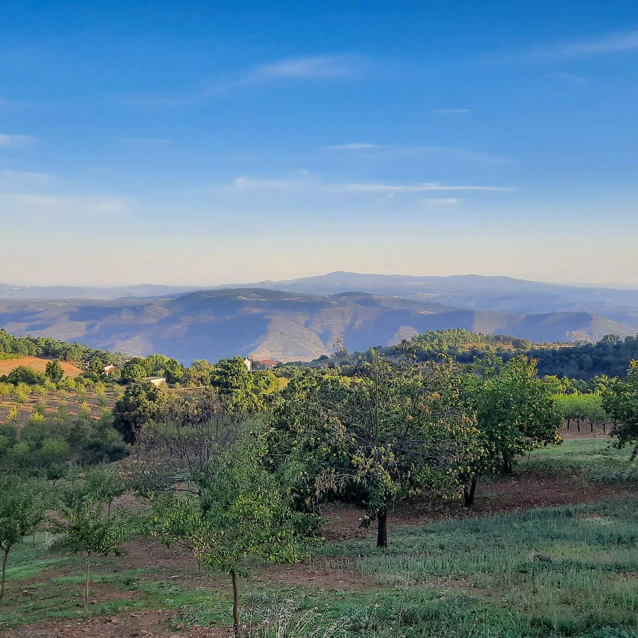
Road cycling routes around Souto Da Velha traverse a landscape characterized by rolling hills, river valleys, and agricultural areas. The region features significant elevation changes, offering challenging climbs and descents. This terrain provides varied road cycling experiences, from routes along the Douro River to paths through historic towns and rural settings.
Best road cycling routes around Souto Da Velha
- The most popular road cycling route is Torre de Moncorvo and Douro Almond Route, a 49.0 miles (78.9 km) trail…
Last updated: July 2, 2026
5
riders
78.9km
04:04
1,410m
1,410m
This difficult 49.0-mile road cycling route in Douro International Natural Park offers stunning views and challenging climbs.
4
riders
50.4km
02:49
1,140m
1,140m
Hard road ride. Very good fitness required. Mostly well-paved surfaces and easy to ride.

Sign up for free
14
riders
99.9km
05:18
1,790m
1,790m
Hard road ride. Very good fitness required. Mostly well-paved surfaces and easy to ride.
5
riders
36.5km
02:02
720m
720m
Moderate road ride. Good fitness required. Mostly well-paved surfaces and easy to ride.
2
riders
51.3km
03:12
1,200m
1,200m
Hard road ride. Very good fitness required. Mostly well-paved surfaces and easy to ride.
Our route recommendations are based on thousands of hikes, rides, and runs completed by other people on komoot.
Start today with a free account
Your next adventure awaits.
Login or Signup
Popular around Souto Da Velha
Tips from the Community

Beautiful location, also visit the cemetery
0
0

Old Carmelite convent that is located on one side of the road and that allows us to see incredible views of the monastery and its walls.
0
0
After the town of Açoreira is this road that allows us to see the impressive views of these mountains in a magnificent stretch.
0
0
Beautiful town of Freixo de Espada-à-Cinta that allows us to see its round tower in the center of the same town.
0
0
Nice road, which leaves us at the entrance to Urros, on a hilly and winding road, good for riding.
0
0
At this fork of the Douro River, which is called the Ribera do Arroio, this road appears that reaches the two towns that are above the river terrace of the same river, Açoreira and Peredo Dos Castelhanos.
0
0
Nice bridge that helps cross this stretch of the Sabor River on a big, tall bridge. Good views of the valley and the surrounding hills.
1
0
Impressive viewpoint on this descent/ascent where these two viewpoints are located, the one at this point and one further north, called the Miradouro do Vale do Sabor.
1
0
Frequently Asked Questions
What kind of terrain can I expect on road cycling routes around Souto Da Velha?
The region around Souto Da Velha is characterized by rolling hills, river valleys, and agricultural areas, particularly known for its distinctive almond groves. You can expect significant elevation changes, offering both challenging climbs and rewarding descents, with routes often following the Douro River or passing through historic towns and rural settings.
Are there road cycling routes suitable for beginners in Souto Da Velha?
The road cycling routes around Souto Da Velha primarily cater to experienced road cyclists due to significant elevation changes and challenging terrain. All routes listed in this guide are rated as 'difficult' or 'moderate', suggesting that beginners might find them quite demanding.
What is the typical duration for road cycling routes in this area?
Route durations vary depending on the distance and elevation. For example, the Torre de Moncorvo and Douro Almond Route, at 78.9 km, typically takes around 4 hours 4 minutes, while the 50.4 km Rio Duero along the Ribera do Arroio and city of Urros — circular from Torre de Moncorvo can be completed in about 2 hours 49 minutes.
Are there any circular road cycling routes available?
Yes, several routes are designed as loops. A popular option is the Rio Duero along the Ribera do Arroio and city of Urros — circular from Torre de Moncorvo, which offers river views and rural landscapes. Another is the Pocinho Station – Pastry shop in Moncorvo loop from Torre de Moncorvo.
What scenic views or attractions can I expect along the road cycling routes?
Road cycling routes in Souto Da Velha offer diverse scenic views, including the Sabor River Valley and agricultural landscapes, especially during almond blossom season. You can also pass by points of interest like the Scenic road between Açoreira and Pocinho and the Carmel of the Holy Family Monastery.
Are there places to stop for refreshments or food along the routes?
Yes, some routes pass through or near towns where you can find places for refreshments. For instance, the Pastry shop in Moncorvo – Pocinho Station loop from Castelo Branco includes a stop at a Pastry shop in Moncorvo, offering a chance to refuel.
When is the best time of year for road cycling in Souto Da Velha?
The region's climate, with its hot, dry summers and mild winters, makes spring and autumn ideal for road cycling. Spring offers pleasant temperatures and the beauty of almond blossoms, while autumn provides cooler weather and vibrant fall colors. Summers can be very hot, and winters, though mild, may bring more unpredictable weather.
What are the most challenging road cycling routes in Souto Da Velha?
Many routes in the area are considered challenging due to significant elevation gains. The Pastry shop in Moncorvo – Pocinho Station loop from Castelo Branco is a difficult 99.9 km path with extensive climbs, and the Torre de Moncorvo and Douro Almond Route also features substantial elevation gain through its 78.9 km.
Is it possible to combine road cycling with public transport in Souto Da Velha?
While specific public transport options directly to trailheads may be limited, the region has train stations like Pocinho, which could serve as starting or ending points for some routes. For example, the Pocinho Station – Pastry shop in Moncorvo loop from Torre de Moncorvo starts near a station, potentially allowing for public transport access.
Where can I find parking for road cycling routes in Souto Da Velha?
Parking availability will vary by starting point. Many routes begin in or near towns like Torre de Moncorvo or Castelo Branco, where public parking is generally available. It's advisable to check specific starting locations on komoot for detailed parking information before your ride.
What do other road cyclists enjoy most about the routes in Souto Da Velha?
Road cyclists often praise the challenging hills, the stunning river views along the Douro, and the unique agricultural scenery, especially the almond groves. The region offers a rewarding experience for those seeking varied terrain and a good workout, with over 30 road cyclists having explored these routes using komoot.
Most popular routes around Souto Da Velha
Most popular attractions around Souto Da Velha

Get inspired with the komoot mobile app


Explore more
Browse the best Road cycling routes in other regions.
