The best road cycling routes around Celas
66
riders
5
rides
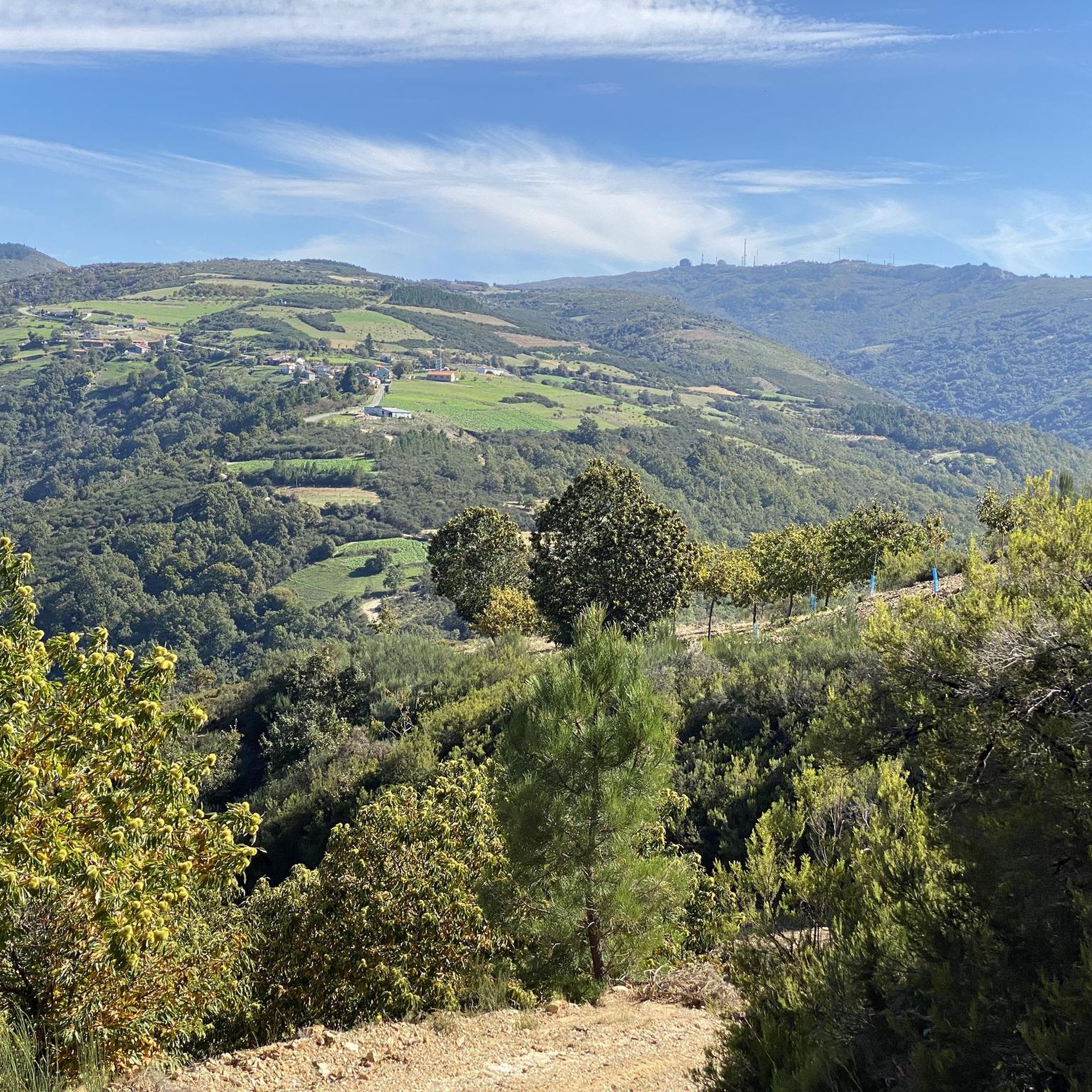
Road cycling routes around Celas are characterized by varied terrain, including rolling hills and more challenging ascents. The region features a mix of agricultural landscapes, forested areas, and small villages. Cyclists can expect routes that traverse diverse natural settings, offering both open stretches and winding roads. The area provides a network of road cycling routes suitable for those seeking a physical challenge.
Best road cycling routes around Celas
- The most popular road cycling route is View of Pinela and Serapicos…
Last updated: June 28, 2026
2
riders
50.6km
02:39
850m
850m
Moderate road ride. Good fitness required. Mostly well-paved surfaces and easy to ride.
1
riders
68.7km
03:41
1,350m
1,350m
Hard road ride. Very good fitness required. Mostly well-paved surfaces and easy to ride.

Sign up for free
59.6km
03:27
1,270m
1,270m
Hard road ride. Very good fitness required. Some segments of this route may be unpaved and difficult to ride.
58
riders
92.0km
04:53
1,440m
1,440m
Hard road ride. Very good fitness required. Mostly well-paved surfaces and easy to ride.
4
riders
53.4km
02:34
730m
730m
Moderate road ride. Good fitness required. Mostly well-paved surfaces and easy to ride.
Our route recommendations are based on thousands of hikes, rides, and runs completed by other people on komoot.
Start today with a free account
Your next adventure awaits.
Login or Signup
Popular around Celas
Tips from the Community

With the administrative reform of 1853, Macedo de Cavaleiros became one of the municipalities of Portugal. This elevation to the status of municipality was met with opposition, both in rural areas, where the struggles between those in favour of the old and the new municipality lasted until 1911, and in parliamentary circles, triggered mainly by the deputy for the Moncorvo constituency, João Pedro de Almeida Pessanha. Even so, the municipality was confirmed by royal decree on 24 October 1855. On 15 January 1863, Macedo de Cavaleiros was elevated to the status of town. In 1903, the railway was built, establishing the Tua line, which naturally gave a strong economic boost to the region. Finally, on 13 May 1999, Macedo de Cavaleiros was elevated to the status of city.
3
0

He believes that it is in the same town of Torre de Dona Chama and that it represents one of the town's most important architectural elements.
0
0
Impressive cobbled old town with a beautiful main street where you have to take your bike firmly and firmly!
0
0
Nice road that goes in the direction of the town of Nogueira first and then towards Bragança.
1
0
Beautiful town located in this area crossed by the Sabor River on its eastern side. Within the town is the Igreja de Izeda.
1
0
Small town that is located in this area close to Izeda and that is surrounded by roads that green forests and fields of tree cultivation.
0
0
Well-known city in this area of Portugal thanks to the nearby Albufeira do Azibo, a humid area that offers beach areas and roads with good views.
0
0
Small town located a few kilometers from Bragança, in a land of hills and small towns in round mountains!
0
0
Frequently Asked Questions
How many road cycling routes are available around Celas?
There are over 7 road cycling routes documented around Celas on komoot, offering a variety of challenges for cyclists.
What kind of terrain can I expect when road cycling in Celas?
Celas offers a diverse landscape for road cycling, characterized by rolling hills, agricultural plains, and forested sections. You'll find routes that traverse varied natural settings, providing both open stretches and winding roads, often with significant elevation gains.
Are there any easy road cycling routes for beginners in Celas?
While many routes in Celas are considered challenging, there is at least one moderate route suitable for those looking for a less strenuous ride. The View of Pinela and Serapicos — circular from Santa Comba de Rossas is a moderate 50.6 km trail with an elevation gain of over 800 meters.
What are some challenging road cycling routes in Celas for experienced riders?
For experienced road cyclists seeking a challenge, Celas offers several difficult routes. Consider the Agrochão, Torre de Dona Chama o Macedo de Cavaleiros — circular pelo ribero de Ferreira, a demanding 68.7 km path with over 1350 meters of climbing, or the even longer Vinhais Castle – Historic Center of Vinhais loop from Bragança, which spans 134.5 km with over 2000 meters of elevation gain.
Are there any circular road cycling routes in Celas?
Yes, many of the road cycling routes in Celas are circular, allowing you to start and end at the same point. Examples include the View of Pinela and Serapicos — circular from Santa Comba de Rossas and the Agrochão and Montesinho-Nogueira Site of Community Importance — circular.
What can I see along the road cycling routes in Celas?
Road cycling routes around Celas offer opportunities to discover various points of interest. You might pass by the Scenic Road to Nogueira, a notable viewpoint, or historical sites like the Church of Saint Michael of Soutelo Mourisco. Natural features like the Ranca Bridge (Tuela River) are also accessible.
Are there any routes that go through protected natural areas?
Yes, the Agrochão and Montesinho-Nogueira Site of Community Importance — circular is a 59.6 km trail that leads through protected natural areas, offering a chance to experience the region's biodiversity.
What is the best time of year for road cycling in Celas?
While specific seasonal details for Celas are not provided, regions with similar varied terrain in Spain often benefit from a mild climate, making them popular for cycling year-round. However, for challenging routes with significant elevation, spring and autumn typically offer the most comfortable temperatures.
What do other road cyclists enjoy the most about road cycling in Celas?
Over 120 road cyclists have used komoot to explore Celas's varied terrain. They often praise the region's challenging routes and diverse landscapes, which include rolling hills, agricultural plains, and forested sections, providing a rewarding experience for those seeking a physical challenge.
Are there any routes that offer particularly scenic viewpoints?
Yes, some routes in Celas will lead you to beautiful vistas. The Scenic Road to Nogueira is highlighted as a viewpoint, and routes like the Agrochão – Scenic Road to Nogueira loop from Antigo apeadeiro e posto do guarda da passagem de nível de Remisquedo incorporate such picturesque sections.
What is the longest road cycling route available in Celas?
The longest road cycling route currently available in Celas is the Vinhais Castle – Historic Center of Vinhais loop from Bragança, which covers an impressive 134.5 km with over 2000 meters of elevation gain, making it a significant challenge for endurance cyclists.
Most popular routes around Celas
Most popular attractions around Celas

Get inspired with the komoot mobile app


Explore more
Browse the best Road cycling routes in other regions.
