The best walks and hikes around Segura
4.2
(5)
26
hikers
9
hikes
Hiking around Segura offers access to the Sierra de Segura mountain range, part of the Sierras de Cazorla, Segura y Las Villas Natural Park. This region is characterized by extensive pine forests, deep river valleys, and rugged rocky massifs. The diverse geology includes limestone formations, providing varied terrain for outdoor activities.
Best hiking trails around Segura
- The most popular hiking route is Peñafiel Castle Trail, a 5.6 miles (9.0 km) trail that takes 2 hours 22 minutes to complete.…
Last updated: June 24, 2026
3.0
(1)
6
hikers
9.00km
02:23
80m
80m
Hike the moderate 5.6-mile Castillo de Peñafiel Salvaterra round trip from Zarza la Mayor, exploring history and nature in Tajo Internaciona
22.6km
06:15
390m
390m
Hard hike. Very good fitness required. Easily-accessible paths. Suitable for all skill levels.

Sign up for free
Moderate hike. Good fitness required. Mostly accessible paths. Sure-footedness required.
8.14km
02:07
50m
60m
Hike the 5.1-mile Dolmen Pata de Buey round trip from Zarza la Mayor, a moderate route exploring ancient history and Extremadura's diverse l
16.1km
04:21
210m
210m
Hike 10 miles (16.1 km) from Piedras Albas to the historic Roman Segura International Bridge, a moderate round trip with 705 feet of elevati
Get access to more routes and recommendations from other explorers.
Sign up for free
Already have an account?
Our route recommendations are based on thousands of hikes, rides, and runs completed by other people on komoot.
Start today with a free account
Your next adventure awaits.
Login or Signup
Popular around Segura
Tips from the Community

The Erjas River (also known as the Eljas River in Spain and the Erges River in Portugal) is a tributary of the Tagus River that serves as a natural border between Spain and Portugal for approximately 50 km.
6
0
Salvaterra do Extremo is a picturesque village in Portugal, known for its stunning views and natural surroundings.
8
0
The Mirador de la Caseta del Río Erjas, also known as the Eljas River in Portuguese, is a picturesque place that offers stunning views on the border between Spain and Portugal.
9
0
On the Spanish side, the bridge is located in the municipality of Alcántara in the province of Cáceres. It is reached via the regional highway EX-207 from the nearby town of Piedras Albas. On the Portuguese side, it connects with a local road to reach the town of Segura, from which this bridge takes its name. It was built in the Roman province of Lusitania to give continuity to the Roman road that connected Norba Caesarina (on the Via de la Plata) with the civitas Egitania (Idanha-a-Velha, Portugal) and with Bracara Augusta (Braga, Portugal), in order to save the Erjas river. This river marks the border line between Spain and Portugal, and the bridge serves as an international crossing between both countries.
9
0
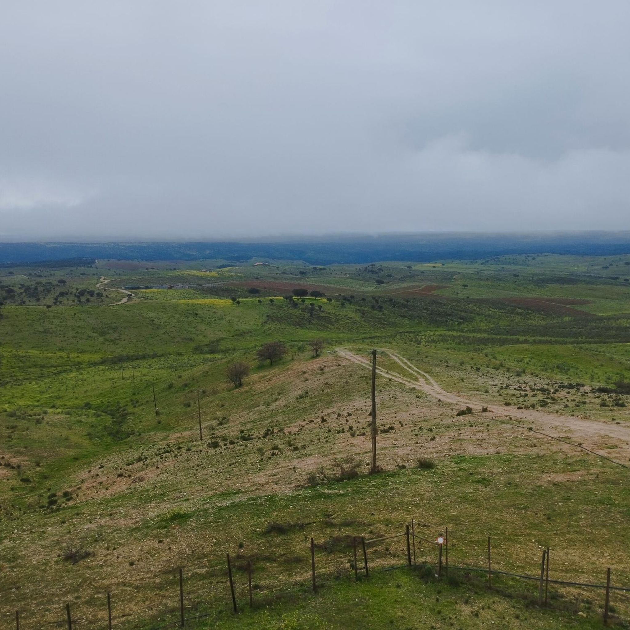
The Cañada Real de Gata is a short-distance hiking route that offers great scenic value as it passes entirely through the surroundings of the Tajo Internacional Natural Park in Extremadura.
7
0
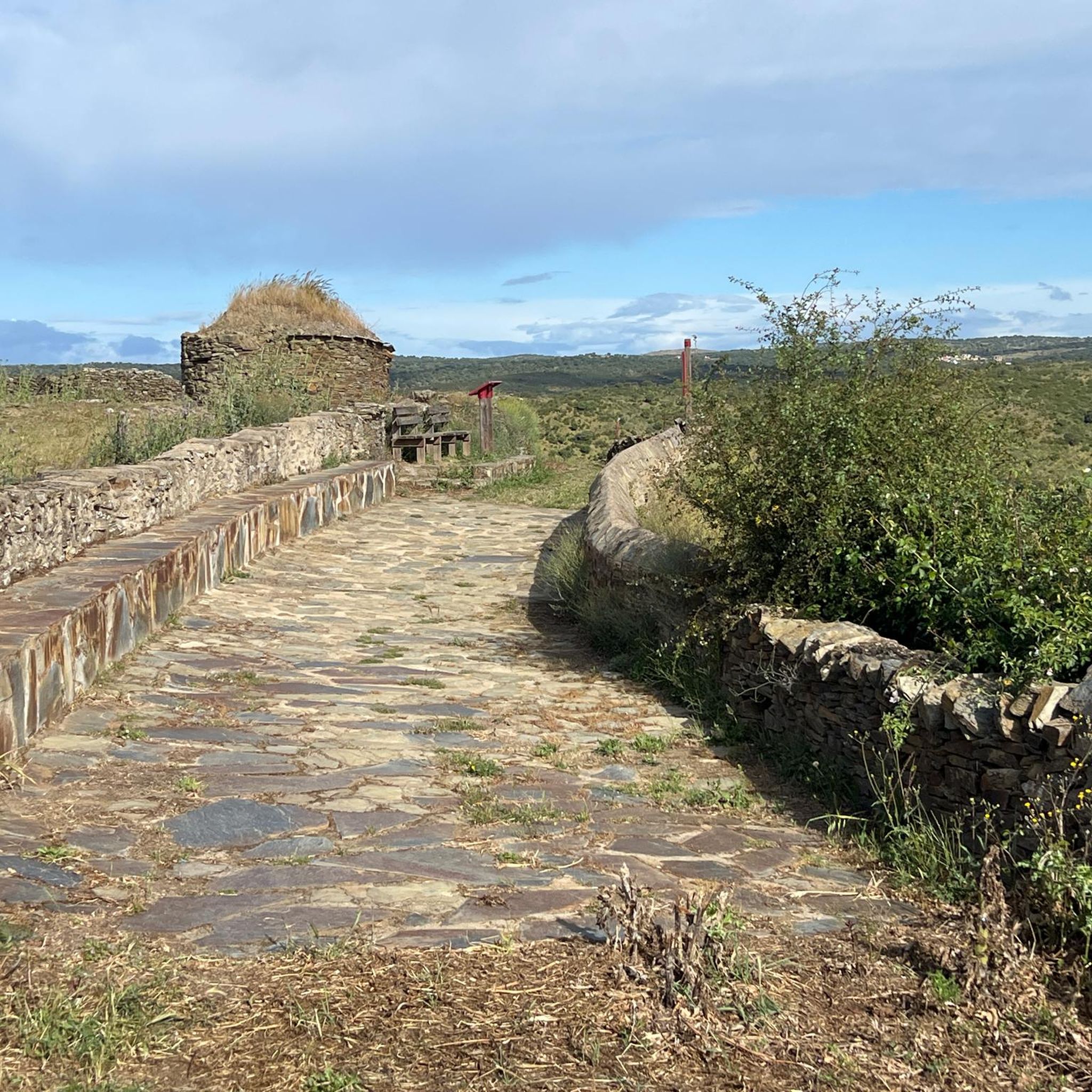
Peñafiel Castle, also known as Racha Rachel Castle, is an old fortification located in the municipality of Zarza la Mayor, in the province of Cáceres. The construction of the castle dates back to the 13th century. It was built on the remains of a fortress of Arab origin from the 9th century. King Alfonso IX conquered the fortress in 1212 and granted it to the Order of Alcántara, thus forming an important commandery.
11
0
The Pata de Buey Dolmen is a funerary structure that consists of a large chamber with an approximate diameter of 3 meters. The slate slabs that formed the chamber have remained mostly on the same side, especially in the areas adjacent to the corridor. In the northeast sector, there are also three small slabs.
8
0
Zarza la Mayor is a Spanish town and municipality, located in the province of Cáceres, in the autonomous community of Extremadura. It belongs to the judicial district of Cáceres and is the westernmost town in the community of Rivera de Fresnedosa. Furthermore, it is the only municipality in said community that has a border with Portugal, located four kilometers in a straight line from Salvaterra do Extremo.
10
0
Frequently Asked Questions
What kind of terrain can I expect on hiking trails around Segura?
Hiking around Segura offers a diverse landscape, characterized by extensive pine forests, deep river valleys, and rugged rocky massifs. You'll encounter varied geology, including limestone and dolomite formations, with altitudes ranging significantly. Trails can feature everything from gentle paths along rivers to challenging ascents through mountainous terrain.
Are there any family-friendly hiking options in the Segura area?
Yes, the Segura region offers hiking options suitable for families. While specific family-friendly routes are not detailed in the provided data, the diverse terrain means there are paths of varying difficulty. Look for trails with less elevation gain and shorter distances for a more relaxed family outing. The natural park's beauty, with its forests and rivers, provides an engaging environment for children.
Can I bring my dog on the hiking trails in Segura?
Many trails in natural parks like Sierras de Cazorla, Segura y Las Villas generally allow dogs, often requiring them to be on a leash to protect wildlife and ensure other hikers' safety. It's always advisable to check specific park regulations or local signage for any restrictions, especially regarding protected areas or during certain seasons. Be aware of pine processionary caterpillars, which can be a hazard for dogs in pine forests during spring.
Are there any circular hiking routes available around Segura?
Yes, there are circular routes in the area. For example, the Menhir del Cabezo from Piedras Albas — circular via Ruta de la Cañada Real de Gata is a moderate 5.8-mile (9.3 km) loop. The broader region also features the extensive GR 247 (Bosques del Sur), a large circular route connecting emblematic areas of the Biosphere Reserve.
What natural features or landmarks can I see while hiking in Segura?
The Segura region is rich in natural beauty and historical sites. You can explore the headwaters of the Guadalquivir and Segura rivers, impressive river routes like the Borosa River trail with its waterfalls, and natural spots such as the Charco del Aceite. The area also boasts Spain's largest continuous pine forest. For historical landmarks, the village of Segura de la Sierra itself is a historical-artistic site with a Mudéjar Castle and ancient walls. Nearby, you can find highlights like the Alcántara Roman Bridge or the Roco-Campofrío Palace.
What is the best time of year to go hiking in Segura?
The Sierras de Cazorla, Segura y Las Villas Natural Park, where Segura is located, offers hiking opportunities throughout much of the year. Spring and autumn are generally ideal, with pleasant temperatures and vibrant landscapes. Summer can be hot, especially at lower altitudes, making early mornings or higher elevation trails preferable. Winter hiking is possible, but some higher routes may experience snow and require appropriate gear.
Are there any trails that follow rivers or feature water elements?
Yes, the region is known for its significant river systems. The Borosa River trail is particularly famous for its spectacular scenery, wooden footbridges, and waterfalls. The Salvaterra do Extremo from Zarza la Mayor — circular by the Río Erjas also follows the Río Erjas, showcasing beautiful riverine landscapes. The presence of numerous fountains and springs throughout the park adds to the allure of many trails.
Do I need any permits to hike in the Sierras de Cazorla, Segura y Las Villas Natural Park?
For general day hikes on marked trails within the Sierras de Cazorla, Segura y Las Villas Natural Park, permits are typically not required. However, certain activities, such as camping, specific climbing routes, or accessing highly restricted areas, might require authorization. It's always a good practice to check with the park's official information centers for the most current regulations, especially if planning an activity beyond a standard day hike.
What do other hikers enjoy most about the trails around Segura?
The trails around Segura are highly rated by the komoot community, with an average score of 4.2 stars. Hikers often praise the region's stunning natural beauty, the extensive pine forests, and the varied terrain that offers options for different ability levels. The presence of significant river systems and historical landmarks also contributes to a rich hiking experience.
Are there any easy or beginner-friendly hiking trails near Segura?
Yes, among the available routes, there are options suitable for beginners. While the Peñafiel Castle Trail is rated moderate, it offers a manageable distance of 5.6 miles (9.0 km) with relatively low elevation gain, making it accessible for those with a basic fitness level. The park's diverse network includes paths that are less demanding, perfect for a gentle introduction to hiking in the region.
Where can I find parking for trailheads in the Segura area?
Parking availability varies by trailhead. Many popular starting points for hikes within the Sierras de Cazorla, Segura y Las Villas Natural Park, including those near Segura, often have designated parking areas, especially at recreational zones or visitor centers. For specific routes, it's recommended to check the route details on komoot or local park information for precise parking locations.
Are there any long-distance hiking routes in the Segura region?
Yes, the Segura region is part of a network of long-distance trails. The most notable is the GR 247 (Bosques del Sur), a large circular hiking route that connects many emblematic areas of the Biosphere Reserve. Other significant long-distance trails, such as the GR 144, GR 146, and GR 147, also traverse the area, offering extensive journeys through forests, valleys, and villages for experienced hikers.
Most popular routes around Segura
Most popular attractions around Segura

Get inspired with the komoot mobile app


Explore more
Browse the best Hikes in other regions.
