The best running trails around São Paio De Gramaços
5.0
(1)
62
runners
8
runs
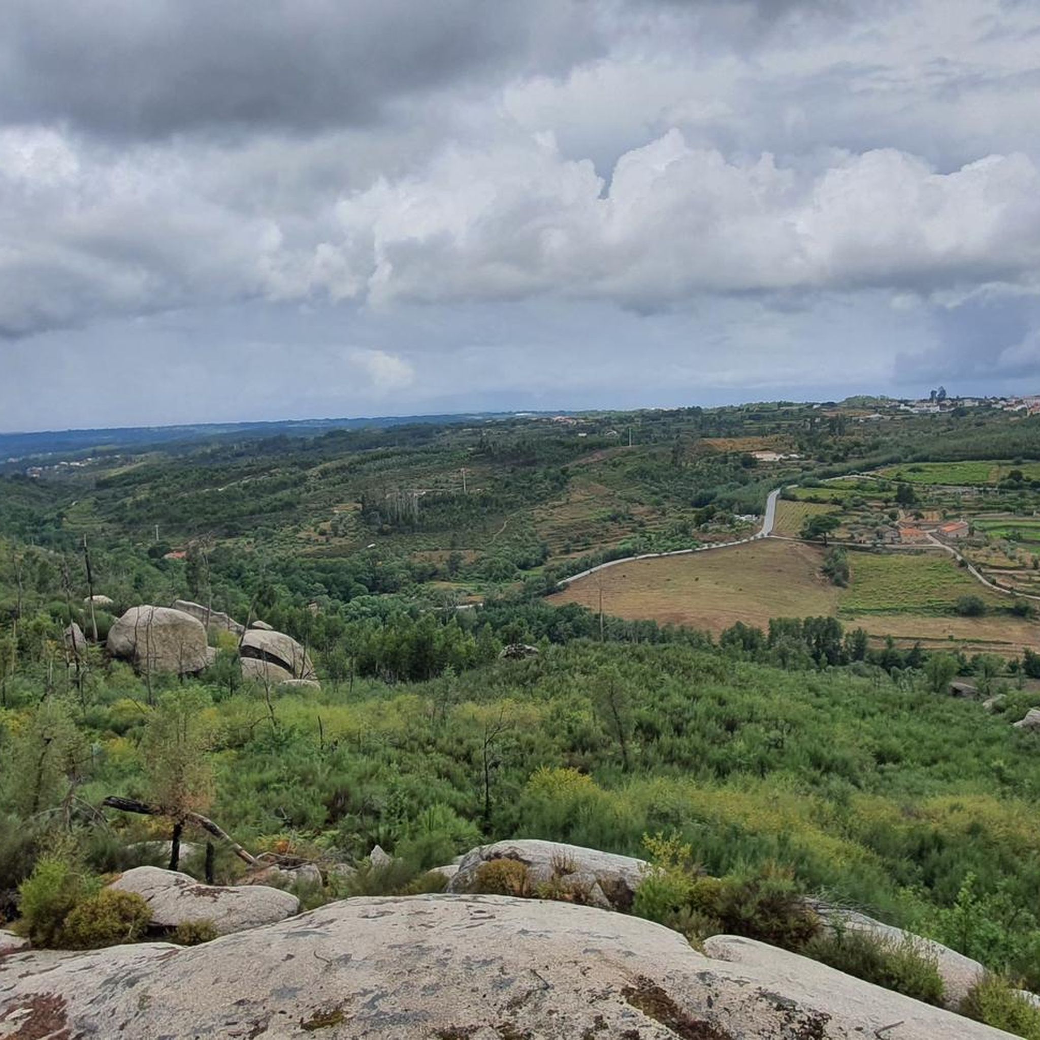
Jogging around São Paio De Gramaços offers a diverse landscape for runners, characterized by rolling hills and varied terrain. The region features routes with significant elevation changes, providing challenging options for advanced runners. Trails often lead through natural settings, with some routes exploring local landmarks and forested areas.
Best jogging routes around São Paio De Gramaços
- The most popular jogging route is Oh Meu Deus 50k Trail, a 35.4 miles (57.0 km) trail that takes 8 hours 32 minutes…
Last updated: July 8, 2026
8
runners
57.0km
08:32
2,990m
3,050m
Hard run. Very good fitness required. Mostly paved surfaces. Suitable for all skill levels.
12
runners
14.0km
02:09
720m
720m
Hard run. Very good fitness required. Mostly paved surfaces. Suitable for all skill levels.

Sign up for free
7
runners
8.50km
00:55
120m
130m
Moderate run. Good fitness required. Mostly paved surfaces. Suitable for all skill levels.
7
runners
9.65km
01:03
140m
140m
Moderate run. Good fitness required. Mostly paved surfaces. Suitable for all skill levels.
5
runners
13.7km
01:52
550m
550m
Hard run. Very good fitness required. Mostly paved surfaces. Suitable for all skill levels.
Get access to more routes and recommendations from other explorers.
Sign up for free
Already have an account?
Our route recommendations are based on thousands of hikes, rides, and runs completed by other people on komoot.
Start today with a free account
Your next adventure awaits.
Login or Signup
Popular around São Paio De Gramaços

Tips from the Community

The Devil's Horns are a prominent granite rock formation with two horn-like points, located in the Serra da Estrela mountain range, near Lapa dos Dinheiros and Senhora do Desterro (not in Gerês, but in Seia, Portugal). They are the highlight of a famous circular hiking trail that follows a water channel and the Caniça stream, offering stunning landscapes, lagoons, and waterfalls. 👍🥾
0
0

The Lapa dos Dinheiros river beach is in perfect harmony with nature. Located in the parish of Lapa dos Dinheiros, on the Caniça River, a right-bank tributary of the Alva River, this bathing area is nestled in a mountainous landscape dominated by the Lapa Souto (south of Lapa) and imposing granite outcrops. With clear water, very appealing for swimming, the beach boasts the award for accessible beach and has lifeguards and a bar available to visitors. The rugged terrain of the valley causes the river to form a succession of small waterfalls nearby. The Lapa Souto, in addition to its valuable collection of centuries-old chestnut trees, is also home to a high level of biodiversity. From the bridge, a pedestrian path leads to the Moura Hole and a viewpoint over the Caniça Waterfalls. The Buraco da Moura is a natural cave system created by the sliding and accumulation of large granite blocks, which formed a complex system of rooms and galleries. How to get there? Once in Seia, follow the EN231 to S. Romão. From there, continue uphill for about 5 km, toward Loriga/Lapa, until you find the sign for Lapa dos Dinheiros on the left. Once inside the town, simply follow the beach signs. Coordinates: 40º 23′ 07.0″ N / 7º 41′ 50.1″ W
1
0

The Serra da Estrela Natural Park is something truly special. This 1,000-square-kilometer park, spread across six municipalities, was the first and currently the largest protected natural park in Portugal. It is home to the highest point on the Portuguese mainland, the country's only ski slope, the source of two important rivers, and a fascinating, alpine-like landscape formed by glaciers.
5
1
At exactly 1993 meters above sea level, Torre is the highest point in mainland Portugal, where the only ski resort is located. The landscape on the upper plateau of the Serra da Estrela is like a sprinkling of granite rocks over low scrub and patches of snow and ice, which the sun threatens to melt soon in the summer and which always returns the following winter. In winter, it sometimes becomes inaccessible.
6
0

Caution: collapsed path (also aqueduct) 2.5 km from the start. Possible but dangerous passage.
3
0

Monte do Colcurinho is an imposing peak of about 1,242 meters in the Serra do Açor, Portugal. It offers spectacular views that extend from the Serra da Estrela to much of central Portugal. In addition to its natural beauty, it is an important religious site, with a sanctuary dedicated to Nossa Senhora das Necessidades, a destination for annual pilgrimages. It is a place that combines breathtaking nature and deep spirituality.
0
0

The enigmatic Devil's Horns rise from the granite, defying the sky with their six-metre height. Sculpted by erosion over the centuries, they earned this bold name thanks to their sharp and imposing profile. But the charm doesn't end there: around this unique formation, there are small crystal-clear lagoons and serene waterfalls, creating a true natural refuge that seems to have come straight out of a fantasy story.
3
1
Nestled on the banks of the Caniça river, a tributary of the Alva river, this beach area is a haven in the middle of a mountainous landscape, where ancient chestnut trees and granite blocks shape the scenery. The crystal-clear, inviting water is perfect for a refreshing dip. The beach, which has been awarded the title of accessible, has lifeguards and a bar, making the experience even more enjoyable.
3
0
Frequently Asked Questions
Are there running routes suitable for beginners in São Paio De Gramaços?
While there are no routes specifically classified as 'easy' in the immediate area, São Paio De Gramaços offers several moderate running trails that are suitable for those looking for a less strenuous experience. A good option is the Running loop from Oliveira do Hospital e São Paio de Gramaços, which is 8.5 km long and takes about 54 minutes to complete.
What options are available for experienced runners seeking a challenge in São Paio De Gramaços?
São Paio De Gramaços is well-suited for advanced runners, featuring several difficult routes with significant elevation changes. The most challenging is the Oh Meu Deus 50k Trail, a 57 km path with substantial elevation gain. Another demanding option is the Monte Colcurinho loop from Casal Cimeiro, an 14.2 km route with notable climbs.
Are there any circular running routes in São Paio De Gramaços?
Yes, many of the running routes in São Paio De Gramaços are designed as loops, offering convenient circular paths. For example, the Running loop from Oliveira do Hospital e São Paio de Gramaços and the Monte Colcurinho loop from Casal Cimeiro are both popular circular options.
What is the best time of year for jogging in São Paio De Gramaços?
The region experiences warm, dry summers and mild, wet winters. Spring (April-June) and Autumn (September-November) generally offer the most pleasant conditions for jogging, with moderate temperatures and less rainfall. However, routes are accessible year-round, with winter runs offering a different, often quieter, experience.
Are there any running trails where I can spot wildlife?
Many of the trails in São Paio De Gramaços lead through natural settings and forested areas, providing opportunities for wildlife spotting. Keep an eye out for local bird species and small mammals, especially during quieter times of the day like early mornings or late afternoons. The more secluded routes, such as those venturing into the hills, are often best for this.
What do other runners enjoy most about jogging in São Paio De Gramaços?
The running routes in São Paio De Gramaços are highly rated by the komoot community, with an average score of 5.0 stars. Reviewers often praise the varied terrain, the challenging elevation changes, and the natural scenery that defines the region's trails.
Are there any landmarks or points of interest along the running routes?
While the routes themselves focus on natural landscapes, the broader region around São Paio De Gramaços offers several interesting sights. Notable attractions include the Roman Bridge of Sumes and the stunning Waterfall and natural swimming pool in Parque Natural da Serra da Estrela. Some routes may offer distant views of these or other local features.
Are the running routes in São Paio De Gramaços suitable for families?
The routes in São Paio De Gramaços are generally characterized by varied elevations and can be quite challenging. While there are no routes specifically classified as 'easy' for very young children, families with older, active children who are comfortable with moderate distances and some climbs might enjoy the shorter, less steep moderate trails like the Running loop from Oliveira do Hospital.
Are there any dog-friendly running trails in the area?
Most natural trails in São Paio De Gramaços are generally dog-friendly, provided your dog is well-behaved and kept on a leash, especially in areas where livestock might be present or during nesting seasons. Always ensure to clean up after your pet. It's advisable to check local regulations for specific areas or nature reserves.
Where can I find parking near the running trails?
Parking availability varies by trailhead. For routes starting near urban centers like Oliveira do Hospital, you can often find public parking in town. For more rural starting points, roadside parking might be an option, but it's always best to check the specific route details on komoot for recommended parking spots or access points before you go.
Are there any running routes that pass by cafes or refreshment stops?
Routes that start or pass through villages or towns, such as the Running loop from Oliveira do Hospital e São Paio de Gramaços, are more likely to have access to cafes or small shops for refreshments. For routes in more remote, natural areas, it's always recommended to carry sufficient water and snacks.
How many running routes are available in São Paio De Gramaços?
There are over 8 dedicated running routes available in São Paio De Gramaços, ranging from moderate to difficult in intensity. This variety ensures options for different fitness levels and preferences.
Most popular routes around São Paio De Gramaços
Most popular attractions around São Paio De Gramaços

Get inspired with the komoot mobile app


Explore more
Browse the best Running Trails & Routes in other regions.
