The best running trails around Paços Da Serra
5.0
(3)
261
runners
27
runs
Jogging around Paços Da Serra offers a variety of running routes through a landscape characterized by rolling hills and natural water features. The region features trails that traverse both open terrain and areas near reservoirs, providing diverse environments for runners. Elevation changes are common, with routes ranging from moderate climbs to more challenging ascents. This makes Paços Da Serra suitable for different levels of running experience.
Best jogging routes around Paços Da Serra
- The most popular jogging route is Vale…
Last updated: July 8, 2026
12
runners
Moderate run. Good fitness required. Mostly paved surfaces. Suitable for all skill levels.
10
runners
11.0km
01:30
410m
410m
Hard run. Very good fitness required. Mostly paved surfaces. Suitable for all skill levels.

Sign up for free
8
runners
9.42km
01:01
170m
170m
Moderate run. Good fitness required. Mostly paved surfaces. Suitable for all skill levels.
7
runners
4.89km
00:40
190m
190m
Moderate run. Good fitness required. Mostly paved surfaces. Suitable for all skill levels.
10
runners
Hard run. Very good fitness required. Mostly paved surfaces. Suitable for all skill levels.
Get access to more routes and recommendations from other explorers.
Sign up for free
Already have an account?
Our route recommendations are based on thousands of hikes, rides, and runs completed by other people on komoot.
Start today with a free account
Your next adventure awaits.
Login or Signup
Tips from the Community

Covão dos Conchos is an artificial lagoon located in the Serra da Estrela Natural Park, Portugal, near the mountain village of Sabugueiro. Covão dos Conchos became famous for its bell-mouth spillway[1]. The spillway was built in 1955 to allow water to be transferred from the Ribeira das Naves River to Lagoa Comprida. It is part of the Serra da Estrela Hydroelectric System. This science fiction-style spillway became famous when photographs of the hole went viral on social media in 2016. Over the past 60 years, the growth of vegetation at the funnel's mouth has created extraordinary biodiversity and increased its ethereal allure. It is 4.6 meters high and 48 meters in circumference. The tunnel that collects the water is 1,519 meters long.
1
0
Located within the Planalto Superior biogenetic reserve, the Rossim Valley is a unique location of great scientific, environmental, and scenic value that deserves to be protected and enhanced. Although it is an artificial lake, over time, conditions have been created that have transformed this area into an excellent leisure and recreation area that attracts countless tourists. The Vale do Rossim recreation center is located at an average altitude of 1,437 meters. Before the dam was built, it was one of the best high-altitude pastures in the municipality of Gouveia. The area has almost always been frequented by transhumance herds, flocks that gathered here from São João to the Sr. do Calvário festivities in August.
3
0

Beautiful photos of special places. Thanks for sharing.🙏
0
0

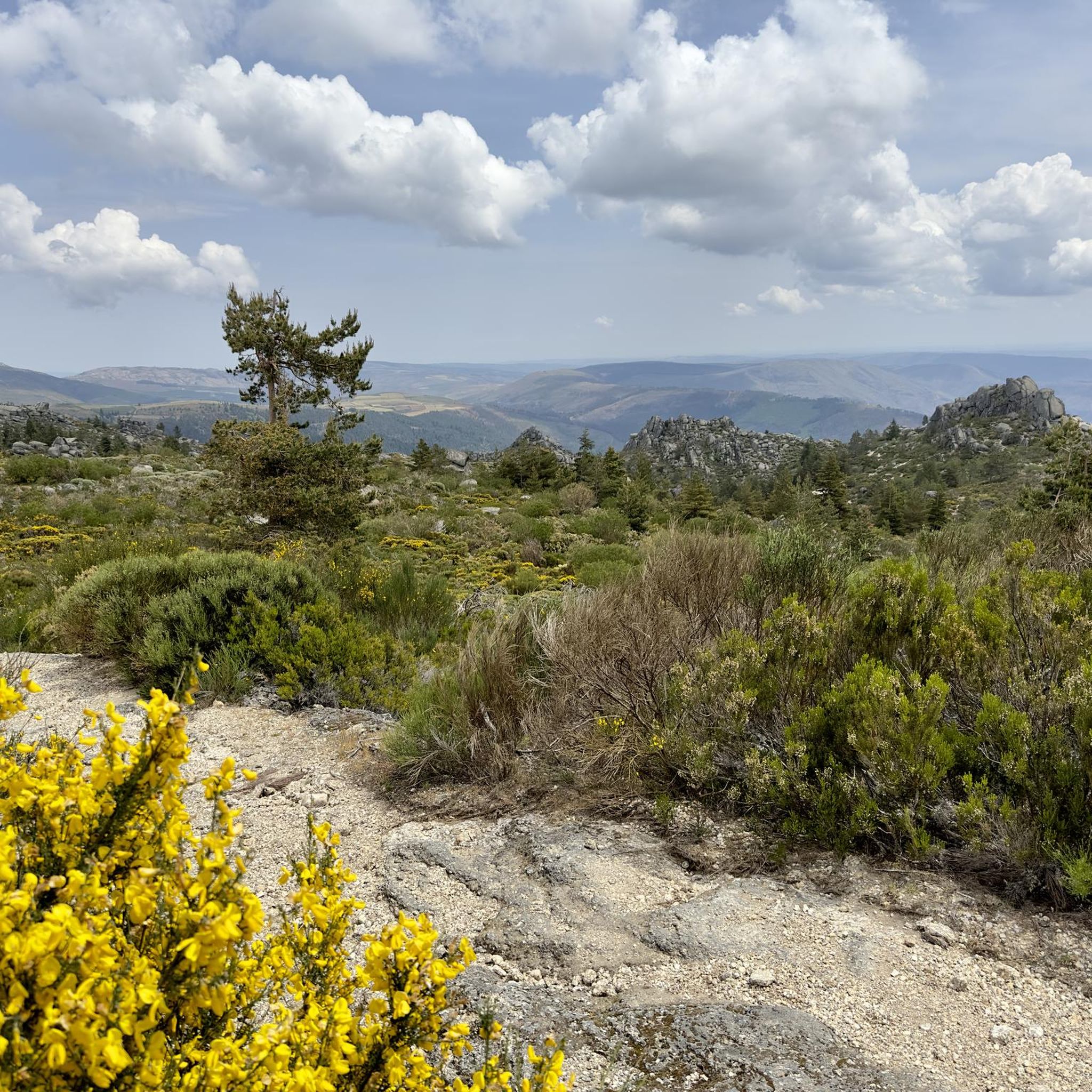
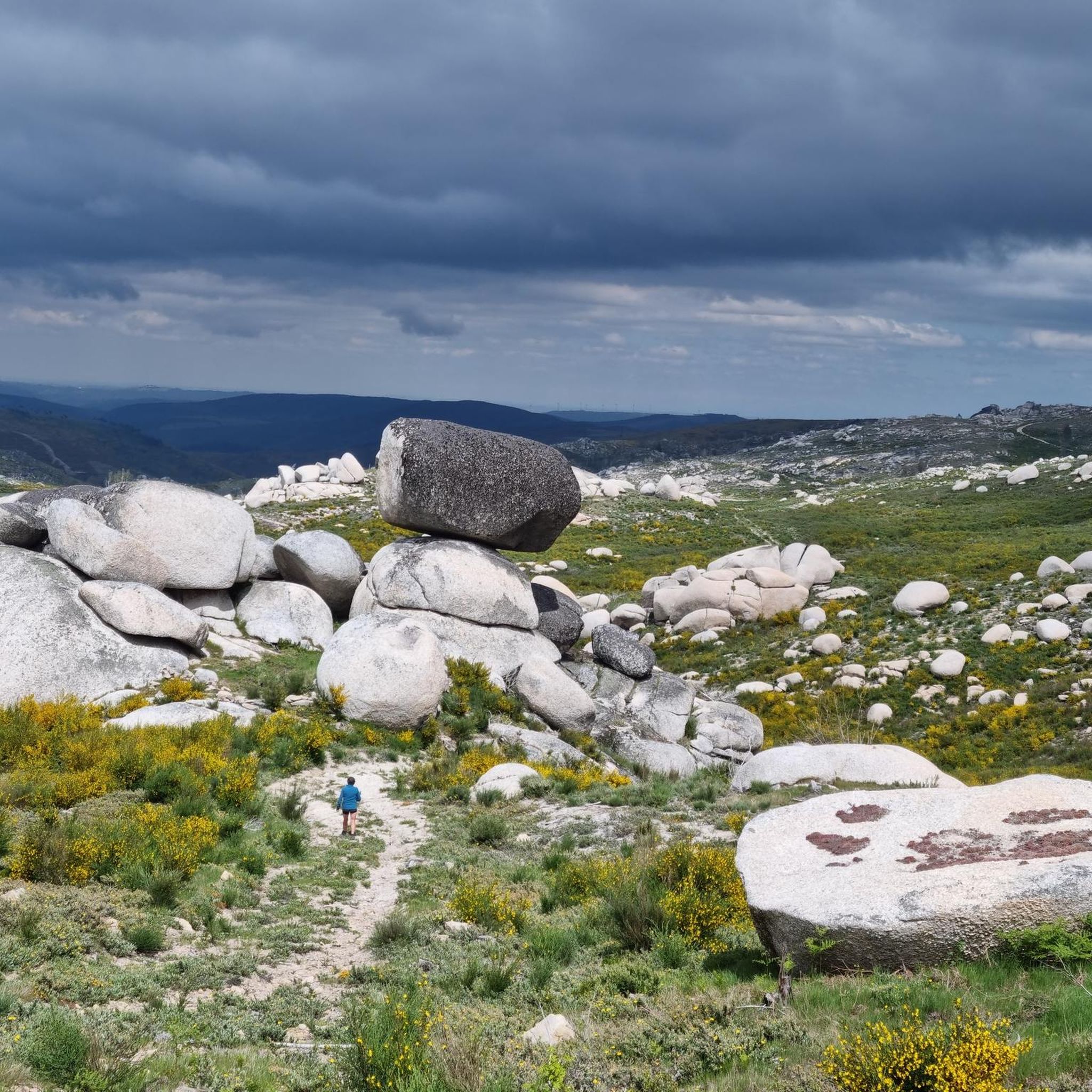
At over 1,400 meters above sea level, the Rossim Valley Reservoir is a haven of granite, pine trees, and crystal-clear waters in the heart of the Serra da Estrela Mountains. It's the perfect setting for strolls, summer swims, and admiring nature in all its splendor, one of Portugal's highest jewels.
3
0

A beautiful nature trail, about 9 km round trip to Covão dos Conchos. Unfortunately, on August 15th, the water couldn't reach the hole and thus reveal the waterfalls. It's a reservoir, part of the Serra da Estrela hydroelectric system. A funnel-shaped drainage structure that allows water to flow from this body of water to Lagoa Comprida. The spillway was built in 1955 to divert water from Ribeira das Naves to Lagoa Comprida. Over the past 60 years, moss and foliage have grown over the mouth of the funnel, creating a captivating spectacle. It is 4.6 meters high and 4.8 meters in circumference. The tunnel that collects the water is 1,519 meters long. It's a stunning place to visit, not only for the combination of human intervention and nature, but also for the surrounding landscape.
2
1
Located at an altitude of approximately 1,600 meters, Lagoa Comprida is the largest water reservoir in the Serra da Estrela, intended for hydroelectric generation. This natural lake lies in a wide depression of glacial origin, approximately one kilometer long, which fed the Covão Grande glacier. Numerous glacial scars are visible along its banks, making this lake one of the most interesting geomorphological sites in the Serra da Estrela. Construction on this lake began in 1911, and by 1914, it was already six meters high. Later, in 1965, it underwent heightening work that increased its height to 28 meters, currently boasting a storage capacity of approximately 14 cubic hectometers, flooding an area of approximately 80 hectares. Small streams of water flow into this lagoon, as well as water retained in the Covões dos Conchos and Covões do Meio and carried to this lagoon through underground tunnels.
6
1

Gouveia is a picturesque Portuguese town and municipality located in the district of Guarda, on the northern edge of the Serra da Estrela Natural Park. With an elevated position that provides it with a mountain climate and picturesque views, Gouveia is considered one of the "gateways" to the highest mountain range in mainland Portugal. The town stands out for its rich historical and architectural heritage, with a charming old town characterized by narrow cobbled streets, traditional houses and monuments such as the Mother Church of São Pedro and the Paços do Concelho (Town Hall). Gouveia is also renowned for the production of the famous Queijo Serra da Estrela, a DOP sheep's cheese, and for its tradition of the Cão da Serra da Estrela dog breed. Its proximity to the Natural Park makes it an excellent base for exploring the natural beauty of the Serra.
0
0
The waters of the Rio Mondego originate here and you can find a fountain where you can fill your water bottle with fresh water!
3
0
Frequently Asked Questions
How many running routes are available in Paços Da Serra?
Paços Da Serra offers a diverse selection of over 25 running routes, catering to various skill levels. You'll find everything from moderate loops to more challenging trails with significant elevation changes.
Are there easy running routes suitable for beginners in Paços Da Serra?
Yes, Paços Da Serra has options for beginners. While many routes feature elevation changes, there is at least one designated easy route. Look for trails with shorter distances and less steep climbs to start.
Where can I find longer running trails in Paços Da Serra?
For those seeking longer distances and more challenging runs, Paços Da Serra features 17 difficult routes. An example is the Gouveia loop from Gouveia, which is 6.7 miles (10.8 km) with significant elevation gain.
Are there circular running routes in Paços Da Serra?
Yes, many of the running routes in Paços Da Serra are circular, offering convenient starting and ending points. A popular example is the Vale do Rossim Reservoir loop from Casa das Penhas Douradas Tesla Destination Charger, which circles the reservoir.
What kind of terrain can I expect on the running trails around Paços Da Serra?
The terrain in Paços Da Serra is characterized by rolling hills and natural water features. You'll encounter trails that traverse both open landscapes and areas near reservoirs, often with noticeable elevation changes. This provides a varied running experience.
What do other runners enjoy most about jogging in Paços Da Serra?
The running routes in Paços Da Serra are highly rated by the komoot community, with an average score of 5.0 stars from 3 reviews. Runners often praise the diverse environments, from reservoir loops to hilly terrain, and the options available for different ability levels.
Are there any interesting landmarks or natural sights along the running routes?
Yes, the region offers several natural attractions. While running, you might be near highlights such as the Covão dos Conchos Trail, Long Lake, or the Vale do Rossim Reservoir. Some routes also pass through or near local towns.
Is parking available near the running trails in Paços Da Serra?
Parking is generally available near many trailheads and starting points in Paços Da Serra. For instance, the Vale do Rossim Reservoir loop starts near a Tesla Destination Charger, indicating parking facilities.
Are there any running routes that connect local towns?
Yes, the network of routes in Paços Da Serra includes options that connect local towns. The Casa das Obras Fountain – Afonso Costa Statue loop from Seia is an example, leading through both urban and natural surroundings.
Can I find running routes that offer views of water features?
Absolutely. Paços Da Serra is known for its natural water features. Many routes, such as the Running loop from Vale do Rossim, offer scenic views of reservoirs and other water bodies.
What is the best season for running in Paços Da Serra?
The region's diverse landscape makes it suitable for running across multiple seasons. However, given the hilly terrain and open areas, spring and autumn often provide the most comfortable temperatures for longer runs. Always check local weather conditions before heading out.
Most popular routes around Paços Da Serra
Most popular attractions around Paços Da Serra

Get inspired with the komoot mobile app


Explore more
Browse the best Running Trails & Routes in other regions.
