The best MTB trails around Vinhó
3.6
(9)
119
riders
6
rides
Mountain biking around Vinhó, nestled in Portugal's Serra do Açor mountain range, offers routes through a landscape characterized by lush green hills and a predominantly schistose geological formation. The region features varied terrain, including river valleys and elevated sections, providing diverse riding experiences. Riders can explore areas rich in natural features and traditional villages built from local stone.
Best mountain bike trails around Vinhó
- The most popular mountain bike trail is Covão do Curral Lagoon – Lagoa Comprida Dam loop…
Last updated: May 16, 2026
3.0
(1)
1
riders
30.4km
02:58
920m
920m
Hard mountain bike ride. Very good fitness required. Advanced riding skills necessary. Some portions of the route may require you to push your bike.
44.8km
04:25
1,300m
1,300m
Tackle the challenging Folgosinho and Videmonte Loop, a 27.9-mile mountain bike ride with 4270 feet of climbing in Serra da Estrela.

Sign up for free
2.7
(6)
16
riders
22.6km
02:08
450m
450m
Moderate mountain bike ride. Good fitness required. Suitable for all skill levels.
29
riders
54.5km
05:54
1,930m
1,940m
Hard mountain bike ride. Very good fitness required. Suitable for all skill levels.
22
riders
59.4km
05:18
1,020m
1,020m
Hard mountain bike ride. Very good fitness required. Advanced riding skills necessary.
Our route recommendations are based on thousands of hikes, rides, and runs completed by other people on komoot.
Start today with a free account
Your next adventure awaits.
Login or Signup


Tips from the Community

The Lapa dos Dinheiros river beach is in perfect harmony with nature. Located in the parish of Lapa dos Dinheiros, on the Caniça River, a right-bank tributary of the Alva River, this bathing area is nestled in a mountainous landscape dominated by the Lapa Souto (south of Lapa) and imposing granite outcrops. With clear water, very appealing for swimming, the beach boasts the award for accessible beach and has lifeguards and a bar available to visitors. The rugged terrain of the valley causes the river to form a succession of small waterfalls nearby. The Lapa Souto, in addition to its valuable collection of centuries-old chestnut trees, is also home to a high level of biodiversity. From the bridge, a pedestrian path leads to the Moura Hole and a viewpoint over the Caniça Waterfalls. The Buraco da Moura is a natural cave system created by the sliding and accumulation of large granite blocks, which formed a complex system of rooms and galleries. How to get there? Once in Seia, follow the EN231 to S. Romão. From there, continue uphill for about 5 km, toward Loriga/Lapa, until you find the sign for Lapa dos Dinheiros on the left. Once inside the town, simply follow the beach signs. Coordinates: 40º 23′ 07.0″ N / 7º 41′ 50.1″ W
1
0
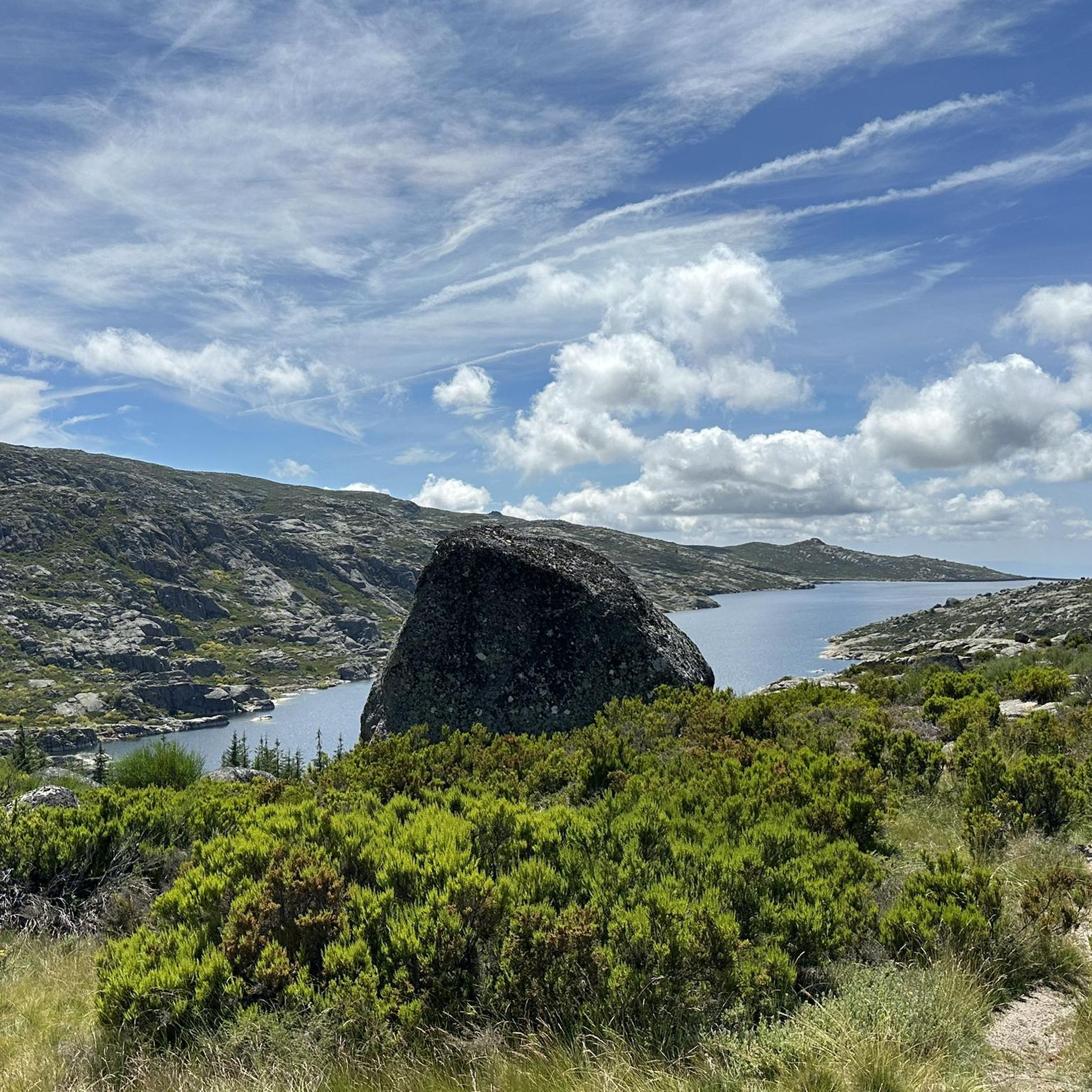
Located at an altitude of approximately 1,600 meters, Lagoa Comprida is the largest water reservoir in the Serra da Estrela, intended for hydroelectric generation. This natural lake lies in a wide depression of glacial origin, approximately one kilometer long, which fed the Covão Grande glacier. Numerous glacial scars are visible along its banks, making this lake one of the most interesting geomorphological sites in the Serra da Estrela. Construction on this lake began in 1911, and by 1914, it was already six meters high. Later, in 1965, it underwent heightening work that increased its height to 28 meters, currently boasting a storage capacity of approximately 14 cubic hectometers, flooding an area of approximately 80 hectares. Small streams of water flow into this lagoon, as well as water retained in the Covões dos Conchos and Covões do Meio and carried to this lagoon through underground tunnels.
6
1

Characterized by a serene and rural atmosphere, Freixo da Serra offers a taste of traditional Portuguese mountain life. Its stone houses, narrow streets and surrounding environment of cultivated fields and forests make it an ideal place for those seeking peace and contact with nature. Its strategic location allows easy access to some of the trails and points of interest of Serra da Estrela, while maintaining the tranquility of a less touristy settlement.
0
0
Gouveia is a picturesque Portuguese town and municipality located in the district of Guarda, on the northern edge of the Serra da Estrela Natural Park. With an elevated position that provides it with a mountain climate and picturesque views, Gouveia is considered one of the "gateways" to the highest mountain range in mainland Portugal. The town stands out for its rich historical and architectural heritage, with a charming old town characterized by narrow cobbled streets, traditional houses and monuments such as the Mother Church of São Pedro and the Paços do Concelho (Town Hall). Gouveia is also renowned for the production of the famous Queijo Serra da Estrela, a DOP sheep's cheese, and for its tradition of the Cão da Serra da Estrela dog breed. Its proximity to the Natural Park makes it an excellent base for exploring the natural beauty of the Serra.
0
0
Here you ride on a beautiful gravel road with a wide and flat surface. On one side you have fields and on the other a thick forest.
0
0
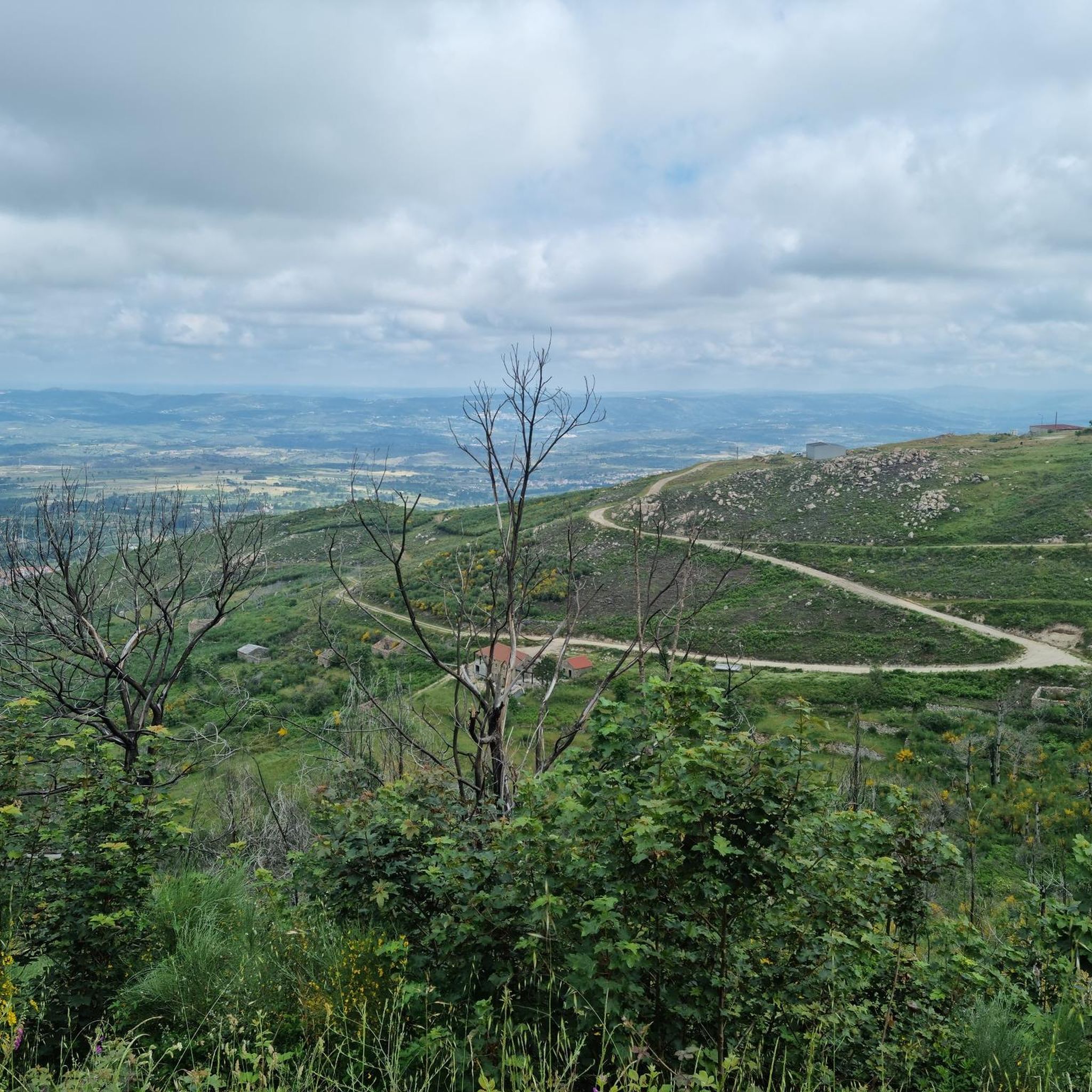
This elevated location is particularly appreciated for its uninterrupted view, which extends over an accumulation of reliefs and depressions, creating a dynamic and engaging landscape. In addition to being a breathtaking observation point, Cabeço da Azinha is also an important site for air sports enthusiasts, as it hosts a paragliding runway that hosts national and international events. Its elevated position also makes it a strategic point for the fire observation post, Ponto de Vigia Gorgulão. The local flora is rich and varied, with species such as the kermes oak (azinha, from which it takes its name), heather and rosemary, which contribute to the wild beauty of the place.
0
0
The village is famous for its granite houses, cobbled streets and its imposing medieval castle, which offers spectacular views of the surrounding landscape. Legend has it that Folgosinho was founded by Lusone, grandson of Noah, which adds a touch of mysticism to its already fascinating history.
0
0
Lagoa Comprida is the largest glacial lake in Serra da Estrela, Portugal, and one of the most iconic spots in the Natural Park. Its name, meaning "Long Lake," perfectly describes its elongated shape, nestled between the surrounding peaks. Originally a glacial lake, it was artificially enlarged with the construction of a dam in the early 20th century for hydroelectric power generation, becoming an important reservoir. Its crystalline waters reflect the sky and the rugged surrounding mountains, creating breathtaking views. It is a popular starting point for hikes and treks to other lagoons and peaks, and offers a sense of grandeur and serenity typical of alpine environments.
2
0
Frequently Asked Questions
What kind of mountain biking terrain can I expect around Vinhó?
The mountain biking terrain around Vinhó, nestled in the Serra do Açor, is characterized by lush green hills and a predominantly schistose geological formation. You'll find varied landscapes, including river valleys and elevated sections, offering diverse riding experiences. The region's traditional villages, built from local schist stone, also add a unique cultural element to many routes.
Are there mountain bike trails suitable for beginners or families in Vinhó?
While the komoot guide primarily features moderate to difficult routes, the broader Serra do Açor MTB Center, located nearby in Coja, offers a Green Route (6.4 km) specifically designed as an easier path. This route winds through Coja's narrow streets and dirt roads, making it ideal for beginners or a relaxed family ride.
What are some challenging mountain bike routes for experienced riders?
For experienced riders seeking a challenge, Vinhó offers several difficult routes. The Loop from Nabainhos towards Freixo da Serra is a difficult 18.9-mile (30.4 km) path with significant elevation changes and panoramic views. Another demanding option is the Folgosinho and Videmonte Loop, a 27.8-mile (44.8 km) trail leading through varied and often challenging terrain.
Can I find circular mountain bike routes in the Vinhó area?
Yes, many of the mountain bike routes around Vinhó are designed as loops, allowing you to start and finish in the same location. For example, the Covão do Curral Lagoon – Lagoa Comprida Dam loop from Casa da EDP is a moderate 14.0-mile (22.6 km) circular trail exploring a scenic lagoon and dam area.
What natural attractions or viewpoints can I discover along the trails?
The Serra do Açor region is rich in natural beauty. You can find stunning viewpoints like Santinha, offering expansive vistas. The area also features dozens of limpid water streams and river beaches. While not directly on a listed MTB route, the famous 'Cascata da Fraga da Pena' waterfall is a notable highlight in the region.
Are there any cultural sights or traditional villages to explore while mountain biking?
Absolutely. The Serra do Açor is home to charming 'Schist Villages' (Aldeias do Xisto) like Benfeita and Vila Cova de Alva, which are built using the local schist stone. These villages offer a unique architectural and cultural experience. You might also encounter historical sites such as the Ruins of the Old Water Mill.
What do other mountain bikers say about the trails around Vinhó?
The mountain bike routes around Vinhó are highly rated by the komoot community, with an average score of 3.8 stars from over 7 reviews. Riders often praise the diverse terrain, the lush green hills, and the opportunity to explore traditional schist villages and scenic river valleys.
What is the best time of year for mountain biking in Vinhó?
The Serra do Açor region, with its lush green hills, is generally pleasant for mountain biking during spring and autumn when temperatures are milder. Summer can be warm, but the presence of river beaches offers refreshing breaks. Winter can bring cooler, wetter conditions, but trails remain accessible for those prepared for the weather.
Are there any river beaches or places to cool off after a ride?
Yes, Vinhó itself features a tiny river beach, and the broader Arganil municipality offers various river beaches. These provide excellent spots for swimming and relaxation after a day of mountain biking, allowing you to cool off in the clear waters of the region's streams and rivers.
How long do mountain bike trails typically take to complete in Vinhó?
The duration of mountain bike trails around Vinhó varies significantly based on distance and difficulty. For example, a moderate 14.0-mile (22.6 km) route like the Covão do Curral Lagoon – Lagoa Comprida Dam loop typically takes around 2 hours and 8 minutes, while longer, more difficult trails can take upwards of 4 hours.
Can I bring my dog on the mountain bike trails in Vinhó?
While specific regulations for dogs on mountain bike trails can vary, the natural and open character of the Serra do Açor region generally welcomes dogs, especially on less technical paths. It's always advisable to keep your dog under control, especially when encountering wildlife or other trail users, and to check for any local signage regarding pet access.
Are there options for food and drink near the mountain bike routes?
The villages scattered throughout the Serra do Açor, including those near mountain bike routes, often have small cafes or local restaurants where you can refuel. For example, the nearby village of Coja, home to the Serra do Açor MTB Center, offers amenities. Additionally, places like the Vale do Rossim River Beach Restaurant provide options in scenic locations.
What are some of the longer mountain bike routes available?
For those looking for longer rides, the Caniçada Waterfall – Casa das Obras Fountain loop from Seia is a challenging 33.9-mile (54.6 km) route, and the Afonso Costa Statue – Casa das Obras Fountain loop from Seia covers 36.9 miles (59.4 km). These routes offer extensive exploration of the region's diverse landscapes.
Most popular routes around Vinhó
Most popular attractions around Vinhó

Get inspired with the komoot mobile app


Explore more
Browse the best MTB trails in other regions.
