The best running trails around Várzea De Meruge
66
runners
15
runs
Jogging routes around Várzea De Meruge offer a diverse landscape for runners, characterized by significant elevation changes and varied terrain. The region features challenging long-distance trails that traverse hills and valleys, alongside moderate loops through rural areas. This makes it suitable for runners seeking both endurance tests and scenic, less strenuous outings.
Best jogging routes around Várzea De Meruge
- The most popular jogging route is Oh Meu Deus 50k Trail, a 35.4 miles (57.0 km) trail that takes 8…
Last updated: July 8, 2026
8
runners
57.0km
08:32
2,990m
3,050m
Hard run. Very good fitness required. Mostly paved surfaces. Suitable for all skill levels.
12
runners
Hard run. Very good fitness required. Mostly paved surfaces. Suitable for all skill levels.

Sign up for free
7
runners
8.50km
00:55
120m
130m
Moderate run. Good fitness required. Mostly paved surfaces. Suitable for all skill levels.
7
runners
9.65km
01:03
140m
140m
Moderate run. Good fitness required. Mostly paved surfaces. Suitable for all skill levels.
8
runners
9.42km
01:01
170m
170m
Moderate run. Good fitness required. Mostly paved surfaces. Suitable for all skill levels.
Get access to more routes and recommendations from other explorers.
Sign up for free
Already have an account?
Our route recommendations are based on thousands of hikes, rides, and runs completed by other people on komoot.
Start today with a free account
Your next adventure awaits.
Login or Signup

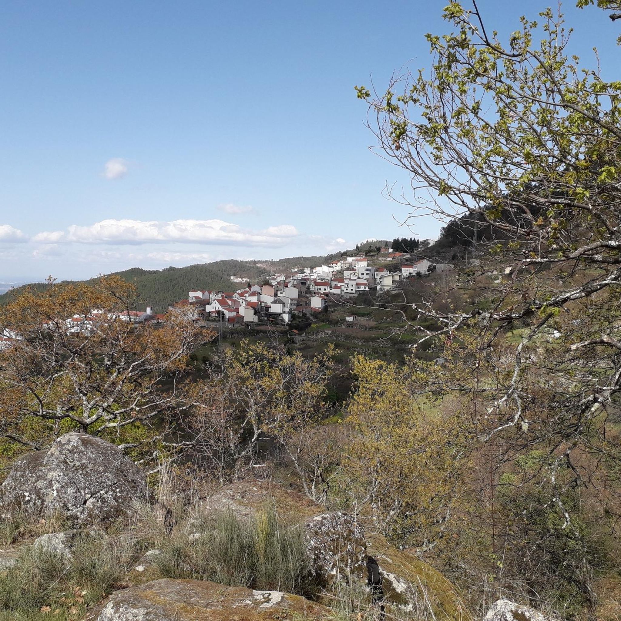
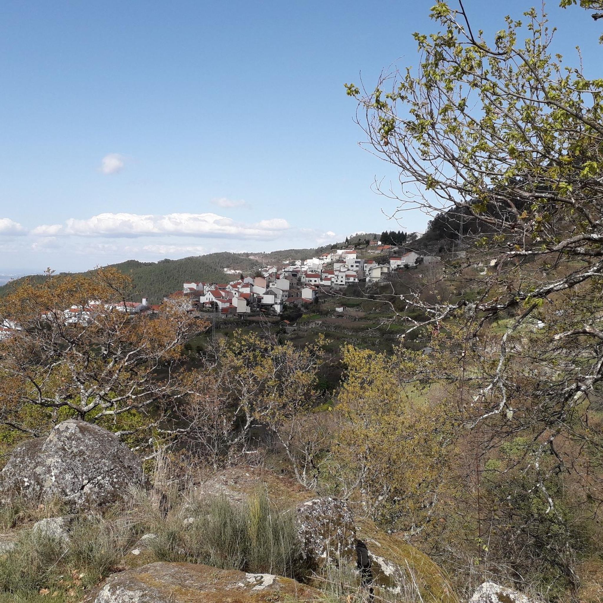

Tips from the Community

The Devil's Horns are a prominent granite rock formation with two horn-like points, located in the Serra da Estrela mountain range, near Lapa dos Dinheiros and Senhora do Desterro (not in Gerês, but in Seia, Portugal). They are the highlight of a famous circular hiking trail that follows a water channel and the Caniça stream, offering stunning landscapes, lagoons, and waterfalls. 👍🥾
0
0

The Lapa dos Dinheiros river beach is in perfect harmony with nature. Located in the parish of Lapa dos Dinheiros, on the Caniça River, a right-bank tributary of the Alva River, this bathing area is nestled in a mountainous landscape dominated by the Lapa Souto (south of Lapa) and imposing granite outcrops. With clear water, very appealing for swimming, the beach boasts the award for accessible beach and has lifeguards and a bar available to visitors. The rugged terrain of the valley causes the river to form a succession of small waterfalls nearby. The Lapa Souto, in addition to its valuable collection of centuries-old chestnut trees, is also home to a high level of biodiversity. From the bridge, a pedestrian path leads to the Moura Hole and a viewpoint over the Caniça Waterfalls. The Buraco da Moura is a natural cave system created by the sliding and accumulation of large granite blocks, which formed a complex system of rooms and galleries. How to get there? Once in Seia, follow the EN231 to S. Romão. From there, continue uphill for about 5 km, toward Loriga/Lapa, until you find the sign for Lapa dos Dinheiros on the left. Once inside the town, simply follow the beach signs. Coordinates: 40º 23′ 07.0″ N / 7º 41′ 50.1″ W
1
0

The Sanctuary of Our Lady of Desterro stands on the banks of the Alva River as an authentic path of faith, marked by ten chapels built over more than two centuries, between 1650 and 1892. Near the village, nature itself left its masterpiece: a curious rock, sculpted by time, that resembles the head of an old woman watching over the mountains.
0
0

The Serra da Estrela Natural Park is something truly special. This 1,000-square-kilometer park, spread across six municipalities, was the first and currently the largest protected natural park in Portugal. It is home to the highest point on the Portuguese mainland, the country's only ski slope, the source of two important rivers, and a fascinating, alpine-like landscape formed by glaciers.
5
1
At exactly 1993 meters above sea level, Torre is the highest point in mainland Portugal, where the only ski resort is located. The landscape on the upper plateau of the Serra da Estrela is like a sprinkling of granite rocks over low scrub and patches of snow and ice, which the sun threatens to melt soon in the summer and which always returns the following winter. In winter, it sometimes becomes inaccessible.
6
0

Caution: collapsed path (also aqueduct) 2.5 km from the start. Possible but dangerous passage.
3
0
The enigmatic Devil's Horns rise from the granite, defying the sky with their six-metre height. Sculpted by erosion over the centuries, they earned this bold name thanks to their sharp and imposing profile. But the charm doesn't end there: around this unique formation, there are small crystal-clear lagoons and serene waterfalls, creating a true natural refuge that seems to have come straight out of a fantasy story.
3
1
Nestled on the banks of the Caniça river, a tributary of the Alva river, this beach area is a haven in the middle of a mountainous landscape, where ancient chestnut trees and granite blocks shape the scenery. The crystal-clear, inviting water is perfect for a refreshing dip. The beach, which has been awarded the title of accessible, has lifeguards and a bar, making the experience even more enjoyable.
3
0
Frequently Asked Questions
How many running routes are available in Várzea De Meruge?
There are over 15 dedicated running routes around Várzea De Meruge, offering a variety of distances and difficulty levels for all types of runners.
Are there any challenging long-distance running trails in the region?
Yes, Várzea De Meruge is known for its challenging long-distance trails. For experienced runners, the Oh Meu Deus 50k Trail is a demanding 35.4-mile (57.0 km) route with substantial elevation gain, ideal for endurance tests.
Can I find moderate or beginner-friendly jogging loops in Várzea De Meruge?
Absolutely. While the region has challenging routes, there are also moderate loops through rural areas. The Running loop from Oliveira do Hospital e São Paio de Gramaços is a moderate 5.3-mile (8.5 km) trail that takes about 54 minutes to complete, offering a less strenuous option.
Are there any scenic running routes with viewpoints or natural attractions?
Many routes offer scenic views and pass by natural attractions. The Cornos do Diabo – Aqueduct of the Caniça Route loop from Lapa dos Dinheiros, for example, combines natural landscapes with historical aqueduct views. You can also explore highlights like Cornos do Diabo and the Aqueduct of the Caniça Route.
Are there any running routes that pass by waterfalls?
Yes, the region features several beautiful waterfalls. You can find routes near Poço da Broca de Serapitel, the Waterfall and natural swimming pool in Parque Natural da Serra da Estrela, and Poço Fundeiro Waterfall, offering refreshing sights along your run.
What kind of terrain can I expect on the running trails in Várzea De Meruge?
The terrain in Várzea De Meruge is quite varied, characterized by significant elevation changes. You'll encounter a mix of rural paths, trails through hills and valleys, and some routes with notable climbs, providing a diverse running experience.
Are there any circular running routes available?
Yes, many of the running paths in Várzea De Meruge are designed as loops. For instance, the Running loop from Oliveira do Hospital is a moderate 9.7 km (6.0 miles) circular route, perfect for a continuous run.
What do other runners say about the trails in Várzea De Meruge?
Over 60 runners have used komoot to explore Várzea De Meruge's varied terrain. They often highlight the diverse landscape, the mix of challenging long-distance trails, and the scenic rural paths as key attractions.
Are there any running routes suitable for families or those looking for an easier pace?
While many routes involve elevation, there are options for a more relaxed pace. Look for the 'moderate' difficulty routes, which typically feature less intense climbs and cover rural landscapes, making them more accessible for families or casual runners.
Are there any specific landmarks or points of interest I can see while running?
Beyond natural beauty, you can encounter historical elements. The Cornos do Diabo – Aqueduct of the Caniça Route loop from Lapa dos Dinheiros specifically features the Aqueduct of the Caniça Route, a notable man-made monument.
What is the best time of year for running in Várzea De Meruge?
The diverse landscape of Várzea De Meruge makes it suitable for running across multiple seasons. Spring and autumn offer pleasant temperatures and vibrant scenery, while summer mornings can be ideal before the heat sets in. Winter running is possible, but some trails might be more challenging due to weather conditions.
Are there any running routes that start or pass through Lapa dos Dinheiros?
Yes, Lapa dos Dinheiros is a common starting point or feature on several routes. The Cornos do Diabo – Aqueduct of the Caniça Route loop from Lapa dos Dinheiros is a popular option, as is the Running loop from Lapa dos Dinheiros, which is a difficult 6.5 km (4.0 miles) trail.
Most popular routes around Várzea De Meruge
Most popular attractions around Várzea De Meruge

Get inspired with the komoot mobile app


Explore more
Browse the best Running Trails & Routes in other regions.
