The best walks and hikes around Santo Amaro
4.5
(13)
95
hikers
5
hikes
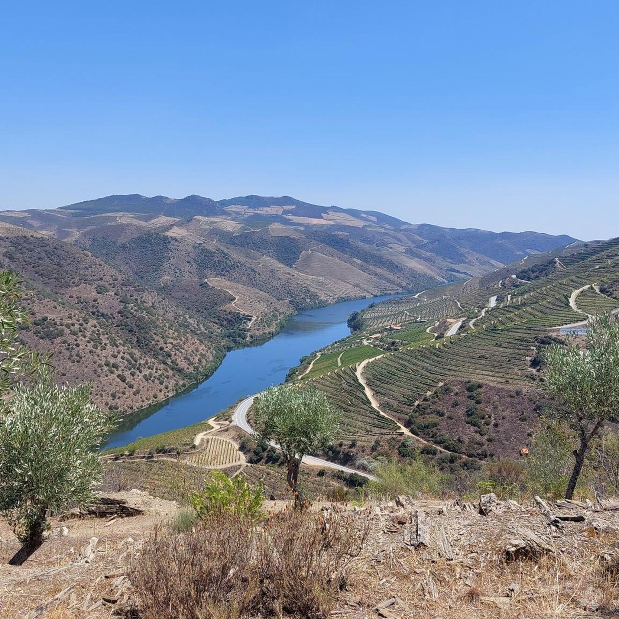
Hiking around Santo Amaro offers a network of trails primarily situated in the Douro region, characterized by river valleys and varied terrain. The landscape features elevations and paths that traverse both natural areas and historical sites. Hikers can expect routes that follow rivers and ascend hills, providing diverse outdoor experiences.
Best hiking trails around Santo Amaro
- The most popular hiking route is Côa Museum – Stairway to Douro loop from Antigo apeadeiro de Coa, a 1.9 miles (3.1 km) trail that takes 1 hour 8 minutes to complete. This easy route features a gentle ascent along the Côa River.
- Another top favourite among local hikers is Old Douro Railway Bridge loop from Pocinho, a moderate 5.6 miles (9.1 km) path. This trail follows the Douro River, offering views of historical railway infrastructure.
- Local hikers also love the Rumansil loop from Murça, an 8.6 miles (13.8 km) trail leading through varied terrain, often completed in about 4 hours 2 minutes.
- Hiking around Santo Amaro is defined by river valleys, rolling hills, and historical points of interest. The network offers options for different ability levels, from easy riverside walks to moderate ascents.
- The routes in Santo Amaro are highly rated by the komoot community with an average score of 4.5 stars from over 10 reviews. More than 80 hikers have used komoot to explore Santo Amaro's varied terrain.
Last updated: June 28, 2026
4.7
(6)
69
hikers
3.12km
01:08
200m
200m
Easy hike. Great for any fitness level. Easily-accessible paths. Suitable for all skill levels.
4.2
(5)
9
hikers
9.07km
02:42
270m
270m
Moderate hike. Good fitness required. Easily-accessible paths. Suitable for all skill levels.

Sign up for free
4.5
(2)
8
hikers
5.29km
01:32
140m
140m
Easy hike. Great for any fitness level. Easily-accessible paths. Suitable for all skill levels.
6
hikers
14.5km
04:14
390m
390m
Moderate hike. Good fitness required. Easily-accessible paths. Suitable for all skill levels.
3
hikers
14.0km
04:05
380m
380m
Moderate hike. Good fitness required. Easily-accessible paths. Suitable for all skill levels.
Our route recommendations are based on thousands of hikes, rides, and runs completed by other people on komoot.
Start today with a free account
Your next adventure awaits.
Login or Signup
Popular around Santo Amaro
Tips from the Community

The Pocinho Road-Railway Bridge, also known as the Pocinho Bridge, is a road-rail infrastructure of the Linha do Sabor, which crosses the Douro River in the Municipality of Vila Nova de Foz Côa, in Portugal; it is closed to service, for both types of traffic. The construction of a bridge at this location, with two superimposed decks, was foreseen by the Plan of the Complementary Network North of Mondego, dated February 15, 1900.
0
0

The Prazo Archaeological Station, located in Freixo de Numão, in the municipality of Vila Nova de Foz Côa (Guarda district, Portugal), is one of the most fascinating sites in the north of the country, with remains spanning from the Neolithic to the Middle Ages.
4
0

Pocinho is a village in the municipality of Vila Nova de Foz Côa, located on the left bank of the Douro River. Its railway station is the current terminus of the Linha do Douro. The small town developed with the construction of the station in the 19th century, which served as a warehouse for goods such as minerals and agricultural products. The Pocinho Dam is located next to the village, which currently provides a road connection between the districts of Guarda and Bragança. Places to visit: Pocinho Railway Station Pocinho Dam Pocinho High Performance Rowing Centre
4
0
From a distance, the building resembles a large outcrop emerging from the ground, and its facade is composed of mineral pigments in concrete, mimicking the natural irregularities of the region's metamorphic rocks. The Côa Museum does not replace a visit to the rock art sites in the Côa Valley Archaeological Park, but it is a gateway that allows visitors to discover the artistic richness of the Côa and Douro valleys. Furthermore, the museum houses the largest library in Portugal dedicated to rock art. 😊
12
0
The Linha do Douro is one of the most scenic railway routes in Europe, running along the Douro River Valley in northern Portugal. This train departs from central Porto and follows the Douro River eastwards, passing vineyards and stunning scenery. The full journey runs from Porto to Pocinho and takes approximately three and a half hours. Along the way, you can see some of the most beautiful scenery in the Douro Valley, especially between Régua and Pocinho1. In addition, there is a historic train operating on this line, offering a unique experience with carriages from the 1920s. 🚂😎🚶♀️🌄
2
0

The museum offers elixir guides to see Paleolithic and Neolithic rock carvings by road and by boat. Enticed of Universal Mondial Value recognized by UNESCO
0
0
The Côa Museum opened on July 30, 2010, and is located on one of the slopes where the Douro and Côa rivers meet. Designed by architects Camilo Rebelo and Tiago Pimentel, the museum is one of the largest in Portugal. Its design is inspired by the notion that "Paleolithic art in the Côa Valley is perhaps the earliest manifestation of 'Land art.'"
13
0

The stairs go all the way to the water, especially nice when it is not so hot
3
0
Frequently Asked Questions
How many hiking trails are available in Santo Amaro?
Santo Amaro offers a selection of 5 hiking trails, catering to various preferences. You'll find a mix of easy and moderate routes to explore the region's landscapes.
What kind of terrain can I expect on hikes around Santo Amaro?
The hiking trails in Santo Amaro are primarily situated in the Douro region, characterized by river valleys and varied terrain. You can expect paths that follow rivers, ascend rolling hills, and traverse both natural areas and historical sites.
Are there any easy hiking trails suitable for beginners in Santo Amaro?
Yes, Santo Amaro has 2 easy hiking trails. One option is the Prazo Archaeological Site loop from Freixo de Numão, which is 5.3 km long and takes about 1 hour 31 minutes to complete.
What are some notable landmarks or points of interest along the hiking routes?
Hikers can discover several interesting sites. You might encounter the Côa Museum, the Ruins of the Pocinho Railway District, or enjoy views from the São Gabriel Viewpoint. Some trails also pass by the Sabor Greenway.
Are there any circular hiking routes in Santo Amaro?
Yes, all the listed routes in Santo Amaro are circular. For example, the Prazo Archaeological Site loop from Freixo de Numão offers an easy 5.3 km walk, while a longer, moderate option is the Prazo Archaeological Site loop from Freixo de Numão at 14.3 km.
What do other hikers say about the trails in Santo Amaro?
The trails in Santo Amaro are highly rated by the komoot community, with an average score of 4.5 stars from over 10 reviews. Hikers often praise the varied terrain and the scenic beauty of the river valleys.
Are there any longer, more challenging hikes available?
While there are no 'difficult' graded trails, Santo Amaro offers several moderate routes for those seeking a longer walk. The Prazo Archaeological Site loop from Freixo de Numão is a moderate 14.3 km trail, typically taking around 4 hours 10 minutes to complete.
What is the best time of year to go hiking in Santo Amaro?
The region's climate, typical of the Douro valley, generally offers pleasant conditions for hiking during spring and autumn. These seasons provide milder temperatures and beautiful landscapes, ideal for exploring the river valleys and historical sites.
Are there any trails that offer historical insights?
Yes, several trails incorporate historical elements. The Prazo Archaeological Site loop from Freixo de Numão takes you past an archaeological site, offering a glimpse into the region's past. Additionally, the Ruins of the Pocinho Railway District are a notable historical landmark accessible in the area.
Can I find trails with good viewpoints in Santo Amaro?
Yes, the region's rolling hills and river valleys naturally offer scenic vistas. The São Gabriel Viewpoint is a specific highlight that provides excellent panoramic views of the surrounding landscape.
Are there options for longer day hikes in Santo Amaro?
For a longer day hike, consider the moderate Prazo Archaeological Site loop from Freixo de Numão. This route spans 14.3 km and typically requires about 4 hours and 10 minutes, making it suitable for a substantial outing.
Most popular routes around Santo Amaro
Most popular attractions around Santo Amaro

Get inspired with the komoot mobile app


Explore more
Browse the best Hikes in other regions.
