The best walks and hikes around Reguengo e Reguengo e Reguengo e São Julião
4.6
(292)
956
hikers
82
hikes
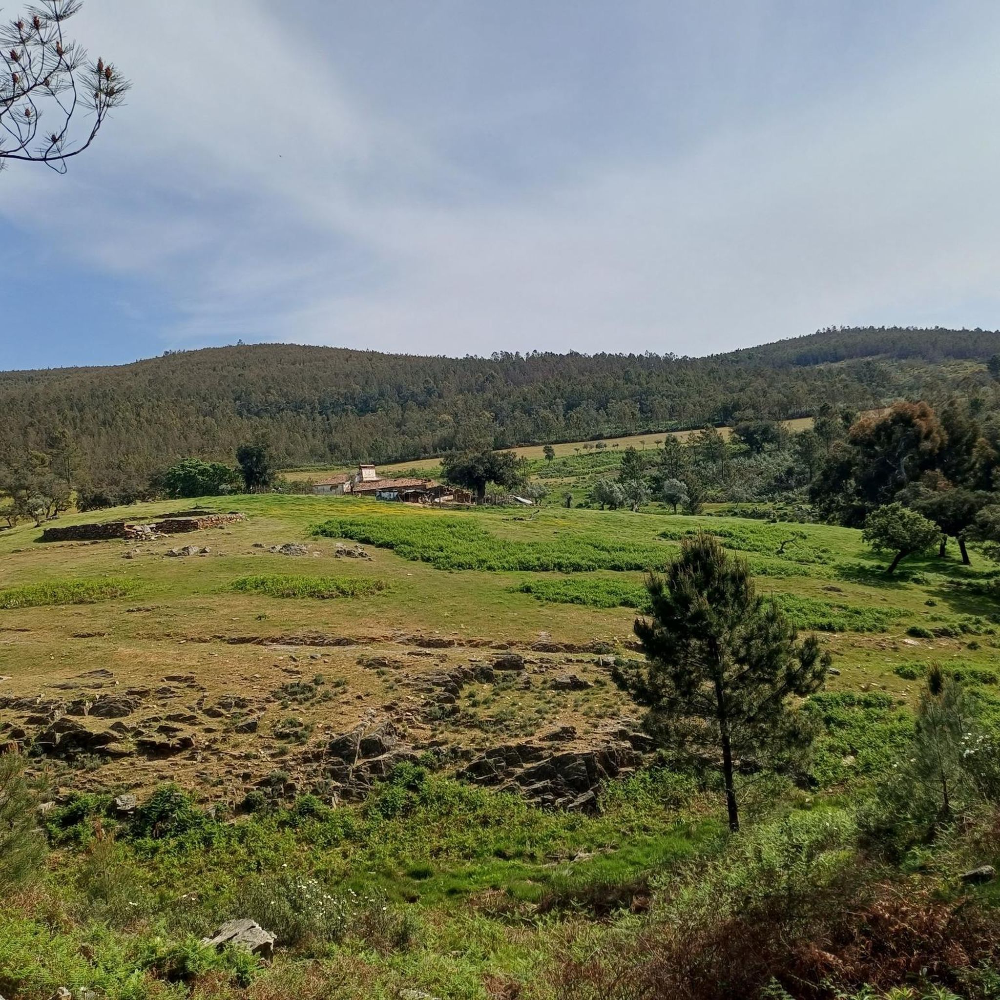
Hiking trails around Reguengo e Reguengo e Reguengo e São Julião traverse a rugged landscape characterized by diverse geology, including ancient granite formations and Ordovician quartzite ridges. The terrain features an undulating profile of peaks, ridges, and escarpments overlooking a peneplain. Forest zones consist of cork oaks, other oak species, maritime pines, and chestnut groves, reflecting both Atlantic and Mediterranean influences.
Best hiking trails around Reguengo e Reguengo e Reguengo e São Julião
- The most popular hiking route is Lady…
Last updated: July 8, 2026
4.8
(4)
10
hikers
10.7km
03:07
290m
290m
Hike the moderate 6.6-mile Lady of Lapa Trail (PR 1) in Serra de São Mamede for diverse landscapes, panoramic views, and the Chapel of Our L
4.7
(22)
54
hikers
Easy hike. Great for any fitness level. Easily-accessible paths. Suitable for all skill levels.

Sign up for free
5.0
(1)
8
hikers
7.95km
02:28
300m
300m
Moderate hike. Good fitness required. Easily-accessible paths. Suitable for all skill levels.
5
hikers
5.70km
01:36
120m
120m
Easy hike. Great for any fitness level. Easily-accessible paths. Suitable for all skill levels.
5.0
(1)
10
hikers
29.0km
08:14
650m
650m
Hard hike. Very good fitness required. Easily-accessible paths. Suitable for all skill levels.
Get access to more routes and recommendations from other explorers.
Sign up for free
Already have an account?
Our route recommendations are based on thousands of hikes, rides, and runs completed by other people on komoot.
Start today with a free account
Your next adventure awaits.
Login or Signup
Popular around Reguengo e Reguengo e Reguengo e São Julião

Running Trails around Reguengo e Reguengo e Reguengo e São Julião
Gravel biking around Reguengo e Reguengo e Reguengo e São Julião
MTB Trails around Reguengo e Reguengo e Reguengo e São Julião
Road Cycling Routes around Reguengo e Reguengo e Reguengo e São Julião
Cycling around Reguengo e Reguengo e Reguengo e São Julião
Tips from the Community

Hiking to Serra de São Mamede (1027 m), the highest point in continental Portugal south of the Tagus, offers a unique experience that combines the hardness of quartzite with the freshness of lush vegetation in the Serra de São Mamede Natural Park. The ascent rewards hikers with panoramic views that extend to the Estrela and deep into Spanish territory. For a safe and rewarding hike on this peak in Portalegre, consider the following advice: Route Planning: There are several trails leading to the summit, with the Serra de São Mamede Walking Route (PR1 PTG) being one of the most popular. The path is often rocky and steep, requiring footwear with good traction and ankle support. Water and Energy Management: The physical exertion and sun exposure, especially in the higher, unprotected areas, require you to carry sufficient water (at least 1.5L) and energy snacks. There are no reliable supply points during the ascent. Pay Attention to the Weather: The weather in the mountains can change rapidly. Even if it is sunny in the city, the summit may be shrouded in fog or strong winds. Always check the local forecast before setting off and bring a windbreaker or warm clothing. Sun Protection: Due to the altitude and sparser vegetation on the summit, UV radiation is more intense. Use sunscreen and a hat, even on cloudy days.
0
0
Cruz do Cume is a small crossroads located in the Serra de São Mamede, in the district of Portalegre, in the northeast of Alentejo, near the city of Portalegre. It is located about 1 km downhill from Alto de São Mamede, which is the highest point in the mountain range at 1025 metres above sea level. This location is known as a good birdwatching spot, especially for species such as the crested tit and the linnet, and is surrounded by pine forests that are home to other birds such as the crested tit and the coal tit. Cruz do Cume also serves as a support and access point for outdoor activities, such as hiking and trail running, and is a stopover point for important races such as the Ultra Trail São Mamede (UTSM). In short, Cruz do Cume is an emblematic location in the Serra de São Mamede, valued for its nature, birdlife and relevance for mountain sports.
2
0
Vale Lourenço is one of the most beautiful valleys in the Serra de São Mamede, Portalegre, offering a challenging hiking trail and natural landscapes of great ecological and scenic value. It is an excellent choice for those seeking contact with nature and the authenticity of Alto Alentejo.
1
0

The Dolmen del Mellizo, also known as Aceña Borrega or Anta de la Marquesa, has a thousand-year history. Although its exact origin is lost in time, it is believed that it was built between the 4th and 3rd millennia BC. This megalith follows the megalithic model known as “anta” in neighboring Portugal. The dolmen chamber is covered by a horizontal slab that protrudes from the roof, and although it is quite worn, the corridor and access to the chamber are still well preserved. In an archaeological excavation carried out in 1985, remains of funerary goods, such as ceramic fragments and arrowheads, were found. The Dolmen del Mellizo is a fascinating place that connects us with the people who built it thousands of years ago. 🌟
7
0
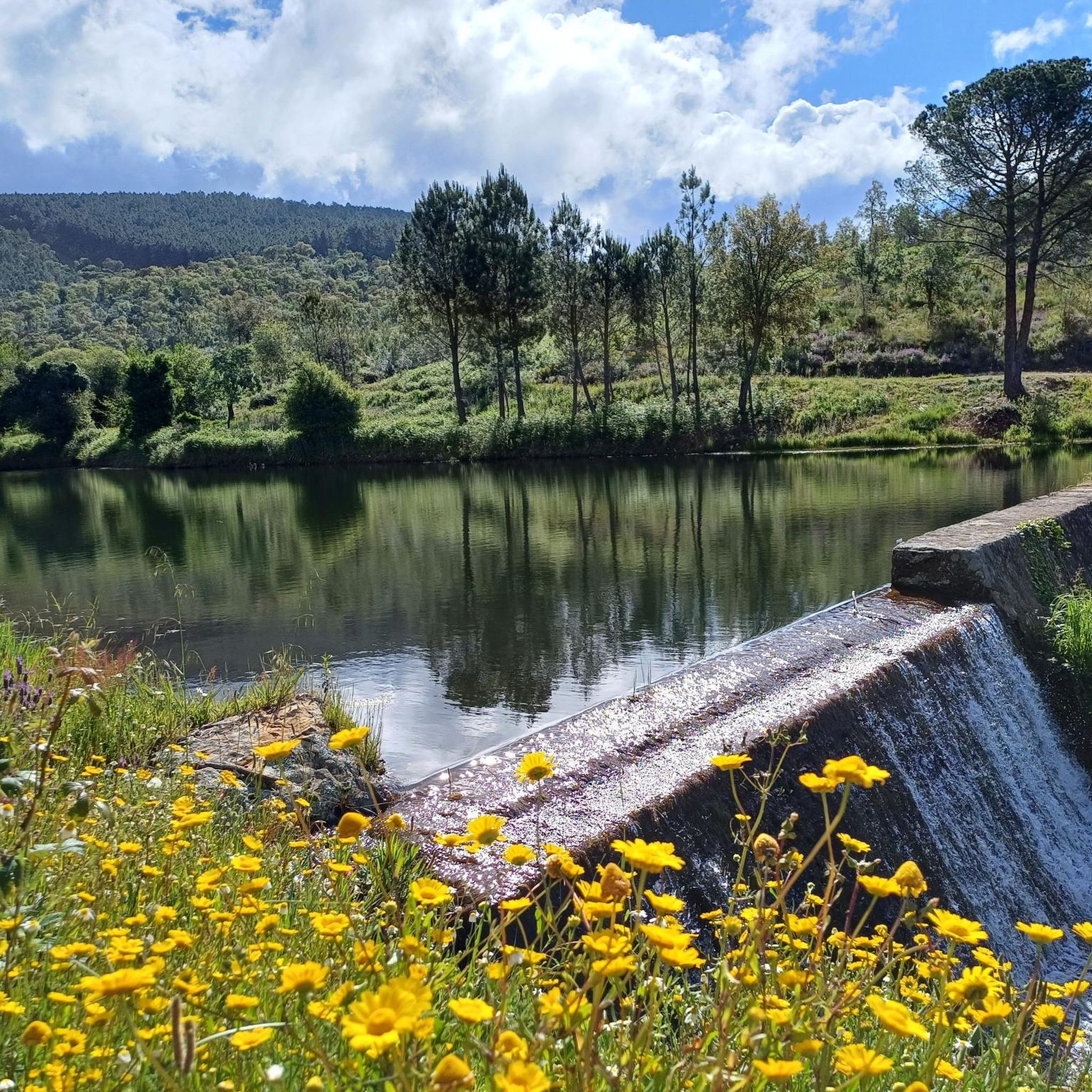
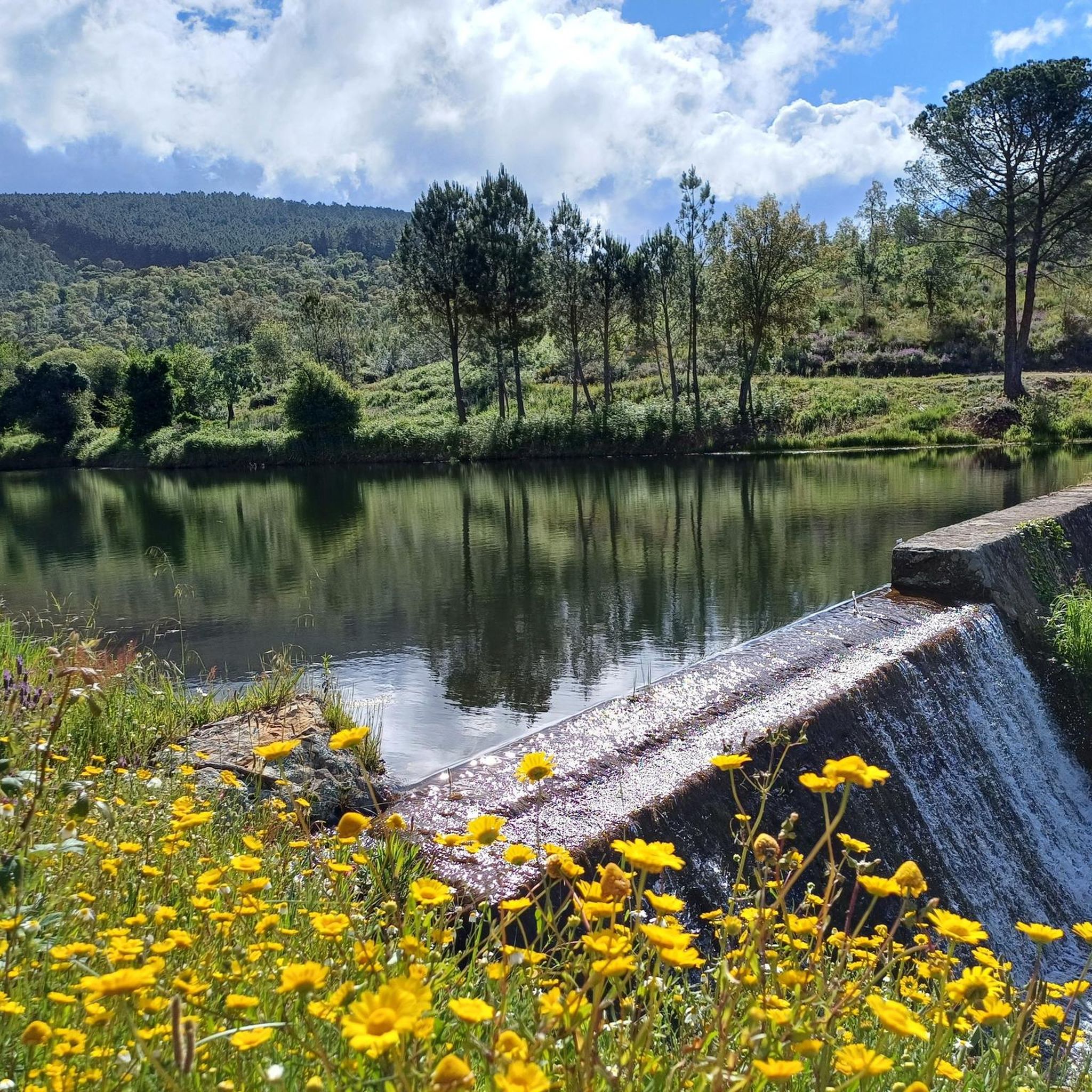
Magnificent mirror in the middle of the São Mamede mountain range.
0
0
Final access point to the top of São Mamede. Easy parking spot for those who want to walk or run in the heart of the mountains. Support place for competitors of the 2 major Trail Running events in the region, UTSM and Reis.
1
0
Highest elevation point in Portugal south of the Tagus River (1027 m).
1
0
Close to Senhora da Lapa, already in Spanish territory, an old air traffic lighthouse.
1
0
Frequently Asked Questions
How many hiking trails are available in Reguengo e São Julião?
Reguengo e São Julião offers a wide selection of hiking opportunities, with over 80 routes available. These range from easy strolls to more challenging treks, ensuring options for various fitness levels.
What types of landscapes can I expect to see while hiking in Reguengo e São Julião?
The region is characterized by its diverse geology, featuring ancient granite formations and Ordovician quartzite ridges. You'll traverse an undulating landscape of peaks, ridges, and escarpments overlooking a peneplain. Forest zones include cork oaks, other oak species, maritime pines, and chestnut groves, showcasing both Atlantic and Mediterranean influences. The treeless, shrub-dotted Quartzite Escarpments of Feiteirinha are a notable natural highlight.
Are there any easy hiking trails suitable for beginners or families?
Yes, there are 28 easy routes in the area. An excellent option is the Apartadura Reservoir – Ti Esperança Spring loop from Serra de São Mamede Nature Park, an easy 6.2 km path offering views of the reservoir and passing by the Ti Esperança Spring.
What are some of the historical or cultural points of interest I can visit near the trails?
Beyond the natural beauty, you can explore several historical sites. The 18th-century rural parish church of Reguengo is a local landmark. Nearby, you might visit the Historic Village of Marvão, the impressive Marvão Castle, or the ancient Roman City of Ammaia. The Dolmen Datas 1 and 2 also offer a glimpse into the region's ancient past.
Are there any circular hiking routes in Reguengo e São Julião?
Yes, many trails in the region are circular. For example, the São Mamede Trail – Pico de São Mamede loop from Reguengo is a moderate 7.9 km route that takes about 2 hours 27 minutes. Another option is the Dolmen Datas 1 and 2 – View of Aceña loop from Peñajurada, a more challenging 28.9 km loop.
What kind of wildlife might I encounter on the trails?
The region is rich in wildlife. You'll likely spot various passerine birds. Mammals such as wild boar and genets inhabit the area. Amphibians and reptiles, including the Iberian frog, midwife toad, Schreiber's green lizard, and the five-fingered skink, can also be found, especially near water sources.
Are there any trails that feature waterfalls?
Yes, if you're looking for a route with a waterfall, consider the Penha Amarela – Cabroeira Waterfall loop from El Jiniebro. This moderate 9.0 km trail offers a chance to experience this natural feature.
What do other hikers say about the trails in Reguengo e São Julião?
The hiking routes in Reguengo e São Julião are highly rated by the komoot community, with an average score of 4.7 stars from over 250 reviews. Hikers often praise the diverse terrain, ancient geological formations, and the opportunities for wildlife observation.
What is the best time of year to go hiking in Reguengo e São Julião?
The Alentejo region, where Reguengo e São Julião is located, generally offers pleasant hiking conditions during spring and autumn when temperatures are milder. Summers can be quite hot, while winters are generally mild but can bring rain. Checking local weather forecasts before your trip is always recommended.
Are there any challenging hikes for experienced trekkers?
Yes, for experienced trekkers, there are 9 difficult routes. A notable challenging option is the Dolmen Datas 1 and 2 – View of Aceña loop from Peñajurada, which is a demanding 28.9 km trail with significant elevation gain.
Can I find trails that lead to viewpoints or summits?
Absolutely. The region's undulating landscape means many trails offer scenic views. For a prominent viewpoint, consider routes that lead towards the Alto de São Mamede Summit (1,025 m), which is the highest point in the Serra de São Mamede.
Is there public transport access to the hiking areas?
While specific public transport details for individual trailheads are not readily available, the broader Alentejo region has some public transport options. However, for maximum flexibility in accessing various hiking areas, particularly those starting from smaller villages or more remote points, traveling by car is often the most convenient method. You can find more general information about outdoor activities in the region on the Visit Alentejo website.
Most popular routes around Reguengo e Reguengo e Reguengo e São Julião
Most popular attractions around Reguengo e Reguengo e Reguengo e São Julião

Get inspired with the komoot mobile app


Explore more
Browse the best Hikes in other regions.
