The best walks and hikes in the Gallatin Range
4.7
(303)
6,139
hikers
83
hikes
Hiking in the Gallatin Range offers diverse terrain across southwestern Montana and northwestern Wyoming, bordering Yellowstone National Park. The region features steep canyons, dense forests, alpine plateaus, and rugged ridges, with elevations reaching up to 10,965 feet at Electric Peak. Hikers encounter volcanic rock formations, subalpine lakes like Heather Lake and Emerald Lake, and dramatic waterfalls such as Palisade Falls. The range is flanked by the Gallatin and Yellowstone Rivers, providing varied landscapes for exploration.
Best hiking trails in the Gallatin Range
- The most popular hiking route is Palette Springs and Mammoth Terraces Trail — Yellowstone National Park, a 1.5 miles (2.5 km) trail that takes 45 minutes to complete. This easy path explores unique geological features within Yellowstone National Park.
- Another top favourite among local hikers is Bunsen Peak and Osprey Falls Loop — Yellowstone National Park, a difficult 10.1 miles (16.2 km) path. This route offers significant elevation gain and views of Bunsen Peak and Osprey Falls.
- Local hikers also love the Triple Tree Trail loop — Bozeman, Montana, a 5.5 miles (8.8 km) trail leading through forested hillsides, often completed in about 2 hours 35 minutes.
- Hiking in the Gallatin Range is defined by towering peaks, deep canyons, and extensive forest systems, with opportunities to explore subalpine lakes and petrified forests. The network offers options for various ability levels, from easy strolls to challenging multi-day treks.
- The routes in Gallatin Range are highly rated by the komoot community with an average score of 4.8 stars from over 130 reviews. More than 2,500 hikers have used komoot to explore Gallatin Range's varied terrain.
Last updated: August 18, 2026
4.7
(30)
601
hikers
4.79km
01:25
140m
140m
Easy hike. Great for any fitness level. Easily-accessible paths. Suitable for all skill levels.
5.0
(14)
195
hikers
8.83km
02:32
220m
210m
Moderate hike. Good fitness required. Easily-accessible paths. Suitable for all skill levels.

Sign up for free
12
hikers
9.66km
02:53
340m
250m
Moderate hike. Good fitness required. Easily-accessible paths. Suitable for all skill levels.
5
hikers
5.32km
01:29
100m
100m
Easy hike. Great for any fitness level. Easily-accessible paths. Suitable for all skill levels.
4
hikers
3.79km
01:36
520m
10m
Moderate hike. Good fitness required. Easily-accessible paths. Suitable for all skill levels.
1
hikers
3.65km
01:10
220m
40m
Easy hike. Great for any fitness level. Easily-accessible paths. Suitable for all skill levels.
9.54km
03:26
980m
0m
Hard hike. Very good fitness required. Easily-accessible paths. Suitable for all skill levels.
1
hikers
4.35km
01:12
80m
70m
Easy hike. Great for any fitness level. Easily-accessible paths. Suitable for all skill levels.
3.70km
01:10
230m
20m
Easy hike. Great for any fitness level. Easily-accessible paths. Suitable for all skill levels.
15.2km
04:12
360m
80m
Moderate hike. Good fitness required. Easily-accessible paths. Suitable for all skill levels.
Get access to more routes and recommendations from other explorers.
Sign up for free
Already have an account?
Our route recommendations are based on thousands of hikes, rides, and runs completed by other people on komoot.
Start today with a free account
Your next adventure awaits.
Login or Signup

Tips from the Community

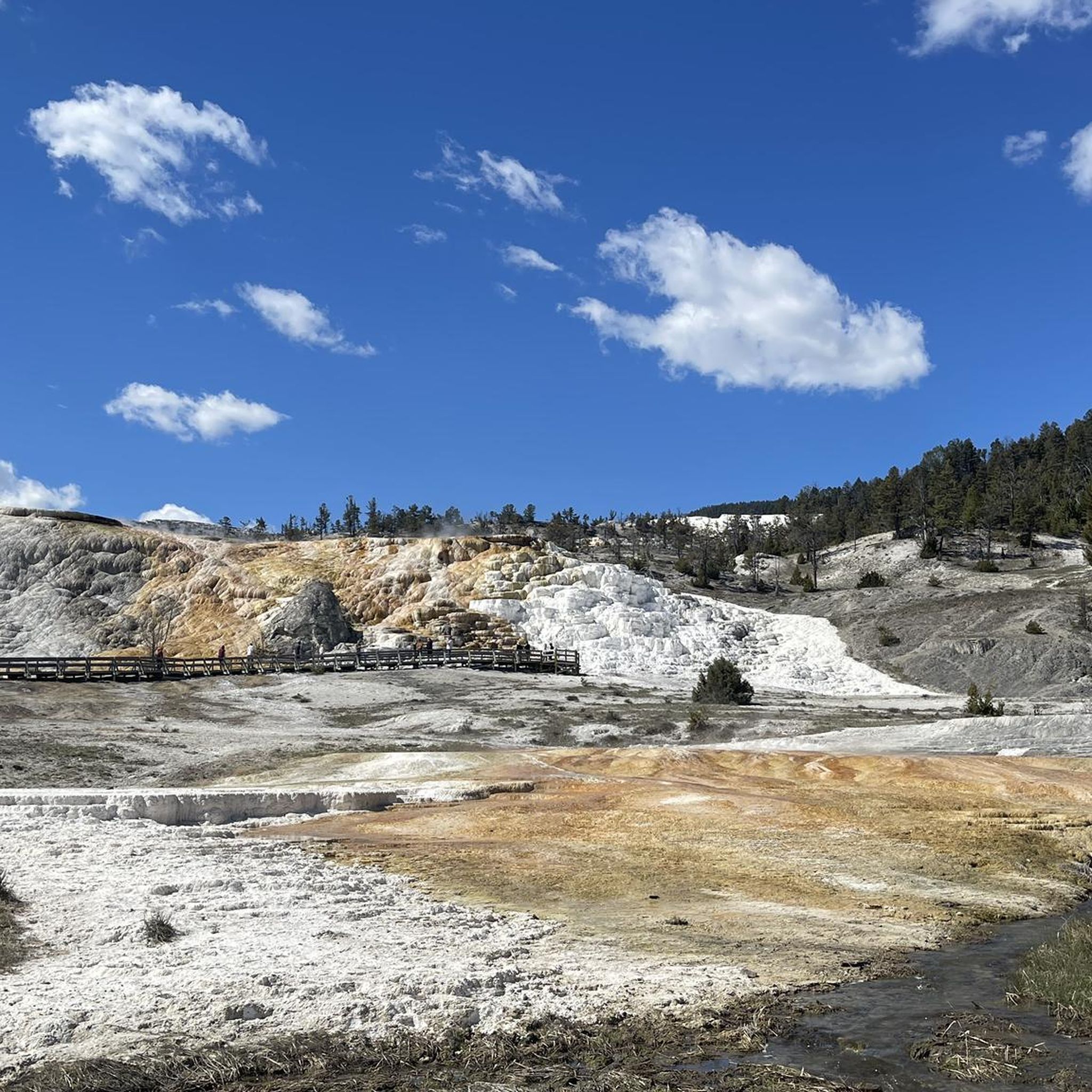
Wooden walkways guide visitors through the fascinating, ever-changing geothermal area. Hot, lime- and mineral-rich water bubbles to the surface and, as it flows down the slopes, deposits lime and minerals, creating the distinctive, constantly growing terraces in various colors.
0
0

The Mammoth Hot Springs Terraces are a stunning collection of cascading limestone formations created by thermal water flowing over the landscape. Their colors and constantly changing shapes make them one of Yellowstone’s most unique geothermal features.
0
0
Nice view onto Mammoth from Elk Plaza Service Road. The ascent up to this point is not too strenuous, so it is worth the effort for the wonderful view.
1
0

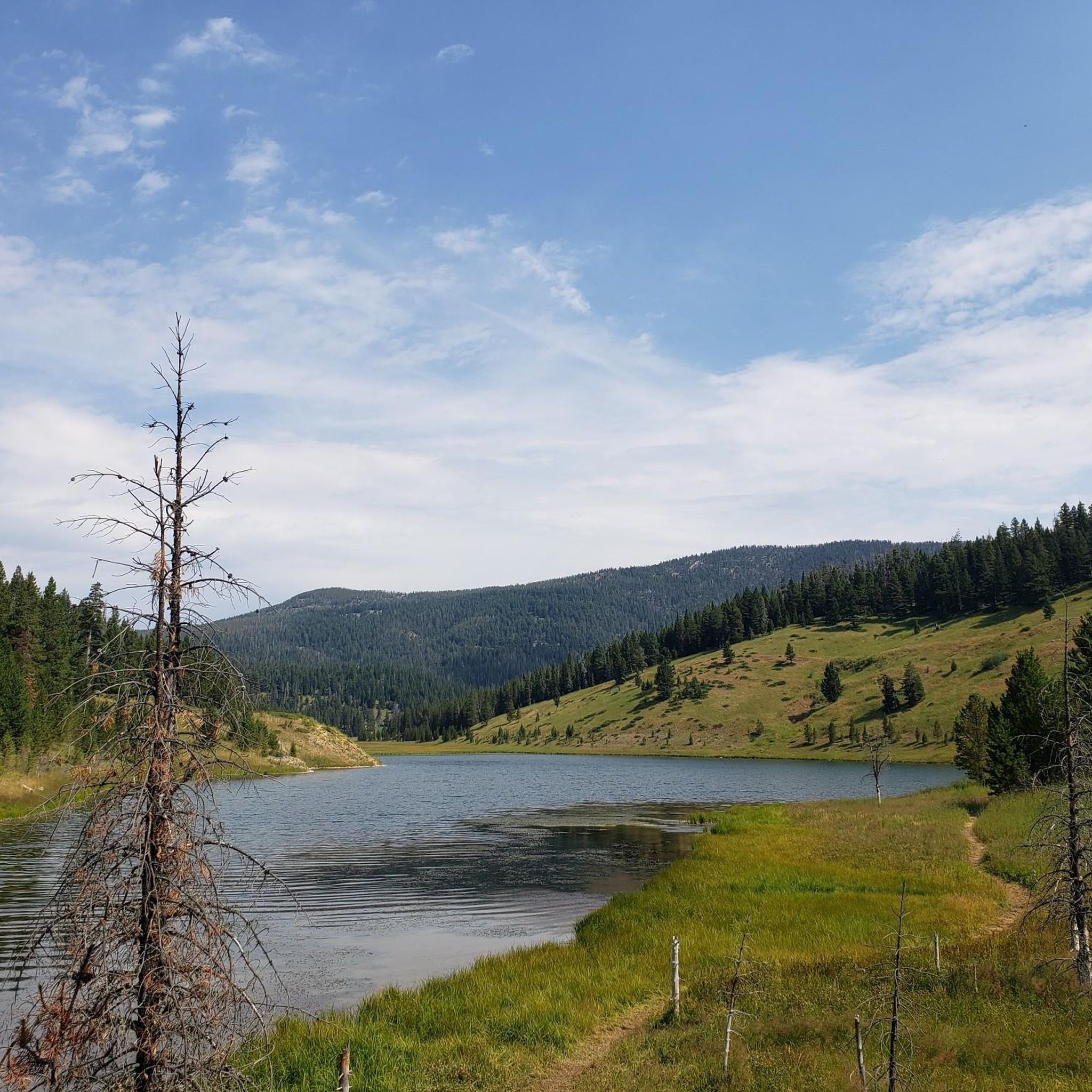
This area is famous for its series of ponds created by beavers, showing off their amazing engineering skills. While seeing a beaver can be tricky as they are often out at dawn or dusk, you'll definitely see their dams and lodges.
0
0
Famous for its amazing terraces made of rock. Hot water from underground rises to the surface, bringing minerals with it. As the water cools, these minerals, mostly calcium carbonate, are left behind, building up over thousands of years into unique, stair-like formations.
0
0

One of the many highlights in Yellowstone NP. A must-see.
0
0

These are easy hikes, some are accessible for handicapped persons and wheelchairs, but not all. Make sure you take the time to hike down the boardwalk to see the Canary Spring side (you can see from my photos, the lovely terraces that you can see close up).
0
0

Easily accessible and beautiful Crescent Lake is a great spot to ride if you're limited on time.
0
0
Frequently Asked Questions
How many hiking trails are available in the Gallatin Range?
The Gallatin Range features over 60 hiking trails, offering diverse terrain for all skill levels. These routes are highly rated by the komoot community, with an average score of 4.8 stars from over 130 reviews.
Are there family-friendly hiking options in the Gallatin Range?
Yes, the Gallatin Range has several easy trails suitable for families. A great option is the Palette Springs and Mammoth Terraces Trail in Yellowstone National Park, which is about 1.5 miles long and takes around 45 minutes to complete, exploring unique geological features. Another accessible choice is the Palisade Falls Trail, a short, easy walk to a beautiful 80-foot waterfall.
Which trails offer views of waterfalls?
You can find stunning waterfalls along several trails. The Palisade Falls Trail leads directly to an impressive 80-foot waterfall. The Bunsen Peak and Osprey Falls Loop also provides views of Osprey Falls. Additionally, the Hyalite Canyon area, accessible via trails like the Hyalite Creek Trail, features numerous waterfalls.
Are there any circular hiking routes in the Gallatin Range?
Yes, the Gallatin Range offers several loop trails. The Triple Tree Trail loop near Bozeman is a popular 5.5-mile route through forested hillsides. Another option is the Bunsen Peak and Osprey Falls Loop, a more challenging 10.1-mile path with significant elevation gain.
What kind of wildlife can I expect to see while hiking?
The Gallatin Range is a critical wildlife corridor, offering excellent opportunities for wildlife viewing. Hikers frequently encounter elk, mule deer, and various bird species. Keep an eye out for larger mammals like grizzly bears, black bears, bighorn sheep, mountain goats, wolves, and lynx, especially in more remote areas. Always maintain a safe distance and carry bear spray.
What are some notable natural attractions or landmarks to explore?
The region is rich in natural wonders. You can explore the unique geological formations of the Mammoth Hot Springs Terraces and Palette Springs. The Gallatin Petrified Forest is another remarkable geological attraction. For impressive peaks, consider trails leading to Mount Blackmore or Bunsen Peak.
Are there any trails that lead to alpine lakes?
Yes, the Gallatin Range is home to beautiful subalpine lakes. The Heather Lake via Emerald Lake Trail is a challenging route that takes you to both Emerald Lake and Heather Lake. The Hyalite Canyon area, generally, is known for its trails leading to several picturesque lakes.
What is the best time of year to hike in the Gallatin Range?
The best time for hiking in the Gallatin Range is generally from late spring through early fall (May to October). During summer, wildflowers are vibrant, and the weather is typically warm. Fall offers cooler temperatures and beautiful autumn foliage. Some higher elevation trails may retain snow into early summer, and conditions can change rapidly, so always check forecasts.
Are there challenging hikes for experienced backpackers?
Absolutely. The Gallatin Range offers numerous challenging routes for experienced hikers. The Mount Blackmore Trail is a difficult 12.9-mile route with over 3,500 feet of elevation gain. The Hyalite Creek Trail, at 11 miles one-way, also offers significant elevation and leads to the Hyalite Lake Basin, with options to continue to Hyalite Peak.
Is parking available at trailheads?
Many popular trailheads in the Gallatin Range, especially those near towns like Bozeman and within the Custer Gallatin National Forest, offer designated parking areas. However, during peak season, these can fill up quickly. It's advisable to arrive early, especially for popular trails, or consider carpooling.
Are dogs allowed on trails in the Gallatin Range?
Dog policies vary depending on the specific trail and land management agency. In general, dogs are often permitted on trails within the Custer Gallatin National Forest, but typically must be kept on a leash. Within Yellowstone National Park, regulations are stricter, and dogs are generally not allowed on hiking trails, boardwalks, or in the backcountry. Always check specific trail regulations before heading out with your pet.
What are some popular day hikes near Bozeman?
For those near Bozeman, the Triple Tree Trail loop is a local favorite, offering a 5.5-mile journey through forested hillsides. The South Cottonwood Creek Trail is another scenic day hike just outside Bozeman, known for its bridges crossing the creek.
Most popular routes in the Gallatin Range
Most popular attractions in the Gallatin Range

Get inspired with the komoot mobile app


Explore more
Browse the best Hikes in other regions.
