The best walks and hikes around Pias
3.9
(39)
212
hikers
15
hikes
Hiking around Pias features a landscape characterized by river valleys, recreational areas, and gentle hills. The region offers a variety of paths suitable for different skill levels, often following waterways or leading to local points of interest. Hikers can expect a mix of natural scenery and accessible trails.
Best hiking trails around Pias
- The most popular hiking route is Parque da Canuda Playground – Lovers' Viewpoint loop from Monção, a 3.7 miles (6.0 km) trail that takes 1 hour…
Last updated: July 4, 2026
5.0
(3)
18
hikers
Easy hike. Great for any fitness level. Easily-accessible paths. Suitable for all skill levels.
4.5
(8)
16
hikers
Moderate hike. Good fitness required. Easily-accessible paths. Suitable for all skill levels.

Sign up for free
4.3
(4)
12
hikers
12.4km
03:16
110m
110m
Moderate hike. Good fitness required. Easily-accessible paths. Suitable for all skill levels.
5.0
(1)
12
hikers
5.71km
01:30
50m
50m
Easy hike. Great for any fitness level. Easily-accessible paths. Suitable for all skill levels.
1.0
(5)
11
hikers
Moderate hike. Good fitness required. Easily-accessible paths. Suitable for all skill levels.
Get access to more routes and recommendations from other explorers.
Sign up for free
Already have an account?
Our route recommendations are based on thousands of hikes, rides, and runs completed by other people on komoot.
Start today with a free account
Your next adventure awaits.
Login or Signup


Tips from the Community

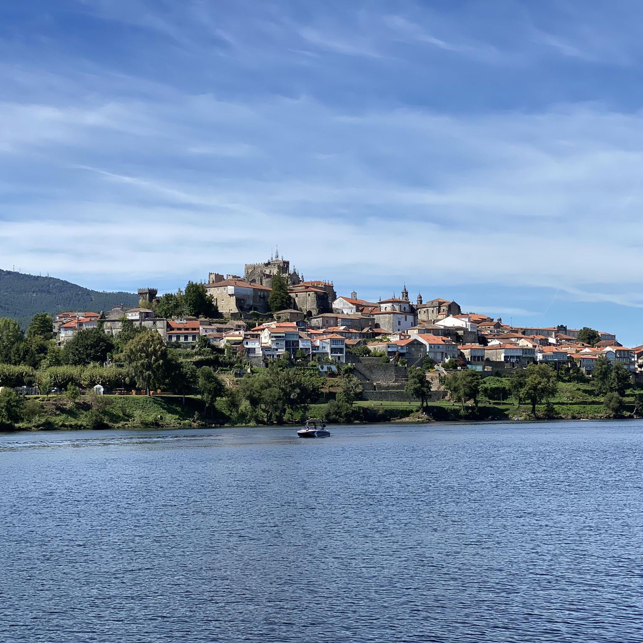
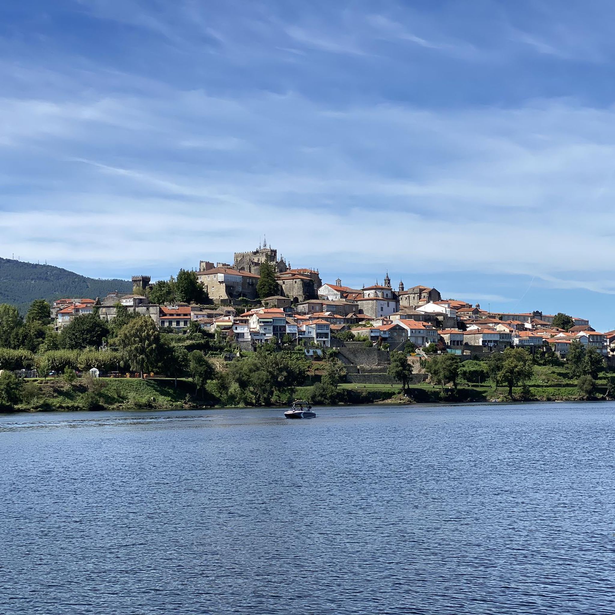
It is part of the path that starts in Monçao and goes towards Melgaço; nearby there is a parking and recreation area and at least one cafeteria.
0
0

The wooden walkways stretch along the city walls of Monção and the banks of the Minho River to the stunning Parque das Caldas, always with views of neighboring Galicia. Inaugurated in 2021, they are a great way to reach Fortaleza de Monção.
1
0
The Danaide Fountain is the most important in Monção and takes its name from the statue that crowns it, at whose base the name "Danaide" can be read. In her right hand, the woman carries a sieve. The original fountain was built in 1837, a little further towards the square. Water flowed from the column, which was collected by the population and also fed a pond where clothes could be washed and livestock watered. In 1869, the column was renovated and engraved with the coat of arms of the city of Monção. In the 1940s, the fountain was remodeled, making it less useful and serving only as a decorative object. The column was placed in its current location.
0
0
The town square and the Visitors' Hall owe their name to the local heroine who saved the city from the Castilian invasion in the 14th century through a courageous and cunning act. Her courage is immortalized in a coat of arms and a monument. Lined with trees and paved with Portuguese cobblestones, it is a popular meeting place for the city's social and cultural activities.
0
0

medieval bridge that crosses the river Tea in the vicinity of the canuda park
2
0

Huge park on the Miño, with a playground, pond, botanical garden, and much more
1
0

Wooden walkway that does not appear on the map.
1
0
Frequently Asked Questions
How many hiking trails are available around Pias?
Pias offers a good selection of routes, with over 15 hiking trails recorded on komoot. These trails cater to various preferences, ranging from easy strolls to more moderate excursions.
Are there easy or family-friendly hiking options in Pias?
Yes, Pias is well-suited for easy and family-friendly hikes. There are 9 easy routes available. A great option is the Parque da Canuda Playground – Lovers' Viewpoint loop from Monção, which is 3.7 miles (6.0 km) long and takes about 1 hour 35 minutes, offering pleasant views.
What kind of moderate hikes can I find in Pias, and how long do they typically take?
Pias features 7 moderate hiking trails. These routes often explore recreational areas, riverbanks, and historical sites. For example, the Caldas Recreational Area – Bridge Over the Ameal River loop from Salvaterra de Miño is an 8.0-mile (12.9 km) path that typically takes around 3 hours 20 minutes to complete.
Are there any challenging or difficult hiking trails in the Pias region?
The Pias region is characterized by gentle hills and river valleys, and currently, there are no trails classified as difficult on komoot. The routes primarily offer easy to moderate experiences, focusing on accessibility and scenic enjoyment rather than strenuous climbs.
What are some interesting landmarks or attractions I can see near the hiking trails in Pias?
The Pias area, being close to the Spain-Portugal border, offers several historical and architectural points of interest. You might encounter the impressive Fortress of Valença or various bridges like the Tui-Valencia International Bridge, which are significant historical crossings.
Are there any circular walks available in Pias?
Yes, many of the hiking trails in Pias are designed as circular routes, allowing you to start and end at the same point. An example is the Castelo de Salvaterra – Old Monção Ferry Ramp loop from Salvaterra de Miño, a 7.7-mile (12.4 km) trail that explores historical sites and riverbanks.
What do other hikers enjoy most about hiking in Pias?
The Pias area is highly rated by the komoot community, with an average score of 3.6 stars from over 30 reviews. Hikers often praise the accessible river paths, recreational parks, and the blend of natural scenery with historical landmarks.
What are the typical trail conditions like for hiking in Pias?
Hiking trails in Pias generally follow river valleys, recreational areas, and gentle hills. You can expect a mix of well-maintained paths, often alongside waterways, making them generally accessible. Conditions are typically suitable for walking, but it's always advisable to check local weather before heading out.
Are there any hikes that offer scenic viewpoints in Pias?
Yes, some routes in Pias provide lovely views of the surrounding landscape. The Parque da Canuda Playground – Lovers' Viewpoint loop from Monção, for instance, is specifically noted for offering views from a local viewpoint.
Is it possible to find parking near the hiking trails in Pias?
While specific parking information for every trailhead isn't always available, many routes in Pias start from towns or recreational areas like Salvaterra de Miño or Monção, where public parking facilities are generally available. It's recommended to check the starting point of your chosen route for specific parking options.
What is the best time of year to hike in Pias?
Given its location and characteristics of river valleys and recreational areas, Pias is generally pleasant for hiking during spring and autumn when temperatures are mild. Summer can also be enjoyable, especially for routes along rivers, but it's wise to start early to avoid the midday heat. Winter offers a quieter experience, though some paths might be damp.
Are there any routes that explore historical sites in Pias?
Yes, the Pias region is rich in history, and several trails incorporate historical landmarks. The Castelo de Salvaterra – Ponte de Fillaboa loop from Salvaterra de Miño is a moderate 6.1-mile (9.8 km) route that takes you past historical sites and along riverbanks, offering a blend of nature and heritage.
Most popular attractions around Pias

Get inspired with the komoot mobile app


Explore more
Browse the best Hikes in other regions.
