The best walks and hikes around Moura Morta
4.3
(98)
578
hikers
19
hikes
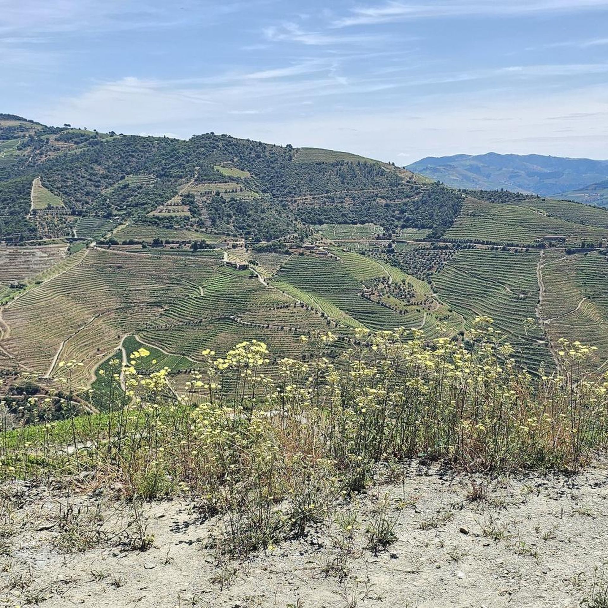
Hiking around Moura Morta offers routes through a landscape characterized by granite formations and lush meadows, sustained by the Vidoeiro river. The region features diverse floristic ecosystems and historical structures, providing varied terrain for outdoor activities. Trails often traverse verdant riverbanks and ascend to viewpoints, showcasing the area's natural and cultural heritage. This environment provides a mix of gentle paths and more challenging ascents.
Best hiking trails around Moura Morta
- The most popular hiking route is On the banks of…
Last updated: June 26, 2026
4.6
(40)
181
hikers
7.77km
02:35
360m
370m
Moderate hike. Good fitness required. Easily-accessible paths. Suitable for all skill levels.
3.4
(13)
103
hikers
Easy hike. Great for any fitness level. Easily-accessible paths. Suitable for all skill levels.

Sign up for free
4.6
(10)
41
hikers
10.1km
03:21
450m
450m
Moderate hike. Good fitness required. Easily-accessible paths. Suitable for all skill levels.
3.8
(5)
32
hikers
10.7km
03:23
400m
400m
Moderate hike. Good fitness required. Easily-accessible paths. Suitable for all skill levels.
4.3
(7)
36
hikers
Easy hike. Great for any fitness level. Easily-accessible paths. Suitable for all skill levels.
Get access to more routes and recommendations from other explorers.
Sign up for free
Already have an account?
Our route recommendations are based on thousands of hikes, rides, and runs completed by other people on komoot.
Start today with a free account
Your next adventure awaits.
Login or Signup


Tips from the Community

Beautiful view of the other side of the river.
0
0
The parking area for motorhomes directly on the Douro River
1
0

The building was built in 1910. It was designed by the architect José Marques da Silva. The building is in the Portuguese Modern style, with Neo-Renaissance influences. It is known for its decorative tiles and elaborately designed façade.
0
0

This highlight is located in Peso da Régua and NOT in Lisbon. Please don't be confused by the misleading comment below. The same goes for the numerous photos, none of which belong here.
2
0

The station is so run-down that it's almost in working order again. Old railway vehicles (burned-out steam locomotives and old wagons) are scattered around the large grounds. There are also many disused tracks, including turntables. At the end of the station, the former storage sheds have been converted into wine shops and restaurants.
2
0
A worthwhile museum, which scores points despite/or because of its very minimalist presentation of the subject matter. At the end, enjoy a port wine on the terrace of the museum's café.
1
0
The bridge is really well-made. The view from the bridge is beautiful, even though there's still a lot that could be done with the buildings at the end.
2
0
The Casa do Douro was established in 1932 as the Douro Winemakers' Union Federation. Its headquarters, dating from 1944, with its exterior clad in polished granite, was designed by Portuguese architect José Porto. Inside, noteworthy are the stained-glass window by painter Lino António and the grand hall, with three central crystal chandeliers, shaped like clusters and weighing over a ton, as well as the Pombaline marker identified with the number 1. When the Douro region was first demarcated, 331 granite markers were placed. The Pombaline markers (so named because the demarcation was designed by the Marquis of Pombal) are all different and share the word Feitoria (vinho de feitoria, synonymous with better-quality wine) and the year (1758 or 1761). At the time, wines were classified according to their quality and destination. The best wine, known as Vinho de Feitoria, was sent to England; Vinho de Embarque was exported to Brazil; and Vinho de Ramo was sold in Portugal. The stained glass window of the Casa do Douro, by painter Lino António, encapsulates the entire dynamic of the Douro Demarcated Region. It covers an area of 50m2 and forms a triptych. In the center panel, we see three large figures. The central figure represents the Casa do Douro and holds a scroll that reads "... Casa do Douro, decree 21,883, November 1932." This means that the government, through the aforementioned Decree-Law, created the Union Federation of Winegrowers of the Douro Region in November 1932, now known as Casa do Douro.
1
0
Frequently Asked Questions
How many hiking trails are available in Moura Morta?
Moura Morta offers a diverse selection of over 15 hiking trails. These routes cater to various skill levels, including 7 easy, 11 moderate, and 1 difficult option, ensuring there's a suitable path for every hiker.
What kind of terrain can I expect when hiking in Moura Morta?
The terrain in Moura Morta is characterized by its granite dominance and lush meadows, particularly the Verdejantes Lameiros along the Vidoeiro River. You'll find paths traversing verdant riverbanks, ancient irrigation channels (levadas), and sometimes ascending to viewpoints, offering a mix of gentle and more challenging sections.
What makes the landscape of Moura Morta unique for hiking?
Moura Morta's landscape is unique due to its striking granite formations, the vibrant Verdejantes Lameiros (lush meadows) sustained by the Vidoeiro River, and its rich floristic diversity. Hikers can observe various orchid species and mountain plants like arnica, all within a setting that blends natural beauty with historical human presence.
What do other hikers say about the trails in Moura Morta?
The trails in Moura Morta are highly regarded by the komoot community, boasting an average rating of 4.3 stars from over 90 reviews. Hikers often praise the varied terrain, the scenic views of the Douro Valley, and the opportunity to explore both natural beauty and historical structures along the way.
Are there easy hiking options in Moura Morta?
Yes, Moura Morta offers several easy hiking options. For a gentle walk, consider the Régua and the Douro River – Régua Pedestrian Bridge loop from Godim, an easy 6.0 km path that follows the Douro River. Another accessible choice is the Régua and the Douro River – Régua Riverside Promenade loop from Peso da Régua, a 3.5 km route perfect for a relaxed stroll.
Are there longer, more challenging hikes in the Moura Morta area?
For those seeking a longer, moderate challenge, the Hiking loop from Mesão Frio covers 10.1 km through varied terrain, typically taking around 3 hours 20 minutes. Another moderate option is the Régua and the Douro River – Douro view loop from Régua, a 10.5 km trail offering expansive views.
Are there any circular hiking routes in Moura Morta?
Yes, many routes in Moura Morta are circular. A popular choice is On the banks of the Douro – Douro Valley Wine Route loop from Samodães, a moderate 7.8 km trail offering views of the Douro Valley. The Régua and the Douro River – Régua Pedestrian Bridge loop from Godim is another excellent circular option, ideal for an easy walk along the river.
What historical sites or landmarks can I see while hiking in Moura Morta?
Hiking in Moura Morta allows you to discover centuries of human presence. You can find ancient watermills along the Vidoeiro River, traditional granaries (canastros do curral), and even an old Roman-era bridge. The area is also part of the Rota da Água e da Pedra, highlighting its historical water management structures and geology. Don't miss the Lamego Castle or the Régua Pedestrian Bridge, which are notable nearby attractions.
Are there any specific natural features to look out for on the trails?
Absolutely. The Verdejantes Lameiros (lush meadows) are a highlight, sustained by ancestral irrigation techniques along the Vidoeiro River. Keep an eye out for the rich floristic diversity, including various orchid species like heath spotted-orchids and great flower serapias, as well as mountain plants such as arnica and Iberian paradise lily.
Is Moura Morta part of any larger hiking networks?
Yes, Moura Morta is integrated into broader hiking networks. It's a key part of the Rota da Água e da Pedra (Route of Water and Stone), which emphasizes the region's historical water management and geology. The village is also connected to the Grande Rota das Montanhas Mágicas (Great Route of the Magical Mountains), indicating its significance within a wider system of scenic and culturally rich pathways.
What is the best time of year to hike in Moura Morta?
Moura Morta's lush meadows thrive year-round, even through harsh winters, making it a destination that can be enjoyed in various seasons. Spring and autumn generally offer pleasant temperatures and vibrant landscapes, while the sustained greenery along the Vidoeiro River ensures beauty even in colder months.
Are there any religious or spiritual sites accessible via hiking trails?
Yes, the Senhora da Ouvida Sanctuary is an important ancient place of worship and pilgrimage. Located on a plateau, it also features several mamoas (funerary monuments from the late Bronze Age), offering a glimpse into the area's long spiritual history and making it a significant point of interest for hikers.
Most popular attractions around Moura Morta

Get inspired with the komoot mobile app


Explore more
Browse the best Hikes in other regions.
