The best road cycling routes around Várzea Da Serra
5.0
(4)
116
riders
5
rides
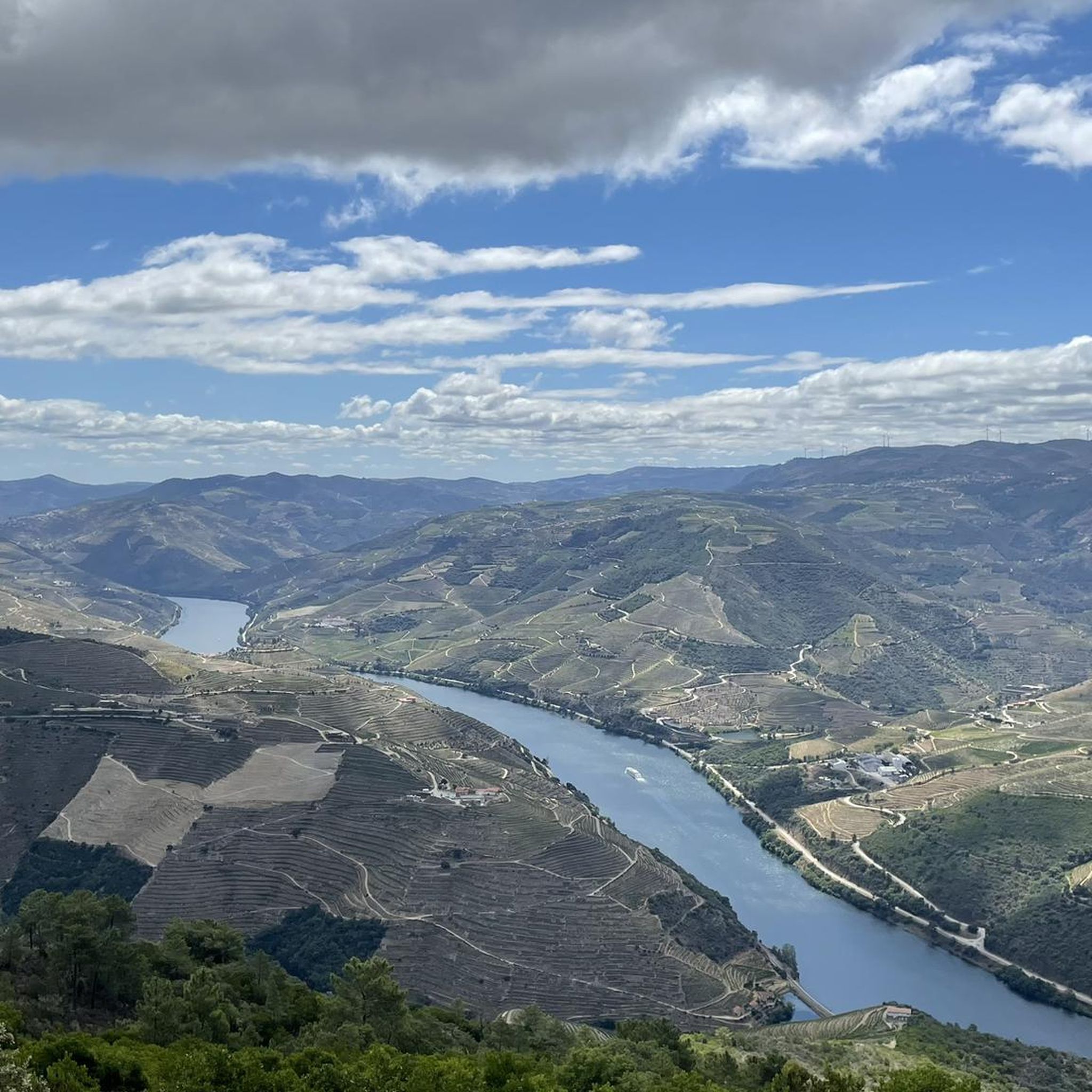
Road cycling around Várzea Da Serra features a diverse landscape characterized by a high plateau that descends into the Varosa and Varosela river valleys. The region is nestled amidst peaks, including Serra de Santa Helena (over 1,100 meters) and Testos (1,080 meters), providing varied topography. This mountainous terrain offers significant elevation changes, making it suitable for challenging and scenic road cycling routes. The area's natural features include winding roads through river valleys and rolling hills.
Best road cycling routes around…
Last updated: June 28, 2026
5.0
(2)
45
riders
44.3km
02:24
800m
800m
Moderate road ride. Good fitness required. Mostly well-paved surfaces and easy to ride.
5.0
(2)
36
riders
57.1km
03:03
1,000m
1,000m
Hard road ride. Very good fitness required. Mostly well-paved surfaces and easy to ride.

Sign up for free
16
riders
42.1km
02:15
720m
720m
Moderate road ride. Good fitness required. Mostly well-paved surfaces and easy to ride.
7
riders
57.4km
03:22
1,250m
1,250m
Hard road ride. Very good fitness required. Mostly well-paved surfaces and easy to ride.
6
riders
117km
06:04
1,870m
1,870m
Hard road ride. Very good fitness required. Mostly well-paved surfaces and easy to ride.
Our route recommendations are based on thousands of hikes, rides, and runs completed by other people on komoot.
Start today with a free account
Your next adventure awaits.
Login or Signup
Popular around Várzea Da Serra

Tips from the Community

The parking area for motorhomes directly on the Douro River
1
0

There is, I don't know if it corresponds to the highest point
0
0
We have incredible things throughout this country.
0
0

A worthwhile museum, which scores points despite/or because of its very minimalist presentation of the subject matter. At the end, enjoy a port wine on the terrace of the museum's café.
1
0
The bridge is really well-made. The view from the bridge is beautiful, even though there's still a lot that could be done with the buildings at the end.
2
0

A beautiful church, both inside and out. The courtyard is also worth seeing 😃
2
0

The slopes of the Douro are truly spectacular. Stunning landscapes. 👍🥾
1
0
Thank you for sharing the spectacular photos.👍
0
0
Frequently Asked Questions
How many road cycling routes are available around Várzea Da Serra?
There are several road cycling routes around Várzea Da Serra, with komoot featuring 6 distinct tours. These routes offer a variety of experiences across the region's diverse landscape.
What kind of terrain can I expect on road cycling routes around Várzea Da Serra?
The region is characterized by a captivating highland environment, nestled amidst peaks like Serra de Santa Helena (over 1,100 meters) and Testos (1,080 meters). You can expect significant elevation changes, winding roads through river valleys such as the Varosa and Varosela, and rolling hills. This mountainous terrain provides both challenging ascents and scenic descents.
Are there challenging road cycling routes in Várzea Da Serra?
Yes, Várzea Da Serra offers challenging road cycling routes. For instance, the Régua Pedestrian Bridge – Douro Valley loop from Ferreirim is a difficult 36.0-mile (58.0 km) path featuring demanding climbs and panoramic vistas over the river valleys. Another challenging option is the N2 Marker of Lamego – Régua Road Bridge loop from Lamego, which covers 57.2 miles (92.0 km) with substantial elevation gain.
Are there any easier road cycling routes for beginners in Várzea Da Serra?
While many routes feature significant elevation, some are more moderate. The Douro Valley Wine Route – Douro Valley loop from Lamego is a moderate 27.2-mile (43.8 km) trail offering scenic views through the renowned Douro Valley. Another moderate option is the N2 Marker of Lamego – Régua Road Bridge loop from Queimadela, a 20.7-mile (33.3 km) trail through rolling hills and traditional villages.
What points of interest can I explore near the road cycling routes?
The region around Várzea Da Serra is rich in historical and natural attractions. You can visit landmarks such as Lamego Castle, the impressive Lamego Cathedral, or the historic Ucanha Tower and Bridge. For scenic views, consider the View of Lamego and the Sanctuary of Nossa Senhora dos Remédios.
What do other road cyclists enjoy about cycling in Várzea Da Serra?
The road cycling routes around Várzea Da Serra are highly rated by the komoot community, with an average score of 5.0 stars. Cyclists often praise the varied topography, the scenic views of the Douro Valley, and the challenging ascents that reward with panoramic vistas over river valleys and mountainous landscapes.
Are there long-distance road cycling options in the Várzea Da Serra area?
Yes, for those seeking longer rides, the N2 Marker of Lamego – Nossa Senhora da Oliveira loop from Lamego is a difficult route spanning 72.7 miles (117.1 km). This extensive loop offers a significant challenge and a comprehensive exploration of the region's diverse landscapes.
Can I find circular road cycling routes around Várzea Da Serra?
Many of the road cycling routes in the area are designed as loops, allowing you to start and finish in the same location. Examples include the Douro Valley Wine Route – Douro Valley loop from Lamego and the Régua Pedestrian Bridge – Douro Valley loop from Ferreirim, both offering circular journeys through the scenic landscape.
What is the best time of year for road biking in Várzea Da Serra?
Given the region's mountainous terrain and diverse Portuguese landscape, spring (April-June) and autumn (September-October) are generally ideal for road cycling. During these seasons, the weather is typically mild, offering comfortable temperatures for ascents and descents, and the scenery is particularly vibrant.
Is Várzea Da Serra suitable for family road cycling?
While the region features significant elevation changes, some moderate routes might be suitable for families with older, experienced children. However, due to the mountainous terrain and challenging climbs, it's advisable to carefully review route profiles and choose shorter, less strenuous options if cycling with younger family members.
Are there places to eat or stay along the road cycling routes?
Várzea Da Serra and nearby traditional villages feature a 'typical village' ambiance with traditional granite houses. While specific cafes or accommodations directly on every route are not detailed, the broader Douro region is known for its hospitality. You'll find opportunities for refreshments and lodging in towns like Lamego and other settlements along or near the routes.
Most popular routes around Várzea Da Serra
Most popular attractions around Várzea Da Serra

Get inspired with the komoot mobile app


Explore more
Browse the best Road cycling routes in other regions.
