The best walks and hikes around Frohnhofen
4.6
(1363)
6,172
hikers
13
hikes
Hiking around Frohnhofen offers diverse landscapes, situated between the rolling hills of the Palatinate Forest and the Glan River. The region is characterized by picturesque forests, riverine paths, and local natural features like the Duck Pond. Trails vary in difficulty and length, providing options for different fitness levels.
Best hiking trails around Frohnhofen
- The most popular hiking route is Wartenstein Watchtower – Duck Pond, Frohnhofen loop from Frohnhofen, a 7.4 miles (11.9 km) trail that takes 3 hours 15…
Last updated: May 24, 2026
4.7
(7)
37
hikers
11.4km
03:08
180m
180m
Moderate hike. Good fitness required. Easily-accessible paths. Suitable for all skill levels.
4.5
(6)
35
hikers
Easy hike. Great for any fitness level. Easily-accessible paths. Suitable for all skill levels.

Sign up for free
4.6
(16)
46
hikers
Hard hike. Very good fitness required. Easily-accessible paths. Suitable for all skill levels.
6
hikers
8.92km
02:26
130m
140m
Moderate hike. Good fitness required. Easily-accessible paths. Suitable for all skill levels.
5.0
(1)
6
hikers
Easy hike. Great for any fitness level. Easily-accessible paths. Suitable for all skill levels.
Get access to more routes and recommendations from other explorers.
Sign up for free
Already have an account?
Our route recommendations are based on thousands of hikes, rides, and runs completed by other people on komoot.
Start today with a free account
Your next adventure awaits.
Login or Signup

Tips from the Community

Beautiful but small observation tower
0
0

🪵 Old boundary stone on the Kirschenlandweg Between Frohnhofen and Saal, these massive sandstone monuments bear witness to the former state border between the Electorate of the Palatinate and Palatinate-Zweibrücken. Erected in 1776, they bear the diamond-shaped coat of arms of the Wittelsbach dynasty as well as old regional designations such as "CP" (Electorate of the Palatinate) and "PZ" (Palatinate-Zweibrücken). 💡 Tip: If you look closely, you can still see the historical engravings – ideal for a little journey back in time in the middle of the forest!
0
0
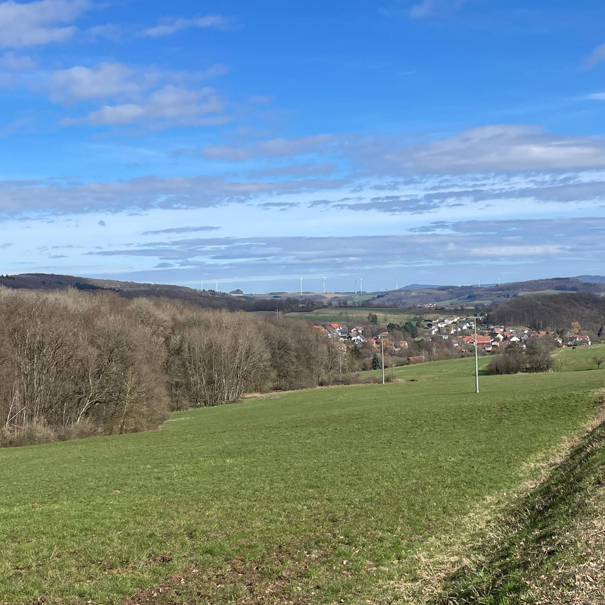
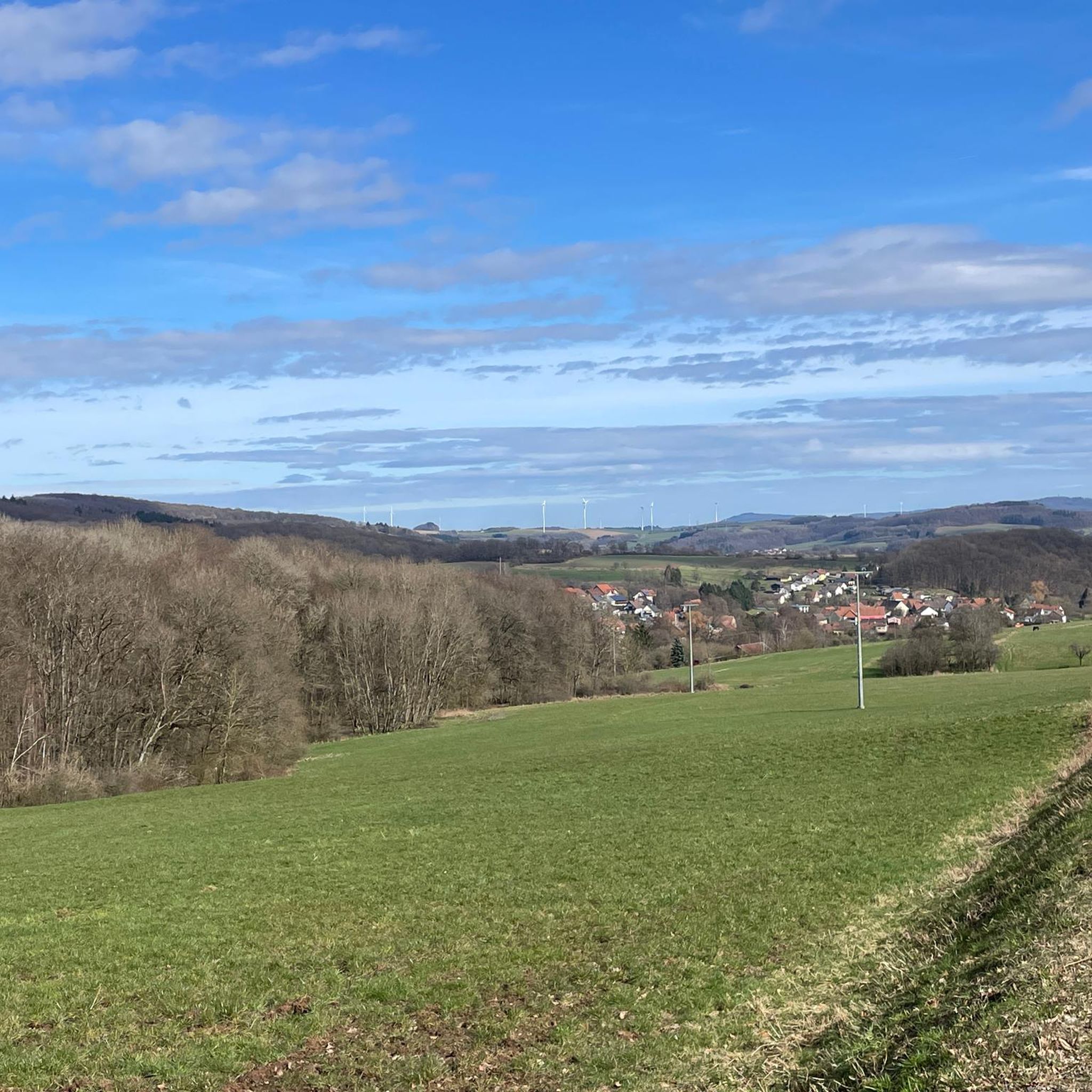
Wide fields, rolling hills, and beyond, the dark green of the Palatinate Forest – this vantage point offers a view of one of the most beautiful regions of the Palatinate. Depending on the time of day, the play of light over the fields changes, making the landscape appear soft or rich in contrast. 💡 Tip: A perfect place for a short rest with a view – a truly postcard-worthy scene, especially at sunset.
0
1

Hello everyone, I'm new here, this is my first comment! I always refer to it as "My Oak" because it inspires awe. In our town, we call it the "Napoleon Oak." The whole cherry blossom trail is highly recommended for beginners like us! Greetings from Dittweiler.
1
0
In the Ackerswald and Heidenbösch forest sections, traces dating back thousands of years lie beneath moss-covered hills: Celtic burial sites dating back to around 100 BC. The burial mounds were originally surrounded by stone rings – today, only the vaults and a few fallen limestones remain. Particularly impressive: A warrior's sword was discovered hidden in one of the graves – along with pottery and scissors. 💡 Tip: The graves are located directly on an ancient long-distance route – the "Höhenstraße" (High Road) between present-day Frohnhofen and Bubach. Just pause for a moment and let the experience sink in.
0
1
In the middle of the quiet forest area of the "Ackerswald" section lies a mossy boundary stone – part of the historic border demarcation of 1776 between the Electorate of the Palatinate and Palatinate-Zweibrücken. The imposing sandstones display the diamond-shaped coat of arms of the House of Wittelsbach on two sides, as well as the initials "CP" and "PZ" for the former rulers. A silent witness to feudal power relations – and an exciting photo spot for hikers with an eye for detail. 💡 Tip: Keep an eye out for other stones – many are still visible and tell a story without words.
0
1
In the middle of the forest, this mossy stone recalls earlier times when borders, tolls, and property claims were still visibly marked. It could be part of the historic Landwehr (land defense) or a relic along the old "Lichtenberger Straße" (Lightenberger Road) – the medieval east-west route towards Kusel. Such boundary stones were often inscribed with coats of arms, letters, or dates and today stand almost unnoticed in the undergrowth. 💡 Tip: Keep your eyes open – places steeped in history are often hidden right along the path!
0
1
🌿 In the middle of the forest, traces of an old border fortification are still visible today: a rampart, ditch, and once dense thorn hedges formed the so-called "Landwehr" (Landwehr) in the 16th century. It served not only as protection, but also to control trade routes – including a customs post, the so-called "Zoll-Eiche" (Customs Oak). The adjacent road was part of an important east-west connection from Zweibrücken to Kusel. 💡 Tip: If you walk through the forest with your eyes open, you can still see the historic ditches in the terrain.
0
1
Frequently Asked Questions
What kind of terrain can I expect on hikes around Frohnhofen?
Hikes around Frohnhofen offer diverse landscapes, ranging from the rolling hills of the Palatinate Forest to scenic paths along the Glan River. You'll find a mix of forested trails, open countryside, and routes that pass by local natural features like the Duck Pond. Elevation gains can vary, with some routes featuring significant climbs, while others are relatively flat.
Are there hiking options for beginners or families in Frohnhofen?
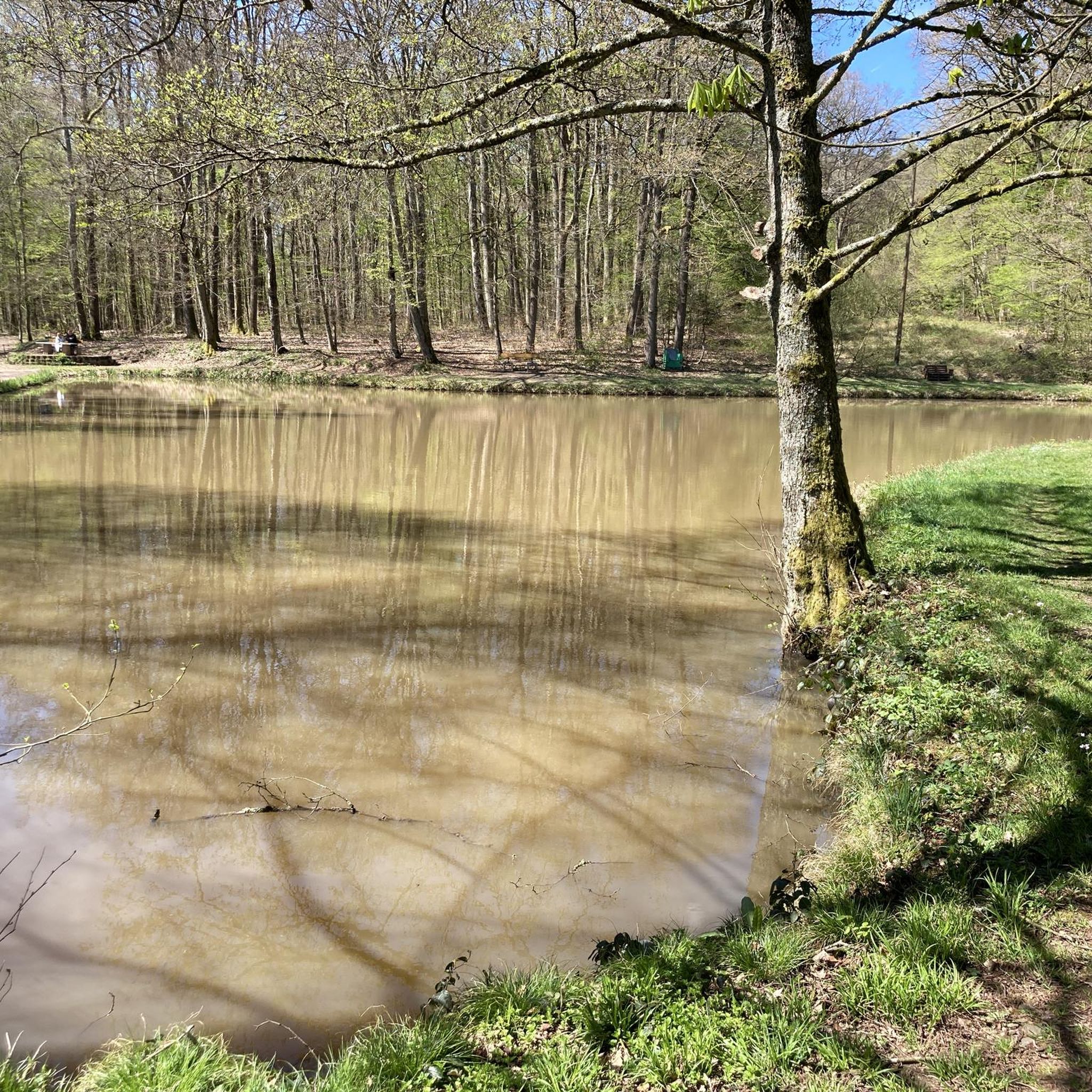
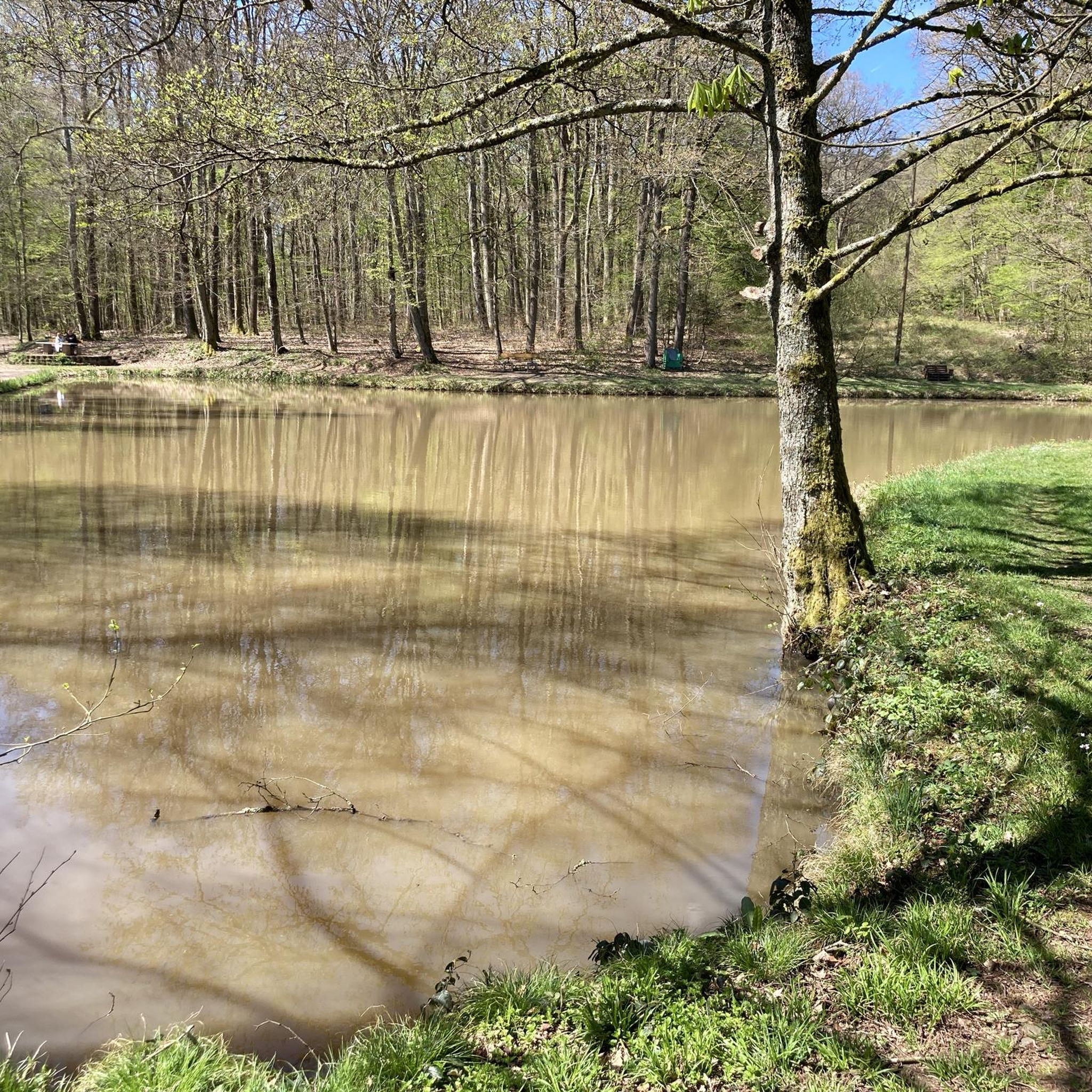
Yes, Frohnhofen offers several easy hiking trails suitable for beginners and families. For example, the Entenweiher – Picnic Area at Entenweiher loop from Frohnhofen is an easy 5.5 km path that explores the area around the Duck Pond. Another easy option is the Hiking loop from Frohnhofen, which is about 4.5 km long.
How many hiking trails are available in Frohnhofen?
Frohnhofen features over 10 distinct hiking trails, catering to various preferences and fitness levels. These include 9 easy routes, 3 moderate routes, and 1 more challenging option.
What do other hikers say about the trails in Frohnhofen?
The hiking trails in Frohnhofen are highly regarded by the komoot community, holding an average rating of 4.6 stars from over 1300 reviews. Hikers often praise the varied terrain, the natural beauty of the Palatinate Forest, and the well-maintained paths that lead to picturesque spots like the Duck Pond and the Wartenstein Watchtower.
Are there any notable natural features or landmarks to see while hiking in Frohnhofen?
Absolutely. Many trails in Frohnhofen incorporate significant natural features and landmarks. You can explore the scenic Palatinate Forest, walk along the Glan River, or visit the local Duck Pond. The 'wild and romantic' Rückersbacher Gorge is another highlight, offering routes through vineyards. Additionally, you might encounter the Steinbach Waterfall or the historic Former Glantal Railway Route.
Are there any circular hiking routes in Frohnhofen?
Yes, many of the hiking routes in Frohnhofen are designed as loops, allowing you to start and end at the same point. Popular circular options include the Wartenstein Watchtower – Duck Pond, Frohnhofen loop and the shorter Entenweiher – Picnic Area at Entenweiher loop.
Can I bring my dog on the hiking trails in Frohnhofen?
Frohnhofen's natural landscapes, including the Palatinate Forest and paths along the Glan River, are generally welcoming for dogs. Most trails are suitable for well-behaved dogs on a leash. Always ensure to respect local wildlife and clean up after your pet.
What is the best time of year to go hiking in Frohnhofen?
The warm season is particularly highlighted as a prime time for hiking in Frohnhofen, offering pleasant weather to enjoy the Palatinate Forest and riverine paths. However, the diverse landscapes provide beautiful scenery year-round, with autumn offering vibrant colors and spring showcasing fresh greenery.
Are there any historical sites or cultural routes in Frohnhofen?
Yes, some trails in Frohnhofen offer a blend of nature and history. For instance, the 'Laufach | Frohnhofen | European Cultural Route' traverses historic ground where significant events like a meeting of the March Revolution in 1849 and a battle in 1866 took place. Information boards along these routes provide historical context.
Are there any challenging hikes for experienced hikers in Frohnhofen?
For experienced hikers seeking a challenge, Frohnhofen offers routes with more significant elevation gain and longer distances. The Wartenstein Watchtower – Römerweiher Pond in Dittweiler loop is a demanding 19.4 km trail with over 300 meters of elevation gain, typically taking over 5 hours to complete.
Are there any viewpoints or scenic overlooks along the trails?
Many trails in Frohnhofen offer scenic views, particularly those that ascend into the rolling hills of the Palatinate Forest. The Wartenstein Watchtower, for example, is a prominent feature on one of the popular loops and likely provides expansive views of the surrounding landscape.
Is there parking available near the hiking trailheads in Frohnhofen?
While specific parking details for every trailhead are not provided, Frohnhofen is a district that caters to outdoor enthusiasts, suggesting that parking facilities are generally available near popular starting points for hikes. It's advisable to check local signage upon arrival.
Most popular routes around Frohnhofen
Most popular attractions around Frohnhofen

Get inspired with the komoot mobile app


Explore more
Browse the best Hikes in other regions.
