The best walks and hikes in Roaring River Wilderness
5.0
(2)
68
hikers
19
hikes
Hikes in Roaring River Wilderness lead through a landscape of subalpine lakes, meadows, and old-growth forest. The area is part of the Mount Hood National Forest and offers views of Cascade volcanoes from certain vantage points. The trail network includes routes of varying difficulty, from short walks to more demanding loops that access the region's numerous lakes.
Best hiking trails in Roaring River Wilderness
- The most popular hiking route is the Serene Lake Trail loop — Roaring River Wilderness, a 10.6 mile (17.1 km) trail that takes around 5 hours 25 minutes to complete. This difficult route features significant elevation gain and provides access to a string of subalpine lakes.
- Another top favourite among local hiking enthusiasts is the Dry Ridge Trail — Roaring River Wilderness, a difficult 10.6 mile (17.1 km) path. The trail involves substantial climbing through forested terrain.
- Local hiking enthusiasts also love the Tumala Mountain Hike — Mount Hood National Forest, a 4.2 mile (6.7 km) trail leading through forest, often completed in about 2 hours 15 minutes.
- Hiking in Roaring River Wilderness is defined by trails to mountain lakes, paths through old-growth forests, and routes with views of the Cascade Range. The network provides options for both moderate day hikes and challenging multi-hour treks.
- The routes in Roaring River Wilderness are highly rated by the komoot community with an average score of 5.0 stars from over 1 review. More than 100 hikers have used komoot to explore Roaring River Wilderness's varied terrain.
Last updated: June 25, 2026
3.27km
00:57
20m
190m
Embark on an easy hike along Shellrock Lake Trail #700, a 2.0-mile (3.3 km) route that takes you through diverse landscapes. You will gain a gentle 55 feet (17 metres) in elevation, completing the journey in about 56 minutes. The path begins among rhododendrons, then opens into clear-cut areas offering views of the surrounding countryside. As you continue, you will re-enter dense timber, leading you to the tranquil, high-elevation Shellrock Lake, nestled within a Douglas fir forest.
Before you set out, be aware that the trailhead for this route is reached via a rough road; a high-clearance vehicle is advised for easier access. While the overall hike is easy, you might encounter some rougher sections near the lake due to erosion, so watch your step. If you wish to extend your adventure, several campsites are available around Shellrock Lake, offering a chance to stay overnight.
This trail offers a peaceful escape within Mount Hood National Forest, showcasing a transition from open clearings to dense forest. Keep an eye out for wildflowers, especially in the clear-cut sections, adding a splash of color to your hike. The pristine Shellrock Lake itself is a highlight, providing a serene backdrop for your outdoor experience.
6.69km
02:18
370m
370m
Moderate hike. Good fitness required. Easily-accessible paths. Suitable for all skill levels.

Sign up for free
2
hikers
17.1km
05:24
670m
670m
Embark on the Serene Lake and Grouse Point Loop, a difficult hiking route spanning 10.6 miles (17.1 km) with a significant elevation gain of 2194 feet (669 metres). This challenging journey, estimated to take 5 hours and 23 minutes, leads you through diverse and demanding terrain. You will traverse old-growth forests and mossy rock fields, eventually reaching the peaceful Serene Lake. Along the way, expect views across the Roaring River canyon to Indian Ridge, and on clear days, you might even spot distant peaks like Mt. Hood. The route also reveals a cluster of other alpine lakes, including Lower Rock Lake, and takes you through Cache Meadow, which bursts with marsh marigolds in bloom.
Before you set out, be aware that access to the trailhead via roads like Forest Road 4610-240 is very rough and narrow, so a high-clearance vehicle is essential. Prepare for challenging conditions, as patches of snow can persist at higher elevations, particularly earlier in the hiking season. Crossing the South Fork of the Roaring River can be difficult before late summer, and you should anticipate navigating numerous fallen trees along the path. Plan your visit carefully to ensure a safe and enjoyable experience on this demanding trail.
This loop is situated within the Roaring River Wilderness, offering a true backcountry experience for experienced hikers. The trail's demanding nature and varied landscape make it a notable adventure in the region. You will encounter a mix of natural features, from the tranquility of Serene Lake to the vibrant flora of Cache Meadow. This route provides a deep immersion into the wilderness, rewarding your efforts with solitude and expansive views.
12.1km
03:45
440m
440m
Explore the Clackamas River Trail #715, a moderate hiking route that takes you through diverse scenery in the Mt. Hood National Forest. You will cover 7.5 miles (12.1 km) and gain 1457 feet (444 metres) in elevation, typically taking about 3 hours and 45 minutes to complete. As you hike, you will pass through old-growth forests of towering cedar and Douglas fir, with continuous views of the wild and scenic Clackamas River. Keep an eye out for the impressive Pup Creek Falls, a significant waterfall that adds a dramatic touch to your journey.
Before you head out, be aware that the 2020 Riverside Fire heavily impacted the trail, meaning some sections are no longer fully connected. You might encounter downed trees and landslides, and certain parts are narrow with steep drop-offs, so exercise caution. A trail fee is required at the Fish Creek Trailhead, and poison oak is common in many areas, especially in sections affected by the fire. Always check current conditions before your visit, as burned areas can present hazards like eroded slopes and flash floods.
This trail is a notable part of the Mt. Hood National Forest, showcasing a rich ecosystem along the Clackamas River, which is designated as a National Wild and Scenic River. The area is known for its natural beauty and resilience, even after the significant fire events. You might also spot unique flora, such as the white Clackamas iris, particularly in the spring. The route offers a chance to connect with a vital part of the region's natural heritage.
17.1km
05:55
930m
930m
Embark on the Dry Ridge Trail #518, a difficult 10.6-mile (17.1 km) hiking route that challenges you with a significant climb. You will gain 3054 feet (931 metres) in elevation, requiring an estimated 5 hours and 54 minutes to complete. As you ascend, look for ancient trees, dogwood, and white iris, and cross Grouse Creek where moss-covered boulders add to the scenic beauty. The trail offers rewarding views, including glimpses into the Clackamas River Valley early in your journey.
To begin your hike, head to the Roaring River Campground, which serves as the trailhead for this route. Be prepared for potential hazards on the trail, as post-fire conditions mean you might encounter burned trees, eroded slopes, mudslides, and brushy areas that can make navigation tricky. While dogs are welcome to join you, horseback riding is not advised due to sections that are extremely steep and narrow, posing a risk for horses.
This challenging route takes you deep into the heart of the Roaring River country, a rugged and wild area. The trail is notable for its connection to Grouse Point Trail #517 at its highest point, offering a gateway to further exploration for those seeking extended adventures. It provides a true wilderness experience within the Roaring River Wilderness, making it a prime choice for experienced hikers looking for a demanding and immersive journey.
Get access to more routes and recommendations from other explorers.
Sign up for free
Already have an account?
Our route recommendations are based on thousands of hikes, rides, and runs completed by other people on komoot.
Start today with a free account
Your next adventure awaits.
Login or Signup
Popular around Roaring River Wilderness
Tips from the Community

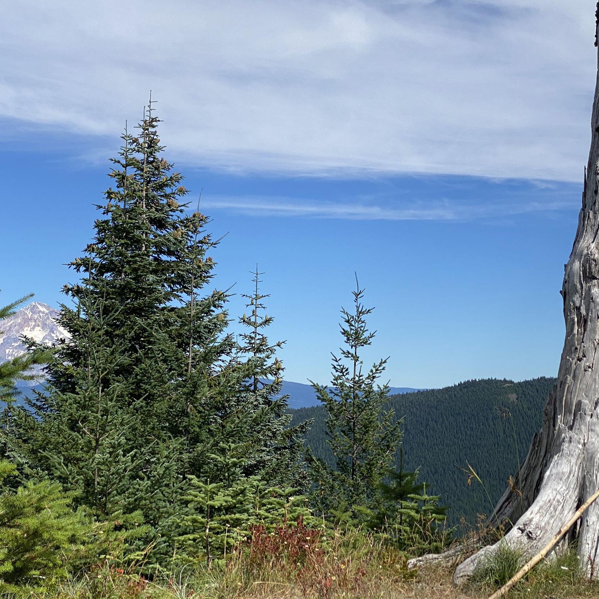
Though gaining popularity, Serene Lake remains less crowded compared to other lakes in the region, offering a more secluded experience. On clear days, the majestic peaks of the Cascade Range grace the horizon, adding a touch of grandeur to the landscape.
0
0

The Dry Ridge Trail is a popular but challenging trail near Estacada. The trail starts out steep, but the gradient levels out once it reaches the ridge. From the trail there are views of the Clackamas River and Grouse Creek.
0
0
Roaring River Campground serves as a gateway to a host of outdoor activities, from lush forests to dry meadows and rocky ridges, Dry Ridge Trail, which leads to stunning overlooks, or exploring the Roaring River Wilderness, teeming with diverse flora and fauna. There is potable water and a vault toilet.
0
0
While not as widely known as some other Oregon waterfalls, Pup Creek Falls offers a more secluded and intimate experience. The falls boast a 230-foot plunge, creating an awe-inspiring spectacle, especially during peak flow in spring.
0
0

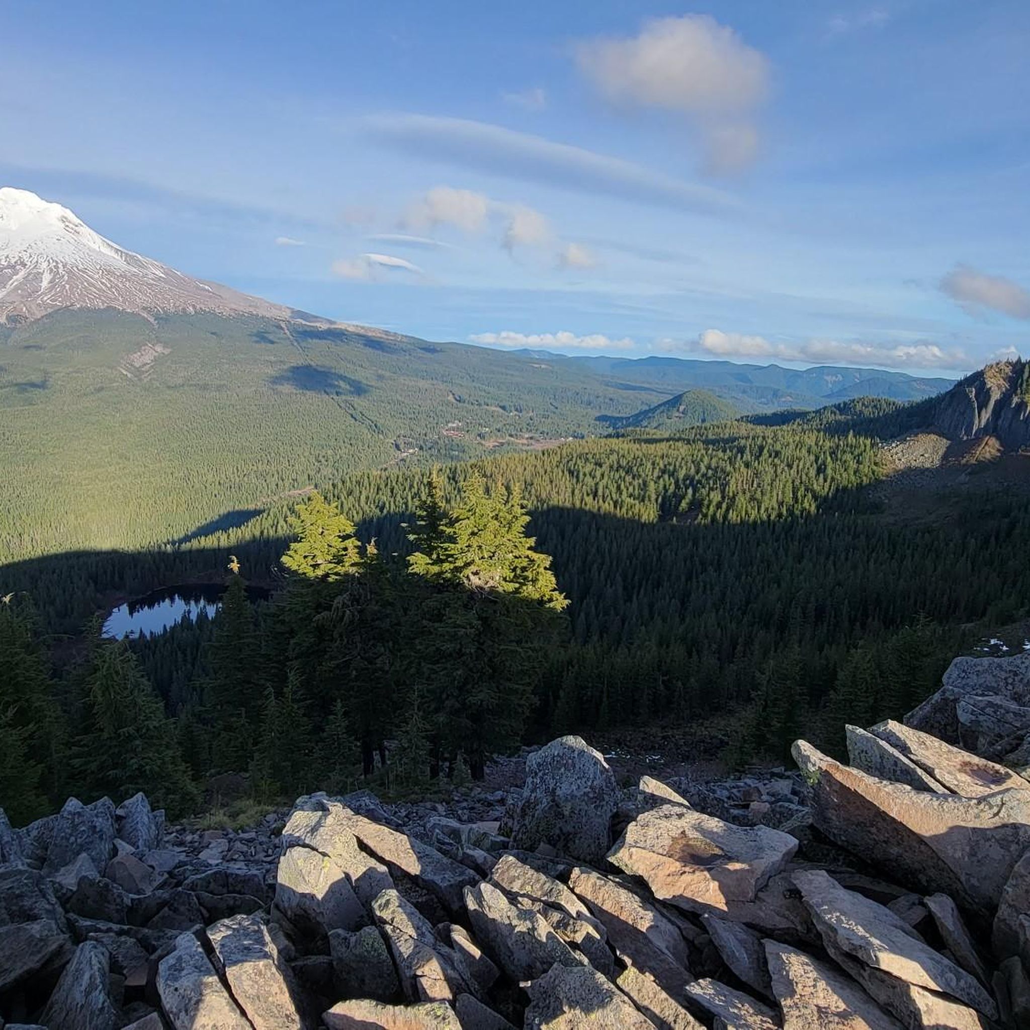
Tumala Mountain is 4,773 feet high. From the rocky summit ridge, you have a great view of Mount Hood and Mount Jefferson. Early summer, the summit is also covered by wildflowers.
0
0
Frequently Asked Questions
Are there any easy, family-friendly hikes in the Roaring River Wilderness?
Yes, the area offers some shorter trails suitable for families. A great option is the hike to Shellrock Lake, which is just a half-mile walk from the trailhead, making it very accessible for a quick and rewarding outing with children.
What are the best options for a multi-day backpacking trip?
The Rock Lakes Basin is ideal for backpacking. You can explore a network of trails connecting several subalpine lakes. The Serene Lake Trail loop is a popular choice, offering a challenging 10.6-mile (17.1 km) circuit with access to secluded campsites by the lakes.
Can I bring my dog on the trails?
Yes, dogs are generally permitted on trails within the Roaring River Wilderness, as it is part of the Mount Hood National Forest. However, they must be kept on a leash at all times to protect wildlife and ensure a positive experience for all hikers.
When is the best time of year to hike in the Roaring River Wilderness?
The prime hiking season is from July through October, after the snow has melted from the higher elevation trails. For wildflowers, plan your visit for early summer when meadows like Black Wolf Meadows are in full bloom. Late summer is excellent for picking huckleberries around the lakes.
Do I need a permit to hike or camp here?
Yes, a free, self-issue wilderness permit is required for both day-use and overnight stays in the Roaring River Wilderness. You can typically find these permits at the trailhead kiosks. Be sure to fill one out before starting your hike.
What are the road conditions like getting to the trailheads?
Access roads to trailheads in the Roaring River Wilderness are often unpaved, rough, and may have potholes. A high-clearance vehicle is recommended, though not always strictly necessary depending on recent conditions. It's wise to check recent trip reports or Forest Service updates before you go.
Are there any hikes with great views of the Cascade volcanoes?
Absolutely. For expansive views, the Tumala Mountain Hike is an excellent choice. This moderate 4.2-mile (6.7 km) trail rewards you with panoramic vistas that can include Mount Hood, Mount St. Helens, Mount Rainier, and Mount Adams on a clear day.
Can I go fishing in the lakes?
Yes, fishing is a popular activity in the wilderness. The lakes, such as those in the Rock Lakes Basin, are stocked with Rainbow and Brook Trout. An Oregon fishing license is required, so be sure to have one with you.
Are there any waterfalls to see in the area?
While the main wilderness area is known more for its lakes, you can find waterfalls in the surrounding region. The hike to Pup Creek Falls in the nearby Clackamas Wilderness follows the Clackamas River Trail to a beautiful waterfall.
What is a good challenging day hike?
For a strenuous but rewarding day, consider the Dry Ridge Trail. This difficult 10.6-mile (17.1 km) route involves significant elevation gain through dense forest, offering a true sense of solitude and a great workout.
How many hiking trails are in the Roaring River Wilderness?
There are over a dozen designated trails to explore in and around the Roaring River Wilderness. These range from short, easy walks to challenging, multi-hour treks, with options for all skill levels across 2 easy, 6 moderate, and 6 difficult routes.
What do other hikers say about the trails here?
The trails in Roaring River Wilderness are highly regarded by the komoot community. Hikers often praise the pristine beauty of the subalpine lakes, the solitude found on the trails, and the majestic old-growth forests.
Most popular routes in Roaring River Wilderness

Get inspired with the komoot mobile app


Explore more
Browse the best Hikes in other regions.
