Sheep Mountain Wilderness
Sheep Mountain Wilderness
The best walks and hikes in Sheep Mountain Wilderness
4.8
(85)
1,781
hikers
102
hikes
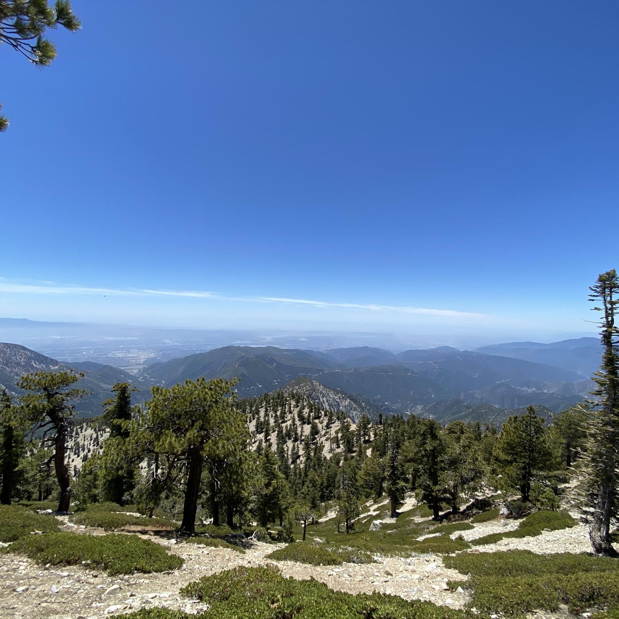
Hikes in Sheep Mountain Wilderness explore a federally protected area within the San Gabriel Mountains. The region is characterized by rugged terrain, with deep canyons carved by the East Fork of the San Gabriel River. Elevations range from around 2,400 feet (730 m) in the chaparral-covered lower areas to over 10,000 feet (3,050 m) at the highest peaks, creating a diverse landscape for hiking.
Best hiking trails in Sheep Mountain Wilderness
- The most popular hiking route is Mount Baden-Powell —…
Last updated: September 28, 2026
4.9
(7)
112
hikers
19.4km
06:55
390m
590m
Hard hike. Very good fitness required. Mostly accessible paths. Sure-footedness required.
21
hikers
6.47km
02:37
820m
20m
Moderate hike. Good fitness required. Easily-accessible paths. Suitable for all skill levels.

8
hikers
23.7km
08:23
1,390m
1,390m
Hard hike. Very good fitness required. Easily-accessible paths. Suitable for all skill levels.
2
hikers
3.53km
01:06
200m
20m
Easy hike. Great for any fitness level. Easily-accessible paths. Suitable for all skill levels.
1
hikers
4.52km
01:21
170m
80m
Easy hike. Great for any fitness level. Easily-accessible paths. Suitable for all skill levels.
Get access to more routes and recommendations from other explorers.
Already have an account?
Our route recommendations are based on thousands of hikes, rides, and runs completed by other people on komoot.
Start today with a free account
Your next adventure awaits.
Popular around Sheep Mountain Wilderness
Tips from the Community

Inspiration Point is a scenic viewpoint where the Pacific Crest Trail crosses the Angeles Crest Highway; there is a parking area here.
0
0
Vincent Gap has a restroom and parking and some nice views of the surrounding area. There is a gate beyond the gab heading west that is seasonally closed. Continue past the gates to further your adventure on the scenic Angeles Crest Highway.
0
0

Great view towards Mount Baden-Powell from the PCT. If the trail is not too busy, this is a great place to stop and take in the wonderful vistas.
0
0

Hiking the PCT northbound you will be at Highway 2 (Angeles Crest Highway) a little bit below Inspiration Point. This is a popular spot to hitch into the lovely mountain town of Wrightwood that has grocery stores, a well-stocked outfitter (Mountain Hardware), restaurants, accommodation, but no laundromat. If you are lucky there might be a water cache at the trailhead.
3
0
Enjoy the view of majestic Mount Baden-Powell from the Crest Trail. If you hike along the PCT northbound this is where you will climb up pretty soon.
1
0
Another turquoise, but not accessible pond with a futuristic shaped ski lift right next to it. It is probable that the water is used to create artificial snow for the ski slopes.
1
0
Although the signs state that you should not trespass or swim in the water, some hikers try to get water if Guffy spring is dry.
2
0
The campground has tables, benches, fire pits and pit toilets. It is also accessible by car. Guffy spring is close by to get fresh, cold water.
3
0
Frequently Asked Questions
Are there any easy hikes suitable for beginners or families?
Yes, the area offers some less strenuous options. A great choice is the Big Horn Mine trail, a relatively flat 3.8-mile (6.1 km) path that leads to a historic mine site, offering a glimpse into the region's past without a major climb.
I'm looking for a serious challenge. What are the steepest hikes?
The Sheep Mountain Wilderness is known for its demanding climbs. Iron Mountain, in particular, is famous for its steepness and is considered a formidable challenge even for experienced hikers. Successfully summiting it provides a great sense of accomplishment and rewarding views.
Are dogs allowed on the trails in the Sheep Mountain Wilderness?
Yes, dogs are generally permitted on the trails within the Sheep Mountain Wilderness and the surrounding Angeles National Forest, but they must be kept on a leash at all times. Be sure to bring enough water for your dog, as the terrain can be rugged and exposed.
Do I need a permit to hike in the Sheep Mountain Wilderness?
A permit is required for entry into the Sheep Mountain Wilderness, particularly for popular access points like the East Fork Trailhead. Additionally, a California Campfire Permit is needed for using stoves or campfires. It's essential to check with the U.S. Forest Service for the most current regulations before your visit.
What is the best time of year to hike in this area?
The best times to hike are typically spring and fall when temperatures are more moderate. Summer can be extremely hot, especially at lower elevations, requiring an early start and plenty of water. Winter can bring snow and ice to the higher peaks, like Mt. Baldy, making them suitable only for experienced mountaineers with proper gear.
Are there any circular or loop trails available?
Yes, there are several loop trails. For a moderately challenging option, consider the Inspiration Point and Grassy Hollow loop. This 4.3-mile (7 km) route offers varied scenery and is a great way to experience the landscape without backtracking.
What should I know about water sources and river crossings?
Many trails, especially those along the East Fork of the San Gabriel River, involve multiple water crossings. Water levels can vary, so be prepared for wet feet. Always carry and treat your own water, as natural sources may not be reliable or safe to drink. Be extremely cautious of flash floods, especially during and after rainstorms.
Can I go backpacking or camping in the Sheep Mountain Wilderness?
Yes, backpacking and dispersed camping are permitted within the wilderness, offering a more immersive experience. You must follow Leave No Trace principles and camp at least 100 feet from any water source or trail. Remember that a California Campfire Permit is required for camp stoves.
What kind of wildlife might I see?
The wilderness is an important habitat for a variety of animals. You might spot mule deer, and if you're very lucky, the elusive Nelson's bighorn sheep for which the area is named. The area also supports the endangered mountain yellow-legged frog and the California spotted owl.
What is the hike to the Bridge to Nowhere like?
The hike to the Bridge to Nowhere is one of the most popular and unique adventures in the region. It's a moderately strenuous 9.5-mile round trip that follows the East Fork of the San Gabriel River. The trail involves numerous river crossings and leads to a 120-foot-high bridge, a relic of an abandoned road project where bungee jumping now takes place.
How many hiking trails are in the Sheep Mountain Wilderness?
There are over 60 designated hiking routes to explore in the Sheep Mountain Wilderness on komoot. These range from easy walks along historic sites to strenuous ascents of the highest peaks in the San Gabriel Mountains, offering options for all skill levels.
What do other hikers enjoy most about this region?
The area is highly rated by the komoot community, with an average score of 4.9 stars. Hikers often praise the dramatic landscapes, from the deep, rugged canyons to the panoramic views from the high peaks. The sense of true wilderness so close to Los Angeles is a frequently mentioned highlight.
Are there any good hikes through forested areas?
For a hike that takes you through a beautiful forested canyon, the Vincent Gulch trail is an excellent choice. This 7.1-mile (11.3 km) route descends into the gulch, offering shade and a different environment compared to the exposed chaparral of the lower elevations.
Most popular routes in Sheep Mountain Wilderness
Most popular attractions in Sheep Mountain Wilderness

Get inspired with the komoot mobile app


Explore more
Browse the best Hikes in other regions.
